Sokhta Koh: A Harappan Settlement in Pakistan
Site at a Glance
- Popularity
- Medium
- Country
- Pakistan
- Primary era
- Bronze Age
- Eras represented
- Bronze Age
- Civilizations
- Indus Valley
- Site type
- Settlement
- Remains
- Town
On this page8 sections
History
Sokhta Koh is a settlement of the Harappan civilization in the Shadi Kaur valley north of Pasni, Pakistan. Its pottery places it in the Mature Harappan period, also called the Integration period, a phase of the Bronze Age civilization centered on the Indus region dated to about 2600–1900 BC. Also known as Sotka Koh, its name means “burnt hill.” Its position near the Makran coast has prompted proposals that it took part in overseas exchange, though its precise commercial role is uncertain.
Harappan settlement and exchange
Sokhta Koh’s substantial pottery industry may have made containers for perishable goods exchanged for luxury items. One proposed route linked it by sea with the similar Harappan settlement of Sutkagen-dor, about 30 miles inland, north of Jiwani on the Dasht River, before continuing west overland. The route remains a proposal rather than a confirmed account of trade.
Regional evidence relevant to such exchange includes the marine snail Xancus pyrum. Its shells occur at distant sites, including Tepe Yahya and Shahr-i-Sokhta in Iran and settlements in the Indus Valley. The shells may have been carried intact and worked where they arrived, while their distribution can help trace the movement of materials.
The ancient shoreline may have extended farther inland than it does today. Sokhta Koh may have been abandoned as the coast receded, perhaps because of tectonic uplift, silt accumulating in the Shadi Kaur delta, or sand deposited by waves along the beach and estuary. Ruins nearer the river mouth have been interpreted as possible evidence of relocation after a harbor at Sokhta Koh dried up, but both the harbor and the move remain uncertain.
Survey and investigation
American archaeologist George F. Dales first surveyed Sokhta Koh in 1960 while exploring estuaries along the Makran coast. Excavation at the settlement has been sporadic.
Remains
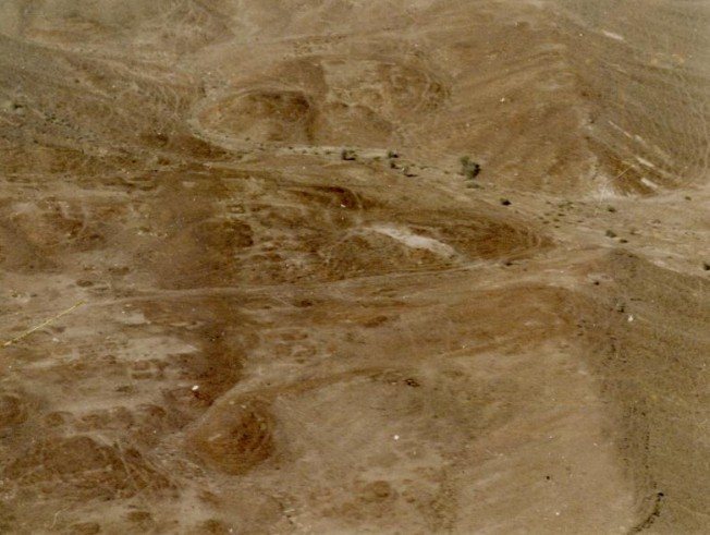
The settlement occupies low hillocks beside the Shadi Kaur, within a valley surrounded by jagged, layered hills. Old riverbeds meander nearby, and small streams, mostly fed by rain, drain into the river. The hillocks extend for about two miles in circuit; visible settlement remains occupy their southeastern part and extend for less than a mile. Dry ravines define the northern and southern boundaries.
Settlement layout and buildings
Erosion has exposed rooms built on bases of layered rock, with mud or mud-brick walls above. Rectangular room foundations follow north-south and east-west alignments in aerial views. The hilltop setting may have lowered the risk of flooding from the river.
Pottery production and finds
Pottery-firing ovens
Numerous open-pit ovens used to fire pottery are visible across the settlement, including some buried beneath rubble. Hundreds of thousands of pottery fragments are scattered over the site.
Pottery and terracotta pieces
The pottery includes kiln-fired jars, plates, pierced colanders and knobbed lids, as well as fine terracotta pieces shaped like bangles. The wheel-turned vessels are mostly pink, with some buff examples; some jars have a reddish glazed band around the neck. Black decoration includes horizontal lines of varying thickness, fish-scale designs, intersecting circles, comb-like patterns and wavy lines. Potters’ marks appear on the rims of some jars and pots.