Skopje Fortress: A Historic Citadel and Military Stronghold
Site at a Glance
- Country
- North Macedonia
- Primary era
- Medieval
- Eras represented
- Stone Age, Bronze Age, Iron Age, Medieval, Early Modern, Modern
- Civilizations
- Byzantine, Ottoman, Serbian
- Site type
- Military
- Remains
- Citadel
On this page19 sections
History
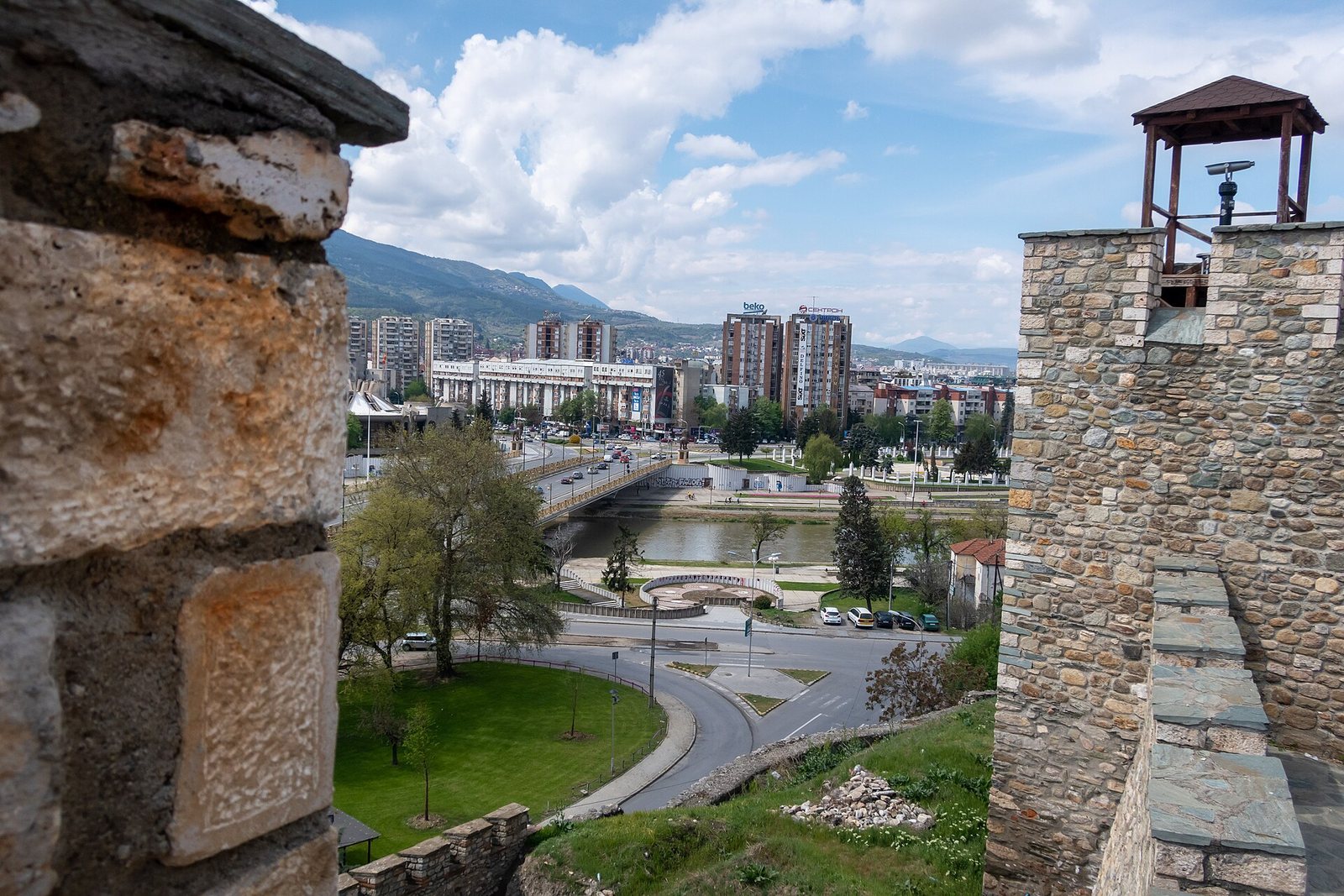
Skopje Fortress is a fortified complex on the north bank of the Vardar River in Skopje, North Macedonia. Established in the sixth century AD, probably during the reign of Byzantine emperor Justinian I, it became a defensive center above the city. The Byzantine Empire, centered on Constantinople, was the eastern continuation of the Roman Empire. Human activity on the hill dates back much further, to the Neolithic and Bronze Ages.
Early occupation and Byzantine stronghold
People used the hill in prehistoric times, though the evidence does not establish a settlement there in the fifth or fourth centuries BC. A ritual well from the fourth century BC points to ceremonial use. The fortress itself was established after an earthquake in 518 destroyed the Roman city of Scupi, near present-day Skopje. Stonework from Scupi’s ruins was reused in the new defenses.
The hill formed the upper center of a settlement that extended across a lower terrace to the east. Known as the Upper and Lower Towns, these areas belonged to a wider urban network whose principal route crossed the Vardar and continued southeast toward Thessaloniki, linking with a road from Kosovo.
Medieval political center
Skopje was an important center of the First Bulgarian Empire, a medieval Bulgarian state that competed with Byzantium for control of the Balkans, particularly from 992 to 1015. Byzantine forces retook the city in 1004. During the eleventh century it faced repeated attacks, including those associated with the Norman leader Robert Guiscard and local insurgents. Peter Delyan’s revolt against Byzantine rule was centered at Skopje.
The Upper Town’s defenses were altered repeatedly from the tenth and eleventh centuries onward. Serbian forces captured Skopje in 1282 under King Milutin. In the fourteenth century, Serbian ruler Stefan Dušan moved his court from Prizren to the city, which became the capital of his empire. He was crowned there in 1346 as Emperor of the Serbs and Greeks. Medieval records also place several churches within the Upper Town. In 1299 or 1300, Byzantine statesman Theodore Metochites described a walled Lower Town and a notable cathedral in Skopje.
Ottoman rule and changing military role
Skopje came under Ottoman rule in 1392. The fortress was damaged during the conquest and changed from a residential and commercial urban center into a military installation, with storehouses, barracks, and workshops for weapons. As the Ottoman frontier moved north, the stronghold lost strategic importance and was sometimes abandoned or occupied by only a small garrison.
An earthquake damaged the fortress in 1555. In 1689, Austrian forces commanded by Piccolomini found it neglected and in ruins, and they burned Skopje. The Ottomans rebuilt the fortress around 1700, strengthening its defenses and adding towers and gates. By the 1830s, Ottoman records counted only five residents within the walls, alongside a storehouse, military hospital, arsenal, and prison.
Modern military use and archaeological work
Austro-Hungarian forces used the fortress during the First World War before French forces under General Jouinot-Gambetta captured it. About a dozen military buildings were erected between 1921 and 1930, and the Yugoslav army continued using the site. Near the end of the Second World War, a partisan artillery brigade was stationed there, and a mutiny took place. The army left in 1951, after which the fortress passed to Skopje’s archaeological museum. Some military buildings were demolished; the two largest were used for the Archaeological Museum and the Historical Museum.
Surface investigations began in the 1930s, followed by excavations in 1953 and extensive work in 1967 and 1968. A further investigation began in 2006 and 2007, continued in 2009, and concluded in 2012 after examining ten sectors. The 1963 earthquake had severely damaged the walls and buildings. Later conservation strengthened or rebuilt parts of the defenses, though some restorations drew criticism for using concrete and cement and for emphasizing a medieval appearance.
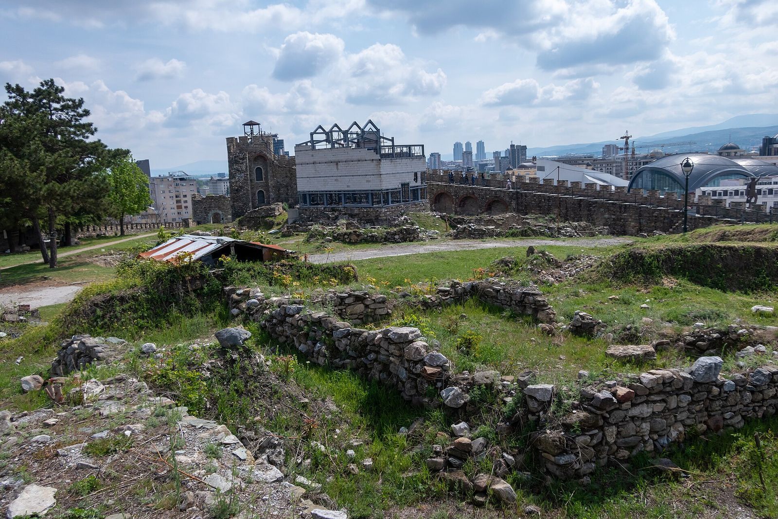
Excavations exposed the foundations of a thirteenth-century church and those of the Hatik Pasha Mosque. A plan to build a church museum over the church foundations prompted competing interpretations of the remains, including claims that they belonged to an older Illyrian or Albanian structure. Construction was halted after protests and violence in 2011, leaving an unfinished structure exposed to the weather. A proposal to reconstruct the mosque’s foundations also formed part of the dispute.
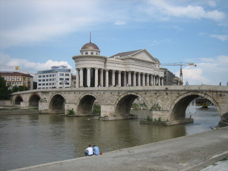
The fortress appears on Skopje’s coat of arms, which is incorporated into the city flag. Together with the Stone Bridge, it is regarded as a symbol of the city.
Remains
The fortress occupies the summit of the rocky Gradište promontory, which extends for more than a kilometer from east to west and rises roughly 40 to 45 metres above the surrounding low ground. Clay, marl, and sandstone form the hill. Steep slopes descend toward the Vardar on the west and south, while the ground is more accessible from the north. The enclosure is roughly semicircular, with its southwestern edge following the terrain and its northern side defined by the fortifications.
Enclosure and defenses
Sixth-century wall
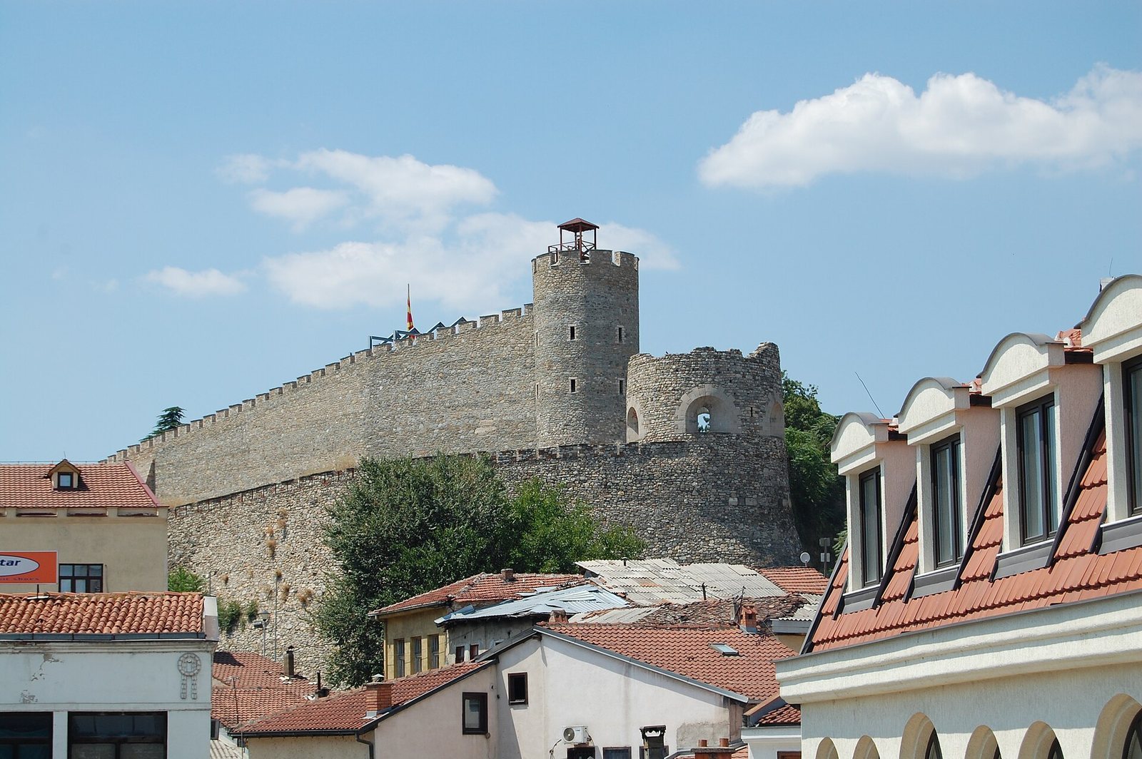
The sixth-century enclosure covered about 2.3 hectares, measuring approximately 280 by 110 metres. Its most imposing surviving stretch is on the northeast side. The northern half of this wall still reaches its original height of about 10 to 11 metres and is up to 2.85 metres thick. It has a solid stone core and an outer face made from hundreds of travertine blocks. Many are reused Roman stone slabs, altars, and architectural pieces, chiefly from Scupi. Builders set the blocks in different orientations to help bind the facing together.
Later walls and towers
Later defenses were built against or above the sixth-century wall. Their stonework, materials, dimensions, decoration, supports, and stairways vary, reflecting successive building phases. The northeastern and northern sides were the strongest; parts of the southern and western walls had weaker foundations and gradually slipped down the steep slopes. Towers linked to the early wall had circular, polygonal, rectangular, and triangular plans.
A round tower on the northeast survives to a height of up to 11.5 metres. It dates to the sixth century and was topped by a brick dome. Holes for wooden beams indicate a basement, ground floor, and upper floor. Its small rectangular entrance chamber contains a vault at floor level, twelfth-century frescoes, and thirteenth-century decoration scratched into the plaster. The basement served as a prison for a time.
At the southeast corner, a polygonal tower stands with an adjoining wall up to 4.30 metres thick. A long, deep cut beneath its foundations marks an attempt to undermine the defenses. In the early Ottoman period, the tower’s interior was filled with mortar and used as a gun position; a separate cannon tower was later built in front of it. At the northwest corner, a semicircular tower was replaced in the twelfth century by a square tower positioned farther east.
Gates and the southern wall
Traces of a northern gate remain in the wall, although much of it was lost when a modern asphalt road was cut through the area. The southern gate dates to the twelfth century. It was adapted under Ottoman rule and sealed in the eighteenth century, leaving a smaller passage. An inscription above a gate records repairs in 1446.
The southern wall west of the polygonal tower includes a tenth- to eleventh-century section, a fourteenth-century stretch with internal supports, and another section from the Komnenian period, when a prominent Byzantine ruling dynasty was in power. A twelfth-century church stood beside part of the wall before its destruction in the thirteenth century. Small wooden buildings, possibly barracks, were built against another stretch in the twelfth and thirteenth centuries. A larger plastered stone building later occupied the area, was enlarged in the fifteenth and sixteenth centuries, and was destroyed by fire and collapse late in the seventeenth century.
Outer defenses
A second defensive wall stood at varying distances in front of the main enclosure: 12 to 25 metres away from the southern wall, 6 to 25 metres from the northeastern wall, and about 40 metres from the northern wall. On the south, it forms a narrow stone covering over an irregular rocky slope as high as 16 metres. On the northeast, it is a lower, narrower wall with a defensive ditch in front. A gate with a wooden bridge over the ditch dates to the sixteenth or seventeenth century.
In the northern part of the space between the main wall and outer defenses, a shaft 6 to 7 metres deep held an outward-facing, double-leaf wooden gate. Attributed to the sixth century, it allowed defenders to emerge suddenly into the ditch. The Ottomans sealed it with a new outer wall, leaving two small exit gates. Surviving stonework also includes Ottoman-period work from the fifteenth to eighteenth centuries.
Upper and Lower Town
Upper Town buildings
A large, partly excavated building in the northwest corner of the Upper Town may have served as a fourteenth-century residence for Serbian rulers and formed part of an assembly or knights’ hall. During the 1963 earthquake, this sector and the adjoining western wall slipped down the rocks. The foundations of the thirteenth-century church and the Hatik Pasha Mosque have also been identified inside the fortress.
Lower Town
The walled Lower Town occupied the lower terrace east and northeast of the Upper Town. Its remains and the contours of the terrain cover an estimated 8 to 10 hectares. The southern city wall is thought to have followed the terrace’s steep southern edge and joined the Upper Town at its southeast corner. A cross-wall leads east from the outer defenses; a southern gate probably stood there, with the main street running north through the Lower Town. Its course may have continued along the line of present-day Macedonia Street.
Archaeological probes identified sections of Lower Town wall near the Church of the Holy Savior, north of that church, and near Shar Street. Cemeteries lay south of the church. Farther north, a high retaining wall in the courtyard of Mustafa Pasha Mosque is thought to meet the northeastern part of the ruined medieval city wall. Medieval layers and fourteenth-century Serbian silver coins were found in the area of the Museum of Macedonia. Beyond the Lower Town, the unwalled suburb of Varosh extended east toward the Serava River.
Water Tower
A square tower in the northwestern foothills beside the Vardar is identified as the Water Tower in a charter from 1300. Archaeologist Ivan Mikulčić argued that it did not belong to the northern city wall. Its decorated south and west faces appear to have been exterior surfaces, while walls on the east and north enclosed a small rocky area about 40 by 30 metres. This enclosure may have given defenders protected access to water during a siege.
Finds and later features
Archaeological finds
Prehistoric finds from the site include earthen huts, houses, pottery, wells, clay figures, and bone and stone tools. Bronze Age remains include a pottery kiln, structures attributed to the Middle Bronze Age, and a house attributed to the Late Bronze Age. Iron Age traces include houses and pottery, alongside the fourth-century BC ritual well. Excavations also uncovered remains of thirteen Neolithic houses, musical instruments, and clay ornaments. Other finds include medieval weapons and tools, nineteenth-century cannonballs, and ceramic pipes used for smoking opium. In 2010, excavators found the largest hoard of Byzantine coins yet discovered in North Macedonia.
Finds beside the southern wall include fragments of frescoes and valuables concealed from a church: part of a silver-gilt chain for an icon, a small flask with a chain, and a large cup decorated with red garnets and an inscription.
Excavated religious foundations
The foundations of the thirteenth-century church are covered by an unfinished metal structure intended for the proposed museum. Foundations of the Hatik Pasha Mosque have also been identified within the complex.
Restoration and modern features
After the 1963 earthquake, restoration strengthened or rebuilt circular and square towers and reconstructed sections of the walls. Four southern-wall towers, three square and one round, and a gate toward the Vardar were restored. Some building foundations have also been restored, while others remain exposed. A four-metre statue by sculptor Jordan Grabuloski stands on the western side of the fortress. Titled “Strength, Glory and Victory,” it depicts victory over fascism in the Second World War. A flagpole bearing the North Macedonian flag is another feature of the site.