Servian Wall: Rome’s Early Defensive Circuit
Site at a Glance
- Popularity
- Very High
- Country
- Italy
- Primary era
- Classical
- Eras represented
- Iron Age, Classical
- Civilizations
- Roman
- Site type
- Military
- Remains
- Wall
On this page24 sections
History
The Servian Wall is the ancient defensive circuit around Rome, Italy, traditionally begun in the sixth century BC and rebuilt on a larger scale during the fourth century BC. Its early beginnings are associated with Rome’s kings, especially Servius Tullius, for whom the wall was named, while the Republican reconstruction formed a major public defense. The circuit also marked Rome’s sacred territory and expressed the city’s unity and authority.
Early Rome and the Archaic Defenses
Roman tradition credits Tarquin the Elder with starting a defensive circuit and Servius Tullius with continuing and completing it. The historical details of the early kings are uncertain, and it remains disputed whether sixth-century defenses formed one continuous wall or consisted of separate hill defenses and earthworks. Archaeological remains point to an early phase, but its route and extent are not established. Tarquin the Proud is credited with enlarging ditches, raising the wall, and perhaps adding towers in exposed places. The early circuit may have measured about seven kilometres.
These defenses took shape as settlements on Rome’s hills developed into a more unified city. Iron Age occupation is known on the Capitoline, Palatine, Quirinal, and Velia. A shared cemetery on the Esquiline took the place of an earlier burial ground in the valley that would become the Forum. Activity on the Aventine, which had begun in the Late Bronze Age, was interrupted when the wall was built. Before the later, larger circuit, the inhabited area covered about 150 hectares.
The wall did not follow Rome’s pomerium, the city’s formally defined sacred boundary, or its four administrative regions exactly. It enclosed the Capitoline and Aventine even though both hills then lay beyond those limits. The circuit’s relationship to the sacred boundary changed as the pomerium was redefined.
Republican Reconstruction
After the Gallic sack of Rome in 390 BC, the city’s defenses were almost entirely rebuilt, largely along the earlier route. Work began soon afterward, and a levy imposed in 378 BC helped pay for it. Responsibility was assigned to the censors Spurius Servilius Priscus Structus and Quintus Cloelius Siculus, officials who oversaw public duties including public works. The exact completion date is unknown, although tradition associates the rebuilding with 378 BC. Reused material from the earlier circuit may have been incorporated, and workers or architects from Syracuse may have taken part.
The Republican wall strengthened Rome against siege weapons and required an extensive public effort, though the project’s duration and the status of its workforce are uncertain. Its enclosed area is estimated at between about 365 and 467 hectares. Rome repaired the defenses in 353, 217, and 212 BC, and again in the late Republic. During the Second Punic War, the conflict in which the Carthaginian commander Hannibal campaigned against Rome, he approached the city in 211 BC but withdrew without attacking. The repaired defenses and the forces guarding Rome may have contributed to his decision.
Rome’s internal conflict continued to test the wall. During the struggle between the Roman leaders Marius and Sulla, Marius captured the city in 88–87 BC, partly because its defenses were in poor condition. Before the Battle of the Colline Gate in 83–82 BC, repairs were made to the circuit. The battle ended a later phase of the conflict.
The wall had a military purpose, but its role was also civic and ritual. It marked sacred territory, though its boundaries did not always coincide with the pomerium; entry into the city followed established rules and rites, while the gates themselves were not sacred. Tradition connected the Carmentalis Gate’s later name, Accursed Gate, with a disaster in 477 BC. The Fabii left Rome through it and were ambushed by the people of Veii; none survived.
Expansion and Changing Uses
By the late Republic, Rome had spread beyond the wall, and its defensive importance was declining. Buildings began to use sections of the circuit as supports or foundations. Augustus, Rome’s first emperor, restored several gates, partly as a public display. His division of the city into fourteen regions did not align neatly with the wall: four regions lay wholly within it, seven crossed it, and three were outside. Some entrances were later adapted or transformed into monumental arches.
As Rome’s territory and armies expanded, the old circuit gradually lost its military function. An earthquake damaged part of the wall in AD 15, and Nero ordered a section demolished in AD 68. During the early Empire, the city expanded beyond the circuit and remained largely without a surrounding wall for about three centuries. The old boundary nevertheless retained sacred, symbolic, and perhaps administrative importance. Gates continued to serve as sites for urban watch posts and firefighting, and may also have been used for customs control.
Rome’s growth reshaped the land around the wall. Blocks were taken for other buildings, parts of the defensive slope and rampart became gardens, and the filled ditch on the Esquiline was occupied by a meeting place used by a Roman association. Other buildings were laid out in alignment with the former circuit. In the third century AD, renewed threats led Emperor Aurelian to order a larger wall, built between 271 and 275. Its plan took account of roads and gates belonging to the earlier circuit.
By the sixth century, the Servian Wall’s history as a continuous enclosure had largely faded from memory. The historian Zosimus described the later Aurelian Wall as the first wall built around Rome.
Rediscovery and Modern Changes
From the fifteenth century, renewed study of ancient texts and examination of surviving masonry helped identify sections of the circuit. Major urban works in Rome in the late nineteenth century revealed nearly half of the remains known today; later construction also destroyed some portions. The long stretch near Termini was included in Italy’s national-monument list in 1902.
Remains
The circuit followed Rome’s hills in a broadly kidney-shaped plan, with the Capitoline forming an inward notch. Most of its surviving substantial masonry belongs to the Republican rebuilding and uses large blocks of volcanic tuff, a rock formed from compacted ash and fragments. The wall combined steep slopes, ditches, and earthworks with masonry defenses. Its enclosed ground included space for refuge and future growth as well as built-up districts.
Route and Defensive Works
Course and Dimensions
The Republican circuit ran for about 11 kilometres. Estimates of its enclosed area range from approximately 365 to 467 hectares, with one estimate placing it near 426 hectares. The wall often followed the steep outer slopes of the hills, sometimes along the break of slope; in places, workers cut the ground back to make it steeper. Earth added on the inner side could provide a level route for defenders. Trastevere, the Emporium, and the Campus Martius lay outside the circuit.
The wall was generally about 3.6 to 4 metres thick and could reach roughly 10 metres in height. Foundations observed at some points extended as much as 3 metres below ground and used irregular tuff blocks. The outer face was usually more carefully finished than the inner face, which was often backed by earth. A path for patrols probably ran along the top, perhaps protected by a low wall or a notched crest.
Ditches and the Inner Rampart
Some stretches had a ditch beyond the wall, with a sloped strip of ground between them. This arrangement probably replaced the protection of a steep natural slope where the wall did not stand on a hill crest. An open area beyond the ditch gave defenders a view of approaching attackers, and wooden bridges carried roads across the cuts. Dimensions varied: one reconstruction gives a ditch about 36 metres wide and 13 metres deep, while excavated examples reach 18 metres deep and can be much narrower. On some flatter stretches, ditches averaged more than 30 metres across and about 9 metres deep.
Along the exposed northeastern section, especially on the Esquiline, an inner earth rampart provided a broad platform for defenders. Its width ranged from about 7 to 42 metres at different points, and soil from the ditch may have supplied its fill. A retaining wall of gray volcanic tuff, known as cappellaccio, held the lower slope; some of its blocks may have come from the earlier defenses. A drain at the rampart’s base carried away seepage and runoff. The rampart may have extended along much of the circuit, though its full reach is uncertain.
Masonry and Construction
Archaic Stonework
The early phase used gray cappellaccio tuff associated with Rome’s hills, together with earthworks and a ditch. Blocks survive in place in some locations, as facing or supporting masonry beside the later wall, and reused in repairs. At some points Republican masonry covers the earlier blocks. Excavations on the Aventine also indicate an early tuff wall beneath the later construction.
The Republican Wall
Most substantial surviving sections belong to the fourth-century-BC rebuilding and were made mainly from Grotta Oscura tuff quarried near Veii. Blocks were typically about 59 centimetres high and wide, and roughly 100 to 180 centimetres long. Builders laid them in squared courses, alternating the direction of the blocks, without mortar. Iron, lead, or bronze fastenings could secure them. A thin clay coating may have helped the blocks slide into position. Lifting equipment may have been used to extract or transport them, but was probably unnecessary for setting them in place.
The long Termini section shows slight differences in workmanship and joins between stretches of about 36 metres, suggesting several crews worked at once. This pattern is not evident everywhere. Incised marks on some blocks may have identified quarry or masonry work and helped track construction. Their forms and dates vary, and some resemble characters from archaic Greek writing.
Repairs and Later Masonry
Later repairs employed other volcanic stones, including red Fidenae tuff with porous black volcanic rock, Monteverde tuff, and stone from the Aniene Valley. Some late Republican work used smaller blocks and mortar instead of the earlier squared-block construction. Carefully set stones in a net-like pattern formed the outer face, enclosing a core of rubble and mortar.
Gates and Arches
Number and Identification
The number of gates is uncertain: estimates range from about 15 to 22, while sixteen are known from ancient references. Names attached to the entrances may not be original, and some locations remain disputed. The gates may first have been simple openings, perhaps protected by towers or projecting defenses. Augustus and later rulers altered or monumentalized some entrances.
Capitoline and Quirinal Gates
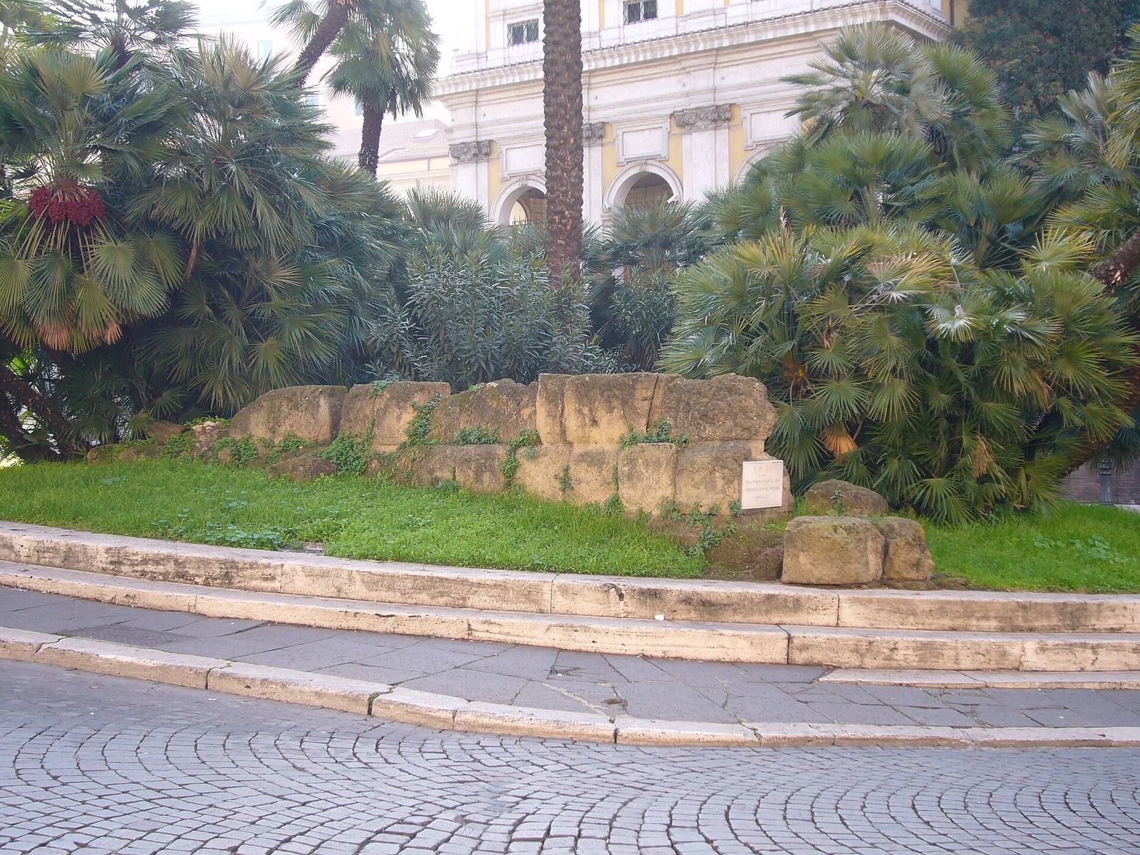
The Fontinalis Gate stood north of the Capitoline, where the Via Lata entered between the Campus Martius and the Imperial Fora; masonry attributed to it is uncertain. Southwest of the hill, the Carmentalis Gate occupied the area between the Capitoline and the river, though its precise position is debated. The Flumentana Gate was probably near the Tiber, with proposed locations along the Via Aurelia route or near the Forum Boarium. On the Quirinal, the Sanqualis Gate stood near tombs; three visible courses at Largo Magnanapoli comprise twelve blocks, each about 120 by 57 by 54 centimetres. The Salutaris Gate lay near the temple of Salus and the present Via della Dataria. The Quirinalis Gate was beneath Via delle Quattro Fontane, and nearby gray tuff blocks may have belonged to steps leading up the steep slope.
The northernmost entrance, the Colline Gate, stood on the Quirinal where the Via Salaria and Via Nomentana entered Rome. The rampart reinforced this stretch. The gate’s remains were destroyed during urban construction. The Viminal Gate stood on the Viminal Hill, at the northwestern end of the surviving wall near Termini.
Esquiline and Caelian Gates
The Esquiline Gate, the easternmost entrance, served the Viae Labicana, Tiburtina, and Praenestina. It survives in altered form as the Arch of Gallienus. On the Caelian, the Querquetulana Gate crossed the Via Tusculana, with proposed positions near the Basilica of the Four Crowned Saints or San Clemente. The Caelimontana Gate, possibly shifted during a Republican rebuilding, survives as the Arch of Dolabella and Silanus.
Aventine and River Approaches
The Capena Gate stood between the Caelian and Aventine, where the Via Appia and Via Latina entered Rome; the Aqua Appia aqueduct also passed through it. Its remains were excavated in the nineteenth century near San Gregorio al Celio. On the Aventine, the Naevia Gate served the Via Ardeatina. The Raudusculana Gate was associated with a branch of the Via Ostiensis, perhaps near Piazza Albania, while the Lavernalis Gate is placed tentatively near Via del Priorato or Via Icilio. The Trigemina Gate stood near the Aventine’s foot and the Tiber, probably by Santa Maria in Cosmedin and the Forum Boarium. It was rebuilt under Augustus and later disappeared. Its name has been explained in several ways, including as a reference to three arches or successive openings.
The Triumphalis Gate was added after the circuit was built and is placed near Sant’Omobono, between the Capitoline and the Tiber. It may have served triumphal processions and other exceptional events, including Augustus’s funeral procession. The proposed Ratumena Gate may have been an earlier name for the Fontinalis entrance or an opening in the Capitoline defenses. The Catularia Gate is placed tentatively near an approach to the Capitoline. A pedestrian passage called the Scala Cassii may also have crossed the steep Aventine slope, but its position is uncertain.
Arch of Gallienus
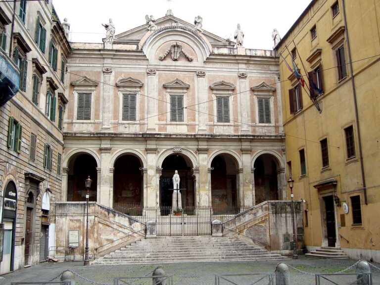
The Arch of Gallienus preserves the Esquiline Gate in a changed form. It originally had three openings and was rebuilt in travertine under Augustus. An inscription honoring Emperor Gallienus was added during repairs in AD 262. The two side openings were removed in 1447 for a church, leaving the central arch.
Arch of Dolabella and Silanus
The Arch of Dolabella and Silanus incorporates the Caelimontana Gate and is dated to AD 10. An arch in the courtyard of Palazzo Antonelli may represent a late Republican repair, perhaps dating to 87 BC. It may have supported a platform for a catapult or ballista, an ancient mechanical weapon that launched projectiles.
Surviving Wall Sections and Reused Masonry
Termini
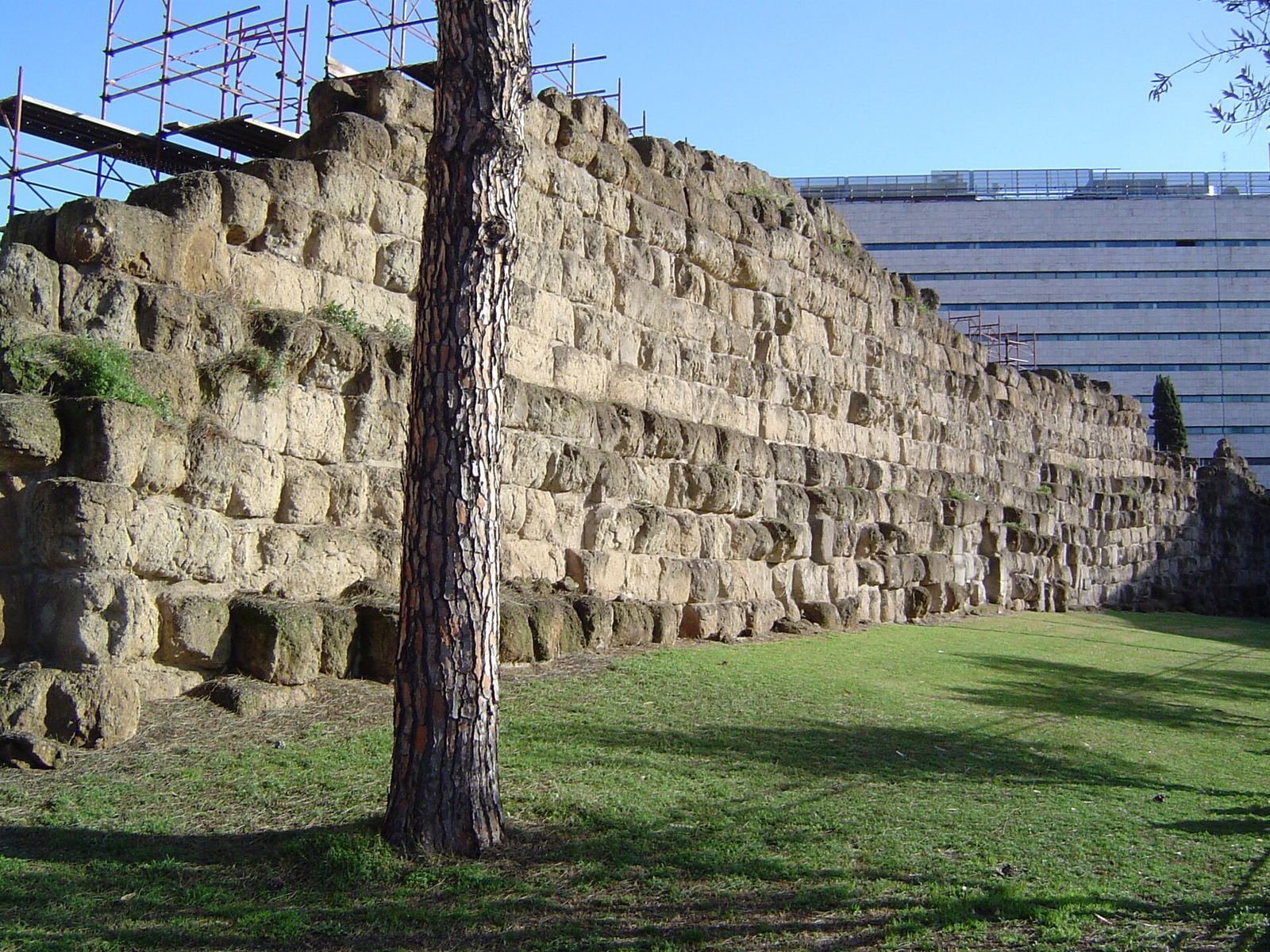
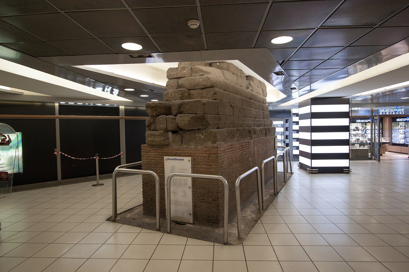
The principal exposed stretch at Termini runs for 94 metres in front of the station’s main entrance, along the southwestern edge of the Quirinal. Built from Grotta Oscura tuff, it is about 4 metres wide and 8 metres high, with 17 horizontal rows of blocks. The Viminal Gate remains at its northwestern end, and the wall’s inner face looks toward the station forecourt. Gray tuff blocks visible in the station’s underground hall probably formed part of the rampart’s retaining wall.
Aventine Sections
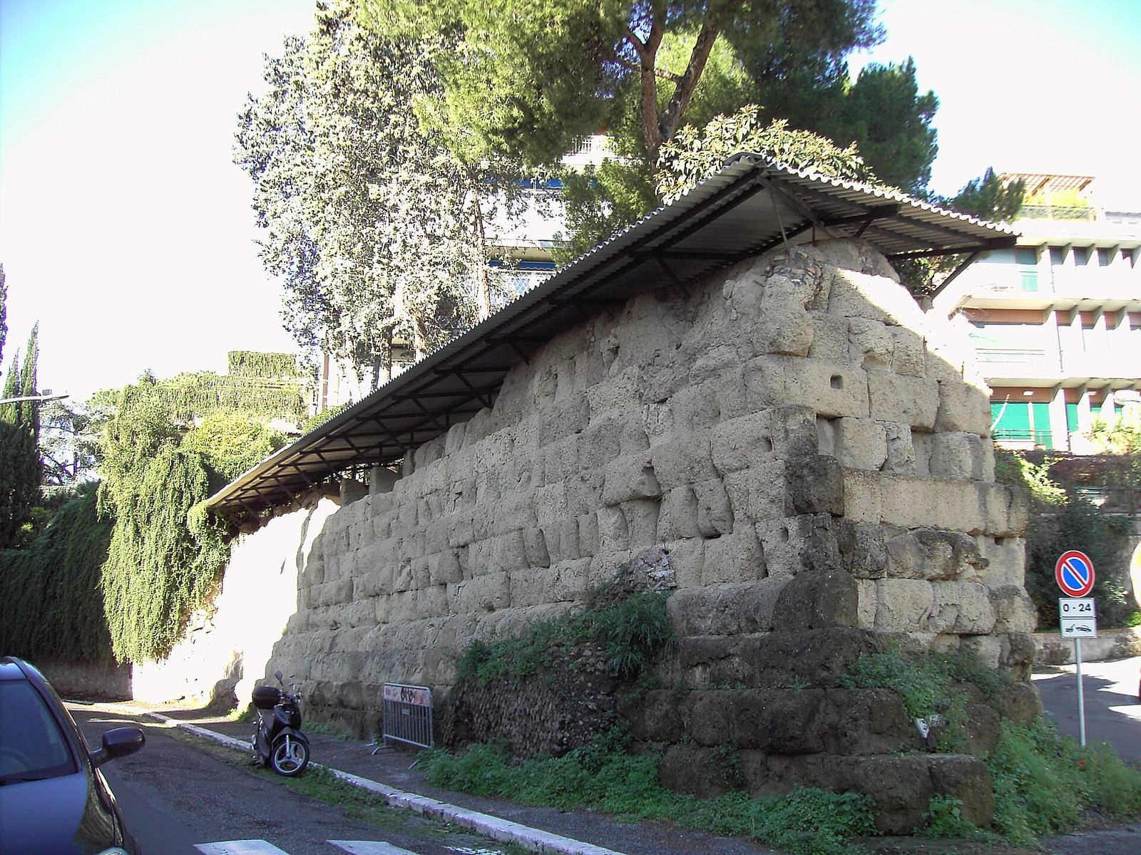
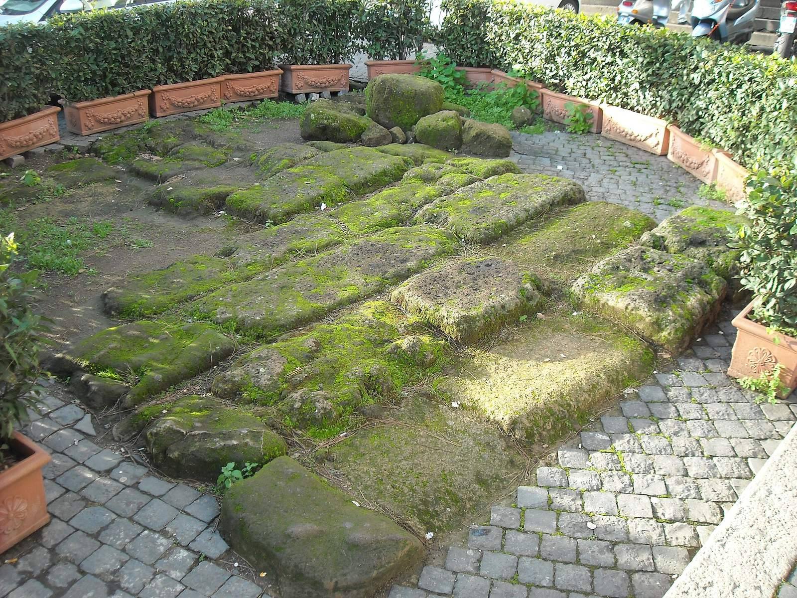
About 40 metres of wall survive along Via di Sant’Anselmo on the southern Aventine. Made of Aniene tuff, this stretch includes an arch that may have supported a defensive catapult. The wall dates to the late Republic. Repairs in net-pattern masonry during the early Empire show that it was reused as a support for private buildings, and a garden against it preserves part of the earth rampart.
Below Santa Sabina on the Aventine, masonry includes superimposed sections of the early and Republican circuits. The earlier wall uses gray cappellaccio tuff beneath the later stonework. Remains elsewhere are visible or recorded on the Capitoline and Aventine, at Largo Magnanapoli and near Via Salandra, and in the Esquiline and Termini districts. Nineteenth-century excavations also exposed the Capena Gate near San Gregorio al Celio.
Reuse in Later Buildings
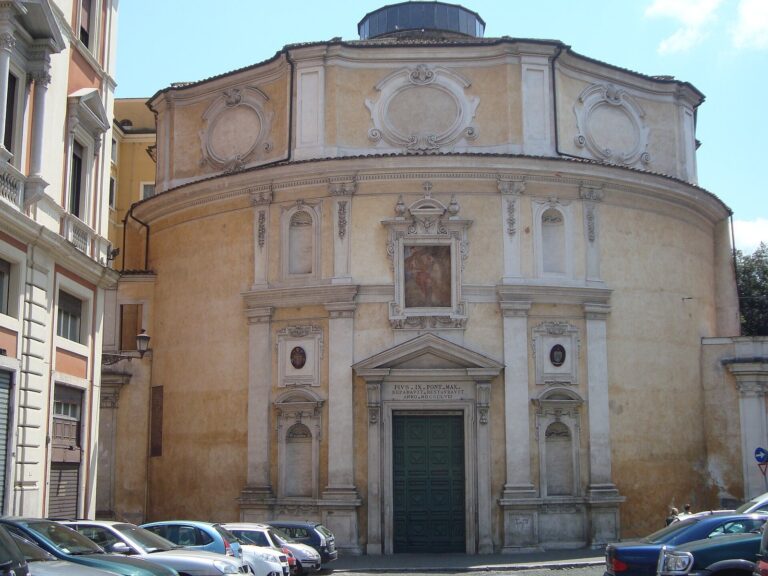
Some blocks from the circuit survive in later structures rather than in their original positions. Grotta Oscura tuff at the base of an aisle wall in San Martino ai Monti was reused in the church; wall blocks also occur in parts of the San Saba monastery. Grotta Oscura blocks probably taken from the Servian circuit have also been identified in a section of the Aurelian Walls.