Schlossberg Ulrichstein: A Medieval Hilltop Castle in Germany
Site at a Glance
- Rating
- 4.5
- Popularity
- Very Low
- Country
- Germany
- Primary era
- Medieval
- Eras represented
- Medieval, Modern
- Civilizations
- Holy Roman Empire
- Site type
- Military
- Remains
- Castle
On this page14 sections
History
Schlossberg Ulrichstein, also known as Ulrichstein Castle, is a twelfth-century hilltop fortress ruin in Germany, built on the 609.7-metre Schlossberg in the Vogelsberg. Its elevated position helped protect important trade routes and provided a strong defensive and surveillance point above the town of Ulrichstein.
Medieval origins and Hessian rule
The castle’s earliest ownership is uncertain. It may have entered the Landgraviate of Hesse through Büdingen and the noble family of Breuberg. The Landgraviate of Hesse was a territorial principality ruled by landgraves, and a document from 1296 identifies the Ulrichstein forest as belonging to Henry I of Hesse, the founder and first landgrave of the independent landgraviate.
During the fourteenth century, the Ulrichstein estate became a fief of the Lords of Eisenbach. A fief was an estate granted by a higher lord to a vassal in return for service or allegiance. The Eisenbach family considerably strengthened and enlarged the castle, shaping its role as a fortified centre within the surrounding territory.
Administration under the Riedesel family
The Barons of Riedesel later succeeded the Lords of Eisenbach as hereditary marshals and rent officials of the Landgraviate of Hesse. A hereditary marshal was a senior court official, while a rent official administered territorial revenues and financial affairs. The Riedesels used the outwork below the castle hill to collect road tolls and the tithe, a customary levy traditionally based on a tenth of agricultural production. They also exercised judicial authority there until the end of the Holy Roman Empire in 1806.
Wartime burials and modern conservation
The Schlossberg was contested during successive wars. A memorial plaque at the entrance commemorates soldiers of the Seven Years’ War, the major European conflict fought from 1756 to 1763, who were buried at the site. Military cemeteries in the western castle grounds contain graves from the First and Second World Wars.
Between 1991 and 2005, a local nonprofit support association carried out extensive work at the ruins. The inner castle wall and the remains of the palas, the principal residential and representative building of a medieval castle, were restored. The outer wall was renewed, and the surviving defensive tower was adapted as an observation tower. Since 2001, the six-hectare Vogelsberggarten around the ruins has formed part of the Vulkanregion Vogelsberg Nature Park. Its historical and ecological displays preserve evidence of regional agriculture, pastoral practice, woodland use, and plant life.
Remains
Castle hill and surviving complex
The ruins occupy a former basalt volcanic vent on the 609.7-metre Schlossberg in the northwestern Vogelsberg. A volcanic vent, also called a volcanic neck, is the solidified conduit through which magma once rose toward the surface. The basalt formed through volcanic activity approximately 19 million years ago. A research borehole drilled near Ulrichstein in 1996 reached more than 650 metres and encountered volcanic rock throughout its depth without reaching the underlying bedrock. The town extends below the hill, while the castle ruins occupy the summit and remain visible across the surrounding plain.
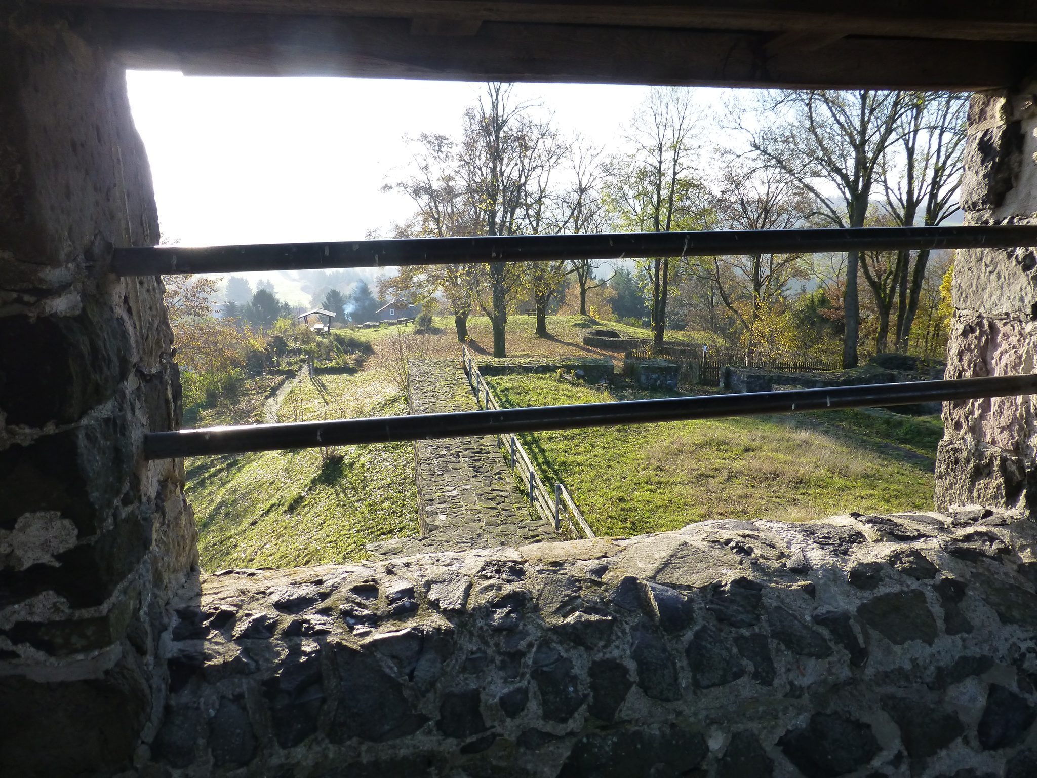
Only a rudimentary structure of the medieval complex survives. The main arrangement included an inner castle wall, an outer wall, a defensive tower, and a palas within the core castle. Foundations in the southern part belong to stables, service buildings, and the castle chapel. A cistern, a built reservoir for collecting and storing water, was discovered in 2003.
Inner castle wall
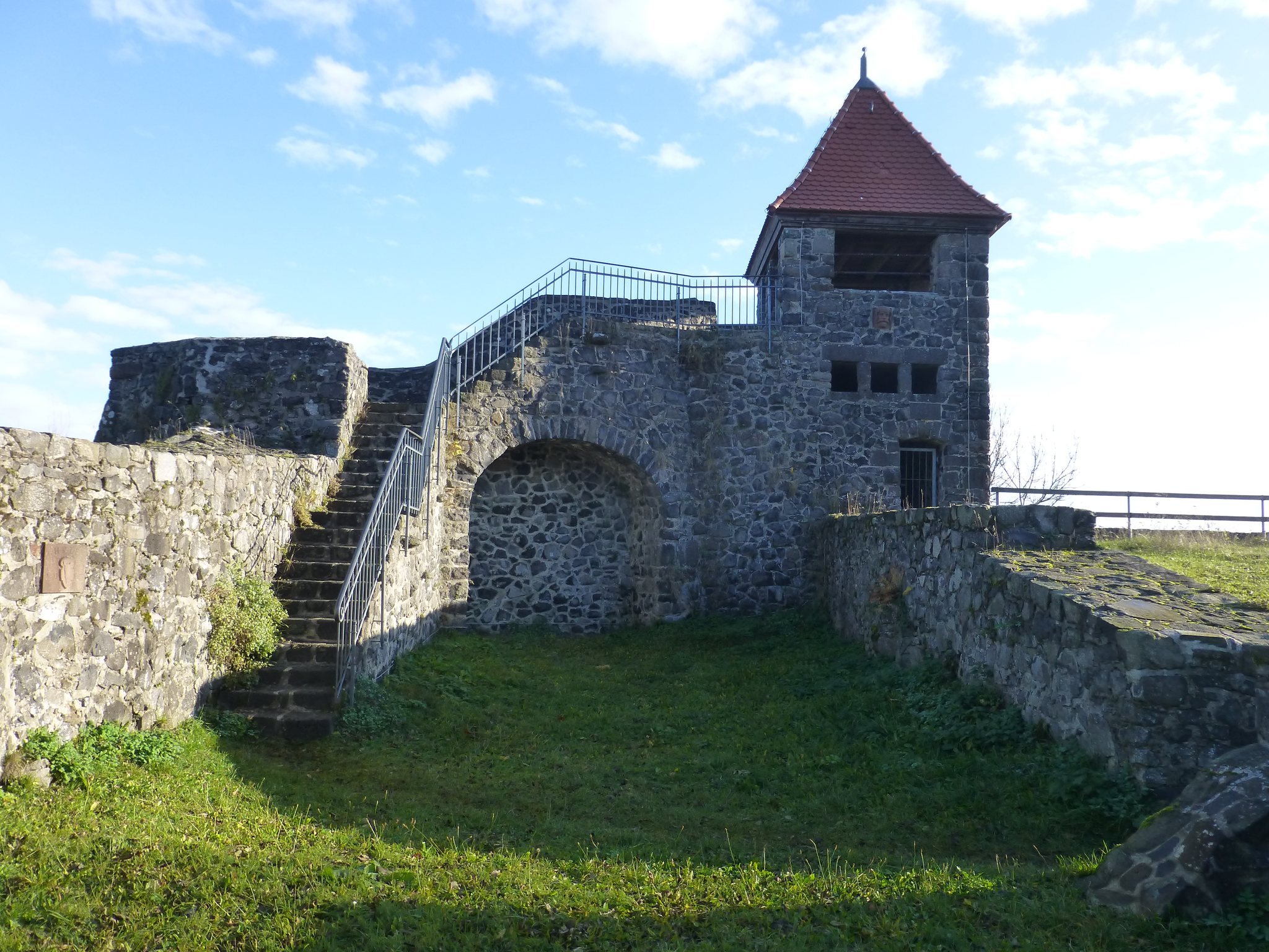
The inner castle wall forms part of the surviving core of the fortress. It was restored in the early 1990s, preserving the principal enclosure of the inner castle and helping define the relationship between the residential area and the defensive structures.
Outer castle wall
The outer castle wall marked the broader defensive perimeter. It was renewed in 2000 and remains part of the visible arrangement of the hilltop fortress, together with the inner wall and the other surviving structural remains.
Defensive tower
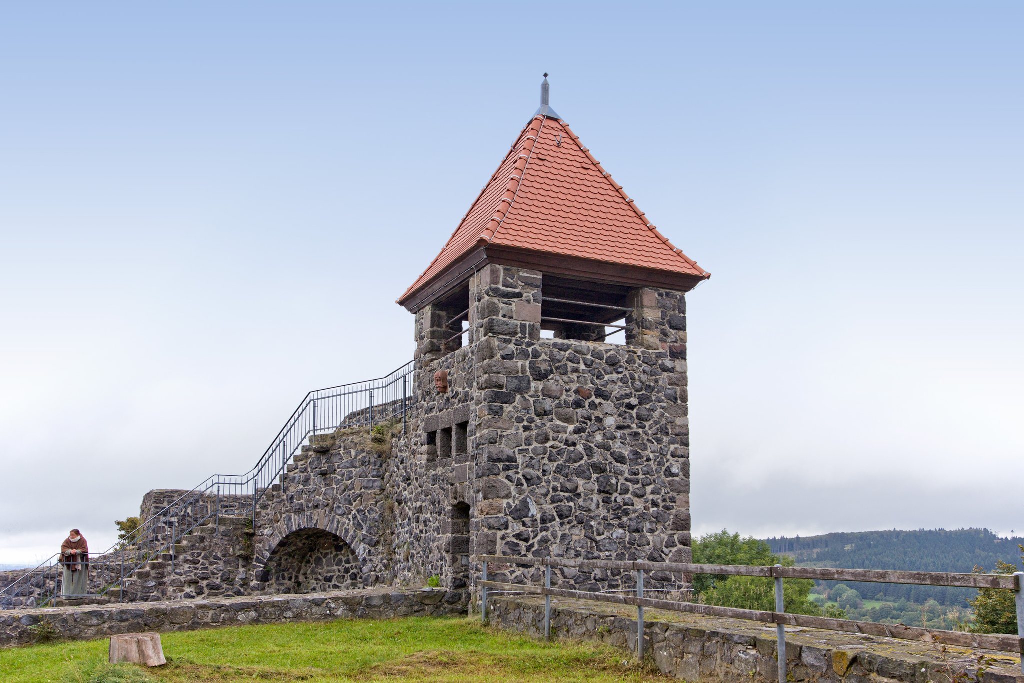
The defensive tower was newly erected in 1905. It received a new roof in 2004 and 2005 and now rises just over ten metres. The structure has been prepared as an observation tower, retaining its association with the castle’s defensive architecture while serving a later commemorative and interpretive purpose.
Palas and southern foundations
The restored remains of the palas identify the principal residential and representative building within the castle core. Restoration took place in the mid-1990s. Farther south, exposed foundations belong to the stables, service buildings, and castle chapel, outlining parts of the complex that supported residence, administration, and religious practice.
Gardens, cemeteries, and landscape features
Herb garden and model cottage garden
A small herb garden was laid out in 1999 in the form of a Latin cross, following the style of historical monastery herb gardens. An enclosed model cottage garden, entered through a rose arch, was reconstructed to document domestic cultivation. It contains useful and ornamental plants, culinary herbs, fruit, and vegetables.
Military cemeteries
The western castle grounds contain military cemeteries with graves from the First and Second World Wars. A memorial plaque at the entrance marks the burial place of soldiers from the Seven Years’ War, linking the surviving landscape to several periods of military history.
Vogelsberggarten
The six-hectare Vogelsberggarten surrounds the castle ruins and presents the agricultural, pastoral, woodland, and ecological history of the region. Its plant collection contains 243 wild species, including the protected globeflower. An educational trail presents nineteenth- and twentieth-century agriculture, woodland grazing that continued until the nineteenth century, and sheep breeding. Ulrichstein maintained a municipal sheepfold until 1953.
The garden includes smooth oat-grass meadows with bedstraw, hawkbit, and meadow bellflower, as well as higher-altitude golden oat-grass meadows with bistort, devil’s claws, and globeflower. Hedges of blackthorn, dog rose, hawthorn, and hazel accompany piles of stones removed from fields. Historic trees, particularly willows, ash, and maple, form further elements of the cultivated landscape. In clear weather, the elevated site looks north toward Alsfeld and the Knüll Mountains, west toward Grünberg, south toward Büdingen, Gelnhausen, the Wetterau, the Taunus, and the Spessart, and east toward Hünfeld, Fulda, and the Rhön.