Schloss Rodenberg: A Medieval Water Castle and Renaissance Palace Complex in Germany


Site at a Glance
- Rating
- 4.5
- Popularity
- Very Low
- Country
- Germany
- Primary era
- Early Modern
- Eras represented
- Medieval, Early Modern
- Civilizations
- Holy Roman Empire
- Site type
- Military
- Remains
- Castle
On this page15 sections
History
Schloss Rodenberg is a medieval water castle and later palace complex in Rodenberg, Germany, founded by the Counts of Schaumburg between 1228 and 1240. It developed beside a ford across the Rodenberger Aue and was transformed into a Renaissance residence with extensive artillery fortifications during the sixteenth century.
Origins and Schaumburg Rule
The castle probably began under Count Adolf IV of Schaumburg. Its position at a crossing of the Rodenberger Aue appears to have helped secure Rodenberg after the settlement received the privileges of a free Wickbold in 1250, meaning a market town with formally recognized rights. An alleged predecessor from around 930 stood elsewhere, on the area known as the old Rodenberg west of the town, but little is known about it.
The castle first appears in written evidence in 1317, when it was described as being in the castle of Rodenberg. Members of its garrison were present there by 1320. Between 1330 and 1348, Count Adolf VII of Schaumburg renewed and strengthened the castle and its outer ward. Adolf took up residence there in 1348, while the outer ward had already served since 1337 as the seat of the Schaumburg official responsible for the Rodenberg district.
The complex was mentioned again in 1441 and 1471. In 1478, Otto III of Schaumburg strengthened the outer rampart and ditch. This work probably included the northeastern tower rondel, additional round towers, and sluice weirs that controlled water around the defences.
Fortification and Palace Transformation
Anton I of Schaumburg governed the County of Schaumburg from Rodenberg between 1498 and 1526. Around 1510, he added a heavily fortified bastion to the outer rampart, followed by extensive work on the rampart between 1518 and 1525. Adolf XIII of Schaumburg made the castle his residence in 1532.
In 1553, Brunswick troops besieged the complex with stone-throwing siege engines and cannons. Otto IV of Schaumburg repaired the resulting damage in 1556. Four years later, the master builders Jakob Kölling and Heinrich Schrader remodelled the palas, the principal residential and representative hall of a medieval castle, in the regional Renaissance style known as Weser Renaissance. During this period, the older castle was reshaped into a palace complex enclosed by modernized fortifications.
War, Transfer, and Decline
The Thirty Years’ War, the European conflict of 1618 to 1648 driven by dynastic, territorial, and religious rivalries, brought repeated changes of control. Imperial troops successfully defended the fortified castle against Swedish forces in 1638.
After Otto V of Schaumburg, the last member of the ruling Schaumburg line, died, the castle passed to the Landgraviate of Hesse-Kassel in 1647. This German territorial state was ruled by landgraves, or territorial rulers. The transfer of the Schaumburg-Hessian chancery to Rinteln reduced the administrative importance of both Schloss Rodenberg and the town.
Landgrave William VI ordered the castle buildings restored in 1661 and 1662. In 1663, he ordered the outer fortifications dismantled, including the wall towers. The former outer ward became a domain estate, land and property administered for a territorial ruler or state. A map from 1777 shows that only the bastion, the northeastern tower rondel with its sluice weir, and remnants of the southwestern tower rondel still survived among the fortifications.
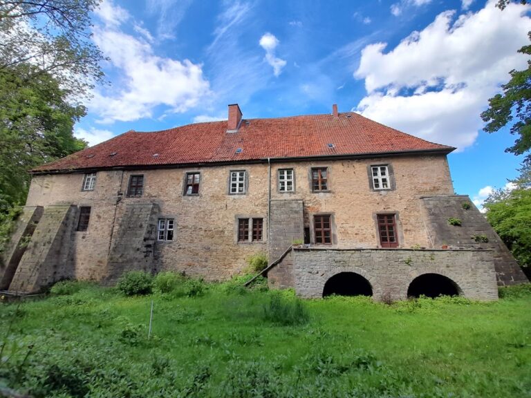
The castle ditch was filled in at the beginning of the nineteenth century and restored in 1940. A major fire in Rodenberg in 1859 damaged much of the castle, including the representative princely building and the domain buildings in the former outer ward. The remaining castle buildings were later demolished, apart from the Ständehaus.
Later Uses and Archaeological Investigation
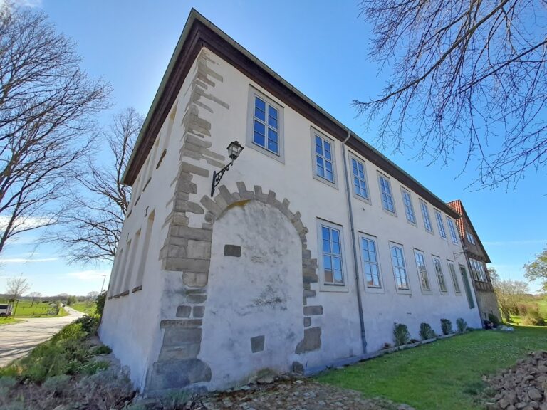
After the Second World War, larger numbers of Catholics displaced from eastern territories settled in Rodenberg. A Catholic church was established in the Ständehaus and consecrated as the Assumption of Mary on 10 December 1950. It remained there until 1975, when the congregation moved to a separate church. The Rodenberg and Surrounding Area Historical Association opened a museum in the Ständehaus in 1981.
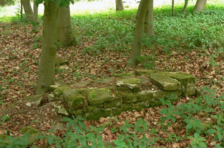
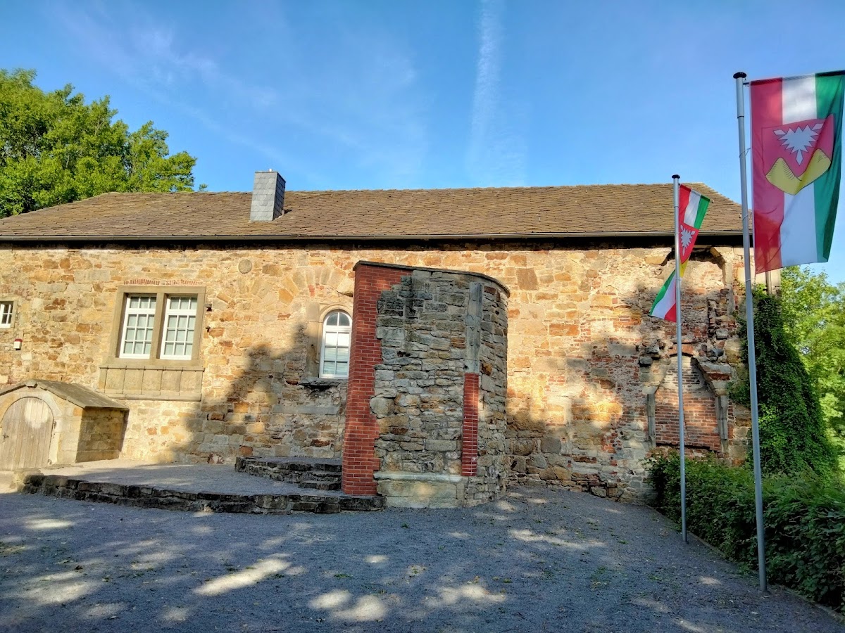
The grounds are protected as a historic monument. Excavations carried out by the Schloss Rodenberg support association between 2000 and 2004 exposed parts of the former fortifications, including the bastion, tower rondel, and two sluice weirs. These structures were partially reconstructed after the investigations, and the site opened as an open-air museum in 2005.
In autumn 2016, magnetometry and ground-penetrating radar examined about 3,000 square metres to a depth of approximately two metres without further excavation. The surveys indicated foundations belonging to stables, a storehouse, a wagon shed, the palas, and the castle well. They also suggested that the castle probably originated on the island now occupied by the Ständehaus. Compacted ground near the former stair tower may mark earlier wall foundations and corresponds with a thirteenth-century reference to an enlargement of the castle.
Remains
Schloss Rodenberg lies on level ground in the centre of Rodenberg, broadly enclosed by the Rodenberger Aue and the Mühlgraben, a branch of that river. The original castle and later palace complex stood within water defences and was reached by a bridge over the castle ditch. The surviving layout combines the island bearing the Ständehaus, a broad defensive rampart, outer ditches, water-control structures, and reconstructed artillery fortifications.
Island, Ramparts, and Water Defences
Ständehaus and Castle Island
The Ständehaus stands on an island surrounded by the water-filled castle ditch. It is the only surviving building of the former castle and originally formed the palas within an almost closed four-wing complex. Later alterations reduced the former palas to a single storey. The remains of an attached stair tower preserve evidence of its earlier height and form, while an exterior fireplace belonged to a neighbouring building that has since been demolished.
Rampart and Ditches
The defensive rampart remains visible in the terrain around the castle and palace complex. Its base is approximately 24 metres wide and it rises to about four metres, while the inner water ditch reaches up to 30 metres in width. Bastions and rounded artillery works were incorporated into the rampart. Two survive archaeologically, while three others disappeared through stone robbing in earlier centuries.
Traces of an additional outer ditch, known as the Butengraben, survive along three sides of the rampart. It was fed by the Rodenberger Aue and was later filled in. Two sluice weirs extended from the bastion and tower rondel toward the river, allowing the water level to be raised during an attack.
Former Buildings and Outer Ward
Outer Ward
A southern outer ward once stood in front of the main castle, but its surface has been levelled. Numerous foundations found during sewer works at Amtsplatz in the 1960s did not correspond to the eighteenth-century plans, adding evidence for changes in the arrangement of the complex.
Buried Foundations
The 2016 geophysical surveys revealed subsurface foundations of former stables, a storehouse, a wagon shed, and the palas, together with the castle well. These buried remains preserve parts of the former internal layout beneath the grounds. The evidence also supports the interpretation that the earliest castle stood on the island occupied by the present Ständehaus.
Reconstructed Artillery Defences
Hexagonal Bastion
The excavated hexagonal bastion dates from the beginning of the sixteenth century and measures 10 by 10 metres. It has two storeys, with a powder chamber housed in a casemate, an enclosed chamber within a fortification, in the lower storey inside the rampart. Its cannon positions used eight muzzle embrasures, openings through which cannons fired, together with one forked, trouser-shaped embrasure. The bastion was partially rebuilt and given a protective roof to shield its masonry from the weather.
Tower Rondel
The excavated tower rondel was built around 1480 and has a diameter of nearly eight metres. Its walls were repaired and the structure received a roof during reconstruction. Together with the bastion, it demonstrates how the castle’s older defences were adapted for artillery with a longer effective range during the transition from the late Middle Ages to the early modern period. Both reconstructed structures are fenced, and the bastion, tower rondel, rampart, Ständehaus, and information panels now form the open-air museum.