Rheingrafenstein Castle: A Ruined Rock Castle in Germany


Site at a Glance
- Rating
- 3.8
- Popularity
- Very Low
- Country
- Germany
- Primary era
- Medieval
- External website
- Open
- Eras represented
- Medieval
- Civilizations
- Holy Roman Empire
- Site type
- Military
- Remains
- Castle
On this page10 sections
History
Rheingrafenstein Castle is a ruined medieval rock castle in Germany, on the Rheingrafenstein opposite Bad Münster am Stein-Ebernburg near Bad Kreuznach. It was probably built in the eleventh or twelfth century by the Emichonen, a medieval comital dynasty associated with the Nahegau, the historical region along the Nahe River. An information board at the site dates its construction to the eleventh century. The castle became the ancestral seat of the Lords of Stein, whose lineage later acquired the titles and territories of the Wildgraves and Rhinegraves.
The Lords of Stein and the Rhinegraves
The Lords of Stein are documented from the twelfth century. Around 1160, Siegfried I of Stein married Lukardis, the daughter of Rhinegrave Embricho I, also known as Count Embricho III of the Emichonen family. Their son Wolfram inherited the Rhinegraviat on the right bank of the Rhine. A Rhinegrave was a medieval noble title associated with the Rheingau and later with the ruling family based at Rheingrafenstein.
Wolfram of Stein first used the title “Rhinegrave” in 1196. The designation was later applied to the castle, which is securely recorded as Rheingrafenstein by the thirteenth century. After the Battle of Sprendlingen in 1279, Siegfried II lost the family’s possessions on the right bank of the Rhine to the Archbishop of Mainz. He then transferred his residence to Rheingrafenstein, giving the rock its present name and strengthening the castle’s place in the family’s history.
During the fourteenth and fifteenth centuries, marriages enabled the Rhinegraves to acquire the Wildgraviat and half of the County of Salm. The Wildgraves were a separate noble lineage whose title and territories became connected with the Rhinegraves through inheritance and marriage. In 1610, a separate Rhinegrave branch known as the Rheingrafenstein line was established. The descendants of the Wildgraves and Rhinegraves had been elevated to princely rank in 1632.
War, destruction, and later ownership
Rheingrafenstein was drawn into the Thirty Years’ War, the major European conflict fought from 1618 to 1648, when Spanish and Swedish forces captured the castle. Its final destruction came during the War of the Palatine Succession, a European war fought from 1688 to 1697. In 1688, French troops commanded by General Mélac destroyed the castle under Louis XIV, king of France from 1643 to 1715. The princely Grumbach line, a branch of the Wild- and Rhinegraves that had most recently lived there, subsequently moved its residence to Gaugrehweiler.
In 1721, the ruins were made available for use in constructing the salt works at Münster. In 1835, descendants of the Wildgraves and Rhinegraves bought Rheingrafenstein and the Huttental back from the municipality of Münster. The castle is also traditionally connected with “The Priest’s Cap,” a legend that explains its origin in relation to Kauzenburg, another castle site associated with the story.
Remains
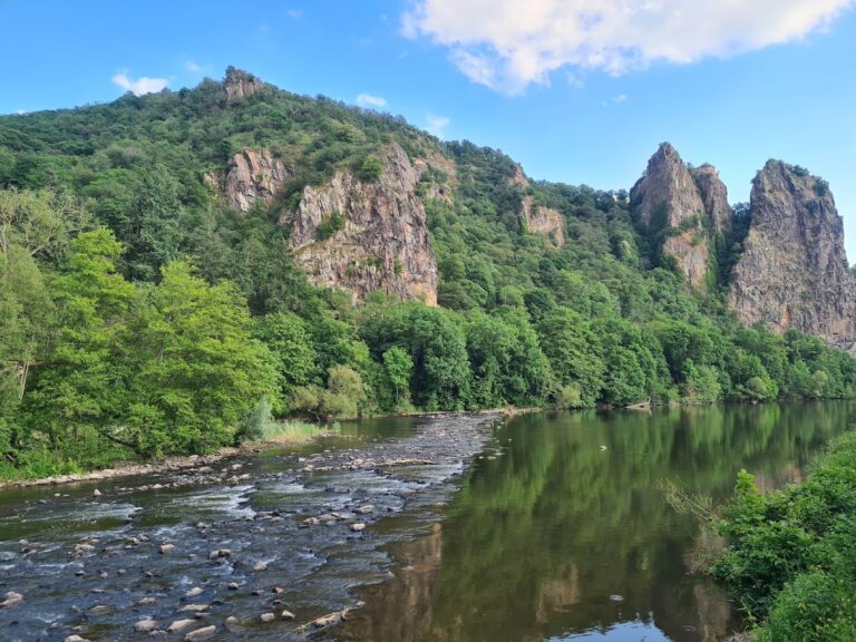
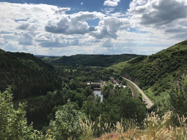
Rheingrafenstein Castle occupies the Rheingrafenstein, a 136-metre-high porphyry formation that rises to approximately 245 metres above sea level. Porphyry is a hard volcanic rock containing larger crystals within a finer-grained groundmass. The formation stands directly on the Nahe opposite Bad Münster am Stein-Ebernburg. It was known as Huhinstein about a thousand years ago, before the later name became associated with the Rhinegraves and their castle.
Fortified rock and residential remains
Enclosing fortifications
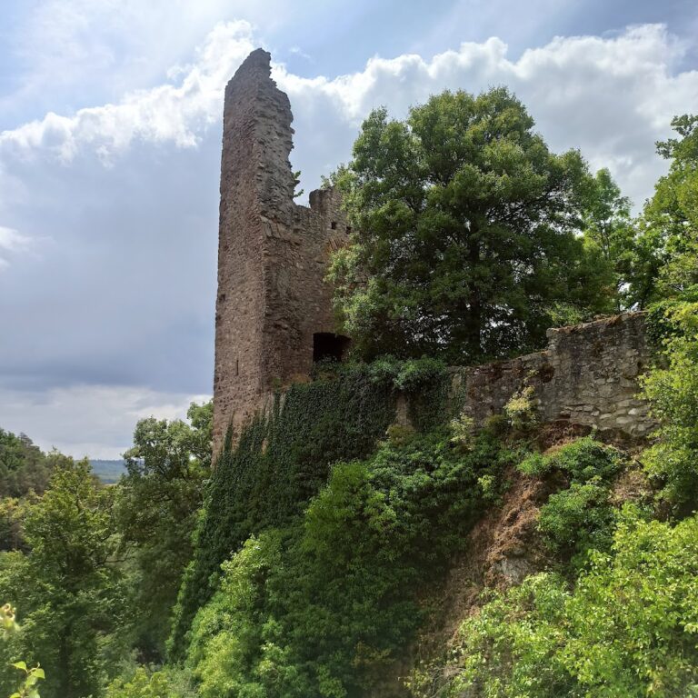
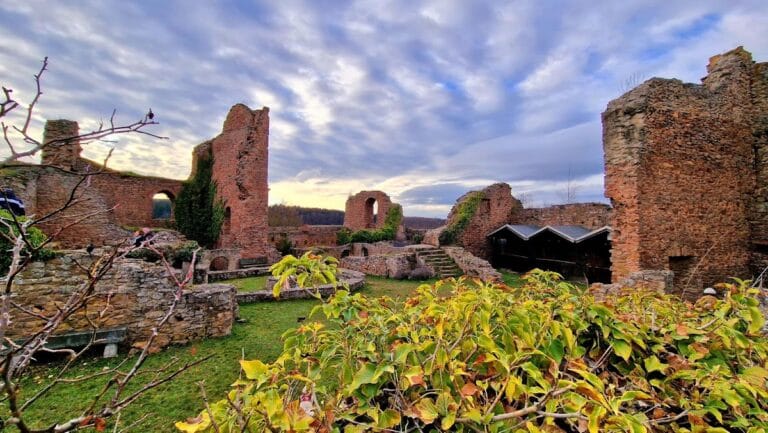
Parts of the enceinte, the main enclosing wall circuit of a fortified site, survive among the ruins. These fragments preserve the line of the castle’s principal defensive enclosure on the rock. The surviving fabric is chiefly masonry, showing the castle as a fortified complex integrated with the steep volcanic formation.
Residential tower and stair tower
Several steps lead toward the former residential tower, while the foundation walls of the former stair tower remain visible. Together, these elements indicate the vertical organization required by the rocky site, linking residential space with the higher parts of the fortification. A vaulted cellar is also preserved and forms one of the clearest surviving interior features of the castle.
Outer ward and access through the rock
Affenstein outer ward
On the southern slope lies Affenstein, the outer ward, meaning a subsidiary enclosure outside the principal fortified area. Its name derives from “Afterstein.” The feature formed a distinct part of the castle’s wider defensive arrangement below the main rock stronghold.
Rock passage and viewing platform
A separate stairway passes through the rock to a viewing platform. This route is a physical feature of the site itself, demonstrating how movement through the formation was incorporated into the castle landscape. The surviving masonry fragments, vaulted cellar, steps, stair-tower foundations, and outer ward together express the remains of a stronghold shaped by its rocky setting.