Sanisera: The Roman City and Archaeological Site on Menorca
Site at a Glance
- Popularity
- Medium
- Country
- Spain
- Primary era
- Classical
- Eras represented
- Iron Age, Classical, Medieval, Early Modern, Modern
- Civilizations
- British, Roman, Spanish
- Site type
- City
On this page27 sections
History
Sanisera is an archaeological site beside the natural harbour of Sanitja on Menorca, Spain, identified with a Roman settlement named by Pliny the Elder, although that identification remains disputed. Roman activity began during the Roman conquest of the Balearic Islands in the second century BC, and the settlement later developed into a city. Its harbour also supported activity during late antiquity and later periods.
Roman conquest and settlement
Rome’s conquest of the Balearic Islands began in 123 BC under the general Quintus Caecilius Metellus and was completed in 121 BC. Roman authorities cited piracy that disrupted the movement of Italian goods in the western Mediterranean, though opposition to piracy may also have served as a justification for annexation. The islands became part of Hispania Citerior, a Roman territory in the Iberian Peninsula. Metellus returned to Rome in 121 BC and received the honorific Balearicus after his victory.
A Roman garrison was established at Sanitja, where the harbour’s strategic position led Metellus to create a military settlement. Balearic slingers, known for their use of the sling, served in the Roman military presence and trained in Roman methods. The camp continued in use after the conquest, with reorganisation and other evidence pointing to occupation through the late Roman Republic, the final period of government before the emperors. It probably remained active until about 45 BC. It may have seen use during the Sertorian Wars of 83–72 BC, conflicts in Hispania involving supporters of Sulla and Sertorius, and possibly during the civil wars between Julius Caesar and Pompey. Its eventual abandonment may have followed changes to the Roman army and a period of relative peace and Romanisation in the islands.
Supplies arriving by sea brought sailors and traders to the harbour. The garrison may also have attracted craftspeople, retired soldiers, local residents, and others, helping a civilian settlement grow around the camp. The settlement developed into the Roman city of Sanisera. Farming, herding, and fishing supported its inhabitants, while imported pottery and other materials indicate connections with other parts of the western Mediterranean. The city probably prospered most between the first and third centuries AD.
Late antiquity
During and after the third-century crisis of the Roman Empire, the city’s population and occupied area declined. Some active spaces may have been reorganised for small-scale production and local supply. Imported pottery nevertheless shows that connections beyond the island continued.
Menorca came under Vandal rule in the fifth century and Byzantine rule, under the Eastern Roman Empire, in the following century. The effect of these political changes on Sanitja is uncertain. Material from the harbour indicates activity and substantial trade in the fifth and sixth centuries, including continued and possibly stronger connections with North Africa. Sanisera may have been abandoned around the sixth century, although a small population could have remained in or used the area. The transition from Antiquity to the Middle Ages is not clear.
Muslim-period occupation
A small mosque built with reused Roman building material provides evidence of later Muslim-period occupation at Sanitja. It may have served a rural settlement or farmstead whose location is unknown. Muslim leader ‘Isâm al-Khawlânî conquered Mallorca and Menorca in 903. The islands remained under Islamic rule until Christians conquered Menorca in 1286. The harbour may have continued to take part in navigation and trade within the eastern territories of Al-Andalus, the name for lands under Muslim rule in the Iberian Peninsula.
Later maritime and military use
Menorca passed between British, French, and Spanish rule during the eighteenth century. British periods lasted from 1708 to 1756, 1763 to 1781, and 1798 to 1802, with French rule from 1756 to 1763 and Spanish rule from 1782 to 1798. In 1800, during the final British period, a watchtower was built at Sanitja as part of a coastal defense network intended to prevent enemy landings. The port’s strategic position also contributed to later military use; bunkers in the vicinity date from the Spanish Civil War.
Fishing ventures at S’Almadrava began in 1787 with an attempt to catch tuna, but the company was dissolved the following year. A new attempt in 1859, assisted by fishermen from the eastern Iberian coast, was eventually abandoned. The house then served as a refuge for fishermen from Fornells and remained in use into the mid-twentieth century.
Island authorities requested a lighthouse at Cavalleria Cape because shipwrecks were frequent along Menorca’s northern coast. Built in 1857, it formed part of a maritime landscape in which charts record more than 700 wrecks from the fourteenth to nineteenth centuries. Among them were the Sardinian sailing vessel La Asunción, believed wrecked in 1821, and the Italian schooner Bourgianen, wrecked at the harbour entrance in June 1900 after its rudder broke.
Names and archaeological investigation
Pliny the Elder included Sanisera among Menorca’s settlements in the first century AD, but his reference does not establish where it stood. The remains at Sanitja have been linked to that settlement, though the identification is disputed. Fornells harbour, possibly including the area around the early Christian basilica at Es Cap des Port, has also been proposed, but that location is uncertain. The name’s origin is unresolved. One proposal connects Sani with an Iberian personal-name element and tentatively relates Sera to a root meaning “to run” or “flow,” perhaps referring to a stream entering the sea. A separate suggestion links the modern name Sanitja to the Arabic word sanija, associated with a water-lifting well, rather than establishing the origin of Sanisera.
Portolan charts, navigational maps of coasts and ports, helped associate the ancient name with Sanitja from the sixteenth century onward. Their spellings varied, including Zenage, Seneua, and Sa Nitja. From the eighteenth century, writers and explorers also described pottery, other objects, and old building remains around the harbour, strengthening the proposed connection. Local folklore collected by F. Camps i Mercadal tells of an earlier population called Janissari and a small church at S’Almadrava associated with an old image of Our Lady of Mount Carmel. Another story concerns a bishop supposedly dragged in chains along a canal and buried at Mitjà de ses Abelles.
Amphorae recovered from the seabed beginning in 1974 provided evidence of Roman activity in the harbour. Land surveys and excavations on its western side in 1979–1984 exposed the first remains identified with Sanisera, including a building that may have had an industrial use. Work in 1985–1987 uncovered another building with graves inside and nearby, later identified as an early Christian basilica. Investigations resumed in 1993 on land and underwater. They identified a Roman military camp east of the port, while work on the city examined its size, layout, uses, and phases of occupation. A survey of visible structures was carried out in 1994. Regular diver-based surveys have taken place since 2006 to map and assess seabed remains and consider their protection. Sanisera received Spanish Asset of Cultural Interest status in the archaeological-zone category in 2004.
Remains
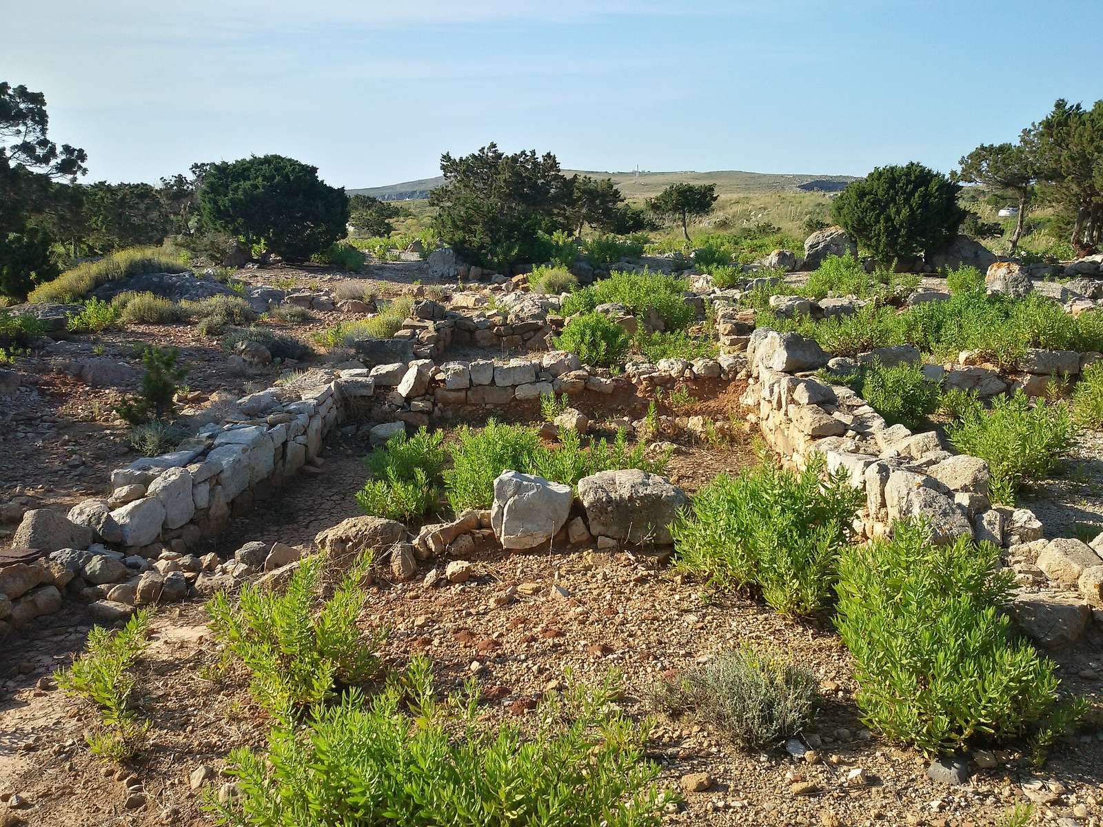
The archaeological landscape follows the natural harbour, with the Roman city on its western side and the military camp on high ground near the harbour’s southern end. The remains include Roman buildings, Christian religious and burial sites, a Muslim-period structure, and later coastal defenses. The harbour and its rocky approaches help explain the arrangement of activity around the port.
Harbour setting
Natural harbour
The sheltered inlet runs south-southeast for about 800 metres and is approximately 150–200 metres wide. Porros Island and a rocky arm extending roughly 200 metres from the Cavalleria peninsula flank its entrance. Joined underwater, they form a natural barrier that reduces wave action in rough weather. The peninsula projects north, while the eastern end rises to Punta Llevant, an 89-metre-high cliff. On the western side, a long subsidiary peninsula and two small rocky islands near the coast further shape the harbour landscape.
Working shoreline
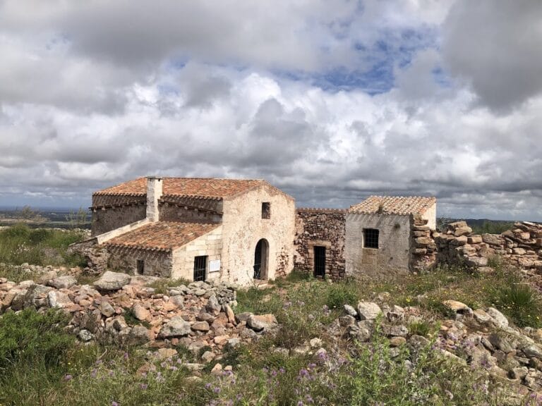
S’Almadrava is a small, white traditional house built at the end of the eighteenth century. South of the harbour lie an old limestone quarry and a lime kiln, which may date to the eighteenth or nineteenth century. At the shoreline, two semicircular structures made of irregular limestone blocks and a wall running east-west into the sea may have formed a dock for British soldiers and small defensive positions controlling boat arrivals.
Roman settlement
Military camp
The Roman camp occupied high ground about 15–20 metres above sea level near the southern end of the harbour. Its described defenses included towers near the coast for watching the harbour entrance and northern Menorca, as well as a trench. Barracks and spaces for daily military work included areas for treating training injuries, repairing clothing and boots, and working lead for sling projectiles.
City and pottery
The Roman city lies west of the harbour. Its estimated area is about 57,000–60,000 square metres, with the maximum expansion put at roughly 14 acres. Surveyed pottery ranges from Punic material to late Roman wares. The assemblage includes Punic amphorae, large ceramic containers used to transport goods, as well as Roman imports from North Africa, southern Gaul, Tarraconensis, and Baetica. Late Republican Dressel 1 amphora fragments make up 4 percent of all surface fragments and 21 percent of the amphorae. North African material accounts for 57.5 percent of recorded ceramics, and North African cooking wares make up 21 percent of ceramics recovered in surveys. Some coarseware, about 20 percent of recovered fragments, may be locally made by hand or Iberian in origin.
Late antique buildings and churches
Building C
Building C consists of eight rectangular rooms and was occupied from about 450 to 524. Some rooms served for storage. One contained a press, probably used to make local wine, although connected cisterns may instead have supported purple-dye production or the salting of fish. The cisterns were lined with opus signinum, a Roman mortar made with crushed pottery. Room C14 held five large African amphorae and a fragment of a marble altar table. Compacted clay formed the floor, and stone slabs marked room entrances.
Earlier basilica
The first early Christian basilica has a rectangular plan, faces east-west, and is divided into a central aisle and two side aisles. At its eastern end, a rounded apse projects from the central aisle. Its floors include opus signinum. Four stone-lined graves lay beneath the floor, with another twenty-one in the surrounding area. A large sarcophagus made from a single stone block was visible nearby.
Later basilica
A second basilica, part of a complex on the western side of the harbour that may date to the sixth century, has three aisles, a rounded apse, and a presbytery, the area around the altar. Its worked masonry blocks are well preserved, and excavated floors were paved with stone slabs. The building preserves evidence of several phases: walls from an earlier structure were partly reused, the church was built and used from about the mid-fifth century, and later partitions divided parts of the central and left aisles into smaller domestic rooms. Hearths and amphorae used for storage belong to this later domestic use. The base of the apse is slightly higher than the rest of the aisles. A wall three metres beyond and parallel to the basilica’s eastern boundary has an undetermined function.
Building 10
Building 10 forms part of the same western complex. Its large, multipurpose plan includes rooms interpreted as stores, storage areas, cisterns, bedrooms, kitchens, latrines, dining rooms, and courtyards.
Necropolis
The cemetery excavated between 2008 and 2011 contains 44 tombs arranged in rows with passageways. Most are cist tombs, burials in stone- or tile-lined pits; two are simple pit graves and one is an amphora burial, in which a large ceramic vessel served as the grave container. The tombs were cut into calcareous bedrock, lined with tiles, and covered with stone slabs. They generally run east-west, with the head at the western end. Burials were single or multiple, with bodies usually laid on their backs and extended. Some graves were reused, and displaced bones were placed at the sides or collected in deposits that may reflect use of the tombs as bone repositories.
The excavated tombs held the remains of at least 250 people, along with many disarticulated bones and teeth. One grave, Tomb 42, contained a one-year-old child in an African amphora. Grave goods from some burials include earrings, rings, pendants, ceramic and glass-paste beads, and clothing pins. Most recovered grave materials date to the sixth century; some beads had been reused from Punic times. Skeletal analysis indicates high mortality among young children and adults, few older adults, and an estimated life expectancy of 31–40 years. Male and female adult mortality was nearly equal. Commonly observed conditions include dental calculus, joint disease, and nonspecific infection.
Underwater remains
Harbour finds
Underwater surveys have identified Roman amphorae dating from the first to fourth centuries AD, as well as later Roman types. Rims collected in 1979 carried the stamps LEPMI BSCD and TEP/LOP. A 1994 survey recorded isolated finds and anchors, including an intact South Gaulish inkwell and four Roman anchors; two others may be medieval or post-medieval. A complete, well-preserved Roman glass vessel was found in 1999. In 2001, surveyors identified thirteen amphora clusters and five additional anchors, bringing the recorded total at that time to eleven. Later work found further amphorae, anchors, lead anchor stocks, and stone anchors. One Roman anchor stock from Sanitja weighed 26 kilograms. In 2009, amphorae and stone anchors were recovered for safekeeping and detailed study.
Shipwreck evidence
A 2006 investigation of the Bourgianen identified timber wreckage, iron concretions, and a possible swivel gun, a small cannon mounted on a pivot. A wreck section recorded in 2009 comprised fourteen framing timbers, four ceiling timbers, and two partly visible outer-planking timbers. These are, respectively, hull supports, timbers lining the inside of the hull, and exterior boards. Scattered masonry and rectangular anthracite blocks on the seabed are thought to come from La Asunción.
Later buildings and defenses
Muslim-period mosque
The mosque is a small rectangular room built from reused Roman construction material. A rounded mihrab, the niche indicating the direction of prayer, projects from the centre of its southern wall. Its entrance has not been identified and may have stood opposite the mihrab in the middle of the northern wall.
Watchtower and batteries
The English watchtower at the harbour entrance was built in 1800. It is circular and has four levels: a rainwater cistern below ground; a ground floor divided into three rooms for supplies and weapons; a sleeping floor for the garrison; and a top floor with a swivel gun. The upper level provided a view of a wide area that included the towers at Fornells and Mount Toro. About 30 metres to the east, batteries were protected by a low dry-stone wall, 80 centimetres high, running parallel to the coast.
Lighthouse
The lighthouse at Cavalleria Cape, built in 1857, stands 15 metres high and 94 metres above sea level. Its light flashes twice every ten seconds and has a range of up to 26 nautical miles.
S’Almadrava
The small traditional house at S’Almadrava was built at the end of the eighteenth century. Its continued use as shelter for fishermen from Fornells lasted into the mid-twentieth century.