Sabina Henrica Fort: A French Coastal Defense Fort in the Netherlands


Site at a Glance
- Rating
- 4.4
- Popularity
- Medium
- Country
- Netherlands
- Primary era
- Modern
- External website
- Open
- Eras represented
- Modern
- Civilizations
- Dutch, French
- Site type
- Military
- Remains
- Fort
On this page12 sections
History
Sabina Henrica Fort is a former French fort in the Netherlands near Willemstad and Helwijk, built in 1810–1811 as part of the defensive line controlling the Hollands Diep and Volkerak waterways. Its construction followed the British Walcheren Expedition of 1809, after which French forces strengthened the coastal defenses. The fort was originally called Fort De Ruijter and stood near the northwestern edge of the Sabina-Henrica Polder.
French origins and renaming
The French built two forts on opposite sides of the Hellegat. Fort De Ruijter was established near Willemstad, while Fort Duquesne was built near Ooltgensplaat. Together, they strengthened control of the waterways leading toward the Dutch interior. After French forces departed in 1813, Fort De Ruijter continued under that name until 1913. It was then renamed Sabina Henrica Fort after a new Fort De Ruyter was constructed at Vlissingen.
The later name came from the Sabina-Henrica Polder. The polder was named for Sabina Henrica van den Santheuvel, who owned it. She was the wife of Michiel Mattheus van Oosterzee, a captain-engineer associated with the design of fortifications around Willemstad.
Modernization and military use
The Dutch Fortress Law of 1874 reorganized and strengthened the national defensive system. Under this program, the fort was adapted to defend against hostile naval forces on the Volkerak and to cover a torpedo barrier, a line of underwater explosive or obstructive devices intended to stop enemy ships in the waterway. Renovation and modernization took place from 1880 to 1883, and the fort’s weapons were renewed in 1917. In 1902, it could accommodate 514 soldiers.
Sabina Henrica Fort was decommissioned as a fortress work on 22 March 1923. In 1936, the government leased three forts near Willemstad, including Sabina Henrica, to the Amsterdam Civic Guard for ten years. Sabina Henrica was used as a work camp rather than a holiday residence, but the experiment failed and all its residents had left before Christmas that year. In 1937, the fort became a work camp for unemployed young people. Under Civic Guard direction, dozens of young people repaired and restored parts of the complex.
War, flood, and later preservation
During the mobilization and the German invasion of May 1940, the fort served as military accommodation. The surrounding land was inundated between 10 and 13 May. Much of the garrison left on 12 May, while the remaining troops had little ammunition and hand grenades that could not be used. Two light machine-gun groups were added, and a new commander took control.
On the afternoon of 14 May, the garrison saw German armored cars attack neighboring Fort De Hel. The troops had no weapons capable of confronting armored vehicles, so they withdrew through Dintelsas and were later captured by German forces. During the Second World War, the fort also sheltered civilians.
The North Sea flood of 1953 brought a further tragedy. The outer dike of the Sabina-Henrica Polder broke near the fort, allowing brackish water into the polder. During the night of 31 January to 1 February, the keeper’s house near the entrance was swept away. Fort keeper Matthijs Mackaij, his wife, their two daughters, and a grandson died. About one kilometre of dike between the fort and Dintelsas along the Volkerak was destroyed, including a final breach of approximately 400 metres near the fort. The breach was closed by the end of March 1953.
The fort remained an ammunition store into the 1950s and 1960s. It was sold to the municipality of Fijnaart and Heijningen in 1977 and to Staatsbosbeheer in 1981. Since 2012, Stichting Fort Sabina has managed the site, which is now used as a nature area. Sabina Henrica Fort is protected as monument number 521705, and the fort and its surroundings adjoin the Sint Antoniegorzen nature reserve.
Remains
Earthworks and military structures
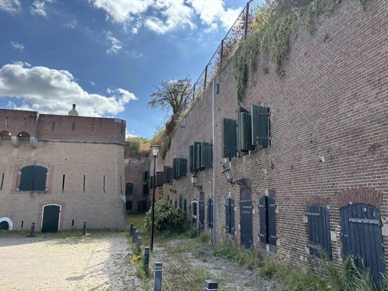
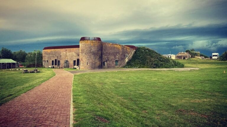
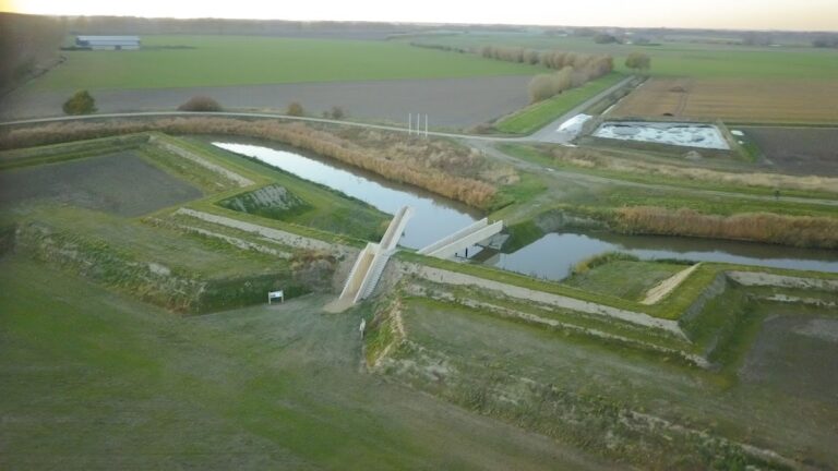
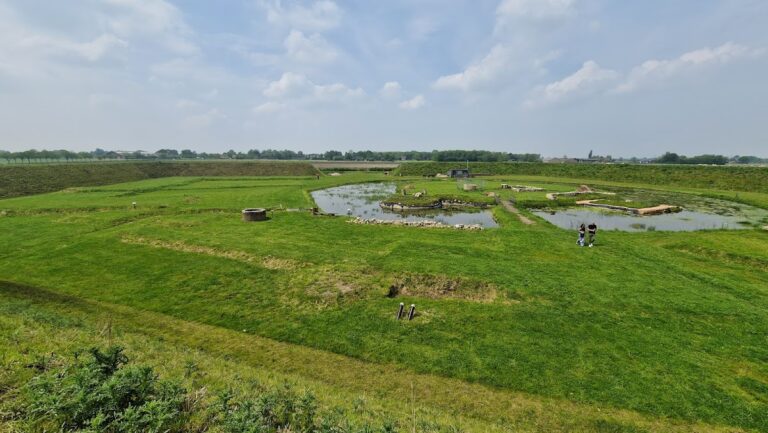
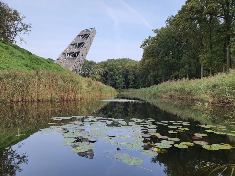
The fort is enclosed by an earthwork embankment shaped as an irregular pentagon and surrounded by a wet moat. Brick forms part of its construction. Within the earthwork stands a French military tower of the Tour modèle no. 2 type, a standardized French tower design used for defense and protected storage. The tower could hold 21 tonnes of gunpowder, while the original fort had a garrison of 69 men.
Torpedo-barrier sheds
Post-1874 defensive works included sheds for storing the components of the torpedo barrier. The barrier was intended to be placed in the waterway to obstruct hostile shipping, extending the fort’s defensive function beyond its moat and earthworks.
Waterworks and access features
Inundation sluice
An inundation sluice, a controllable structure for deliberately flooding land, enabled the terrain in front of the fort to be submerged rapidly as a defensive measure. The sluice dates from 1885 and has been restored by the local water authority.
Outflow canal
An outflow canal ran immediately north of the fort and emptied into the Heyningse, also called the Helse, Haven on the Volkerak. Around 1960, the harbor disappeared and the sea dike was closed, ending the canal’s connection with open water.
Drawbridge
The fort’s drawbridge dates from 1871. Its restoration has been planned.
Natural features
Parts of the fort are used by whiskered bats and Daubenton’s bats. A bird reserve lies beside the fort, while nearby saline, nutrient-poor grasslands support yellow salsify and saltmarsh grass.