Súľovský hrad: A Medieval Defensive and Watch Castle in Slovakia



Site at a Glance
- Rating
- 4.8
- Popularity
- Medium
- Country
- Slovakia
- Primary era
- Medieval
- External website
- Open
- Eras represented
- Medieval, Early Modern
- Civilizations
- Hungarian
- Site type
- Military
- Remains
- Castle
On this page13 sections
History
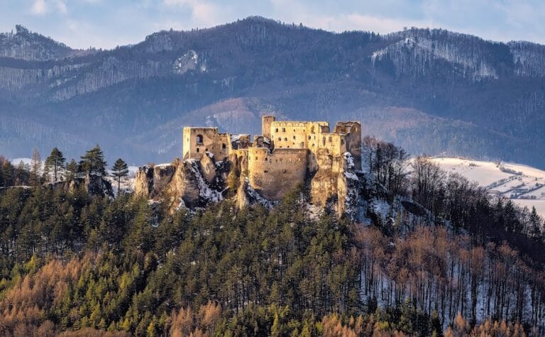
Súľovský hrad is a late-medieval defensive and watch castle in Slovakia, rising above Súľov-Hradná in the Súľov Rocks. Built and developed by medieval Hungarian rulers and noble families, it guarded an old trade route through the Váh valley and later served to observe and protect the surrounding area.
Early occupation and the Roháč fortification
Archaeological evidence points to occupation on the site in the thirteenth century. The location may originally have held a royal castle, while the Súľov estate had entered noble hands by 1336, when the castellan Eliáš acquired it. The precise connection between this early occupation and the later castle remains uncertain.
A small fortified structure or masonry watch post probably stood here by the first half of the fifteenth century. It was known as Roháč, and its first written reference dates from 1470. In that year, Matthias Corvinus, the fifteenth-century king of Hungary, authorized its completion, enlargement, or transformation into a defensive castle. The work was completed around the same time, possibly with the influence of Italian builders.
The first lords of the castle were members of the Súľov family, who also owned the village of Súľov. During the early sixteenth century, Nicholas Kostka sought control of the stronghold. He first supported John Zápolya and later became a supporter of Ferdinand of Habsburg. The Podmanicky family of nearby Bystrica Castle also claimed Súľov, and later documents show that they controlled it for a period.
Ownership disputes and rebuilding
In 1550, the castle was granted to Sebastian Sirmiensis, but Rafael Podmanicky refused to leave. A prolonged legal dispute followed, and Sirmiensis took possession in 1552. The Sirmiensis-Súľovský family then retained ownership until the castle fell into ruin.
A fire destroyed Súľovský hrad in 1550. The castle was rebuilt to its previous extent because the difficult terrain prevented expansion or the construction of additional buildings. Further alterations and repairs followed during the seventeenth century, maintaining the defensive complex within its restricted rocky setting.
Decline and abandonment
In 1682, Katarína Bošániová began a comprehensive renovation with the approval of Leopold I, the Habsburg emperor. She died of typhus before the work was finished. Her son Kasper, also known as Gašpar Sirmiensis-Súľovský, later defended the castle successfully against the troops of Francis II Rákóczi. Rákóczi was a Hungarian nobleman who led an uprising against Habsburg rule, and his forces included kuruc insurgents. By 1703, however, the buildings were already described as being in poor condition.
Troops still occupied the castle in 1730, when it continued to serve defensive purposes. Repairs were hindered partly by disagreements within the Sirmiensis family, while its members lived in more comfortable manor houses in Súľov. In 1739, one family member still used rooms and a kitchen in the castle, and a single person served as both guard and gamekeeper.
Between 1752 and 1759, the family removed its possessions and movable furnishings. The castle then ceased to be a residence. It stopped being guarded in 1780 and received no further care. An earthquake on 15 January 1858 severely damaged the ruins, which were never rebuilt. The castle later burned again and deteriorated further, leaving fragments of masonry and other traces attached to the surrounding rock formations.
Remains
Rock setting and castle layout
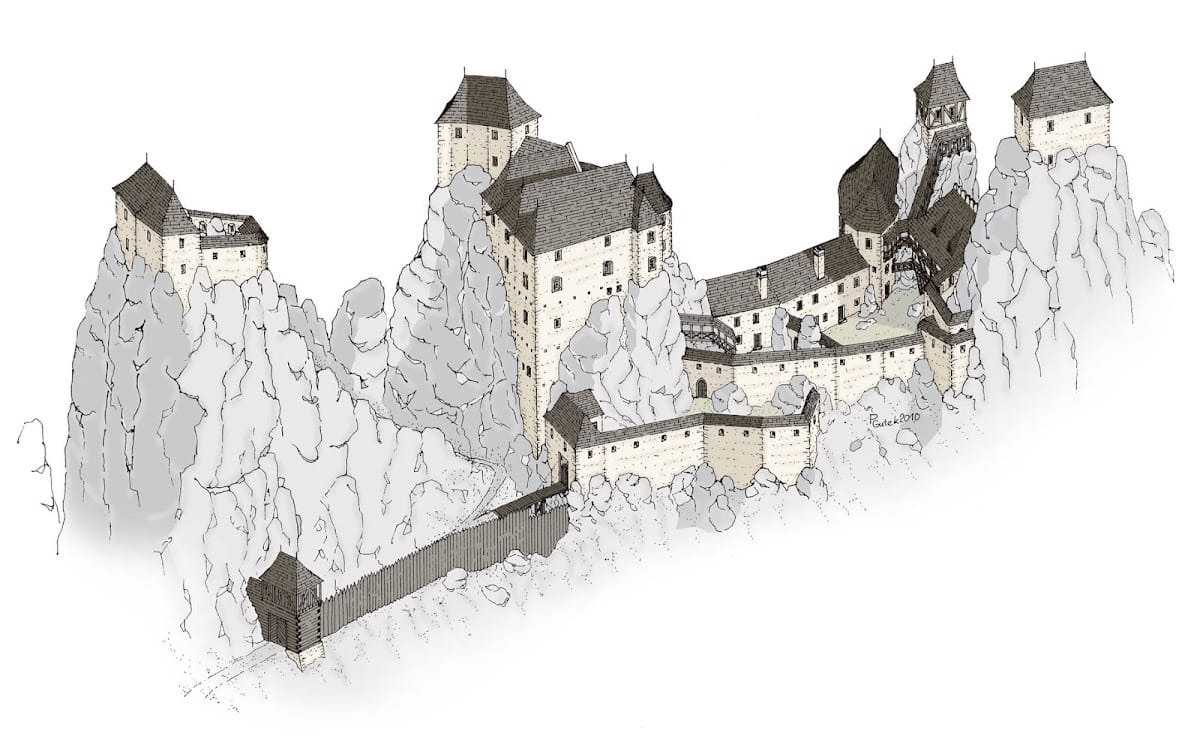
Súľovský hrad was built between three substantial rocky towers or formations at an elevation of approximately 660 metres. Its foundations followed the natural terrain closely, and the complex was divided into a lower castle and an upper castle. The two sections stood about 25 metres apart. The floor of the upper castle’s first level was approximately 14 metres above the lower castle, while the surviving ruin extends through an overall vertical difference of about 18 metres.
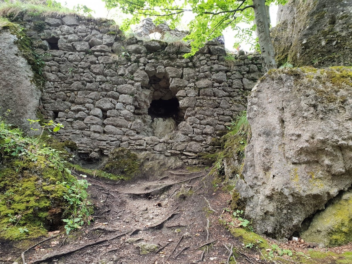
The upper and lower sections were linked through steep, confined terrain. The castle’s construction incorporated the surrounding rock, with foundations, passages, stairs, and structural supports adapted to the available surfaces. Surviving evidence consists mainly of foundations, small wall fragments with window openings, and cuts in the rock made for beams and supports connected with vaulted ceilings.
Lower castle and entrance defenses
Defensive entrance tower
Entry to the lower castle was controlled by a defensive entrance tower, a fortified vertical structure used to protect access. The tower measured approximately 5 by 10 metres and contained several levels. Its walls were between 80 and 120 centimetres thick. The ground-floor room retains four visible windows and about eight loopholes, narrow openings through which defenders could observe or fire outward.
Lower palace and upper passage
Part of the lower palace survives beside the rock that supported a viewing platform. The entrance can still be identified, including a loophole cut directly into the rock. In front of the route toward the upper castle, the rocky passage widens at the entrance area, preserving part of the approach through the natural formation.
Upper castle structures
Narrow entrance and rooms
Access to the upper castle passed through an extremely narrow cleft in the rock, barely wide enough for one person, and was further protected by a drawbridge. The upper section probably contained about 18 rooms, most covered by stone vaults. Their walls were approximately 80 to 100 centimetres thick. Rooms set at different elevations were connected by steep stairs cut directly into the bedrock.
Central palace and rock-cut features
In the former central palace, fragments of a vault and traces of stone stairs remain. A stone pillar still bears marks made by the stairs. From this area, a masonry opening and an iron ladder lead toward the highest part of the castle. The surviving structural traces show how the upper buildings used both masonry and the natural rock as parts of the same compact complex.
Cistern and watch post
A cistern, a chamber for collecting and storing water, was cut into the rock of the upper castle. It measures approximately 80 by 150 centimetres and is filled with rubble and broken rock. The highest rock supported a watch post that provided a wide view over the surrounding area. Traces of both the cistern and the watch post remain among the uppermost features of the ruin.
The ruins lie within the Súľov Rocks nature reserve and the Strážov Mountains Protected Landscape Area.