Roman Villa of Freiria: A Roman Rural Estate in Portugal
Site at a Glance
- Popularity
- Low
- Country
- Portugal
- Primary era
- Classical
- Eras represented
- Iron Age, Classical, Medieval, Modern
- Civilizations
- Portuguese, Roman
- Site type
- Domestic
- Remains
- Villa
On this page18 sections
History
The Roman villa of Freiria, also known as the Villa Romana do Outeiro de Polima, is a Roman rural estate in Portugal, combining a residence with agricultural activity. It was occupied from the late 1st to the early 5th century CE and was probably completed in the 2nd century.
Prehistoric and Iron Age occupation
Human activity in the surrounding area reaches back into prehistory. A Palaeolithic site lies about 300 metres north of Freiria, a Chalcolithic settlement about 200 metres to the northeast, and two Late Bronze Age settlements stood at Cabeço do Mouro. Radiocarbon dates place some finds from Freiria in the second half of the 10th century BCE. The Chalcolithic, or Copper Age, was a period when copper tools came into use alongside stone tools.
Occupation at Freiria itself began by the late First Iron Age and continued into the Second Iron Age, overlapping briefly with Roman activity. Imported goods were common earlier in this phase, while locally made pottery became more prevalent toward its end. Late Iron Age pottery points to possible connections with communities inland or farther north, and the earliest Roman objects occur alongside the latest Iron Age material.
The Roman estate
Freiria grew in importance during the 1st century CE. Building and renovation continued into the 5th century, when the estate began to decline. Titus Curatius Rufinus may have been one of its early owners and may have commissioned an altar to the indigenous deity Triborunnis around the middle of the 1st century CE.
After abandonment
After the villa was abandoned, children and adolescents were buried in part of its former residential area.
Investigation and protection
Virgílio Correia reported Roman remains in the area in 1912 after finding a Roman grave near a quarry while searching for a cemetery. Systematic investigations began in 1973, led by Guilherme Cardoso and José d’Encarnação. They confirmed Roman occupation as well as earlier Chalcolithic and Bronze Age activity. Excavations identified the villa in 1985 and continued in campaigns through 2002, including work on a previously recognized Chalcolithic settlement on an adjacent slope.
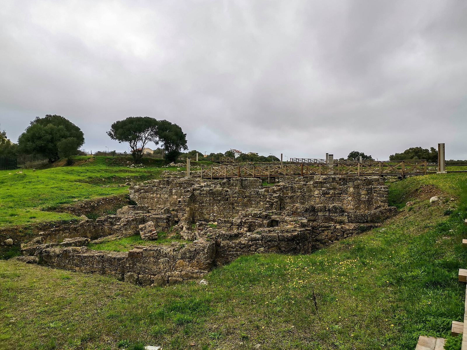
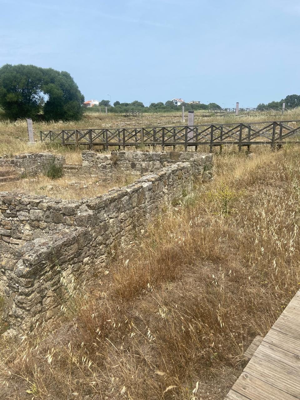
The villa and surrounding area received Portuguese Property of Public Interest protection through a 1990 listing and further measures in 1997 and 2005. In 2018, a rehabilitation project cleaned, conserved, and consolidated the ruins and added wooden walkways across the excavation area.
Remains
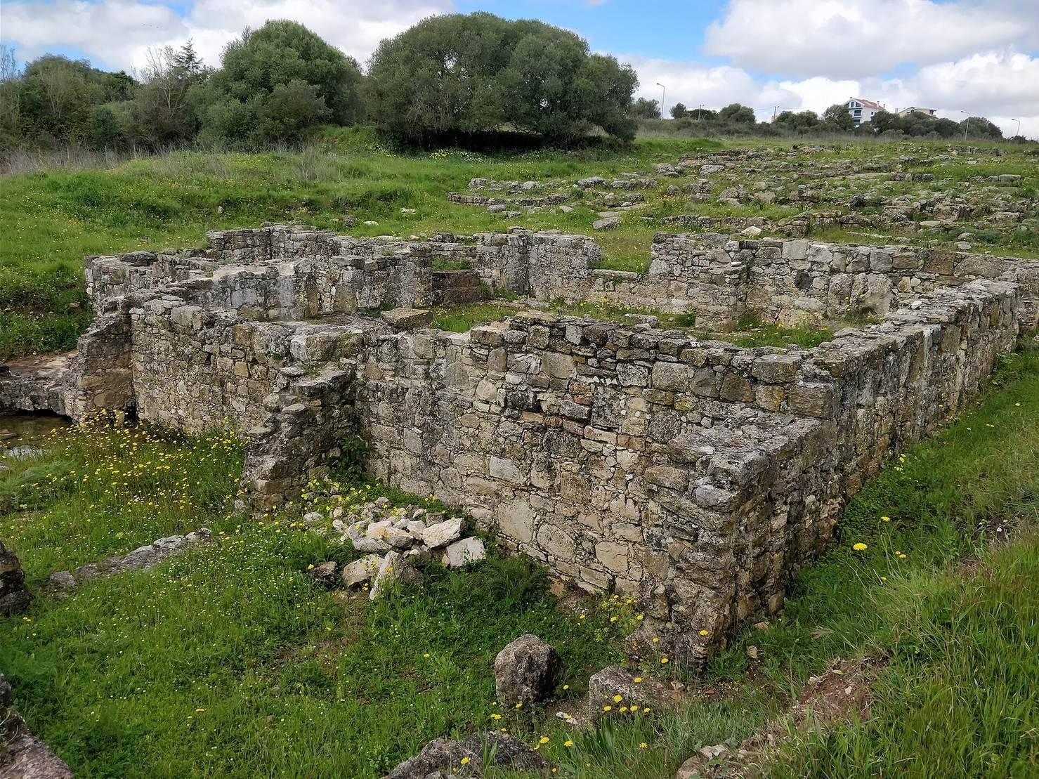
The villa is spread across a small valley between Polima and Outeiro de Polima. The slope descends south and east toward the Ribeira de Polima, formed by two small watercourses before flowing into the Ribeira da Laje. The principal house and granary stood near the upper slope, around 80 metres above sea level, while the baths lay farther south near the valley floor, at about 70 metres. More than 3,500 square metres have been investigated, revealing five principal areas: the main residence, an olive-processing complex, another residential area, a granary, and the baths. The villa is not fully excavated. Down-slope remains are comparatively well preserved, and erosion has exposed deposits up to two metres deep.
Earlier settlement
The earlier settlement occupied a sunnier, more sheltered slope beside the valley chosen for the Roman villa. Possible stretches of wall survive there. Later intensive agriculture damaged some of the prehistoric structures.
Residential and agricultural buildings
Main residence
The main residence, in the northwest of the excavated area, measured about 27 by 20 metres and once had two storeys. Its rooms were arranged around an atrium, an interior reception space, and a peristyle, a courtyard surrounded by columns. The atrium contained an impluvium, a basin for collecting rainwater. A columned passage encircled the peristyle; column bases remain in their original positions, and some capitals were also recovered. A marble column base and a fallen capital were found near the courtyard.
Some rooms had polychrome mosaic floors with geometric patterns. A particularly well-preserved square panel has a Solomonic knot at its centre. The walls were plastered, and some were painted. One room may have been a triclinium, or dining room. Ceramic evidence points to two episodes of remodelling between the 1st and 6th centuries CE.
Olive-processing complex
East of the residential areas stood an agricultural complex probably used to store and process produce. Its press was likely used to make olive oil. Surviving equipment includes stone counterweights and two tanks lined with opus signinum, a waterproof building material made with crushed ceramic.
Granary and associated structures
The granary occupied the upper slope east of the residential areas and covered more than 150 square metres. Parallel north-to-south foundation walls helped accommodate the slope, with buttresses along the northern and eastern foundation corridors. A paved surface surrounded the building. The remains may also represent a walled courtyard with a natural slab floor. A lower section of a mill was associated with the granary. A broad spread of roof tiles may have come from a covered passage linking the agricultural area, including the granary and olive press, with the residence and baths.
Bread oven
A bread oven stood along the southern edge of the agricultural area. It stopped serving its original purpose after the 4th century CE.
Baths
The bath building, south of the granary, measured about 18 by 14 metres and had three principal sections. Its nearly square caldarium, or hot room, had semicircular ends on its western and eastern sides. To the north was a square tepidarium, or warm room, with a semicircular end to the west and another square room to the east. Farther north, the larger frigidarium, or cold room, had a western extension. Excavation revealed a hypocaust, a system that heated rooms by circulating hot air beneath floors or through walls, as well as two tanks for cold and hot water lined with waterproof ceramic-rich mortar. A connection ran between the main residence and the cold room. A water tank may have had a supporting buttress and has been interpreted as a possible swimming pool serving the baths and agricultural area.
Cemetery
Excavation on the opposite, southeastern side of the valley exposed part of the cemetery. It included a cremation area and more than two dozen cremation burials from an early phase, followed by later burials of uncremated bodies. A lamp decorated with Diana, the Roman goddess associated with hunting, came from one of the cremation graves.
Finds
Roman objects
Roman finds include everyday pottery, terra sigillata, fine tableware with a distinctive red surface, bricks, and two coin hoards. The younger hoard contains coins spanning the reigns of Gratian and Honorius, both late Roman emperors. Other objects include a small limestone dog with a furrowed brow and bared teeth, a ceramic mould decorated with lions, glass fragments, gaming pieces, nails, needles, bone pins, iron awls, and a bronze needle. Some finds are now held at the Condes de Castro Guimarães Museum.
Sundial and altar
A conical limestone sundial and its horizontal shadow-casting rod were found at the site; this kind of object is rare in Portugal. An inscribed altar was dedicated to Triborunnis.
Pre-Roman objects
Earlier finds include Bell Beaker pottery, a prehistoric pottery style, and Bronze Age objects. Iron Age material includes fine dark-grey and brown pottery, a belt fitting, amphora fragments, and locally made ceramics. The amphorae, large storage and transport jars, indicate cultural and economic influences from the Mediterranean Iberian region, probably carried through communities established at Alcácer do Sal. A small quantity of polished grey pottery may also reflect outside influence.