Roman Bridge of Chaves: A Roman Road Bridge in Portugal
Site at a Glance
- Rating
- 4.7
- Popularity
- Medium
- Country
- Portugal
- Primary era
- Classical
- Eras represented
- Classical, Modern
- Civilizations
- Portuguese, Roman
- Site type
- Infrastructure
- Remains
- Bridge
On this page13 sections
History
The Roman Bridge of Chaves is a Roman road bridge over the Tâmega River in Chaves, Portugal. Built by Roman engineers at the end of the first century or the beginning of the second century under Emperor Trajan, it served the settlement of Aquae Flaviae, the Roman town corresponding to present-day Chaves. A commemorative column dated AD 104 states that the local inhabitants paid for its construction, linking the bridge to the civic organization of the surrounding region.
Roman construction and civic involvement
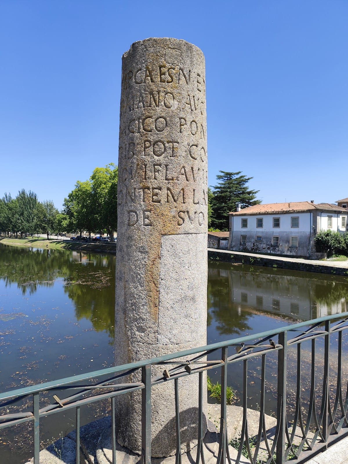
Trajan, Roman emperor from AD 98 to 117, sponsored extensive building and infrastructure projects across the empire. At Chaves, the bridge formed part of this wider Roman investment in roads and river crossings. The inscription now associated with the Padrão dos Povos, a Roman epigraphic monument listing civic communities connected with the region, names imperial officials and ten civitates, or Roman civic communities or administrative districts. A second inscription records the responsibility of the Aquiflavienses, the people of Aquae Flaviae, for arranging the construction of the stone bridge.
The inscriptions preserve more than a record of imperial authority. They also identify a local financial and administrative role in the bridge’s creation. The column was dedicated to the emperors Vespasian and Titus, as well as to an imperial governor and a procurator associated with the Seventh Legion Gemina Felix. Together, the surviving texts connect the crossing with the civic institutions and officials of Roman rule in the region.
Early modern records and the commemorative columns
The bridge first appears in the sixteenth-century book of Duarte d’Armas. His depiction showed 14 arches, parapets between the projecting river-cutters, and watermills on the northern bank. On 7 December 1514, King Manuel I granted Chaves its first charter, and the town’s coat of arms included an image of the bridge.
The Roman inscriptions attracted attention during the sixteenth century. In 1548, the Spanish cardinal Luís de Castro copied an inscription from a column found in Simão Guedes’s vegetable gardens. In 1572, Ambróis de Morales copied another inscription from a column standing opposite the bridge at the house of João Guedes, probably Simão Guedes’s son or grandson.
Between the late sixteenth and seventeenth centuries, the commemorative standard was installed at the northern end of the bridge. It was later repositioned after falling, and the impact broke part of the inscription. Távora copied and published the text in a study completed in 1711 or 1723. In 1738, artillery lieutenant-colonel Rodrigo de Sande Vasconcellos ordered the columns removed. One was placed in the military square and another was used as a marker, while two new matching columns were erected on the town side of the bridge.
Changes from the eighteenth to the nineteenth century
The earthquake of 1 November 1755 caused only minor damage to the bridge. A report dated 27 March 1758 described 12 arches, although the bridge had formerly had 18, and placed it between the suburb of Madalena and Couraças. A drawing from 1762 likewise showed 12 arches and the two columns on the city side of the river.
During the nineteenth century, the commemorative column stood near the middle of the bridge. On 6 December 1878, the king proposed widening the crossing. An inscription dated 1880 records a subsequent remodeling, the construction of a pier, and the placement of the commemorative marker. Around the establishment of the Portuguese Republic, the two end columns received different decorations. One displayed the Portuguese royal arms and crown, while the other carried a fleuron, a stylized ornamental motif. The latter was later transferred to the Museum of Chaves.
Modern alteration, investigation, and protection
The bridge continued to accommodate changing urban uses. In September 1913, João Francisco Alves Carneiro de Lamadarcos received permission to build a metal passage over the bridge and connect it to the first floor of his house, which formed part of the Hotel Comércio. In February and March 1914, authorities approved repairs to the bridge staircase, then in an advanced state of decay. The bridge was classified as a National Monument in 1910. On 1 June 1992, responsibility for it passed to the Portuguese Institute of Architectural Heritage under Decree 106F/92.
Riverbank works and urban construction during the 1930s and 1940s buried or blocked several arches. A long, narrow wall built along the right bank in the 1940s covered four more arches. Four others had already been buried on the right bank and two on the left. Some covered arches were occupied by warehouses that had become commercial premises by 1942.
Hydraulic projects altered the river and its approaches during the mid-twentieth century. A 1956 desilting project included new bridge accesses, followed by a 1961 scheme to widen the river and relieve three arches. Riverbank improvements took place in phases from 1962 to 1964, together with work on the Poldras weir, riverbank protection, and the burial of the former mouth of the Rivelas River. Excavations during these works revealed damage to the footings of seven piers supporting eight arches and uncovered earlier stonework that predated the road between Braga and Astorga.
Further interventions included foundation work and riverbank clearance by the Chaves Regional Commission of Tourism in 1967, improved lighting from 1970, and studies of protection zones in 1972. Between 1981 and 1982, the bridge’s cutwaters were consolidated and their slabs removed. Later work cleared cracks and improved the lighting. In 2001, archaeological prospecting accompanied the remodeling of Chaves’s historic centre, and repair and improvement works on the bridge and riverbanks followed under the Polis program in 2008.
Remains
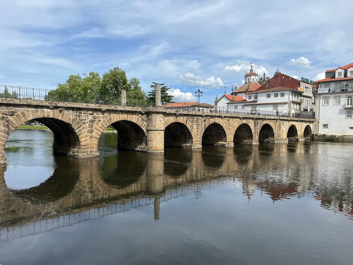
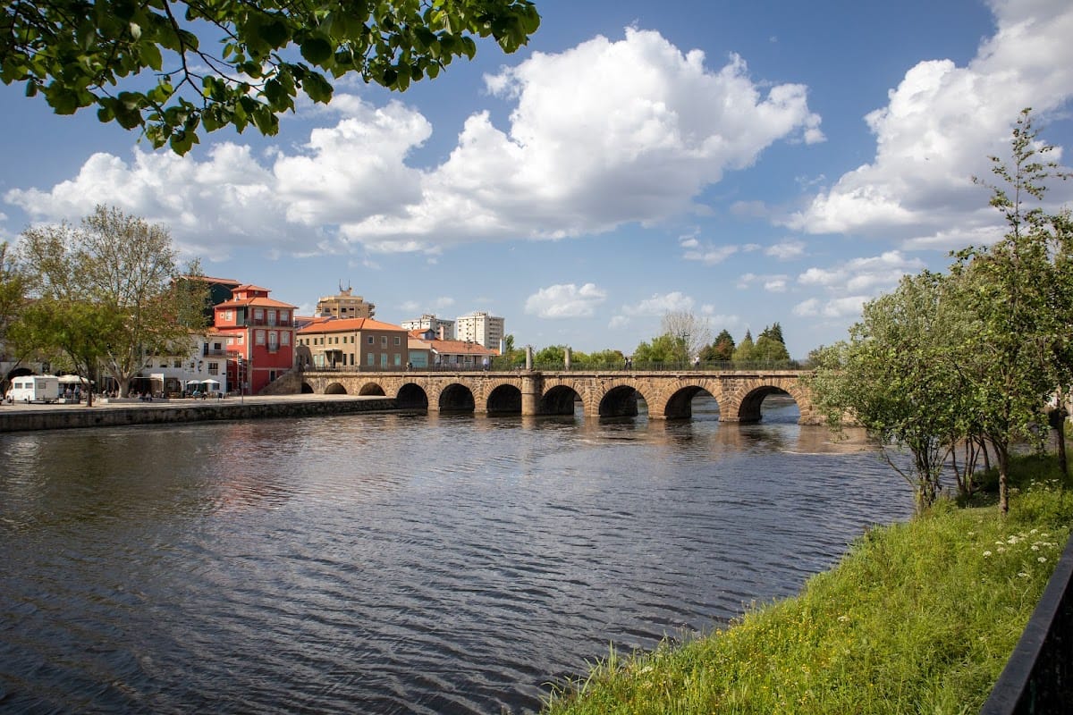
The Roman Bridge of Chaves is a masonry crossing with a flat roadway approximately 140 metres long and 8.9 metres wide. Its regular stone facing and level upper surface extend across the Tâmega, while the surviving structure presents 16 visible semicircular arches. Earlier records give different totals, including 12 arches in 1758 and 18 at an earlier date, reflecting the effects of burial, riverbank construction, buildings, and later alterations. The two arches beside the Madalena neighbourhood rise higher than the others.
Arches, piers, and river protections
Arches and riverbank structures
On the opposite bank, four arches are incorporated into the riverbank and pierced by slatted rectangular openings. Four arches on the right bank are covered by warehouses, while other arches have been buried beneath riverbank works and buildings. A western staircase and a metal passageway between buildings are associated with this side of the bridge. These features belong to the bridge’s long adaptation to the surrounding urban fabric, which also included warehouses and commercial premises in covered arches.
Cutwaters and later piers
Eight slightly staggered, prismatic cutwaters project upstream. A cutwater, or talhamar, is a projecting masonry structure that divides the flow of water and protects a bridge pier. The cutwaters vary considerably in height and size. Their ashlar masonry forms the supports for the arches, although some additional masonry appears attached to the bridge rather than structurally integral to it.
Between the sixth and seventh arches, on both the upstream and downstream sides, projecting semicircular pier structures carry oval masonry cartouches bearing the date 1880. Between the fourth and fifth arches, a two-bodied semicircular pier takes the place of a cutwater, while another pier of similar size occupies the sixth cutwater. The foundations of seven piers supporting eight arches were affected by river works in the 1960s, when earlier stonework was also exposed.
Roadway and commemorative markers
Bridge surface and drainage
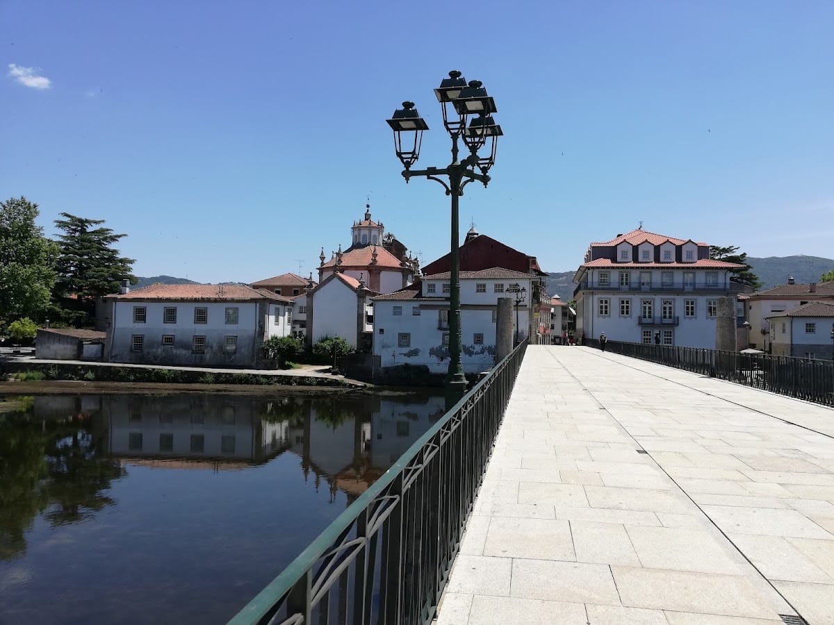
The roadway is paved with parallel granite slabs and bordered by cement side lanes. A stone cornice outlines the outer structure, and regularly spaced semicircular gargoyles carry water away from the bridge. An iron grating forms another part of the surviving structure. The western staircase and the later metal passageway connect the crossing with the built area on the riverbank.
Roman columns
Two cylindrical, monolithic markers stand on a narrow cornice near the centre of the bridge. One is the Padrão dos Povos, whose Latin inscription names Roman imperial officials and ten participating civic communities. The monument is associated with the Roman construction of the bridge and with the Aquiflavienses’ role in arranging the work.
A second cylindrical column was found in the riverbed during dredging in the summer of 1980. Its form resembles the Padrão dos Povos, but prolonged submersion and water erosion have made the inscription difficult to decipher. The discovery accompanied the recovery of a substantial part of the bridge nearby and added material evidence to the history of the Roman crossing.
Roman paving at the Madalena bank
A 50-metre stretch of Roman paving survives on the riverbank in the Madalena neighbourhood. It consists of large stone slabs laid as an oblique ramp. The paving was discovered in 2001, although its later practical use continued into the early twentieth century, when farmers used the route during the dry season to take animals and wagon wheels into the river for cooling.