Priene Ruins: An Ancient Greek City-State in Türkiye

Site at a Glance
- Rating
- 4.7
- Popularity
- Medium
- Country
- Turkey
- Primary era
- Classical
- External website
- Open
- Eras represented
- Classical, Medieval
- Civilizations
- Ancient Greek, Byzantine, Roman
- Site type
- City
On this page29 sections
History
Priene Ruins are the remains of an ancient Greek city-state in Türkiye, at Güllübahçe near Söke in Aydın Province. Priene belonged to Ionia and to the Ionian League, a political and religious association of twelve Greek cities on the western coast of Anatolia. Its earliest foundation was traditionally placed in the eleventh century BCE, although the location of that first settlement is unknown. The later city, rebuilt in the Hellenistic period, occupied the southeastern slopes of Mount Mycale and became one of the best-preserved Greek urban sites in Asia Minor.
Early Priene and the Ionian League
Greek tradition attributed Priene’s foundation to Aipytos, who was said to descend from Kodros, the legendary king of Athens. Another tradition linked later settlers with Philotas, a leader from Boeotia, and associated the city with the name Kadme. These accounts reflect the city’s Greek identity, while its territory extended across an area estimated at 100 to 200 square kilometres. It included land north of the Maeander River, the port of Naulochos, part of Mount Mycale, and at least part of the Panionion, the principal sanctuary and meeting place of the Ionian League.
The early city stood on the coast overlooking the Latmian Gulf and had two harbours, including Naulochos. Its development was repeatedly affected by attacks, political changes, and the accumulation of sediment in the Maeander delta. The Cimmerians attacked Priene, and the Lydian king Ardys conquered it in the seventh century BCE. After the Persian king Cyrus II defeated the Lydian king Croesus, Priene was incorporated into the Persian Empire.
Herodotus stated that the Persians sold the people of Priene into slavery. Whatever the precise circumstances, Priene lost importance during Persian rule. It was active again during the Ionian Revolt, the Greek cities’ uprising against Persian authority, when it contributed twelve ships to the Battle of Lade in 494 BCE. Bias of Priene, counted among the Seven Sages of Greece, came from the city and was associated with its recovery and prosperity in the middle of the sixth century BCE.
Athenian and Spartan Connections
During the fifth century BCE, Priene belonged to the Delian League, an alliance led by Athens that was originally formed against the Persian Empire. The city appears in the alliance’s tribute lists from 454/453 to 442/441 BCE and again in 425/424 BCE. Rival claims by Miletus and Samos over control of Priene contributed to Athens’ attack on Samos in 440/439 BCE. In 398/397 BCE, Priene supported the Spartan commander Dercylidas during his campaign in the Maeander region.
The inhabitants probably abandoned the earlier city around 391/390 BCE and moved to Naulochos, which temporarily served as their polis, or independent Greek city-state. The Panionia festival, associated with the Ionian League, was transferred to Ephesus at one stage but returned to the Panionion in the fourth century BCE, possibly in 373 BCE. The relationship between the earlier settlement and the later city remains uncertain. Priene may have moved to a new location, or the later city may have been established on the site of the earlier one.
The Hellenistic Refoundation
Priene was refounded or substantially reorganized at its present site around 350 BCE or no later than 334 BCE. One interpretation connects this development with Mausolus, the fourth-century BCE Carian satrap whose tomb at Halicarnassus became one of the Seven Wonders of the Ancient World. Another connects the city’s development with Alexander the Great’s campaign in the region in 334 BCE.
Alexander stayed at Priene for a time, supported the completion of the Temple of Athena Polias, dedicated it to Athena as protector of the city, and granted Priene exemption from taxation. Leading citizens also paid for many public buildings, and inscriptions preserved the names of their donors. The refounded city appears to have been governed democratically, with a council, a citizen assembly, and offices including the prytanis, a senior civic magistrate, as well as the secretary, stephanephoros, and timouchos. Priene minted its own bronze coins from the late fourth century BCE.
The new city belonged to the Hellenistic world, the period following Alexander’s conquests and preceding the full Roman expansion in the eastern Mediterranean. Its planned streets, civic buildings, sanctuaries, and houses expressed the organization of a Greek city during this period. Much of Priene seems to have been burned and abandoned during the second century BCE, although the city continued under Roman rule. The silting of the Maeander delta steadily changed its setting. By the Roman period Priene lay several kilometres inland, and its connection with the port was probably lost by about the first century BCE.
Byzantine and Medieval Priene
During the early Christian and Byzantine periods, Priene remained an episcopal see under Ephesus. An episcopal see was the administrative area and centre governed by a bishop. The occupied area contracted to about half the ancient extent, while churches were built and defensive works were added to the acropolis and parts of the lower city. A lower-city fortress occupied the former area of the Sanctuary of Zeus.
After the Byzantine period, Priene declined further and passed into Muslim hands in the late thirteenth century. It was known as Sampson during the thirteenth century, a medieval name associated with the biblical hero Samson. Sabas Asidenos established himself as its ruler in 1204 but soon recognized the authority of the Empire of Nicaea. The region remained under Byzantine control until the late thirteenth century.
After the First World War, the remaining Greek population was expelled during the population exchange between Greece and Turkey. The nearby modern settlement developed under the name Güllü Bahçe, while the former Greek settlement was known as Gelebeç or Kelebeş.
Exploration and Excavation
The Society of Dilettanti investigated Priene in 1764–1766, 1811–1812, and 1868–1869. The first substantial excavations were led by Richard Popplewell Pullan. Larger excavations followed in 1895–1898 under German archaeologists including Carl Humann and Theodor Wiegand. They revealed the city plan, public buildings, and many inscriptions.
Later investigations continued under the German Archaeological Institute, followed by work directed by W. Raeck and W. Koenigs from 1992 to 2000, by W. Raeck from 2001 to 2013, by the Miletus Museum Directorate from 2014 to 2017, and by H. Mert from 2018. Approximately one-third of the ancient city has been excavated. Priene is included on Türkiye’s World Heritage Tentative List under criteria ii, iii, iv, and vi.
Remains
Setting and City Plan
The Hellenistic city occupied the southeastern slopes of Mount Mycale beside the smaller Gaison, or Gaisos, River. Its acropolis stood on the hill of Teloneia, which was connected to Mount Mycale and protected on the south by a very steep slope. The lower city extended down the gentler southern slope. The walled area covered about 37 hectares, including approximately 15 hectares of residential space with an estimated 500 houses.
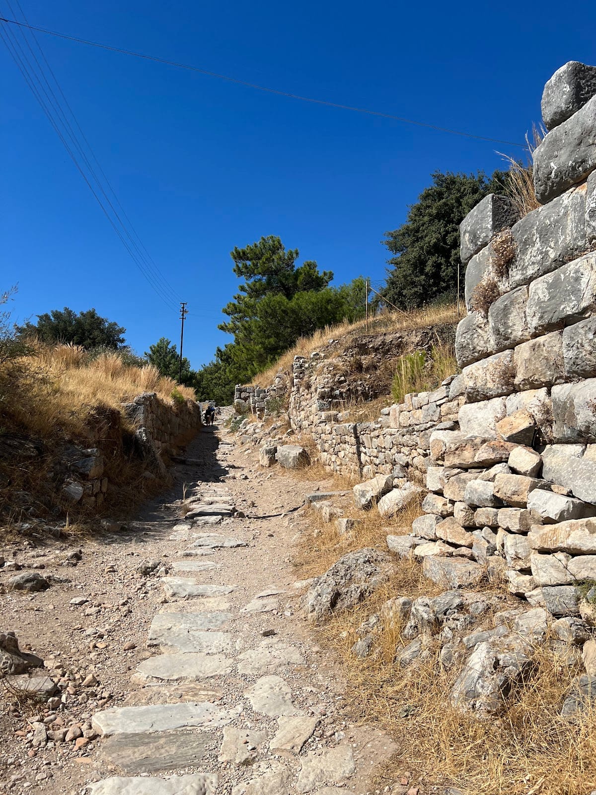
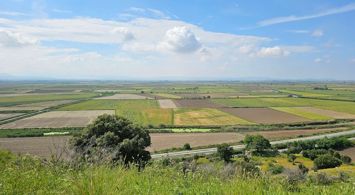
Priene’s original coastal setting changed as sediment filled the Latmian Gulf and the Maeander delta advanced. The ruins now lie about 12 to 13 kilometres from the modern coast. The lower city followed a rectilinear grid associated with the planning principles of Hippodamus of Miletus, an influential Greek urban planner linked with regular street layouts. Six principal east–west streets and fifteen cross streets have been identified. The main streets followed the slope, while the north–south streets climbed against it and often used steps.
The city contained about 80 blocks, usually measuring approximately 35.4 by 47.2 metres. Each block originally held around eight narrow houses, although their internal arrangements changed over time. Principal streets were roughly six to seven metres wide, parallel streets about 4.5 metres wide, cross streets about 3.5 metres wide, and Theater Street about four metres wide. Main streets were paved, while side streets commonly used compacted earth or bedrock. This arrangement remained largely unchanged during the Roman and later periods.
Fortifications and Water Management
Acropolis Walls
The acropolis was fortified along its northern, eastern, and western sides with walls and square towers. The steep southern slope provided natural protection. The fortifications date approximately to 350–340 BCE, are about two metres thick, and survive in places to a height of eight metres. Most towers were solid, while some contained guard chambers. Later Byzantine defenses included the remains of a round tower. Narrow stairs cut into the rock connected the acropolis with the lower city, beginning on the eastern side at the foot of the hill.
Lower City Walls
A roughly semicircular wall enclosed the lower city. It followed the southern side of the settlement and joined the steep slopes of the acropolis at both ends. The principal entrances were the East Gate, the Southeast or Fountain Gate, and the West Gate. Towers protected the circuit, including one beside the Southeast Gate, and the wall survives in places to about eight metres.
Terraces and Waterworks
The steep terrain required extensive terracing. Channels carried rainwater through the settlement, while springs and streams from Mount Mycale fed conduits, a treatment basin, cisterns, and distribution channels. A storage system in the south could help maintain the water supply during a siege. Openings through the fortification walls also allowed rainwater to drain from the city.
Sanctuaries and Temples
Temple of Athena Polias
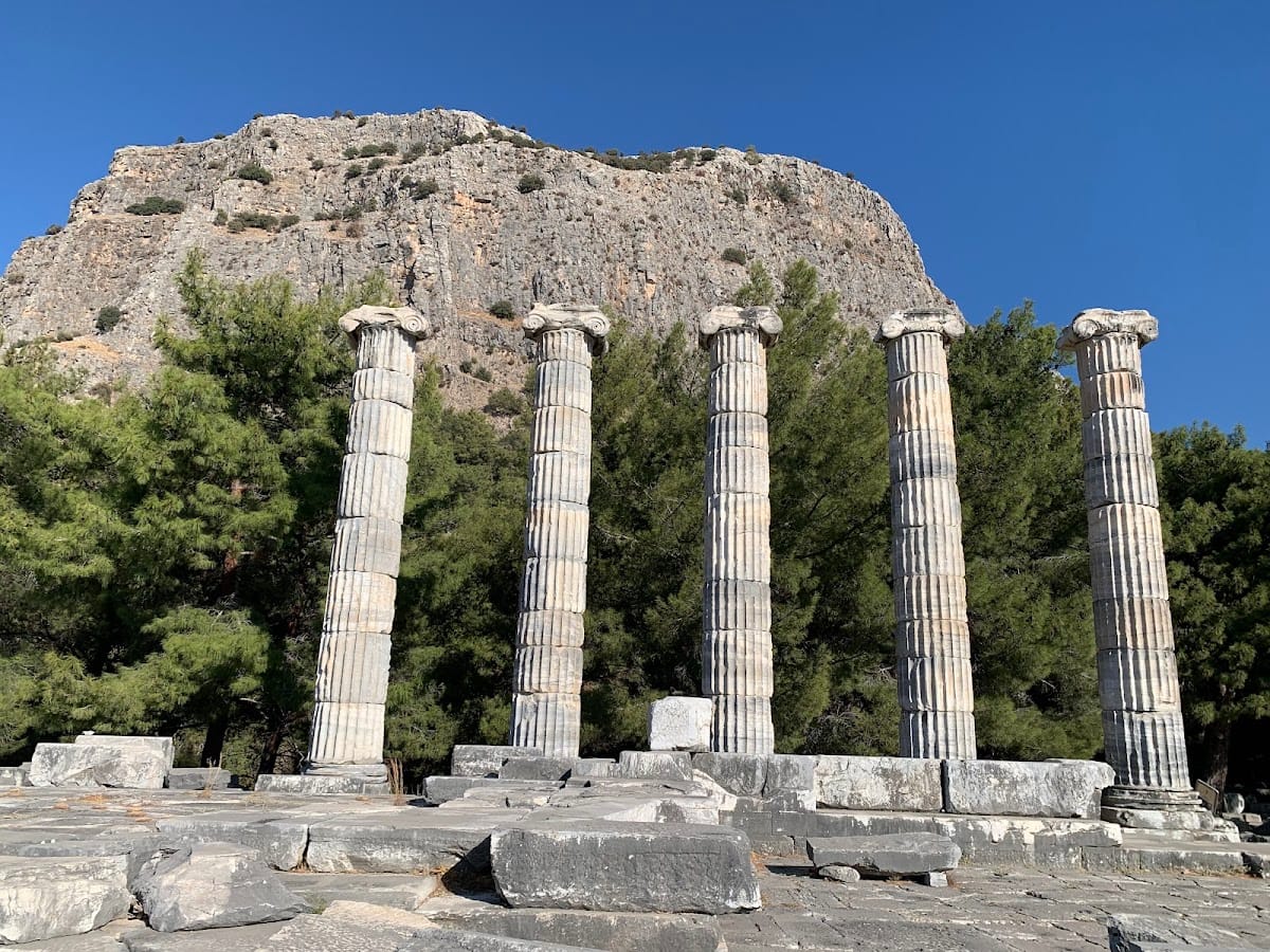
The Temple of Athena Polias occupied a high terrace in the western half of the city, northwest of the agora and north of the principal street. Construction had begun by the 330s BCE and was probably completed during the second century BCE. Designed by Pytheos, it was an Ionic peripteral temple with an 11-by-6 colonnade, a pronaos or entrance porch, a naos or main chamber, and an opisthodomos at the rear.
The foundations and five re-erected columns survive. The reconstructed columns are shorter than the calculated originals. The cult statue of Athena was made in the second century BCE. A portion of a decree issued by Alexander was carved on four marble blocks near the top of the eastern face of the northern projecting wall of the temple porch.
Athena Sanctuary Buildings
An altar stood approximately 12 metres east of the temple. Dating to the second or first century BCE, it measured about 13.2 by 7.1 metres and carried relief decoration, possibly including half-column pilasters in the Ionic order. A monumental propylon, or formal entrance, was built on the eastern side of the sanctuary between about 25 BCE and 1 CE. A Doric stoa, a roofed colonnade, bordered the southern side. Built around 200 BCE, it measured approximately 78.4 by 6.8 metres.
Sanctuary of Zeus Olympios
The Temple of Zeus Olympios stood east of the agora and was connected with its buildings. Constructed around the transition from the third to the second century BCE, it was a small Ionic temple with four columns across the front and columns only at the front, measuring about 11.8 by 8.5 metres. Its sacred precinct measured approximately 30 by 29.7 metres and was surrounded by Doric stoas. Its architectural decoration is now in the Pergamon Museum in Berlin.
Sanctuary of Demeter and Kore
The Sanctuary of Demeter and Kore occupied the northernmost part of the lower city at the foot of the steep southern slope of the acropolis. Built soon after the refoundation, around 350–300 BCE, it consisted of an eastern entrance to a courtyard, a temple on the west, and an altar in the northeast corner. The temple had a columned entrance porch and a transversely oriented main chamber. South of it was an offering pit about two metres deep, faced with cut stone. The altar was added during the Roman period.
Excavations produced statue bases identified by inscriptions as belonging to the priestesses Tmanossa and Nikeso. Recesses for upright stone slabs were found in the western wall of the cult chamber. Finds predating the refoundation may indicate that the earlier city occupied the same location.
Other Religious Buildings
The Sanctuary of the Egyptian Gods, built in the second century BCE between Theater Street and Athena Street, stood east of the theater. Its enclosed sacred precinct contained a large central altar and was dedicated to Isis, Serapis, Anubis, and Harpocrates. A small sanctuary in the western city has been interpreted as the Alexandreion, a cult place associated with Alexander the Great. The building measured approximately 20.5 by 35.4 metres and included a forecourt and small rooms resembling those of a private house. It may have begun as the residence where Alexander stayed before being converted into a sanctuary, although this interpretation remains uncertain.
A small Sanctuary of Cybele stood near the West Gate and included an offering pit. Temples or sanctuaries of Asclepius and other deities have also been identified among the central religious buildings.
Agora and Civic Buildings
Agora and Sacred Stoa
The agora was a rectangular central square used for commerce, meetings, and festivals. It covered about two city blocks and measured approximately 75.6 by 46.35 metres. Stoas and shops bordered its eastern, southern, and western sides, while the northern side opened onto West Gate Street. The eastern edge was later connected with the Sanctuary of Zeus. An altar probably dedicated to Hermes stood at the centre and measured about 6.2 by 5.2 metres. Two stone platforms lay to its east, and numerous statue bases and curved-backed seats were found in the square.
The Sacred Stoa stood across the street to the north. Built around 160–150 BCE, it was approximately 116 metres long. Its facade had 49 Doric columns, while 24 Ionic columns divided the interior into two aisles. Fifteen rooms occupied the rear, and part of the building served as a city archive. Numerous inscriptions were found in its walls.
Bouleuterion and Prytaneion
The Bouleuterion stood along Athena Street north of the Sacred Stoa and formed a building block with the Prytaneion. Built around 200 BCE, it was nearly square, measuring approximately 20 by 21 metres. Seating on three sides accommodated about 600 to 700 people, with another estimate placing the capacity at approximately 640. The hall contained a central altar, a wooden roof, windows in the side walls, and a niche for speakers. It served as the meeting hall of the boule, or city council, and its size may also have allowed the citizen assembly to gather there.
The building identified as the Prytaneion stood immediately east of the council hall. A peristyle courtyard, a courtyard surrounded by columns, was enclosed by rooms. An access space connected it with the northern gallery of the agora, while another room contained a rectangular hearth probably associated with the sacred fire of Hestia. First built around 180 BCE, it was rebuilt during the Roman period no later than about 150 CE. Its Roman phase included a paved courtyard. The building survives poorly, while an inscription records people who held the office of prytanis.
Theater and Athletic Buildings
Greek Theater
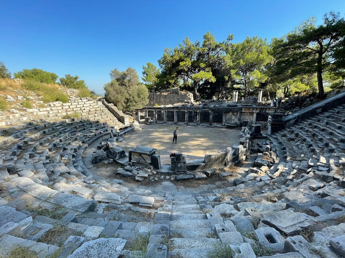
The Greek theater stood beside Theater Street and was built around 300 BCE, making it one of the earliest known Hellenistic theaters. Roman alterations took place during the second century CE, and the building may also have been used for courts. Its seating area, or cavea, extended slightly beyond a semicircle and contained 47 rows. The lower 15 rows survive best. The front row had marble seats with backs for honored persons, and an altar dedicated to Dionysus stood at the centre.
The two-storey stage building survives only at its lower level. Its unusually well-preserved proskenion, the columned front of the stage, measured about 21 metres long and 2.74 metres wide and was supported by twelve columns. Each level of the stage building contained three rooms, while the lower rooms opened onto the proskenion.
Gymnasia
The Lower Gymnasium stood just inside the southern city wall. Built around 130–100 BCE, it had a palaestra, or exercise court, measuring approximately 35.1 by 34.4 metres. Rooms identified as an ephebeion, lecture room, konisterion, korykeion, and elaiothesion surrounded it. Its columns represented the Doric, Ionic, and Corinthian orders.
The Upper Gymnasium stood between the Bouleuterion and the theater. Built in the fourth century BCE, it was repeatedly altered during the Roman and early Byzantine periods, including the addition of baths. Its exercise court was surrounded by rooms, and its entrance opened in the eastern wall. A sanctuary of the imperial cult occupied the northwest corner. The building survives poorly.
Stadium
The stadium lay immediately east of the Lower Gymnasium, inside the southern city wall. Built around 130–120 BCE, it may have replaced an earlier stadium. Its track ran approximately east to west and measured about 191 by 20 metres. Stone seating occupied the central part of the northern side, while a starting-gate structure stood at the western end. During the Hellenistic period, the stadium was connected with a gymnasium.
Houses and Later Religious Remains
Private Houses
Several private houses survive unusually well, many dating to the second century BCE. Their typical arrangement included a vestibule, an open columned courtyard, an anteroom, a principal hall, and surrounding rooms. Some were two storeys high, and certain houses contained bathrooms and toilets. Entrances opened from side streets, while street-facing walls generally had few openings.
Objects found in the houses include fragments of furniture, terracotta pottery, iron and bronze tools, oil lamps, and coins. The largest and best-preserved house stood northwest of the Temple of Athena and belonged to a wealthy resident. It contained a private altar dedicated to Zeus Olympios.
Churches and Synagogue
A three-aisled basilica was built west of the Upper Gymnasium in the fifth century CE and probably served as the city’s cathedral. It included a baptistery and was constructed largely from stones reused from the Gymnasium and the Temple of Athena. Other small churches and an early Byzantine synagogue have also been found.
The synagogue contains carved menorah imagery. A monumental stairway stone leading from the agora to the Sacred Stoa bears a menorah and a shofar alongside a cross, gladiators, phallic symbols, tridents, circles, and other graffiti. This combination has been interpreted as possible evidence of tension or competition between Jewish and Christian communities.
Treasure beneath the Athena Statue
In 1870, silver tetradrachms of Orophernes and jewellery were found beneath the base of the Athena statue. The objects were probably deposited during the Cappadocian restoration of the temple. Together with the inscriptions and surviving buildings, the find contributes to the evidence for the sanctuary’s later history.