Poliochne: A Prehistoric Settlement on Lemnos
Site at a Glance
- Popularity
- Medium
- Country
- Greece
- Primary era
- Bronze Age
- Eras represented
- Stone Age, Bronze Age
- Civilizations
- Unclassified
- Site type
- City
On this page17 sections
History
Poliochne was a prehistoric settlement on the eastern coast of Lemnos, Greece, established around 3700 BCE in the Late Neolithic, the era of settled farming communities. Also called Poliochni, it remained occupied until about 1400 BCE, in the Late Bronze Age, a period named for the widespread use of bronze. It is often regarded as one of Europe’s earliest city-like settlements, growing from a village into a large urban center.
Growth and regional connections
Archaeologists describe seven successive phases, named for the colors assigned to the settlement’s layers. The Black phase dates to about 3700-3200 BCE, followed by Blue (3200-2700 BCE), Green (2700-2400 BCE), Red (2400-2200 BCE), Yellow (2200-2100 BCE), Brown (2100-1700 BCE), and Purple (1700-1400 BCE). Poliochne’s population was about 800 to 1,000 in the Blue phase and reached roughly 1,500 during the Green phase.
The settlement’s position between western Asia Minor and the Aegean islands, along with a sheltered anchorage, plentiful drinking water, and workable farmland, supported a varied economy. Residents farmed, raised animals, fished, made textiles, shaped stone tools and weapons, and worked metal. Trade extended to islands in the northern Aegean and the Cyclades, the coast of Asia Minor, and mainland Greece. The movement of ores and goods by sea helped establish Poliochne as a regional center.
Community life and cultural influences
Movement between the settlement and its fields may have encouraged shared rules for the town and surrounding farmland. Some plots may have been assigned to family groups. Maintaining common facilities and paving gathering places called for collective decisions. A building interpreted as a public meeting place has been taken as possible evidence of community organization with democratic features. Later changes to communal arrangements and the growing influence of a wealthy individual have been interpreted as signs of a shift toward more authoritarian power.
Poliochne belonged to a distinct prehistoric culture of the northeastern Aegean. Its oldest layers show Anatolian characteristics, while influences from Helladic Greece became apparent around 2500 BCE, at the beginning of Early Helladic II, an archaeological term for an early Bronze Age phase on mainland Greece. A possible women-led social structure has also been proposed, drawing on Lemnos’s mythological association with the Amazons, women warriors in Greek mythology, and similarities among some houses. This remains an interpretation rather than an established account of the settlement’s social structure.
Earthquake and decline
A powerful earthquake near the end of the Yellow phase, around 2100 BCE, badly damaged Poliochne, and the settlement was almost entirely abandoned. Limited occupation returned during the Brown and Purple phases. Poliochne is thought to have been a commercial rival of Troy, an ancient city in northwestern Anatolia, and competition between the two has been proposed as one factor in its decline. The hill was abandoned from the end of the Late Bronze Age until the Middle Ages.
Excavation and study
The Italian School of Archaeology at Athens began excavating Poliochne under Alessandro Della Seta, whose campaigns from 1931 to 1936 explored about two-thirds of the settlement. Luigi Bernabò Brea continued work in the 1950s, including campaigns from 1951 to 1956. From 1986, Santo Tiné led further investigations and building-restoration work, with surveys intended to test earlier findings.
Remains
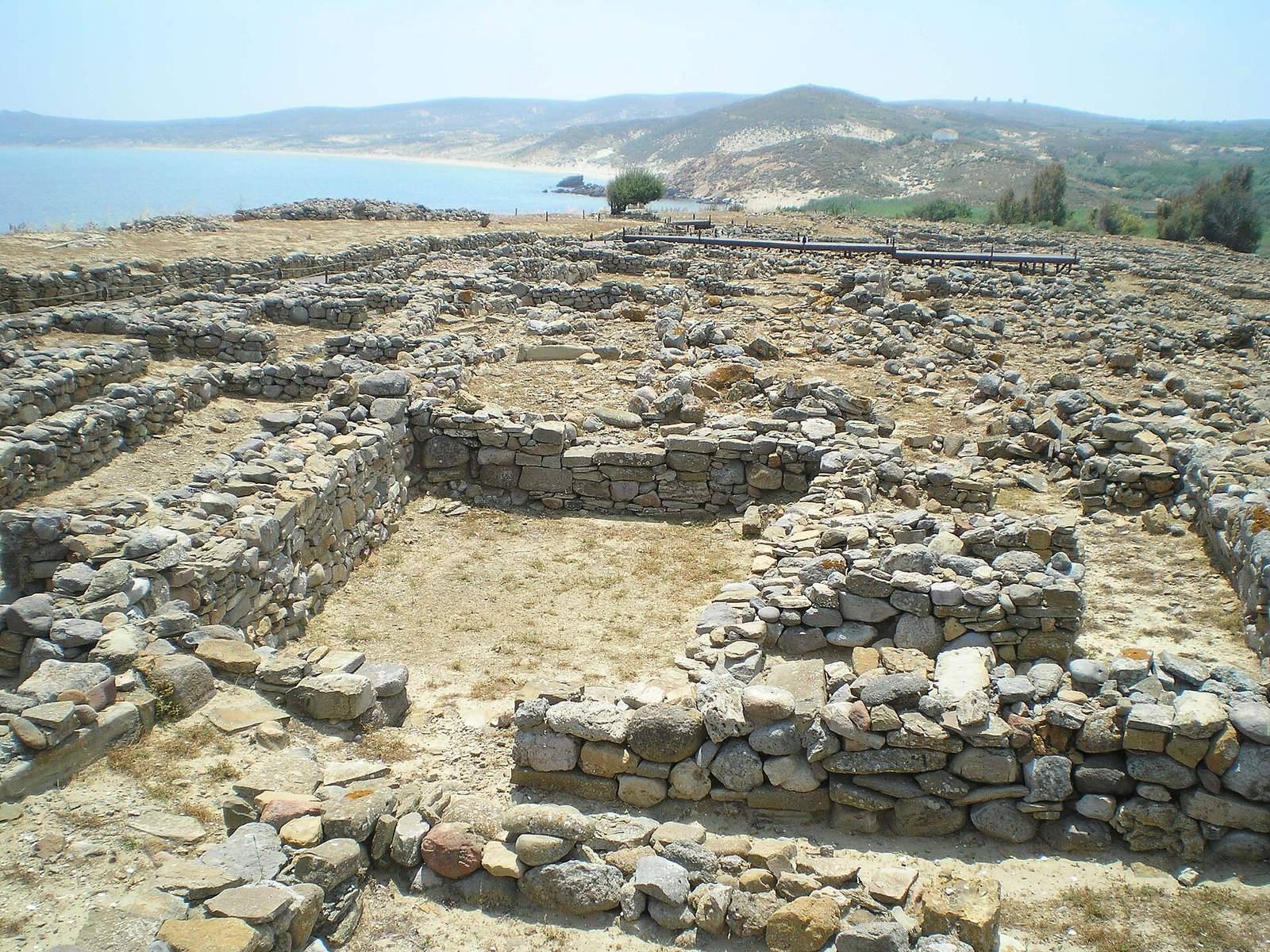
The archaeological area covers about 11,000 to 15,000 square metres on a low, elongated hill beside Voróskopos Bay, between two rivers. In the Yellow phase, the settlement extended across about 20,000 square metres. Its remains show a change from small, light-built dwellings to closely grouped stone houses, with paved streets, shared spaces, and defenses.
Layout, defenses, and shared infrastructure
Enclosure and expansion
A defensive wall was first built along the landward side during the Blue phase, with a main entrance. As the settlement spread north and west, a large retaining wall was added to the north and the western wall was moved farther out. The western side had the strongest defenses, which also protected foundations from erosion by a nearby river. The walls included projecting defensive structures. At their fullest height they reached about five metres, and surviving sections rise to about 4.5 metres.
Streets, squares, and water
Paved streets and open squares formed part of the settlement’s shared spaces. During the Yellow phase, a principal street ran north to south, while paved squares served as gathering places, including for festivals. Wells with built linings descended more than nine metres, and channels collected rainwater.
Housing and public buildings
Houses through the phases
The earliest village stood near the middle of the hill. Its small round or oval huts were made of wood and straw on stone bases. Beneath Megaron 832, seven successive building layers extend more than two metres down; three earlier levels are visible beneath Megaron 605. Later houses were built of stone, often rectangular and packed closely together with shared walls. Blue-phase homes were curved-ended or elongated, while Yellow-phase dwellings formed larger blocks of several rooms, with megaron halls at their centers.
Public buildings
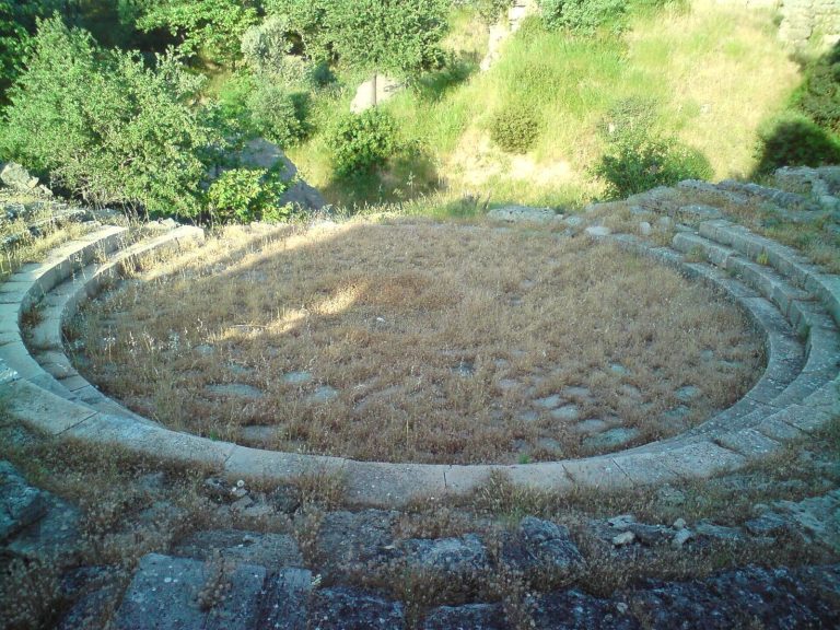
Just inside the main entrance in the western wall stood a building tentatively identified as a council or assembly hall. It covered about 50 square metres and had stone seating tiers along its eastern and western sides, with room for roughly 50 people and a speaking platform in the center. The eastern seating was later removed when a wall was built across that side. A second public building has been interpreted as a central granary, with a capacity of about 260 cubic metres.
Megaron buildings
A megaron is a large hall arranged around a central space. A Blue-phase example belongs to a type associated with Crete, indicating contact between Crete and Poliochne. Monumental rectangular houses of this form appeared in the Red phase. One measured about 10.1 by 7.9 metres, with a central pillar and benches along its side walls; it may have been a palace. Another building of similar form may have served a public purpose. The principal Yellow-phase megaron had numerous storage rooms and may have been a royal palace. Built around 2000 BCE and facing the central square, Megaron 605 was the home of the settlement’s wealthiest and most powerful resident.
Pottery and metalwork
Pottery
Black-phase pottery includes vessels decorated with white painted lines and a high-footed fruit vase. Some of the painted wares resemble pottery associated with the Eutresis culture. A tripod cooking pot belongs to the Blue phase, while the Yellow phase produced two-handled cups of a type also found in later layers at Troy’s second settlement level.
Metal objects and casting
Metal objects appear from the Blue phase, including pins, awls, and a dagger. A mold for an axe with a hole for its handle points to local casting, and stamp seals also date to this phase. Metal casting may have begun as early as the Green phase, perhaps using molds formed around wax models. A Red-phase bronze hoard contained an axe of this type, daggers, and other tools and weapons.
Gold jewelry and museum collections
A large hoard of gold jewelry was found near the principal Yellow-phase megaron. Its workmanship demonstrates advanced goldworking, and the pieces resemble the Treasure of Priam from Troy; they may have come from the same workshop. The jewelry is held by the National Archaeological Museum in Athens. Other finds from Poliochne are exhibited at the Archaeological Museum of Lemnos in Myrina and at the National Archaeological Museum.