Pierre Percée: A Prehistoric Menhir in France
Site at a Glance
- Popularity
- Low
- Country
- France
- Primary era
- Stone Age
- Eras represented
- Stone Age
- Civilizations
- Unclassified
- Site type
- Civic
- Remains
- Megalithic Monument
On this page4 sections
History
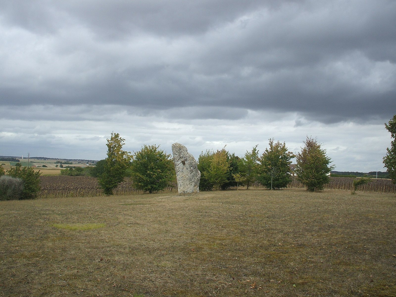
Pierre Percée is a prehistoric upright standing stone, or menhir, near Pesse in Maillé, France. It was probably erected between 2500 and 2000 BCE, although a broader proposed date extends from 4000 to 2000 BCE.
Prehistoric setting
If the stone was raised in the second half of the third millennium BCE, its construction belongs to the Artenacian culture, a Late Neolithic tradition of west-central France associated with distinctive stone and pottery production and long-distance exchange. Grand-Pressigny flint, pottery, and polished stone axes are part of the region’s archaeological context. Some axes are thought to have come from Armorica, an ancient name for northwestern Gaul that included much of present-day Brittany. The spread of these objects along rivers, particularly the Vienne a few kilometres away, has prompted the suggestion that the river served as a major trade route. Some pottery has been interpreted as cheese-draining moulds, an interpretation at odds with a local legend that Arab conquerors introduced cheese-making.
The menhir stands partway up a slope, a position that may have suited early land clearance. Its stony soils, containing silica and clay, are not very fertile and are difficult to cultivate with modern machinery. They may, however, have been easier to work with simple tools than the clay-limestone plains below, while draining better than the damp silts on the plateau. The slope may therefore have been among the first land cleared in the area.
Excavations in 2013 at Fond d’arrêt in Pussigny, several kilometres south of Pierre Percée and near another menhir called Pierre-levée, uncovered substantial archaeological material, field boundaries, and postholes. These finds supported an Artenacian date for that nearby site and pointed to the regional importance of Grand-Pressigny flintworking.
Local traditions and later history
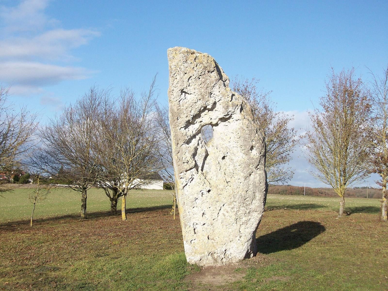
Stories about the stone’s oval opening gave it several supposed uses. Some claimed that condemned people had to put their heads through it before execution, or that sacrificial victims were passed through it. Other beliefs held that presenting children’s heads before the opening would keep them healthy and protect them from scrofula, a tuberculous infection of the lymph nodes in the neck. Local couples were also said to exchange vows of fidelity at the menhir, sometimes passing their hands or a bouquet through the opening. The custom of exchanging a kiss through it seems to have continued.
Other local beliefs credited the stone and its surroundings with protective powers. Lichen taken from the menhir was thought to ward off evil spirits, while grass gathered at its foot was believed to protect cattle from disease. The name Pierre des Arabes (“Stone of the Arabs”) probably arose through a change in pronunciation from Pierre des Érables (“Stone of the Maples”). Érable was an old local word for a maple, said to have grown nearby. An 1880 guide treated Pierre Percée and Pierre des Érables as two different megaliths.
A Touraine tradition placed the Battle of Poitiers of 732, fought between Frankish and Umayyad forces, farther north than Poitiers itself. Some versions linked a battle to the menhir and said that Saracens were buried at its foot. The name Bogue de Gargantua appears to be more recent, arising after the French Renaissance writer François Rabelais helped popularize Gargantua, a fictional giant.
The stone was initially privately owned and was later acquired by the Indre-et-Loire Departmental Council. It was classified as a historic monument in 1911 and appears on Draché’s coat of arms.
Remains
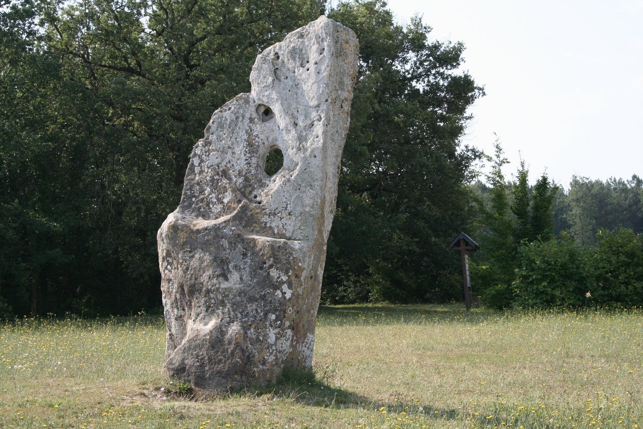
The site centers on a single, slightly leaning menhir on a hillside in northwestern Draché, near Maillé. It stands at about 90 metres above sea level, halfway up a hill whose summit, 106 metres high, lies 800 metres to the southeast. Woodland is beside the stone, which overlooks the plain. An ancient track associated with the menhir forms part of the boundary between Draché to the northeast and Maillé to the southwest. The Indre-et-Loire Departmental Council has marked out and bounded an area around it.
Nearly 4 metres high, Pierre Percée is the tallest standing menhir in Indre-et-Loire. Its base measures about 1.70 by 1.40 metres, and the stone reaches about 1.5 metres across at its widest point. Its broad faces point east and west. An oval opening, approximately 25 by 20 centimetres, lies about 1.40 metres below the top, at roughly two-thirds of the stone’s height. It is thought to have formed through uneven erosion of the stone’s varied rock. A flat surface halfway up has prompted an interpretation of the menhir as an altar.
The stone appears to be made of calcareous rock, composed chiefly of calcium carbonate, though its precise geological identity is uncertain. Tuffeau, a soft, porous limestone, is exposed locally, and slope deposits with a similar appearance occur a little to the south. The buried part of the menhir may extend only about 60 centimetres, and it appears to stand without supporting packing stones. Excavation at its foot in 1910 recovered flint flakes that showed no signs of use.