Penshaw Monument: A Greek-Style Memorial to the Earl of Durham
Site at a Glance
- Popularity
- Very High
- Country
- United Kingdom
- Primary era
- Modern
- Eras represented
- Modern
- Civilizations
- British
- Site type
- Civic
- Remains
- Monument
On this page11 sections
History
Penshaw before the monument
Penshaw Monument stands on Penshaw Hill in the United Kingdom. The Greek temple-inspired memorial was built in 1844–1845 to commemorate John George Lambton, 1st Earl of Durham, a British statesman and colonial administrator. As governor-general of British North America, a group of British colonies in northern North America, Lambton wrote the 1839 Durham Report, which recommended joining Upper and Lower Canada and allowing limited self-government. The monument later became more closely associated with regional identity than with Lambton himself.
The hill may have been the site of an Iron Age hillfort, a defended settlement on elevated ground. Penshaw is named in the Boldon Book, a 1183 survey of lands and obligations, which notes land leased there by William Basset from Jordan de Escoland, later known as Jordan de Dalton. In March 1644, Scottish Covenanters, adherents of a movement defending Presbyterian church governance, camped on the hill after a failed attack on Newcastle and before the Battle of Boldon Hill. Later, an eighteenth-century limestone quarry and farming occupied parts of the area. Penshaw Colliery opened in 1792, and New Penshaw, a mining village, developed to the southwest of the monument site. The wider area had been owned by families including the Bowes-Lyons and Lambtons.
Fundraising and construction, 1840–1845
After Lambton’s death in 1840, a provisional fundraising committee formed in August, followed the next day by a 33-member committee that included the mayors of Newcastle and Gateshead. Its appeal presented the memorial as recognition of Lambton’s public service and personal qualities. About £500 was pledged at the first meeting, and subscriptions reached roughly £3,000 by January 1842. The completed project cost about £6,000, twice the committee’s initial spending limit.
Committee members considered sites in Durham, Chester-le-Street, Sunderland, and Newcastle. In January 1842, Member of Parliament William Hutt proposed Penshaw Hill, noting that it belonged to Lambton and that a monument there would be visible across much of County Durham and near the east coast. Lambton’s wife had also supported the location. The land was donated by Charles Vane, 3rd Marquess of Londonderry, a political opponent of Lambton. Vane explained that he wanted to acknowledge Lambton’s abilities despite their differences and also supplied the building stone.
After seeking the Royal Institute of British Architects’ advice, the committee chose a design by John and Benjamin Green in 1843. Early suggestions had mainly been columns or obelisks topped with a statue. The Greens’ first design drew on temples at Paestum, but the plan was revised to take its model from the Temple of Hephaestus in Athens. An enclosed pleasure garden was also envisaged for the hill. Construction had been underway for several months when Thomas Dundas, 2nd Earl of Zetland and Grand Master of the United Grand Lodge of England, laid the foundation stone on 28 August 1844 in a formal Masonic ceremony. Tens of thousands of people attended, although the columns had then reached only about half their eventual height. Work was completed in 1845.
Damage, conservation, and changing identity
The Lambton Worm, a local tale about a monstrous serpent, became associated with the hill. A folk song by C. M. Leumane, written in 1867, describes the creature winding around Penshaw Hill. The nickname Farmers’ Folly also arose from an unsubstantiated story that local farmers built the monument to impress Lambton, their landlord, who then raised their rents.
In 1889, stones from the monument’s base came loose and rolled down the hill; cracked masonry was repaired in the 1920s. The staircase was closed after apprentice mason Temperley Arthur Scott, aged 15, fell to his death on 5 April 1926 while attempting to cross between the upper walkways. The entrance was kept locked, then sealed with cement and later bricked up after repeated break-ins. Deterioration led to the monument being fenced off in the 1930s. Repairs were underway in 1939, when the National Trust took ownership from John Lambton, 5th Earl of Durham. In April 1950 it was listed at Grade I, England’s highest listed-building category.
The monument escaped damage from Second World War air raids on nearby Houghton-le-Spring, but lightning struck it in 1942, damaging the top of the column containing the staircase. A hole and long crack remained visible a decade later. By 1959, mining subsidence had cracked the north, west, and south sides, and part of a walkway had pulled away from the structure. Repairs followed, including underpinning in 1978 and dismantling and rebuilding of the west side in 1979. Further restoration in 1996 addressed deteriorating columns and lintels. In 2011, the National Trust reopened the staircase under supervision, ending the closure that had followed Scott’s death.
Extensive spray-painted graffiti was applied in July 2014, including text and symbols associated with the film V for Vendetta; specialist contractors removed it. The monument is now regarded as a North East landmark and a regional symbol. It appears on the Sunderland A.F.C. crest adopted in 1997 and forms part of Sunderland’s cultural identity.
Remains
The monument occupies the southwest edge of Penshaw Hill’s summit. Its open, rectangular arrangement is formed by columns raised on a stepped base, with two walkways crossing above them from east to west. The building is made from local gritstone, and its position and surviving woodland form part of the site’s physical setting.
Hilltop and surrounding land
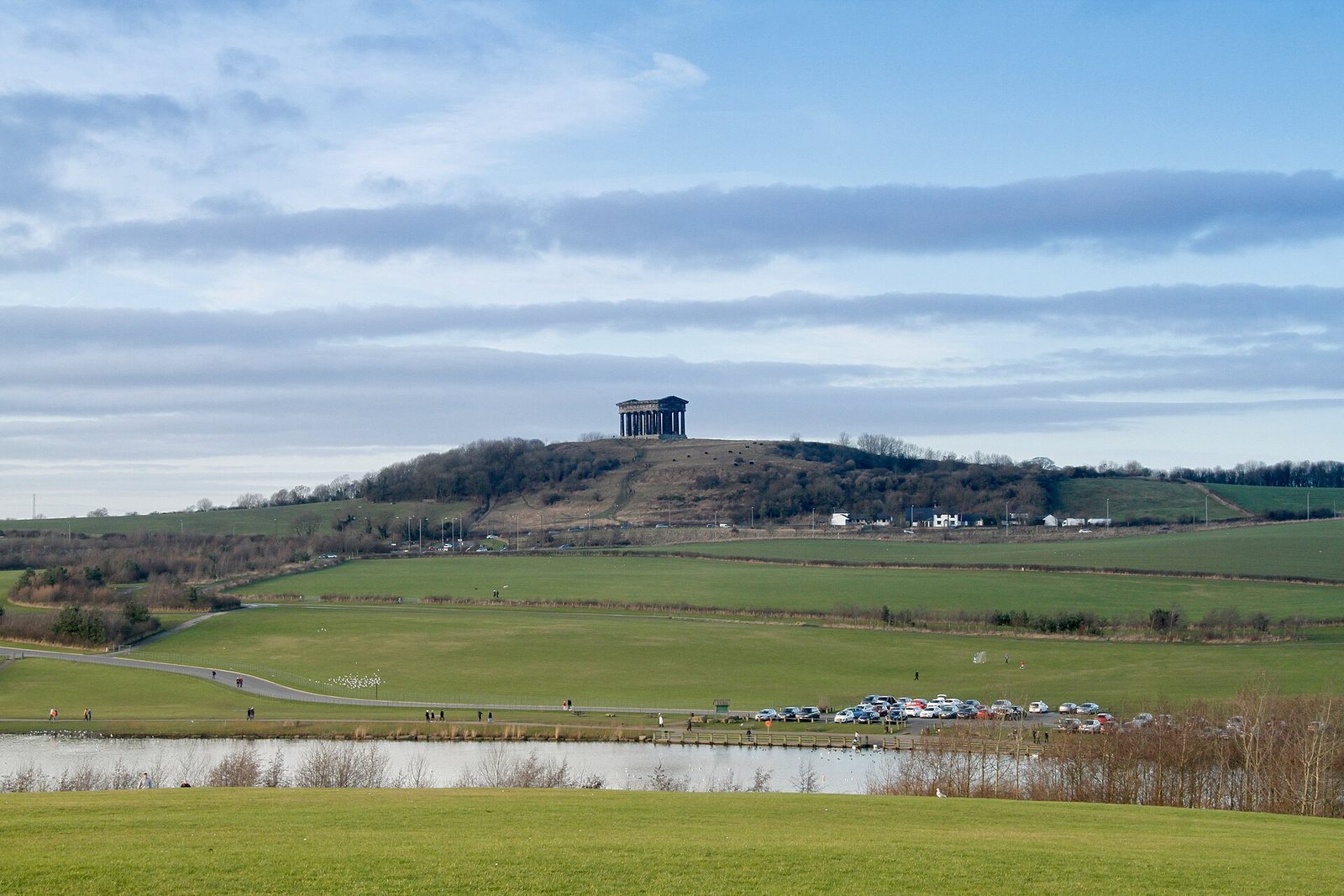
Penshaw Hill is an isolated, 136-metre knoll formed by erosion of an escarpment on the Durham Magnesian Limestone Plateau. In clear conditions, the monument can be seen from about 80 kilometres away. The National Trust’s approximately 18-hectare landholding includes around 12 hectares of deciduous woodland west of the structure. Dawson’s Plantation lies to the north and Penshaw Wood to the south; a triangulation marker is west of the monument. The eighteenth-century limestone quarry in Dawson’s Plantation is another physical feature of the hill, whose surrounding land continued to be used for farming and extraction.
Plan and columns
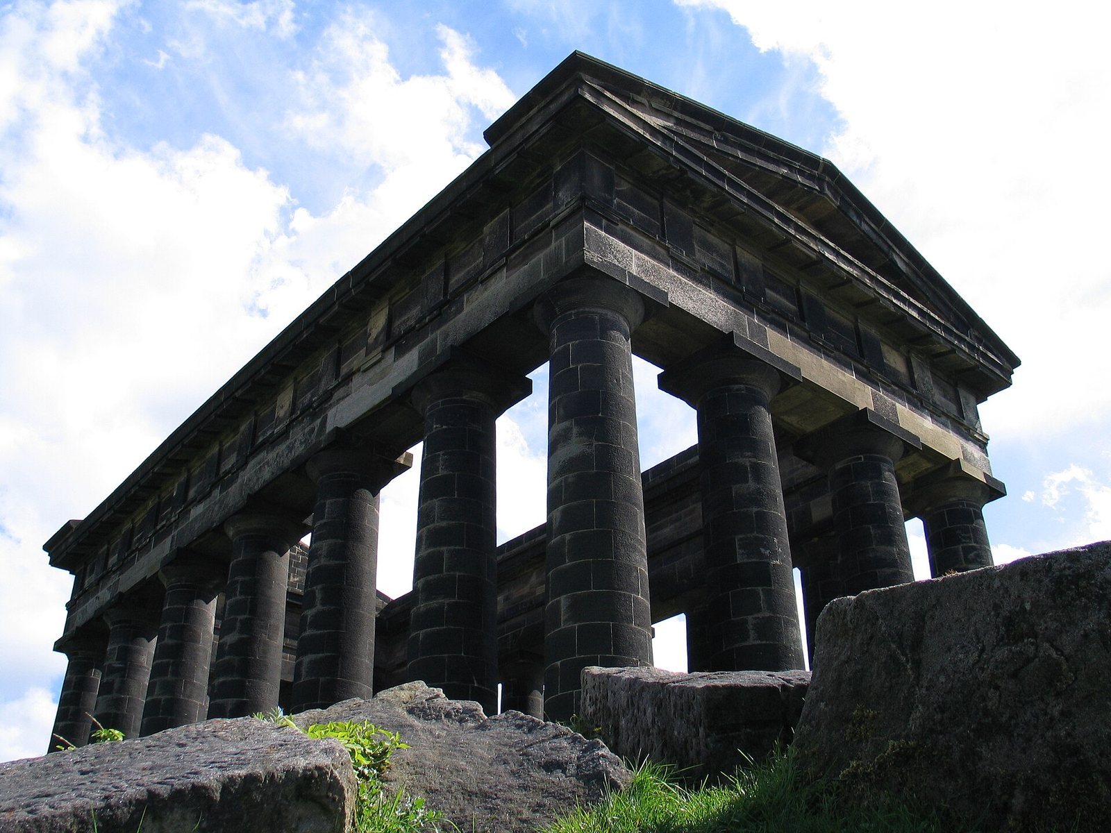
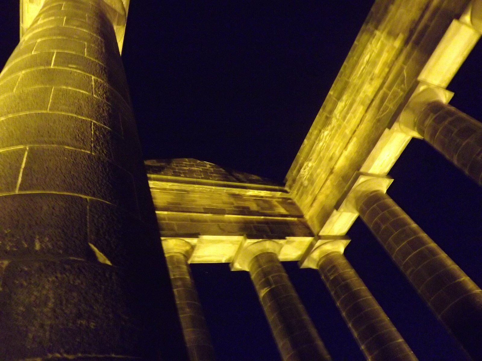
The structure measures about 30 metres long, 16 metres wide, and 21 metres high. Eighteen tapered columns, each about 10 metres tall and roughly 1.9 metres in diameter, make up its open colonnade. Seven stand along each long side and four at each end. The columns have smooth surfaces and are hollow, as are the walls of the base and upper horizontal structure. The design follows the Doric order of ancient Greek architecture and is modelled on the Temple of Hephaestus in Athens, though the closeness of the resemblance has been disputed.
Base and floor
The base has an upper stylobate, the platform that supports the columns, and a lower stereobate, the supporting base beneath it. Large gritstone blocks form the upper platform. The base rises from about 1.23 metres at the southwest corner to 2.35 metres at the southeast, and its foundations reach limestone about 6.1 metres below ground. The floor is paved with small blocks set in mortar on a slope. Diagonal flagstones direct rainwater towards a central channel.
Upper structure and walkways
The columns support a deep entablature, the horizontal structure above a row of columns, whose upper course provides the two walkways. Their parapets are about 0.91 metres high. A 74-step spiral staircase is contained in the second column from the east on the south-facing side and leads to the southern walkway. The entablature comprises an architrave, frieze, and cornice. Its frieze has simplified Doric panels traditionally marked by vertical grooves, but these are rendered without grooves. A triangular pediment caps each end; the entablature and pediments together rise about 6.62 metres.
Materials and construction
The monument is built from carefully cut blocks of local gritstone, initially yellow in colour and later darkened by soot. The stone blocks were joined with steel pins and brackets; holes in the base blocks indicate that a lewis, a lifting device for raising stone, was used during construction. Lime came from kilns owned by the Earl of Durham at nearby Newbottle, while sand was brought from a pit at the foot of the hill. A temporary railway carried materials uphill. The foundation stone contains a cavity that held a vial of Victorian coins placed during the 1844 ceremony. A brass dedication plate covered the cavity.
Repairs and surface
Mining-related movement led to repairs that replaced some stone blocks with concrete slabs faced in stone. In 1979, damaged lintels were replaced with reinforced-concrete ones faced with buff-coloured artificial stone. During the 1996 restoration, rusting cast-iron cramps that were stressing the masonry were replaced by stainless-steel cramps set in lead, and the stonework was repointed with lime mortar. The soot-darkened surface was deliberately retained as a reminder of the region’s industrial past. Carved marks and ink graffiti remain visible on parts of the monument.