Oppidum Üetliberg: A Prehistoric Fortified Settlement in Switzerland
Site at a Glance
- Popularity
- Medium
- Country
- Switzerland
- Primary era
- Iron Age
- Eras represented
- Bronze Age, Iron Age, Medieval
- Civilizations
- Celtic, Holy Roman Empire
- Site type
- Settlement
- Remains
- Village
On this page14 sections
History
Oppidum Üetliberg was a fortified settlement on the Uetliberg summit in what is now Stallikon, Switzerland. Human activity there reaches back to about 4000 BCE, and Celtic communities associated with the Helvetii fortified the site in the 5th century BCE. The settlement is regarded as one of Switzerland’s important Iron Age fortifications and may also have served as a refuge or a center led by a local ruler.
Bronze Age and Celtic settlement
The earliest evidence of permanent settlement dates to the Late Bronze Age, around the 11th century BCE. By that period, a village-like community occupied the plateau. In the 5th century BCE, the Helvetii fortified Uto Kulm and the adjoining approaches. The defenses may have continued to protect the settlement into the 1st century BCE, but it is uncertain whether occupation ended during the Gallic War, Rome’s campaigns in Gaul, or closer to the beginning of the Common Era.
A connection with the 1st-century-BCE settlement at Lindenhof in Zurich is possible. Both sites may have been important within the region, although neither seems to have been among the fortified centers Julius Caesar described.
Roman and early medieval use
After the Roman conquest around 15 BCE, the hill lay near the boundary between Raetia and Germania Superior, two Roman provinces. A watchtower and refuge on the summit may have guarded a customs point and later the fort at Lindenhof, near Turicum, the settlement at present-day Zurich. The hill may have retained strategic importance until the Alemanni, a Germanic people, advanced into the Roman provinces.
The summit may subsequently have served as a refuge or stronghold for the Alemanni and under the Carolingian and Ottonian dynasties, successive ruling houses. The evidence for these possible uses does not establish a continuous sequence of occupation.
Uetliburg and archaeological investigation
A medieval castle called Uetliburg developed on the summit between the 10th and 12th centuries. It belonged to the lords of Regensberg and was destroyed by Zurich during a conflict with the family. Zurich was then allied with Rudolf von Habsburg, the medieval king of the Romans. A high watch post stood at Uto Kulm from about 1620 to 1812. Later, much of the castle fabric was lost or removed, and construction of a hotel altered the site.
Archaeological work began with excavations and trial digs from 1836 to 1839, during construction of an inn and spa, and continued with investigations by Ferdinand Keller in 1866. Railway construction in 1874 destroyed a cemetery dating to the 5th century BCE and brought other finds to light; further discoveries followed track widening in 1901. Excavations continued in 1958 and 1959. A more systematic programme began in 1978, when the Cantonal Archaeology of Zurich investigated the summit through 1989 during extensive building work and excavated and conserved a surviving defensive wall of the medieval castle.
Remains
The fortified settlement occupied the summit plateau and western slope. Its likely extent ran from Uto Kulm, at 873 metres above sea level, west across the Aegerten plateau, at 859 metres, to the area in front of the present mountain-station site, at 820 metres. The fortified zone extended about 1.5 kilometres northwest to southeast, while its wall system ran for almost 2 kilometres across the slope.
Prehistoric settlement and defenses
Walls and approaches
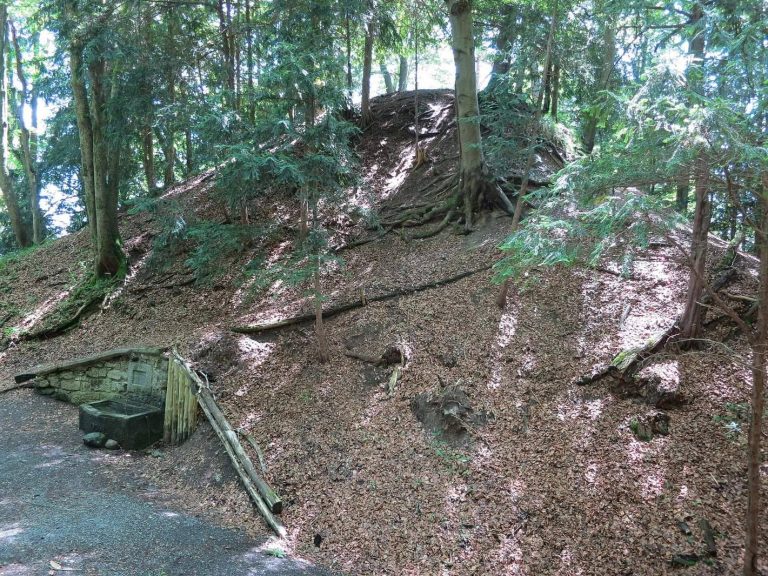
Three defensive walls were built uphill from the area of Ringlikon railway station, at 684 metres above sea level. The westernmost guarded the approaches, another enclosed the Aegerten plateau, and a third protected Uto Kulm. Set at different points along the relatively gentle western slope, the walls formed a layered defense. Beside the railway track and walking path, surviving remains reach about 14 metres high and extend about 35 metres in depth.
Settlement areas and houses
Two small, village-like settlement areas have been identified on the summit plateau. The area at Uto Kulm measured about 150 metres long, roughly 40 metres longer than today, and about 60 metres wide; it may also have offered refuge to people from the surrounding area. A separate Bronze Age settlement was found near Ofengüpf on the western slope in 1950 and 1951, while another settlement lay farther west on the plateau.
A village occupied the plateau during the third phase of the Late Bronze Age, associated with the Urnfield culture, a Late Bronze Age tradition. Houses probably stood along its edges. Excavation on the steep northeastern slope in 1980 revealed one house about 6 metres long and up to 4 metres wide, along with edge remains from two others. The ground had been cut down about 30 centimetres, probably to make space for a wooden floor. Some depressions may mark post settings, while close-set small postholes suggest interior walls made from woven branches coated with clay.
Ditch and defensive material
Finds from the summit and Aegerten point to defenses below the plateau, probably including a wall-and-ditch system and a second, more distant line. In 1981 and 1982, investigators examined the slope of a deep ditch about 35 metres north of the excavated settlement; traces remain on the eastern hillside. It may have been a neck ditch, a defensive ditch across a narrow approach to a hilltop. Material dug from it may have been reused in the uphill wall or in the medieval Uetliburg.
Portable finds
Objects from the summit include two Neolithic stone axes, an axe made from red deer antler, chisels, a three-knobbed needle head, a razor handle, bronze necklace tubes, and part of a handle from a Greek-world wine-mixing vessel dated to the 10th century BCE. Other finds include a Celtic potin coin, a copper-alloy currency possibly made at the settlement, and fragments of Attic pottery decorated in the black-figure style. In the castle-ditch area north of Uto Kulm, pottery found in 1983 included fragments from an approximately 80-centimetre-high vessel, dated to the 11th century BCE and Hallstatt A2, an archaeological dating phase. Its surface had grooves and zigzag lines. An axe with raised flanges at the centre for attaching a handle was found at the same location in 1916. Gold disc brooches and a gold rosette from debris associated with the Sonnenbühl princely burial mound are now exhibited at the Swiss National Museum in Zurich.
Animal remains
Animal bones recovered in 1980 and 1981 help describe livestock keeping. Cattle made up 47.6 percent of the domestic-animal remains, goats and sheep together 18.2 percent, pigs 33.6 percent, dogs 0.4 percent, and horses 0.2 percent. Cattle stood an estimated 1.25 metres at the shoulder. Pig jaws and canine teeth point to the breeding of boars. Dogs were about 50 centimetres tall and the small horses about 1.25 metres. Wild-animal remains comprise three wild-boar bones and one each from hare and red deer.
Terrain, trackways, and medieval wall
Plateau and trackways
The plateau has been reduced by erosion and rockfalls; a major fall at Fallätsche occurred on 8 May 2004. The hill consists of molasse, a sedimentary rock, and conglomerate. At Uto Kulm, cart-track ruts lie beneath deposits dating to the 13th century. Their 1.1-metre width may indicate a Celtic date, although a medieval origin is also possible. Sunken trackways climb the hill from Albisrieden toward Hueb and the Uetliberg. At Ringlikon, several parallel routes ascend toward the summit, and further track traces extend along the ridge between Waldegg and the mountain railway station and across much of the northern ridge.
Uetliburg wall
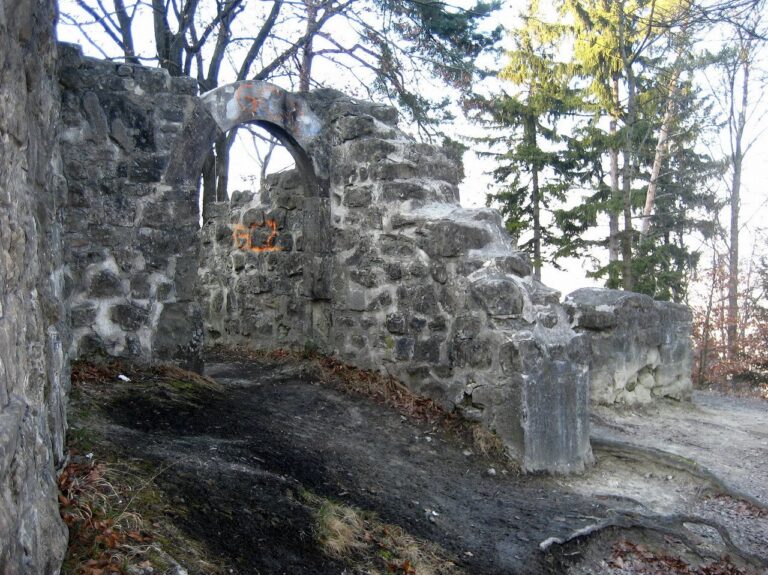
The castle area north of Uto Kulm was investigated in 1983. Beneath the Uto Kulm hotel, remains of the inner fortification lie at the location of the medieval Uetliburg. A surviving section of its defensive wall was excavated and conserved during the investigations carried out from 1978 to 1989.