Festung Uetliberg: A Swiss Second World War Defensive Position
Site at a Glance
- Rating
- 4.6
- Popularity
- Medium
- Country
- Switzerland
- Primary era
- Modern
- Eras represented
- Iron Age, Medieval, Modern
- Civilizations
- Celtic, Swiss
- Site type
- Military
- Remains
- Fort
On this page21 sections
History
Festung Uetliberg was a Swiss Second World War defensive position near Zurich, prepared by the Swiss Army’s 6th Division between October 1939 and August 1940. It formed an approximately three-kilometre section of the Limmat position between Uetliberg, Uitikon-Waldegg, and the Urdorf depression. The position was intended to serve as the main battle line against a possible German attack and used Uetliberg’s steep, wooded terrain as part of a flexible system of defence.
Earlier fortifications on Uetliberg
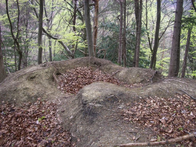
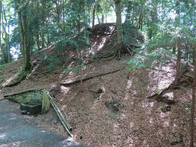
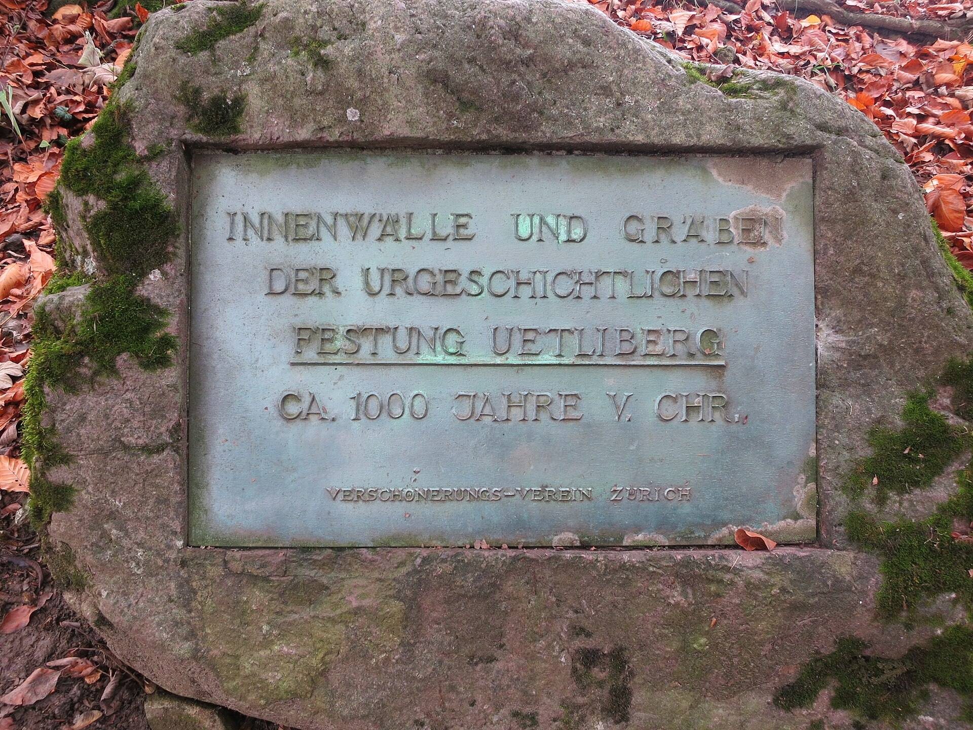
Uetliberg had strategic value long before the Second World War. By the fifth century BC, the Celtic Helvetii, a people who lived in the region of present-day Switzerland during the late Iron Age, had protected their hilltop settlement with a deep, multi-level rampart system. The prehistoric defences comprised three major ramparts. One crossed the western, gently rising side of Uetliberg for approximately two kilometres, another stood on the Aegerten plateau west of the summit, and a third enclosed the summit plateau of Uto Kulm.
A castle known as Uetliburg was built on the summit in the tenth century. These earlier fortifications established a long defensive association with the hill, although the Second World War position was a separate military system distributed across the surrounding landscape.
The Limmat position in 1939 and 1940
Swiss Army Operational Order No. 2, issued on 4 October 1939, called for the occupation of the Limmat position. The defensive line along the Limmat and Reppisch corridors was intended to obstruct an invasion from the north, protect Zurich and its surroundings, and prevent German forces from bypassing the Maginot Line through Switzerland. Zurich City Command and the 6th Division were assigned responsibility for the area.
Preparations had been delayed during the interwar years because funding was insufficient for the modernization and maintenance of weapons, equipment, and fortifications. Work began only at the start of the war, when newer military developments such as blitzkrieg, armoured warfare, and airborne troops were already influencing defensive planning. This timing encouraged a system designed for changing battlefield conditions rather than a single continuous line of permanent fortifications.
Herbert Constam, a divisional colonel and commander of the 6th Division, directed the Uetliberg sector. He chose a dynamic defence that relied on mobility, changing concentrations of troops, and the terrain instead of a uniformly distributed defensive line. Orders issued on 15 February 1940 required the division to hold the right bank of the Limmat, prevent an outflanking movement around Zurich’s left flank through Triemli and the Sihl valley, and block routes from the Limmat valley into the Reppisch valley. The Swiss Army later adopted the principle as “dynamic spatial defence” in the 1995 Army Reform.
Construction and wartime preparation
The defensive plan was intended to keep troops operational during artillery and air attacks. Soldiers were to shelter in rock caverns and structures designed to resist shelling, then oppose infantry assaults. If field positions were destroyed, bomb craters could serve as replacement obstacles or fighting positions. Constam promoted mobility and readiness through close-combat exercises, construction work, gymnastics, and marches.
Infantry Battalions 70, 62, and 166 were assigned to prevent an outflanking movement through the Urdorf depression. Forward anti-tank and all-round defensive positions were established at Altstetten, Oberurdorf, Dietikon, Uitikon-Waldegg, Urdorf, Zurich, and Wollishofen. The Altstetten positions included Dachslern, Kappeli, and Panama, while Dietikon included Fortress Dietikon. Houses in village centres were converted into firing positions, and walls, concrete elements, iron posts, and barbed wire connected and reinforced the positions. Obstacles, iron barriers, and an anti-tank ditch were intended to stop a breakthrough behind the forward defences.
Waldegg was designated as a target area for concentrated artillery fire, directed by observers on surrounding high ground. Artillery was dispersed in a concealed, loosely arranged pattern around Ringlikon, Birmensdorf, Bonstetten, and Oberlunkhofen. Eighteen batteries with 72 guns could reach the Urdorf depression, Waldegg, Zurich, Wallisellen, Rümlang, Dielsdorf, and the Lägern. They could also provide artillery cover for the Limmat crossings at Wipkingen and Dietikon.
The entire Uetliberg area became a restricted military zone. Fences, trenches, road obstacles, and concrete guard shelters controlled the ground, while information about neighbouring positions and concealed artillery sites was kept limited, even among senior officers. Sapper Company II/6 of the 6th Division, commanded by Captain Kollbrunner, sometimes employed more than 10,000 soldiers. Sappers, military engineers responsible for construction, fortification, demolition, and related field works, served as construction foremen or supervisors for groups of approximately 100 soldiers working day and night.
Polish internees built a military road known as the Polenweg between the Ringlikon stop of the SZU railway and Arthur-Rohn-Strasse. The road formed part of the infrastructure supporting the defensive area. From 1938 onward, additional concrete weapon positions, bunker installations, demolition sites, and anti-tank obstacles were established in the forward positions at Altstetten, Dietikon, Schlieren, Uitikon-Waldegg, the Urdorf depression, Zurich, and Wollishofen.
Withdrawal into the Réduit
After the Swiss Army withdrew into the Réduit, the national defensive concept centred on holding fortified positions in the Alpine region, the exposed field positions around Uetliberg were abandoned. The Wollishofen anti-tank barrier was built as an outwork of the Réduit, followed by the Birmensdorf anti-tank barrier in 1944. These changes marked the shift from defending the forward Limmat position to concentrating the army in the Alpine defensive zone.
Remains
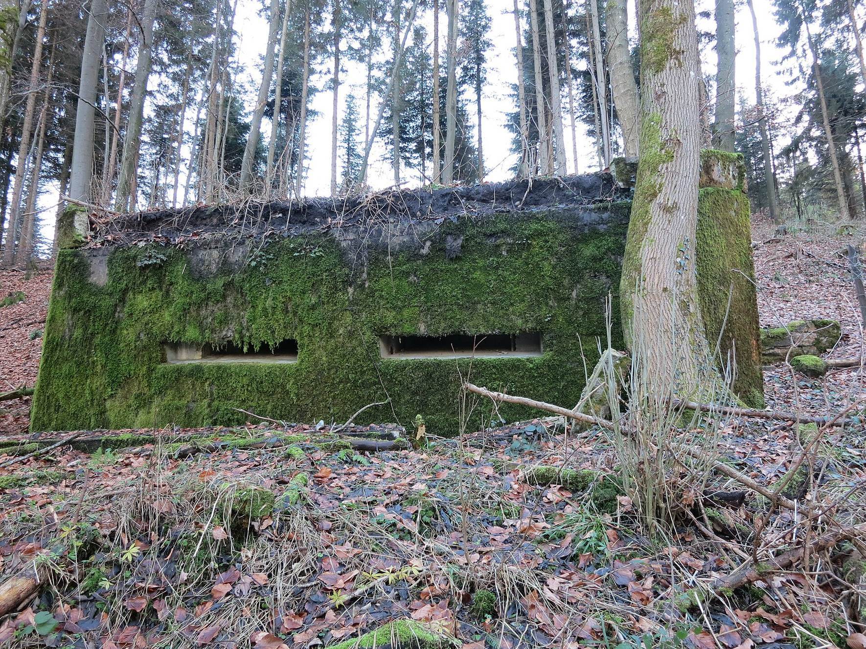
Festung Uetliberg survives as a dispersed military landscape rather than a single fortified building. Its approximately three-kilometre sector extends between Uetliberg, Waldegg, and the Urdorf depression, with defensive depth running from the Limmat to behind the Reppisch. Field positions, trenches, barbed-wire entanglements, concrete shelters, rock caverns, command posts, artillery positions, observation bunkers, medical tunnels, ammunition magazines, demolition installations, and anti-tank obstacles were arranged in separate but related positions. Most field positions and shelters remain, while some trenches survive only partly and have become overgrown.
Prehistoric ramparts
The earlier fortifications occupy the higher ground of Uetliberg. Their three principal ramparts formed successive defensive boundaries across the western approach, around the Aegerten plateau, and on the summit plateau of Uto Kulm. The first extended for approximately two kilometres across the gently rising western side of the hill. The second stood farther east on the Aegerten plateau, and the third secured the summit area.
Forward anti-tank defences
Birmensdorf and Waldegg barriers
Across the open Urdorf depression, an anti-tank barrier with 18 concrete weapon positions formed part of the deep defensive system. The forward anti-tank installations included the terrain obstacle on the lower Birmensdorferstrasse, T 2507; the Birmensdorferstrasse barricade, T 2507.01; the Uetlibergbahn barricade, T 2507.02; and the Buchrainweg barricade, T 2507.03. Associated infrastructure included the Lärchenweg and Tannenweg barricade depots, the Herrligmoos-Lärchenweg-Buchhoger demolition-object depot, B 1681, and the Birmensdorferstrasse-Waldegg tank ditch, T 2510.
Additional obstacles
Other forward works included the Pulverhausstrasse terrain obstacle, T 2512, with its road barricade, T 2512.01, and the Uitikon terrain anti-tank obstacle. The wider system also incorporated concrete weapon positions, demolition sites, barriers, and field defences at Altstetten, Dietikon, Schlieren, Uitikon-Waldegg, Zurich, and Wollishofen. The Wollishofen and Birmensdorf barriers belonged to the later defensive arrangements associated with the Réduit.
Observation and artillery installations
Observation posts and bunkers
Artillery observation and command facilities were distributed across the sector. They included Observation Post Donner, A 4881; the Stauffacher artillery observation bunker, A 4902, at Gugel in Schlieren; the Winkelried bunker, A 4903, at Berg in Schlieren; and the Tellsplatte observation post, A 4904, at Herrenbergli in Zurich-Altstetten. The Tellsplatte small shelter, A 4905, stood nearby in Zurich-Altstetten.
Other observation installations included the Laura post, A 4945, at Schürhof in Urdorf, a bunker for two observers, the Löwenbräustübli and Löwenstübli artillery observation bunker, A 4965, and the double observation bunker at Schürhof in the Urdorf depression. These positions allowed observers to direct fire towards designated areas such as Waldegg.
Gun positions and artillery shelters
The artillery network included the Oel shelter, A 4967, and the Im Brand artillery shields, A 4968 and A 4969, at Ringlikon. At Chleibtel, A 4980, and Kiesgrube, A 4982, gun positions held 12-centimetre field howitzers. Im Stocken, A 4983, held a 7.5-centimetre field gun. Other installations included the Stöck shelter, A 4984; the Maas shield, A 4985; the Bickel shelter, A 4992; the Mooswald shield, A 4993; and the Paula shelter, A 5007. The artillery positions also included Brand at Ringlikon and Schüren at Birmensdorf. Their dispersed arrangement and camouflage prevented the artillery from forming one concentrated fortified complex.
Troop shelters and underground positions
Schlieren and Waldegg shelters
Named troop shelters extended through Schlieren and Waldegg. The Fuchs shelter, A 4897, stood at Bröggen, while Himmel, A 4898, was at Länxelmoos and Margrit, A 4899, at Schlatthölzli. Herdler Ost, A 4900, sheltered ten men, and Hang, A 4901, stood at Stärpel. Other installations included Reh-Rosshau, A 4906; Steiss at Lyrenweg, A 4907; Bach-Friedhof, A 4908; Blick-Im Gubel, A 4909; and Bruch-Emmet, A 4910.
Buchhoger group
The Buchhoger group comprised the Platte shelter at Waldegg 1, A 4911; the Grenze shelter at Waldegg 2, A 4912; the Glatze shelter, A 4913; the Sumpf shelter, A 4914; and the Buchhoger 3 half-platoon shelter, A 4915. It also included the Rohr-Buchhoger small shelter, A 4916, later used as a spring-water intake, the Treppe platoon shelter, A 4917, and the Sempach shelter, A 4918.
Smaller shelters in the group were named Frosch, Totenkopf, Brille, Habsburg, Kaktus, Kropf, Opiumhöhle, Moos, Kyburg, and Jungholz, with designations A 4919 to A 4928. Brille, A 4921, also contained a command-post facility and an emergency exit.
Chapf, Asp, and Sandloch caverns
At Chapf, the Hals cavern and command-post installation, A 4929, formed part of the underground system. The Trotzdem medical-aid cavern, A 4930, had west, north, and east entrances. Planned as a wartime hospital, it was used from 1940 during the Réduit period as a military arsenal. The Charlotte-Rudolf cavern, A 4931, contained a command post, telephone exchange, shelter space for 60 men, east and west entrances, and ventilation for a demolition chamber.
At Asp and Sandloch, the Jakob shelter and command-post installation, A 4932, stood alongside the Marlis shelter and telephone exchange, A 4933. The Waldrand cavern, A 4934, at Sandloch held the command post of Field Artillery Battalion 17. The Unterbruch Waldrand cavern, A 4935, included a 100-metre tunnel with south and north entrances, while the Reserve Waldrand cavern, A 4936, also had entrances to the north and south.
Further tunnels and shelters
Additional underground installations included the Schlitz tunnel and shelter, A 4937, at Schlierenwald, as well as Spalt, A 4938; Wasserloch, A 4939; Ring, A 4940; Murks, A 4941; Lichtung, A 4942; Rutsch, A 4943; and Schlüsselblume, A 4944, at Forrenstrasse in Urdorf. The installation group also included Waldrand and Unterbruch Waldrand troop shelter caverns.
The Hohenstein shelters included Gebiet Hohenstein Feld-Waldegg, A 4946; Süsi, A 4947; Berli, A 4948; Emma, A 4949; Walter-Helene, A 4950; Knall, A 4951; Hans, A 4952; Mü, A 4953; Lump, A 4954; Spunwald, A 4955; Landwehr, A 4956; ETH, A 4957; Effi, A 4958; Mösli, A 4959; Loch, A 4960; Immergrün, A 4961; Ratz, A 4962; Wurst, A 4963; and Schnaps, A 4964.
Ringlikon and Schlössli installations
The Jurablick cavern and command post, A 4966, had east and west entrances. Near Ringlikon and the Schlössli area were Durchzug, A 4973; the Grotte cavern and command post, A 4975; Burg, A 5001, with separate entrance and exit; and Hell, A 5003, at Schäflibach.
Support infrastructure and later condition
The defensive infrastructure also included installations designated ASU 01 through ASU 16. These comprised ASU 01 at Schwandenweg; ASU 02 at Chriegholz in Uitikon; ASU 05 at Hohensteinstrasse in Waldegg; ASU 03 at the Uitikon indoor swimming pool; ASU 08 at Buechhoger; ASU 09 at Asp; ASU 13 at Forrenstrasse; ASU 06 in Schlierenwald; ASU 12 at Schürhof in Urdorf; ASU 11 at Gugelweg; ASU 10 at Hausstrasse; ASU 16 at Bröggen in Schlieren; ASU 15 at Schlattwis in Schlieren; and ASU 14 at Schlierenstrasse in Schlierenwald. A water reservoir at Rütenen, W 00603, was also part of the installation network.
Some shelters are being covered with earth to reduce risks during inspections and prevent accidents. Former trenches are used in places as part of a bicycle trail, while individual rock caverns serve for firefighting exercises or data storage. The Polenweg still survives, although it is no longer signposted. The Military Historical Society of the Canton of Zurich owned ten installations of the Limmat position in 2018, and the Association of Fortifications of the Limmat position is responsible for regular inspection and maintenance.
Fossils from the wartime works
Construction of the caverns at Sandloch in Uitikon produced an unexpected geological discovery. In February 1940, geologist Hans Stauber found two fossil tortoise shells during the excavation. The animals had lived in the area approximately 15 million years ago, and the fossils are now displayed at the Palaeontological Museum of the University of Zurich.