Old Orhei: A Multi-Period Archaeological Landscape in Moldova
Site at a Glance
- Popularity
- High
- Country
- Moldova
- Primary era
- Medieval
- Eras represented
- Iron Age, Classical, Medieval, Early Modern, Modern
- Civilizations
- Dacian, Golden Horde, Ottoman, Principality of Moldavia, Russian
- Site type
- City
On this page25 sections
History
Old Orhei is a multi-period archaeological landscape in Moldova, with a history of settlement, fortification, trade, and religious life extending from the Paleolithic into modern times. Its successive communities included the Getae, the Tatars of the Golden Horde, Moldavians, and Orthodox Christian hermits.
Prehistoric and Getic occupation
Human activity in the area reaches back to the Paleolithic. A camp dated to about 30,000–20,000 BCE is among the earliest known traces. Later communities left remains associated with the Cucuteni-Tripolye culture in the second half of the fifth millennium BCE, Bronze Age activity in the third and second millennia BCE, and the Chișinău-Corlăteni culture of the twelfth to tenth centuries BCE. Iron Age occupation began by the eighth century BCE and included the Getae, an ancient people of the lower Danube and surrounding regions.
A major Getic settlement occupied Butuceni Hill around 500–300 BCE, with a smaller settlement to the south. Geto-Dacian communities, related peoples and archaeological traditions of the region, built fortifications here between the sixth and first centuries BCE. One fortress was abandoned toward the end of the third century BCE during invasions by Germanic tribes.
Medieval settlements and Christian communities
Settlements returned to the area in the sixth century and again from the tenth to twelfth centuries CE. Five cemeteries reflect burial phases dated to the second or first century BCE, the tenth or eleventh century CE, and the fourteenth to sixteenth centuries.
An early Christian tradition connects settlement in the caves with Augias of Edessa, whom the Roman emperor Constantius II reportedly exiled for schismatic teaching. The proposed link remains uncertain. Christian signs on cave walls may point to early occupation, while crosses and reliquary pendants, small containers for relics, provide clearer evidence of a Christian community from the eleventh century onward.
The Golden Horde city
In the twelfth and thirteenth centuries, a fortified settlement in territory influenced by the Principality of Galicia-Volhynia traded by water with towns on the northern Black Sea and communities near the left bank of the Dniester. Timber walls and watchtowers protected the settlement. The Mongol-Tatar invasion of 1241–1242 destroyed both the settlement and its fortress.
The Golden Horde, a Mongol successor state that ruled parts of southeastern Europe, extended its power into the region in the mid-thirteenth century. Around 1330, Tatars founded a city at Old Orhei, incorporating earlier buildings. They called it Yangi-Shehr, or Shehr al-Jadid, meaning New City. Golden Horde and West Asian craftsmen directed its construction, and it may have served as a regional administrative centre. Coins minted there between 1364 and 1369 have been found. The Black Death weakened the Horde’s position on the Black Sea coast, and the Tatars left the region in 1369.
Moldavian Orhei
In 1369, Moldavian forces sacked and destroyed the Tatar city. The local population established Orhei on the site, rebuilding or restoring its defences, including the former Tatar fortress. From the fifteenth century, the town developed as a centre of craft production and trade, with commercial links to Eastern Europe. It prospered under Alexandru cel Bun, who ruled Moldavia from 1400 to 1432, and Ștefan cel Mare, who ruled from 1457 to 1504. A pârcălab, a Moldavian official with military and civil authority over a town and district, administered Orhei from the fortress.
The town’s economy suffered when the Ottoman capture of Bilhorod in 1484 blocked a major Black Sea trade route. Crimean Tatar raids around the turn of the fifteenth and sixteenth centuries caused further damage. A raid in 1499 probably burned a wooden church. A major fire appears to have struck around 1510, when an attack by Crimean Tatars also destroyed both western defensive earthworks. In the summer of 1538, the campaign of Ottoman sultan Suleiman the Magnificent devastated Orhei again.
In the mid-sixteenth century, the Moldavian ruler moved the town about 18 kilometres upstream, to the site of modern Orhei. A change in the trade route may have contributed to the relocation. The village of Movile remained at the old site into the second half of the seventeenth century, then disappeared by the early eighteenth century.
Cave monasticism and modern study
Orthodox hermits were established at the caves by the eleventh century. Cave monastic life flourished from the fourteenth or fifteenth century into the early nineteenth century, as Orthodox communities grew and raids by Crimean and Budjak Tatars encouraged people to seek defensible places. The caves could have housed as many as 400 monks. Earthquakes also caused some cliff dwellings to collapse into the Răut. A separate hermitage of five connected cells was founded in 1675 by Bosie, Orhei’s pârcălab. A nearby rock inscription records that armed irregulars led by the Zaporozhian Cossack Stets Hatman took shelter in the hermitages in 1690.
In the early twentieth century, a new Orthodox church on the hill reduced the cave monastery’s importance. A small community of Orthodox monks continues to maintain the church. Archaeological excavations began in the 1940s, with major campaigns from 1947 to 1962 and renewed work from 1996. Gheorghe Smirnov emphasized Slavic parallels in excavated church architecture; the Moldavian historian Vlad Ghimpu criticized this interpretation for giving too little attention to Moldavian building traditions. A museum complex, established in 1968, displays medieval metalwork and ceramics, including glazed pottery in a Tatar style. Important finds are also held at Moldova’s National History Museum in Chișinău. Old Orhei is a state-recognized cultural and natural protected area and has been placed on UNESCO’s Tentative List for World Heritage consideration. The protected landscape includes Trebujeni, Butuceni, and Morovaia.
Remains
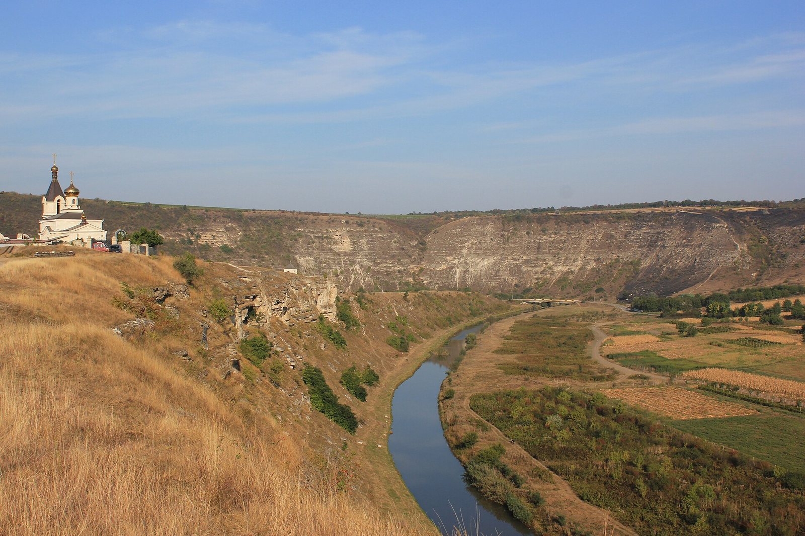
The site occupies a narrow bend of the Răut, which winds around limestone hills, cliffs, and peninsulas. The wider area extends about 3.5 kilometres from east to west and 1.5 kilometres from north to south. The Peștere peninsula is roughly two kilometres long and up to 700 metres wide. Butuceni peninsula extends about three kilometres, reaches around 300 metres in width at its eastern end, and rises about 120 metres above the valley. Steep hillsides and rock faces often descend more than 100 metres to the river.
Butuceni and Peștere settlements
Butuceni Hill fortifications
The Getic settlement covered much of Butuceni Hill across an area about 3,000 metres long and 100 metres wide. Steep slopes offered natural defence, supplemented by successive ditches and ramparts made from earth, stone, and timber. An oval timber enclosure in the upper part of the hill measured 215 metres long and up to 60 metres wide. The settlement served military, economic, and religious purposes and contained the oldest known circular Getic sanctuary. A smaller settlement lay on the plain to the south.
Cliff fortress and nearby remains
A separate Geto-Dacian fortress stood on a cliff reached by a narrow, blockable path. Finds on Butuceni also include material from the Cucuteni culture, dated to the fifth and fourth millennia BCE, and from the Saharna-Coiza culture near the present hilltop church.
Peștere peninsula
The western part of the peninsula contains an early medieval settlement about 350 by 250 metres, opposite the Butuceni cave monastery. A fortress of timber and clay above it, dated to the tenth–thirteenth centuries, could provide refuge during conflict. Tools, pottery, jewellery, and stone ovens from the peninsula span the fifth to fourteenth centuries. Other archaeological layers include Bronze Age material, remains associated with the Chișinău-Corlăteni and Poienești-Lucașeuca cultures, and traces of the Golden Horde city and Moldavian Orhei.
Other settlement areas
Sites near Trebujeni
Several sites along streams near Trebujeni preserve evidence of successive settlement. At Pădurea Țiganca, hand-formed pottery marks a sixth- and seventh-century settlement. At Selitra, eighth- and ninth-century hand-formed pottery lies above remains of the third- and fourth-century Chernyakhov culture. Excavations at Gura Selitrei uncovered tenth–twelfth-century pottery, a potter’s wheel, and a smithy below the Trebujeni-Potarca Geto-Dacian fortress, dated to the fifth–second centuries BCE.
Scoc and Fântâna Joei
At Scoc, a Geto-Dacian settlement of the fourth or third century BCE lies beneath settlement remains dated from the fourth to eleventh centuries CE. Excavations across 9,360 square metres identified more than 300 buildings from the sixth–tenth centuries, along with 41 pottery kilns and 17 ironworking forges. At Fântâna Joei, archaeological layers include remains associated with the Saharna-Solonceni culture of the eighth–seventh centuries BCE, Getic settlement of the fourth–third centuries BCE, Poienești-Lucașeuca culture of the second–first centuries BCE, Chernyakhov culture of the third–fourth centuries CE, and a tenth–twelfth-century village. Finds include wheel-thrown pottery, a potter’s wheel, and yellow-red Tatar pottery of the fourteenth century.
The Golden Horde and Moldavian town
Outer defences and citadel
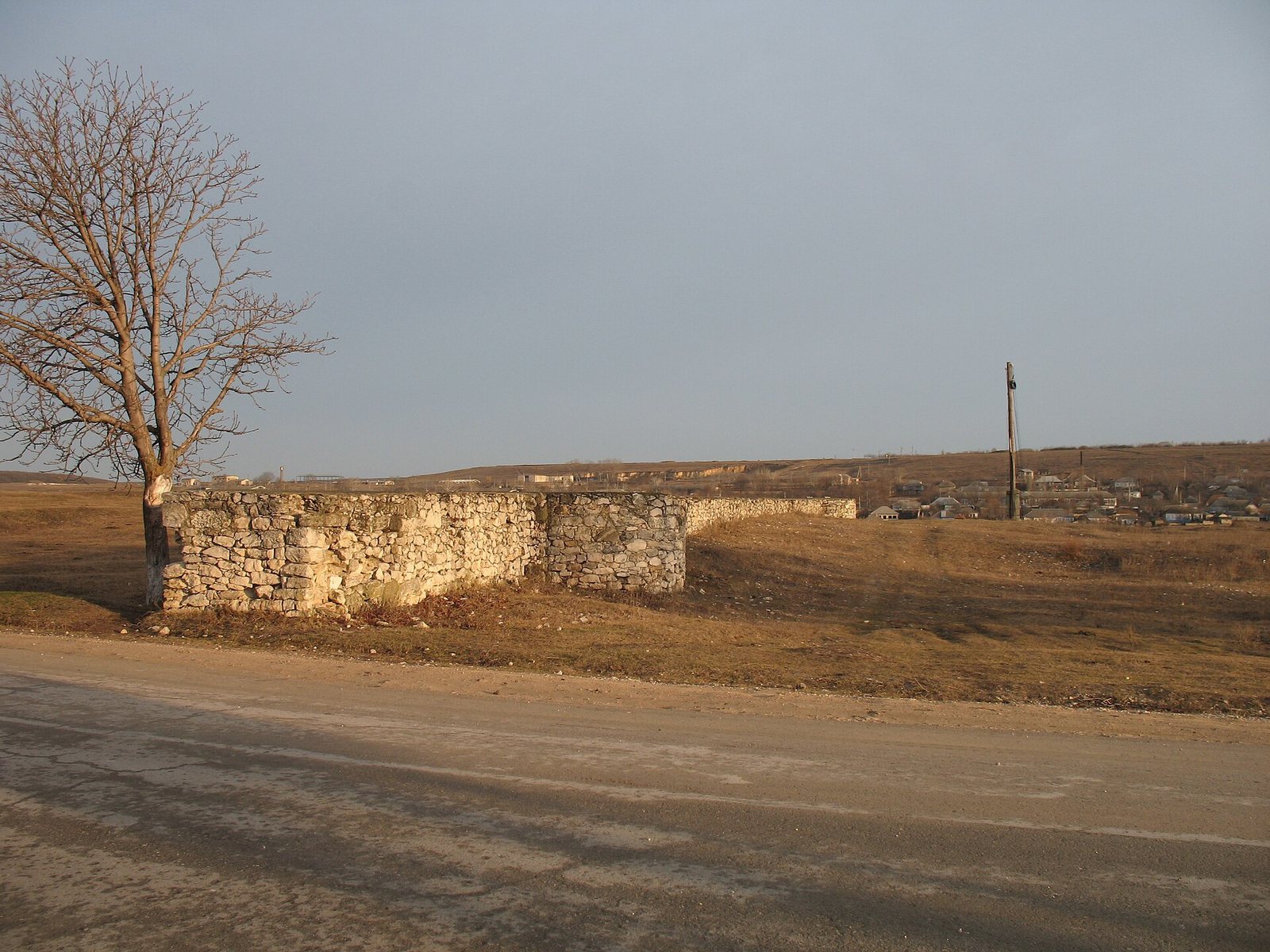
The Golden Horde city occupied the highest part of Peștere Hill. Its outer defensive line formed a rectangle, now crossed by an access road. Two parallel banks closed the western side between the river bends. The outer bank ran about 570 metres and had a ditch 10–12 metres wide; a southern stretch survives 2.5–3 metres high. The second bank was of similar length and rose 6–8 metres. Sections of the perimeter walls have been restored to an even height.
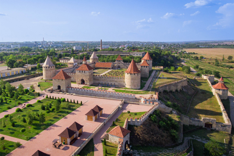
Built in stone in the 1360s, the citadel enclosed a trapezoidal area measuring up to 127 by 92 metres, with circular towers at its four corners. It was restored and enlarged after the Golden Horde withdrawal. During the second half of the fifteenth century, Ștefan cel Mare developed it as the seat of a Moldavian official. The quadrangular fortress had corner towers and a tower above its gate.
Governor’s palace
The pârcălab’s palace stood near the citadel’s northern wall. A Muslim mausoleum with a crypt had previously occupied the location; in 1366 it was converted into a governor’s palace and later expanded as an official residence. The palace had an underground room built with stone blocks reused from an earlier Golden Horde building and a brick upper storey containing 26 rooms. A square of masonry remains at the northeastern corner, and earth covers the excavated area.
Stone building in the courtyard
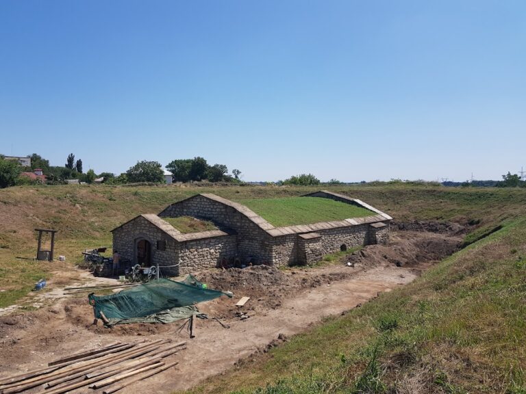
A stone building in the western part of the citadel courtyard was used from the early fifteenth century to about the early sixteenth century. Its two-storey structure included an underground level cut as much as 3.2 metres into the limestone. The plan measured 10.6 by 6.4 metres, and the walls survive to a height of two metres. Inside were eight hearths and a brick kiln. Surviving wood indicates that 16 posts supported the upper floor and roof.
Bathhouses
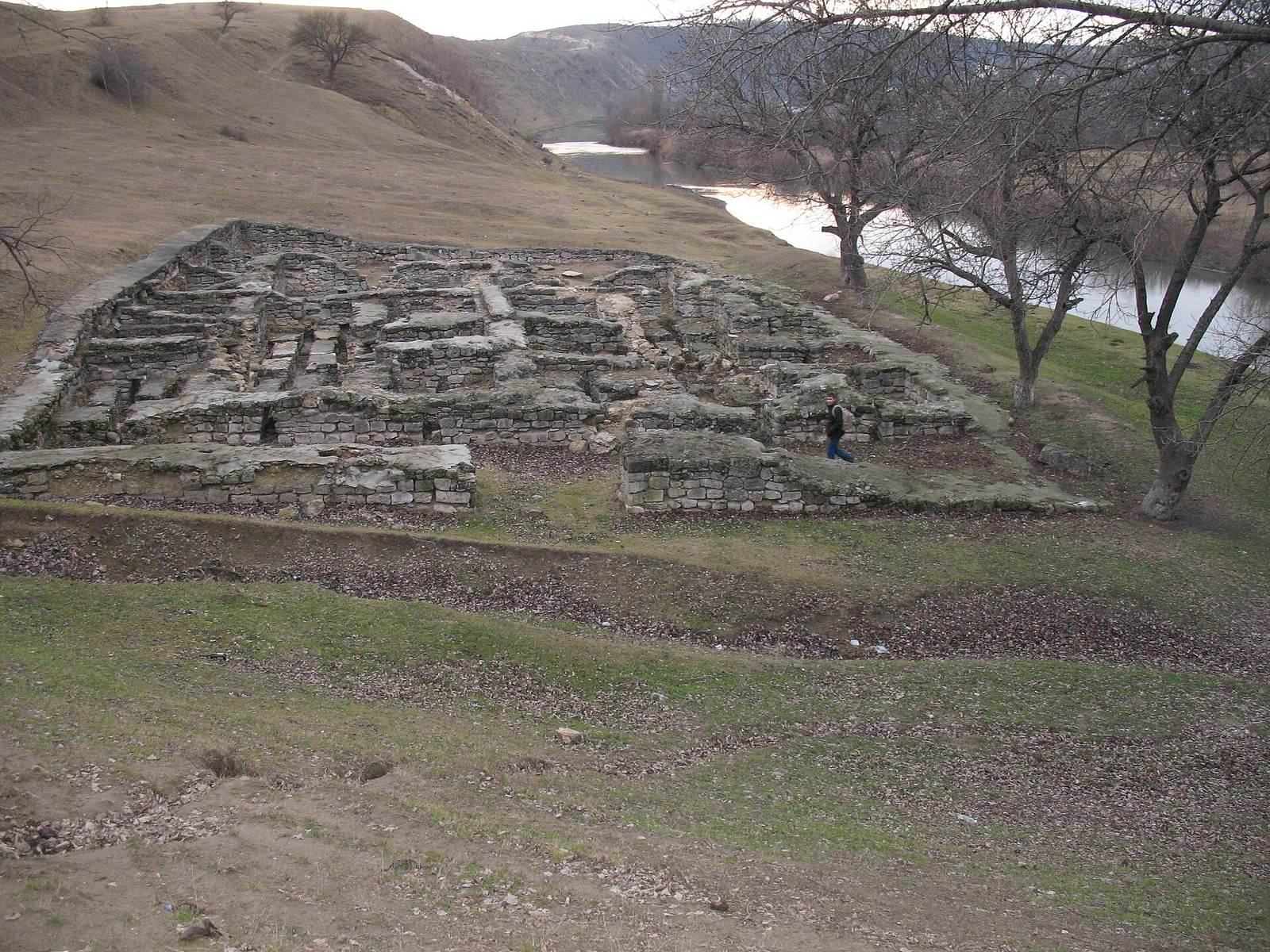
The largest Golden Horde bathhouse is a stone building measuring 37 by 21 metres. Its western entrance opened into a room for changing and resting, followed by two washing areas and two heated, cross-shaped rooms with four adjoining chambers used for sweating treatments and apparently massage. An underfloor system circulated hot air to heat the rooms. The remains also show heating and ventilation arrangements and indicate that the interior was once richly finished. The bathhouse may have had separate areas for men and women.
Mosque and caravanserai
The mosque’s rectangular plan measured 58 by 52 metres, with its long axis oriented south. Its entrance was on the north, and a minaret stood at the northeastern corner. Restored sections of wall rise to 1.5 metres. A fourteenth-century caravanserai, a lodging and trading complex for travelling merchants and their animals, stood a few metres east of the mosque. It measured 56 by 27 metres, with decorated entrances on its north and south sides leading into a courtyard.
Church and cemetery
A small, single-room church south of the caravanserai was used from the fourteenth to sixteenth centuries. It measures 16.5 by 6.5 metres, and its horseshoe-shaped eastern sanctuary end projects beyond the end wall. Two graves beneath the main room contained a man and a woman buried in gold-trimmed clothing; they may have been the church’s founders. A nearby Christian cemetery includes gravestones with Cyrillic inscriptions. The church’s archaic form may place it among the oldest churches east of the Carpathians.
Cave hermitages and hilltop church
Peștere hermitage
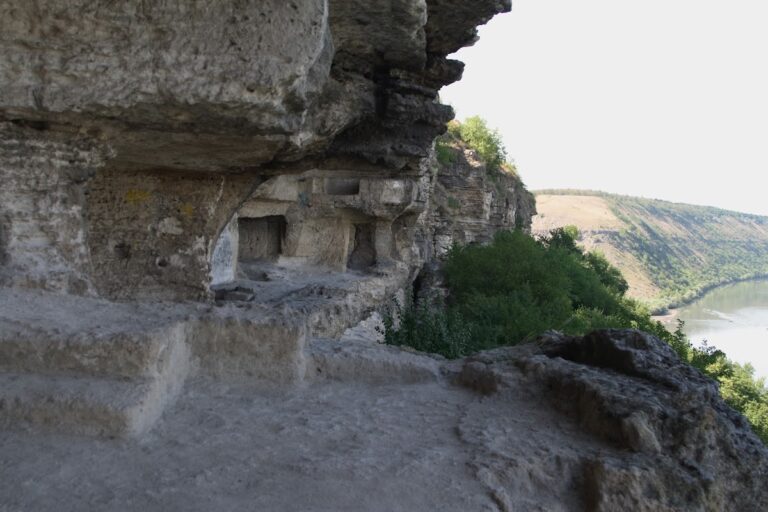
The Peștere hermitage lies about 50 metres above the Răut. Its limestone complex includes a church with an altar, monk cells, and a corridor with steps that originally descended toward the river. Some caves may predate Christian occupation; others were enlarged or cut into the rock. The church is dedicated to the Virgin Mary. Its underground sacred space has a main room and an eastern chapel, with a nearly flat ceiling over the main room and an elliptical vaulted ceiling in the chapel.
A passage opens onto a balcony in the cliff. Steps opposite the chapel descend to a large cave with a low, flat ceiling. Partitions along both sides divide it into 11 monk cells, each opening into the cave; the cells served as accommodation until 1816. Other cells were cut into limestone along the riverbank. A collapse, probably in the eighteenth century, destroyed the original stairway and corridor approaches. Around 1820, a tunnel cut from the Butuceni side created an upper entrance, and a bell tower built beside it in 1890 marks the entrance.
Bosie hermitage and stone cross
Farther upstream and east of the Marian church, the Bosie hermitage consists of five interconnected cave cells, each with its own outside exit. An eighteenth-century stone cross stands a few metres above the bell tower. Local belief credits the cross with healing powers and the ability to grant wishes.
Marian church on Butuceni Hill
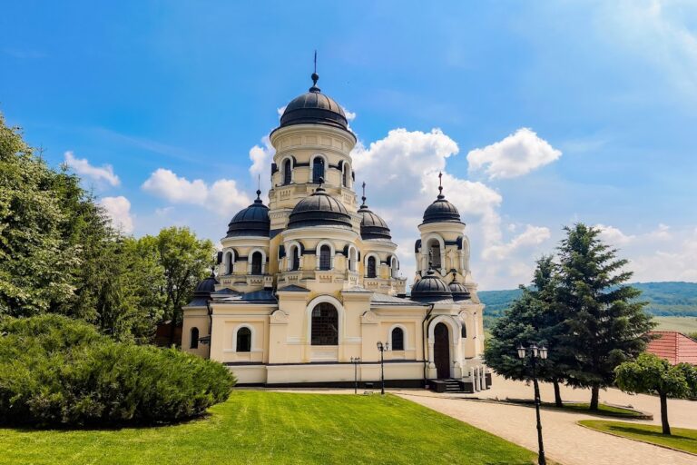
A Marian church in the Neo-Russian style stands at the highest point of Butuceni Hill, in the area of the former Getic fortress. Its bell tower has a square lower storey and an octagonal upper storey, topped by a tent roof and onion dome. A garden, outbuildings, and a monastery wall surround the church.