Nuraghe Losa: A Nuragic Fortified Complex in Sardinia
Site at a Glance
- Popularity
- Medium
- Country
- Italy
- Primary era
- Bronze Age
- Eras represented
- Bronze Age, Classical, Medieval
- Civilizations
- Byzantine, Carthaginian, Roman
- Site type
- Military
- Remains
- Fort
On this page15 sections
History
Nuraghe Losa is a prehistoric fortified complex near Abbasanta in Sardinia, Italy. A nuraghe is a stone tower or fortified complex associated with the Nuragic civilization, Sardinia’s prehistoric culture, conventionally dated from the 14th to the 8th centuries BC. Losa served as a residence from the Middle Bronze Age, a phase of the Bronze Age, with occupation beginning between the late 15th and early 13th centuries BC and continuing through later periods.
Nuragic development
The central tower dates broadly to the 15th through 13th centuries BC. A fortified structure with three projecting sections was probably added during the Late Bronze Age, from the 13th to the late 12th century BC. The outer defenses may have been built in stages, with towers preceding a wall enclosing the settlement. The wall was probably added in the second half of the 12th century BC.
Hut 1 was probably built in the 12th century BC, during the Final Bronze Age. Pear-shaped vessel fragments indicate that people continued to use the site in the 9th century BC, during the First Iron Age, although activity had declined.
Later use
Intermittent activity resumed by the late 4th century BC, during the Punic period, associated with Carthaginian culture and influence in the western Mediterranean. Use continued through the Roman period and into the early Middle Ages. Finds indicate funerary use in the 7th and 8th centuries. A coin of the Byzantine emperor Leontius II, who ruled from AD 695 to 698, also points to activity in the late 7th century.
Archaeology and conservation
The first known illustration of Nuraghe Losa appeared in an atlas published in 1840 by Alberto Ferrero della Marmora. Leon Gouin excavated at the site in the 1880s, and the Archaeological Superintendency acquired a small area containing its central monument in 1893-1894. Filippo Vivanet began work in 1890 with Filippo Nissardi. Their clearance in 1898 exposed the three-lobed central structure, a circular building in front, the outer wall and its two towers, and a rear courtyard. A basic restoration was carried out on the southwestern lobe.
In 1901, Giovanni Pinza published the first description and interpretation of the complex, accompanied by photographs and plans prepared by Nissardi. Antonio Taramelli’s excavations in 1915 revealed additional dwellings attached to the fortress, particularly to its northeast and southwest, as well as parts of the surrounding village. Giovanni Lilliu produced a preliminary study of finds in the mid-1950s. Excavation, consolidation and restoration followed in the 1970s under Ferruccio Barreca, with further work on the central tower and three-lobed structure from 1989 to 1994. Nuraghe Losa is among 31 Sardinian sites proposed as candidates for UNESCO’s World Heritage List, which recognizes cultural and natural heritage.
Remains
The complex stands 304 m above sea level on a basalt plateau near Abbasanta. Its basalt buildings include the central nuraghe, the settlement and structures from later periods. A roughly oval outer wall encloses an area measuring 268 m along a northeast-southwest axis and 172 m along a northwest-southeast axis.
Outer enclosure and settlement
Enclosing wall and towers
The outer wall survives to heights of 1.60 to 2.30 m. At its south-southwestern and north-northwestern points, it extends into two towers, each projecting outward for roughly three-quarters of its volume. Each tower has an outer entrance and an inner entrance passing through the wall, an arrangement considered unusual in comparison with traditional nuraghe architecture. After restoration around 1970, the towers stood at about three-quarters of their original height.
Settlement remains
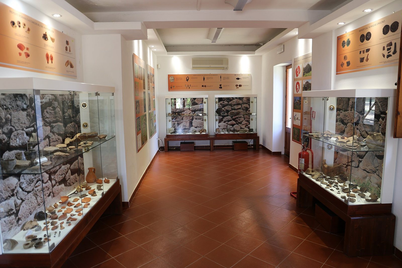
Within the enclosure are remains of the original village of huts and traces of Punic, Roman and early medieval activity. The settlement also contains simple secondary buildings and a small structure displaying regional artifacts. A small cemetery for cremated remains buried in urns lies outside the enclosure.
Central nuraghe
Central tower
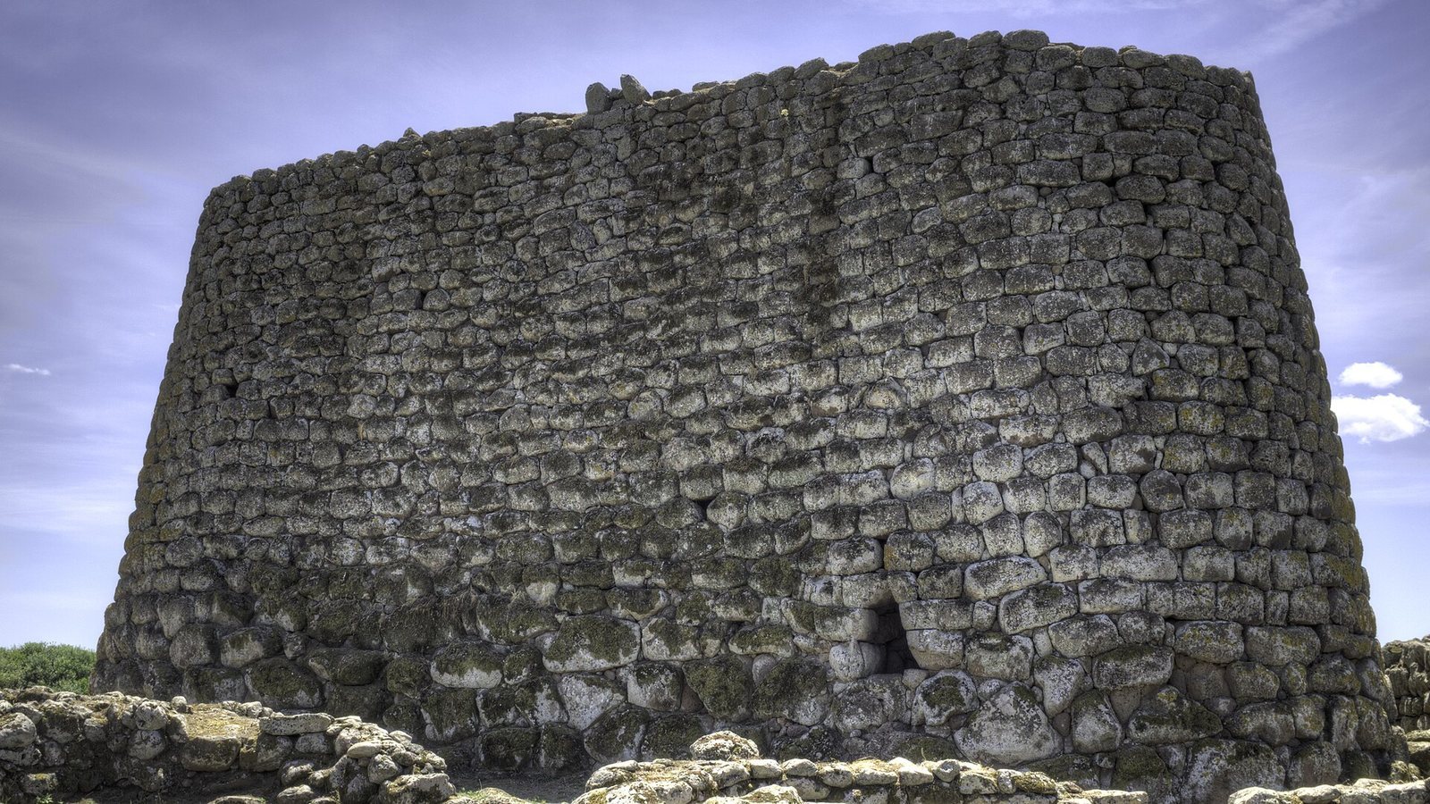
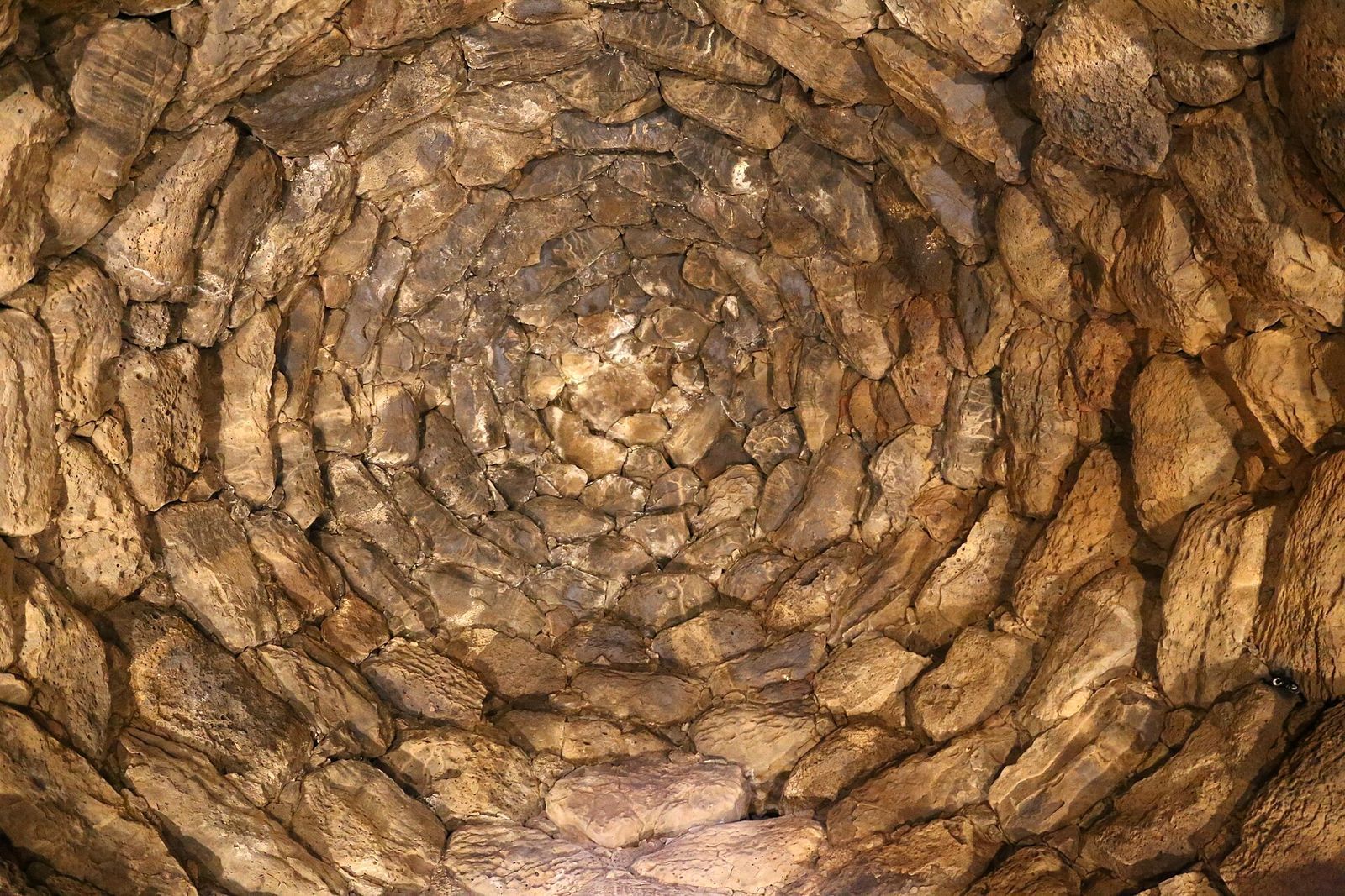
The central tower, designated Tower A, has a maximum diameter of 12 m. Its lower chamber has a roof formed by successive stone courses projecting inward and stands about 7 m high. The narrower upper chamber is centered above it, measures 2.88 m across and survives to a height of 3.46 m. The tower is preserved to 11.40 m, while the main monument reaches about 13 m. The principal chamber has three large niches. Smaller recesses in the corridor and staircase may have admitted light before being blocked during the addition of the three surrounding towers, or may have served domestic purposes; their interpretation remains uncertain.
Three-lobed structure
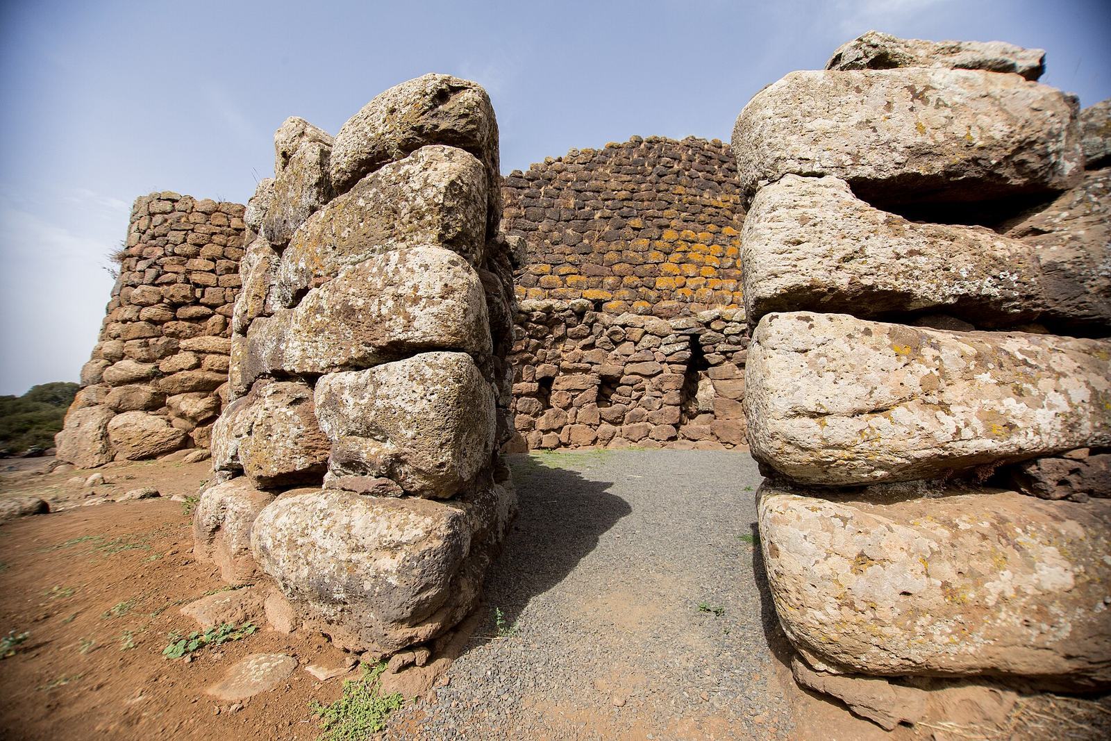
The tower is surrounded by a three-lobed fortified structure whose peripheral towers are designated B, C and D. Its plan is approximately triangular, with rounded corners and a curving, indented profile. The outer towers join directly to the central tower, without intervening courtyards. The structure may have been left unfinished. Its south and east sides each measure 25.70 m. The main entrance is on the south side, where side corridors lead to Tower B on the left and Tower C on the right. Tower D has a separate entrance on the east-northeast side.
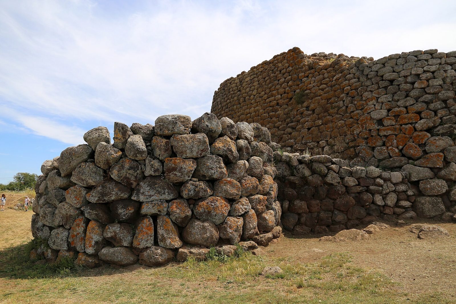
A ground-level corridor links Towers A, B and C. A spiral staircase connects the upper chamber of the central tower to the upper terrace and the walkways between the towers; a second staircase descends to Tower D. The structure rests on a continuous platform of very large stones, averaging 2 to 2.50 m high, which supports its raised entrances and the masonry above. Its large, many-sided blocks contrast with the more carefully cut, regularly laid courses of the upper facing. Inside the central tower and peripheral towers, medium-sized, many-sided basalt blocks form roughly regular courses that narrow upward into pointed roofs. On the central tower’s outer face, rectangular blocks become smaller higher up, with few smaller stones filling the joints. Three projecting support stones remain in place, while other fragments are piled in the village area.
Northwestern defensive wall and towers
A broad defensive wall runs in a broken line along the northwest side of the three-lobed structure, with Tower E at its northern end and Tower F at its southern end. The longer northern section contains five narrow defensive openings: two near the junction with Tower E and three along the northwest-facing stretch. The towers and wall survive to an average height of about 3 m.
Tower E measures up to 10 m across externally and 5.60 m internally. At the base of the wall opposite its entrance is a large underground silo, possibly a cistern for collecting water. Tower F measures 8.90 m externally and 4.50 m internally. The inner blocks and facing of Tower E are more carefully finished than those of Tower F.
Associated buildings and burial features
Hut 1
Hut 1 stands 1.20 m south of the three-lobed structure, directly opposite its main entrance. The circular building measures 10.50 to 10.70 m across and survives to a maximum height of 3.60 m. A wide entrance faces south, while a narrow passage on the northeast connects the hut to the entrance of the fortified structure. Alternating niches line the inner walls, including two curved recesses that measure 2.10 to 3 m wide and 0.50 m deep. The hut’s function in relation to the fortress remains uncertain. A small circular pillar of pink trachyte, a volcanic rock, found inside was interpreted by Taramelli as a ritual object.
Giants’ Tomb
About 50 m west of the outer wall stands a badly ruined Giants’ Tomb, a type of collective prehistoric burial monument found in Sardinia. The remains form a mound visible above ground, with dark-green vegetation distinguishing it from the surrounding area. The ruin extends up to 15.60 m by about 5 m. Surviving parts include the northwest outer facing of the rectangular body and part of the right wing of the southeast-facing curved forecourt. The tomb’s advanced decay may reflect the recovery of its stones for reuse in antiquity.
A fragment of the tomb’s curved-topped upright stone slab has been reused in a nearby low wall. It represents the upper central quarter of the original slab, which was 0.34 m thick. About 1 m of the lintel line survives, along with the upper edge of a small doorway measuring 0.25 by 0.52 m.