Santa Cristina Nuragic Site: A Sacred-Well Complex in Sardinia
Site at a Glance
- Popularity
- High
- Country
- Italy
- Primary era
- Bronze Age
- Eras represented
- Bronze Age, Medieval, Early Modern, Modern
- Civilizations
- Unclassified
- Site type
- Religious
- Remains
- Sanctuary
On this page18 sections
History
The Santa Cristina nuragic site is an archaeological complex on the southern part of the Abbasanta plateau in west-central Sardinia, Italy. Its sacred well was built around the 11th century BC, during the Nuragic period, when the prehistoric Sardinian civilization of the Bronze and Iron Ages built stone towers, settlements, and sanctuaries. A separate single-tower stone structure, or nuraghe, was probably built earlier, indicating activity at the site before the well was constructed.
Nuragic worship and later activity
The sanctuary centered on water and drew Nuragic communities from elsewhere in Sardinia, as well as possibly people from beyond the island. Its ritual use continued to shape the site’s history after the Nuragic period, when gold jewelry of Phoenician origin points to further activity. The Phoenicians were an ancient people of the eastern Mediterranean.
Some interpretations give the well a healing purpose. Dimitrina Mitova-Dzhonova proposed that people came seeking cures and associated the sanctuary’s design and rituals with Enki, a Sumerian god linked with water and wisdom. She also suggested that the bench-lined buildings nearby accommodated people waiting for the water to be stirred and used in healing rites. These proposals remain interpretations rather than established explanations.
Christian worship and pilgrimage
Pilgrimage to the well continued into the Middle Ages, when a rural church dedicated to Santa Cristina was built and the Christian cult supplanted the Nuragic one. The Christian use of the area has also been interpreted as a blending or coexistence of religious traditions. The church belonged to the Diocese of Bonarcado.
Worshippers gathered for a nine-day period of prayer before the saint’s feast. From the 18th century onward, small dwellings around the church provided accommodation for some pilgrims; others attended evening prayers and returned home. In the 1840s, Vittorio Angius described pilgrims arriving in early May, a principal celebration on May 10, and processions to the well. He also noted a July 24 feast commemorating the saint’s death. The May celebration is now held on the second Sunday of that month, while a separate feast for the Archangel Gabriel takes place on the fourth Sunday of October. July 24 remains the Catholic calendar date for Santa Cristina.
Local devotion to Cristina of Bolsena has been connected with the earlier water cult. In her Christian legend, the eleven-year-old martyr was thrown into a lake with a heavy stone tied around her neck; angels supported the stone and brought her back to shore.
Recognition and archaeological work
Alberto La Marmora may have made the earliest written reference to the well in an account of travels between 1819 and 1825. In the 1840s, Angius described its stairway and chamber but did not know its purpose. Giovanni Spano identified the structure as Nuragic in 1857, although he interpreted it as a prison. In 1860, La Marmora praised the monument, compared it with the Treasury of Atreus, a monumental corbelled tomb at Mycenae, and argued that it had been an ancient temple.
Later interpretations varied. In 1900, Domenico Lovisato assigned the well to the Carthaginian period, relating it to the civilization of Carthage, a Phoenician-founded city in North Africa. A. Mayr proposed in 1904 that it was a tomb in a style associated with Bronze Age Mycenaean Greece. From 1910, Antonio Taramelli identified it as a sacred well and compared it with the sanctuary at Santa Vittoria di Serri. Raffaele Pettazzoni subsequently considered water worship among prehistoric Sardinians, called “Proto-Sardinians” in older scholarship. Duncan Mackenzie published a survey of the well and plans of the nuraghe and nearby huts in 1913.
Excavation and restoration began in 1953. Enrico Atzeni led further campaigns in 1967–1973 and 1977–1983, followed by excavations in parts of the village by P. Bernardini in 1989–1990 and by Arnold Lebeuf between 2005 and 2010. During restoration, Atzeni put back one of the two original stones forming the well’s opening.
In 2007, Lebeuf observed moonlight entering the chamber and moving across its wall. He proposed that the structure might have helped track lunar positions at a major lunar standstill and perhaps predict eclipses. This interpretation remains under discussion, as do other explanations connecting the Moon, water, and the sanctuary’s rituals.
Remains
The archaeological area covers about one hectare within a fourteen-hectare park. It comprises the sacred-well sanctuary and nearby structures, plus a second sector about 200 metres southwest, beyond the church, with a nuraghe, later stone huts, and traces of a Nuragic village. The well stands on level ground among olive and cork plantings. Much of its structure lies below ground, while its visible remains show dressed basalt construction and carefully arranged enclosures.
The sacred-well sanctuary
Enclosures and entrance
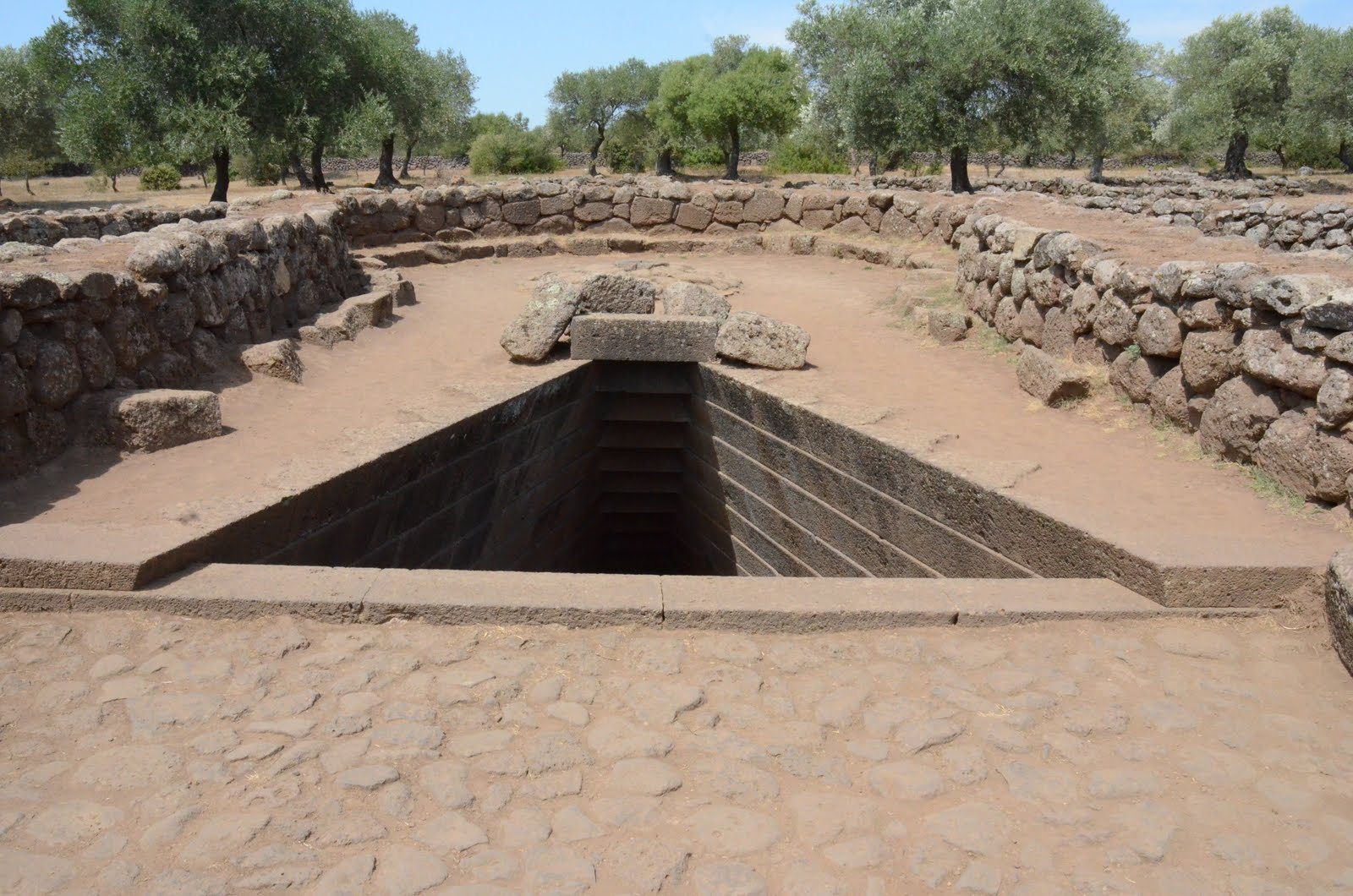
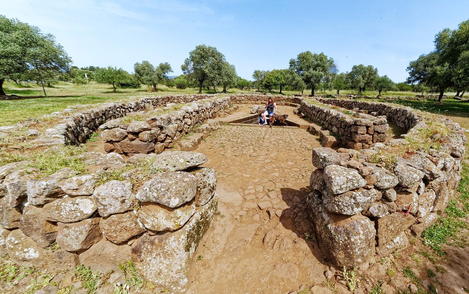
An elliptical enclosure measuring about 26 by 20 metres marks off the sacred area. Within it, a smaller enclosure has a keyhole-shaped plan around the well. Above ground, this inner wall surrounds a rectangular vestibule and the upper part of the well. A bench attached to the well’s upper drum is probably a later addition. The original façade may have had a double-pitched roof. Some interpretations read the keyhole plan as a female form and associate it with female deities, including Tanit, a major goddess in the ancient Carthaginian tradition.
Stair passage and chamber
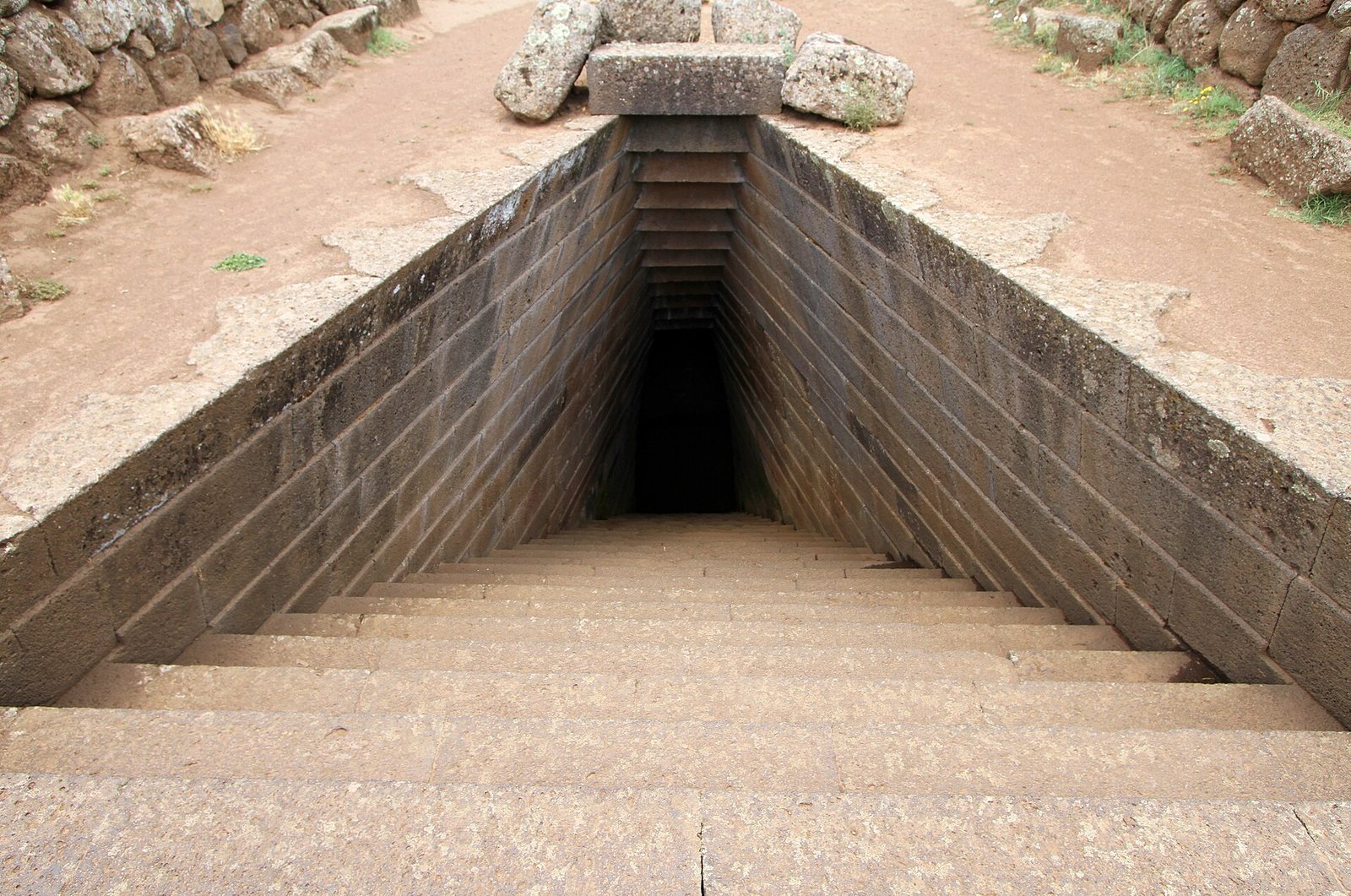
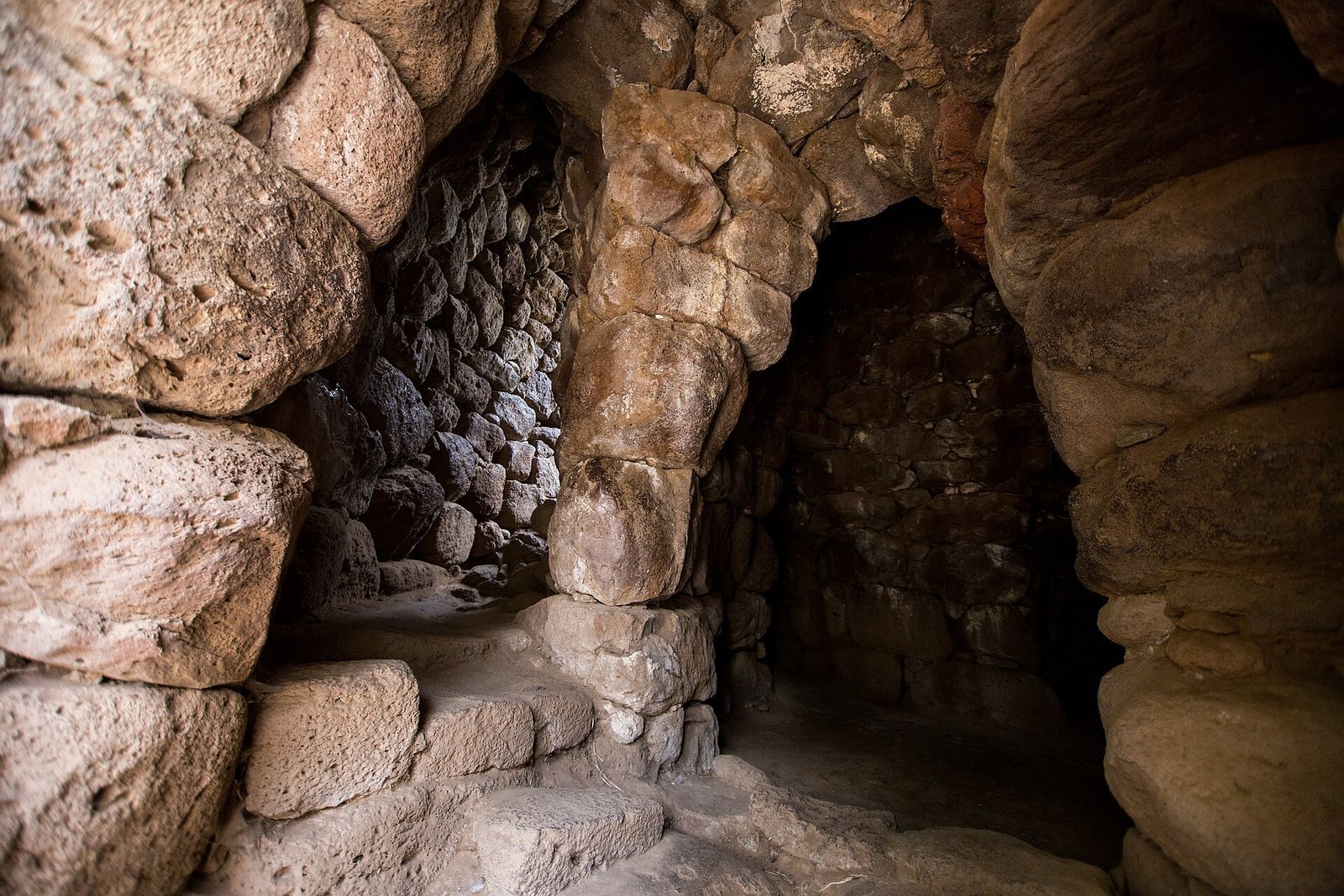
From the vestibule, a passage about 6.5 metres long descends by 25 steps. It narrows from roughly 3.47 metres wide at the top to 1.40 metres at the bottom. Overlapping stone lintels create a stepped ceiling that follows the stairway’s shape in reverse. Some interpretations connect this inverted pattern with a link between heaven and earth.
The passage leads into a circular underground chamber about 2.54 metres across and 6.9 metres high, topped by a pointed dome formed from stone courses projecting inward. Its opening is about 35 centimetres wide; whether a circular stone once closed it is uncertain. Beneath the opening, a shallow basin about half a metre deep is cut into the bedrock floor.
The passage and chamber are built from carefully dressed basalt blocks, averaging about 0.60 metres long and 0.30 metres thick, laid in horizontal courses without mortar. Each lower block projects roughly one centimetre beyond the block above, creating a toothed profile. The chamber walls are smooth and polished, with sharply defined edges and openings. Similar projecting courses occur at Nuragic sanctuaries including Santa Vittoria di Serri, Predio Canopoli, and Su Tempiesu, and at some collective Nuragic tombs known as giants’ tombs.
Water and light
Water from a perennial underground source seeps through gaps in the chamber’s lower courses and fills the basin. At times, especially in winter and spring, it rises to the lowest steps. A drainage channel is thought to help control the level. The opening also admits light. At a major lunar standstill, the roughly 18.6-year point when the Moon reaches the extremes of its northern and southern rising or setting positions, moonlight can illuminate the water even though the Moon is not directly overhead. At midday during the equinoxes, sunlight enters the stair passage and reaches the water. Some archaeologists have argued that an exterior covering would have blocked this light; Lebeuf and Atzeni disputed that conclusion, noting that a structure above the well would not necessarily prevent moonlight from entering.
Buildings and finds near the well
Circular building and adjoining enclosure
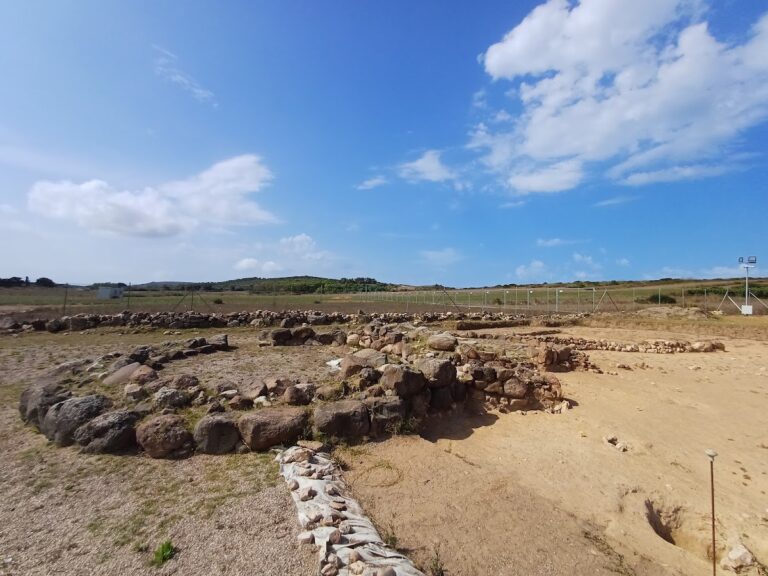
Near the well entrance stands a circular building about 10 metres across, preserved to a height of roughly 1.70 metres. Its pebble-covered floor has an interior bench about 0.50 metres deep and 0.30 metres high. Its size and seating have led to the suggestion that it served as a public meeting place. A smaller curved room adjoins it. A nearby enclosure was probably used to keep animals brought as offerings to the sanctuary, possibly for sacrifice. Two further structures stand beside the circular building, with an irregularly circular enclosure behind them that may belong to the same group and has an entrance from the circular building.
Row of huts and votive finds
Near the well, remains of ten circular or rectangular huts form a row. Stone clearing, particularly during the 1930s, badly damaged this area; the huts now survive as a few courses and spaces along the line. Their arrangement has prompted the suggestion that they supported commercial activity connected with the sanctuary, although their function and date are not established.
Finds from the sanctuary include four bronze statuettes, one depicting a seated woman, other Nuragic bronze figurines, and additional objects dedicated to the sanctuary. Phoenician gold jewelry, belonging to a later period than the Nuragic sanctuary, was also found.
The nuraghe and village sector
Single-tower nuraghe
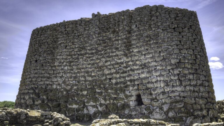
The separate tower is circular, about 13 metres in diameter, and preserved to a maximum height of 6 metres. Its roughly dressed stones are laid irregularly. The surviving first level contains a circular chamber about 3.50 metres across, with three niches arranged in a cross and an intact pointed stone vault. A staircase leads to the second level.
Village traces and later shelters
Traces of a Nuragic village surround the tower. Its circular huts have not been excavated, and only a few elements are visible at the surface. Several giants’ tombs and other nuraghi also lie in the nearby area.
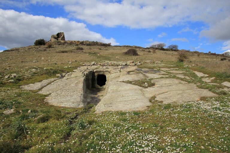
Three elongated stone huts near the tower postdate the Nuragic period and may be relatively recent. They were probably used as livestock shelters. Hut A retains its stone-slab roof and measures about 13.8 metres long, 1.30–1.90 metres wide, and 1.90–2.10 metres high; its walls are 0.80–1.35 metres thick. The main entrance, with a trapezoidal opening and lintel, is at the eastern end. A low secondary opening and a higher rectangular light opening are set into its long wall. Hut B, about five metres northwest of A, is largely collapsed; its remaining structure is about 6.80 metres long, 1.70 metres wide at one end and 1.05 metres at the other, with walls about 1.10 metres thick and a preserved height of roughly one metre. Hut C has no roof and measures about 15.40 metres long and 3.00 metres wide at one end, narrowing to 2.50 metres. Excavation there yielded Roman-period material.
Church and pilgrims’ dwellings
Rural church
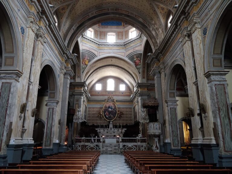
The medieval church dedicated to Santa Cristina has been altered several times. The original walls survive around its apse, the rounded end of the church, and are said to incorporate stones taken from the above-ground part of the Nuragic well.
Dwellings for worshippers
Thirty-six small dwellings stand around the church. An inscription on one places the beginning of their construction in the 18th century or later. They housed worshippers during the nine days of prayer before the saint’s feast, with wealthier visitors staying in the dwellings while less wealthy worshippers came to the church in the evenings and returned home.