Numantia: A Celtiberian City and Roman Siege Site in Spain
Site at a Glance
- Popularity
- Very High
- Country
- Spain
- Primary era
- Classical
- Eras represented
- Iron Age, Classical, Modern
- Civilizations
- Celtiberian, Roman, Spanish
- Site type
- City
On this page22 sections
History
Numantia was a Celtiberian city and later Roman settlement on Cerro de la Muela in Garray, Spain. People occupied the area from the third millennium BC, and a fortified settlement took shape around the seventh century BC. By about 350 BC, it had grown into a substantial Celtiberian town. Its prolonged resistance to Rome, and its destruction after a Roman blockade, made it a celebrated episode in ancient accounts of the Celtiberian Wars, the conflicts between Rome and Celtiberian peoples in Hispania.
Early settlement and Celtiberian city
The earliest settlement is dated to around 1800–1700 BC, in the Chalcolithic or early Bronze Age. Its inhabitants were mobile herders who lived in huts made from perishable materials. The surrounding woodland supported animals such as deer, wild boar, bears, wolves, hares, rabbits, and horses, while nearby pasture provided grazing for sheep and goats. The region experienced severe frosts and heavy snow, and was exposed to a cold northerly wind.
From about the seventh century BC, the settlement developed into a hillfort, a fortified community built on elevated ground. Celtiberians, whose communities combined local Iberian and Celtic influences, made Numantia a larger town around 350 BC. They adopted pottery techniques used by neighbouring Celtiberian communities to the east, including the potter’s wheel, an oxygen-rich kiln, and painted decoration.
Ancient writers disagreed about which people Numantia belonged to. Pliny the Elder associated it with the Pelendones, while Strabo and Ptolemy placed it among the Arevaci. The region is thought to have been controlled first by the Pelendones, who were displaced northward by the Arevaci from the fourth century BC. Numantia was Arevaci during the wars with Rome, but under Roman rule it was assigned to the Pelendones.
The city’s first known historical mention concerns Cato’s expedition of 195 BC. Its first major clash with Rome came in 153 BC, when Numantia sheltered people fleeing Segeda, a town of the Belli. Numantia joined the Belli, led at Segeda by Carus, against the Roman consul Quintus Fulvius Nobilior. The allied forces defeated the Roman army, causing more than 6,000 Roman casualties. Rome later tried to besiege the city with war elephants, but that effort failed.
Conflict and periods of peace continued for roughly two decades. In 137 BC, about 20,000 Roman soldiers surrendered to Numantia’s Celtiberians, whose population is estimated at between 4,000 and 8,000. Tiberius Gracchus, a Roman quaestor, or magistrate with financial and administrative duties, negotiated a treaty that saved the Roman army from destruction.
Siege, destruction, and Roman rebuilding
In 134 BC, the Roman Senate gave Scipio Aemilianus Africanus command of a campaign to destroy Numantia. Rather than attempt a direct assault, he aimed to starve the inhabitants into surrender. Roman forces burned the Vaccaei grain fields, cutting off an important source of cereals for the city, then maintained an encirclement for about 13 months.
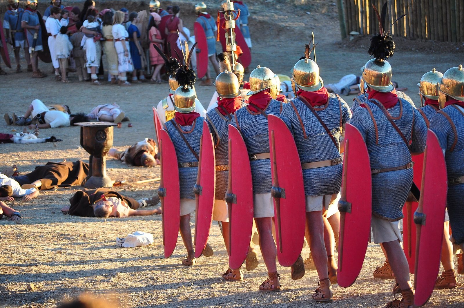
During the blockade, the Numantine leader Retogenes escaped and sought help from neighbouring towns. Only Lutia agreed to assist, and Scipio retaliated against its young men. Famine and disease weakened the people inside Numantia. They burned their city rather than surrender; some survivors gave themselves up and were enslaved, while most chose to die. Scipio returned to Rome in triumph with 50 captured Numantines. After the city’s destruction, he distributed its territory among neighbouring peoples, probably the Pelendones.
A second Celtiberian settlement later arose at Numantia, but it was destroyed during the Sertorian Wars, conflicts in Hispania involving the Roman commander Quintus Sertorius and forces loyal to Rome. The city was rebuilt in the Augustan period, the era of Rome’s first emperor, Augustus, whose reign lasted from 27 BC to AD 14. The new settlement had a Roman street plan and Celtiberian inhabitants. Pliny still described it as a Pelendone city.
Occupation continued through the first century BC. The settlement began to decline in the third century AD but remained inhabited into the fourth. Finds suggest a possible Visigothic presence in the sixth century; the Visigoths were a Germanic people who ruled parts of Iberia after the Western Roman Empire.
Memory and archaeological study
Numantia’s resistance became a familiar example in Roman writing, including works by Pliny and Florus. The later expression Numantine resistance came to describe steadfast opposition under extreme conditions. Miguel de Cervantes dramatized the siege in The Siege of Numantia, written and performed around 1585. During the French intervention and occupation of Spain that began in 1808, the story was revived as a parallel for Spanish resistance.
In the sixteenth century, Fray Antonio de Guevara proposed that Numantia lay at Garray. The site’s location was later forgotten, and some theories placed it near Zamora. Eduardo Saavedra identified the ruins at Garray in 1860, and Adolf Schulten investigated and identified the Roman camps around the city. Regular excavations began in 1906.
The ruins received state protection after Numantia was declared a National Monument in 1882. Luis de Marichalar y Monreal donated the land containing the remains to the state in 1917. The Roman camps entered Spain’s archaeological-zone heritage register in 1999. Later work included excavations in Block XXIII from 2003 to 2020, directed by Alfredo Jimeno and archaeologists from the Complutense University of Madrid. This project examined the arrangement and use of domestic spaces, an area earlier excavations had not consistently recorded.
Before Roman rule, livestock raising was central to Numantia’s economy. Hides and woollen cloaks served as payments to other peoples and to Rome, while trade with neighbouring communities, especially the Vaccaei, supplied grain and other necessities. People ate meat and dairy products as well as cereals, nuts, and legumes. Drinks included wine mixed with honey and caelia, a beer made from fermented wheat. Diodorus Siculus and Strabo also described the inhabitants as bathing in urine.
Remains
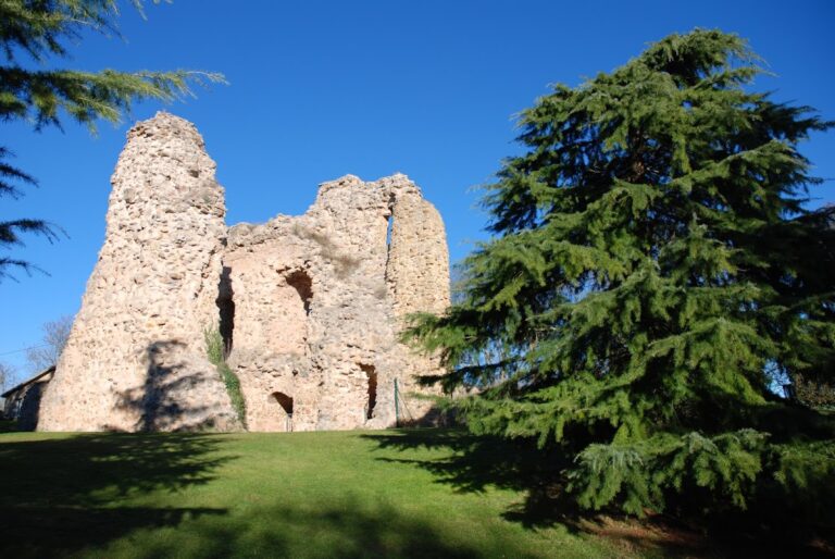
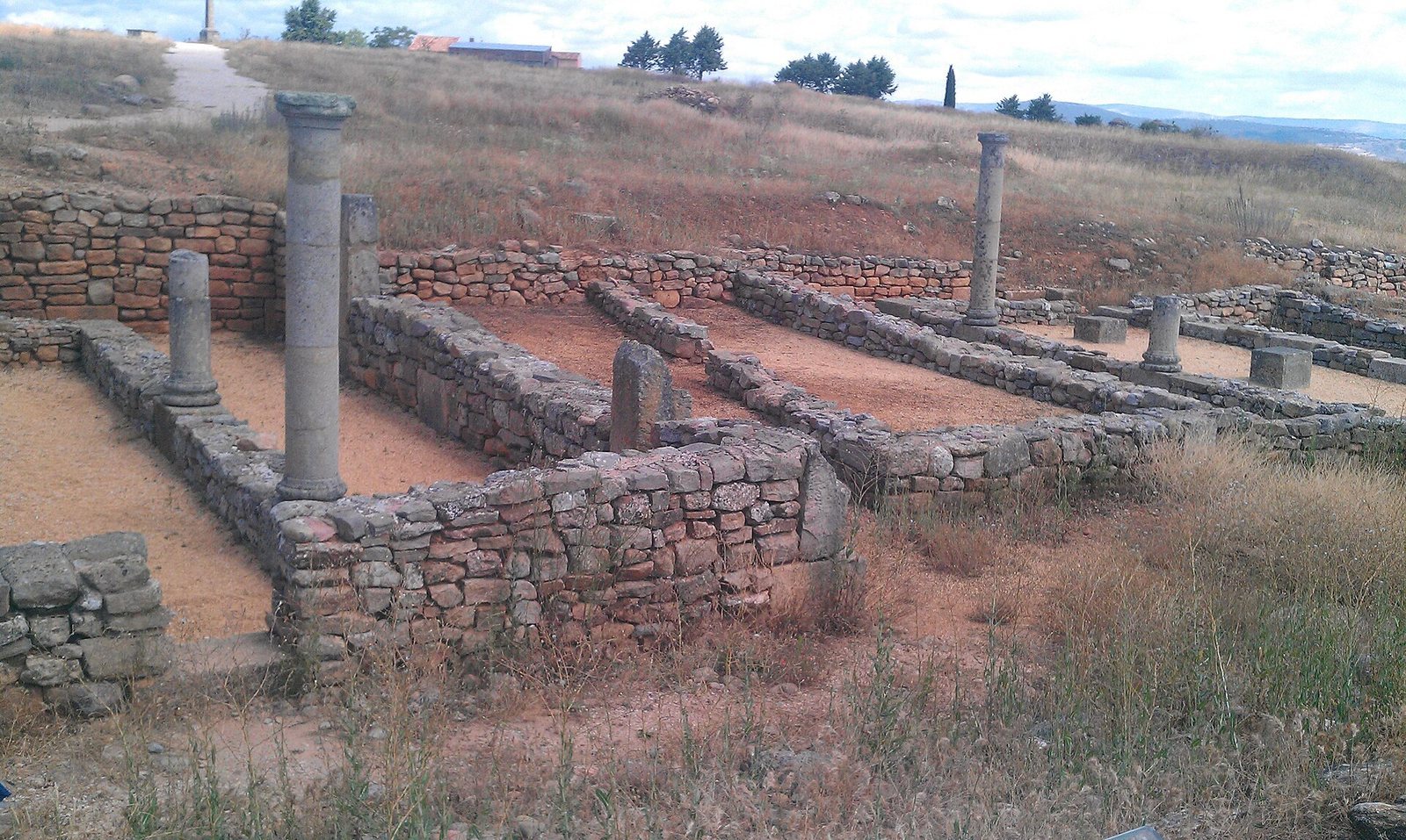
The excavated area covers about six hectares, roughly a quarter of the ancient city’s area, and includes remains of both the destroyed Celtiberian settlement and the Roman city built over it. Numantia occupies elevated ground at about 1,074 metres, on Cerro de la Muela, around seven kilometres north of Soria. The setting between the Iberian System mountains and the Duero and Merdancho rivers helped define the site; the Iron Age settlement controlled a river crossing. The Roman town followed a somewhat irregular grid, retaining the east–west alignment of earlier streets.
The city and its defenses
Town wall and gates
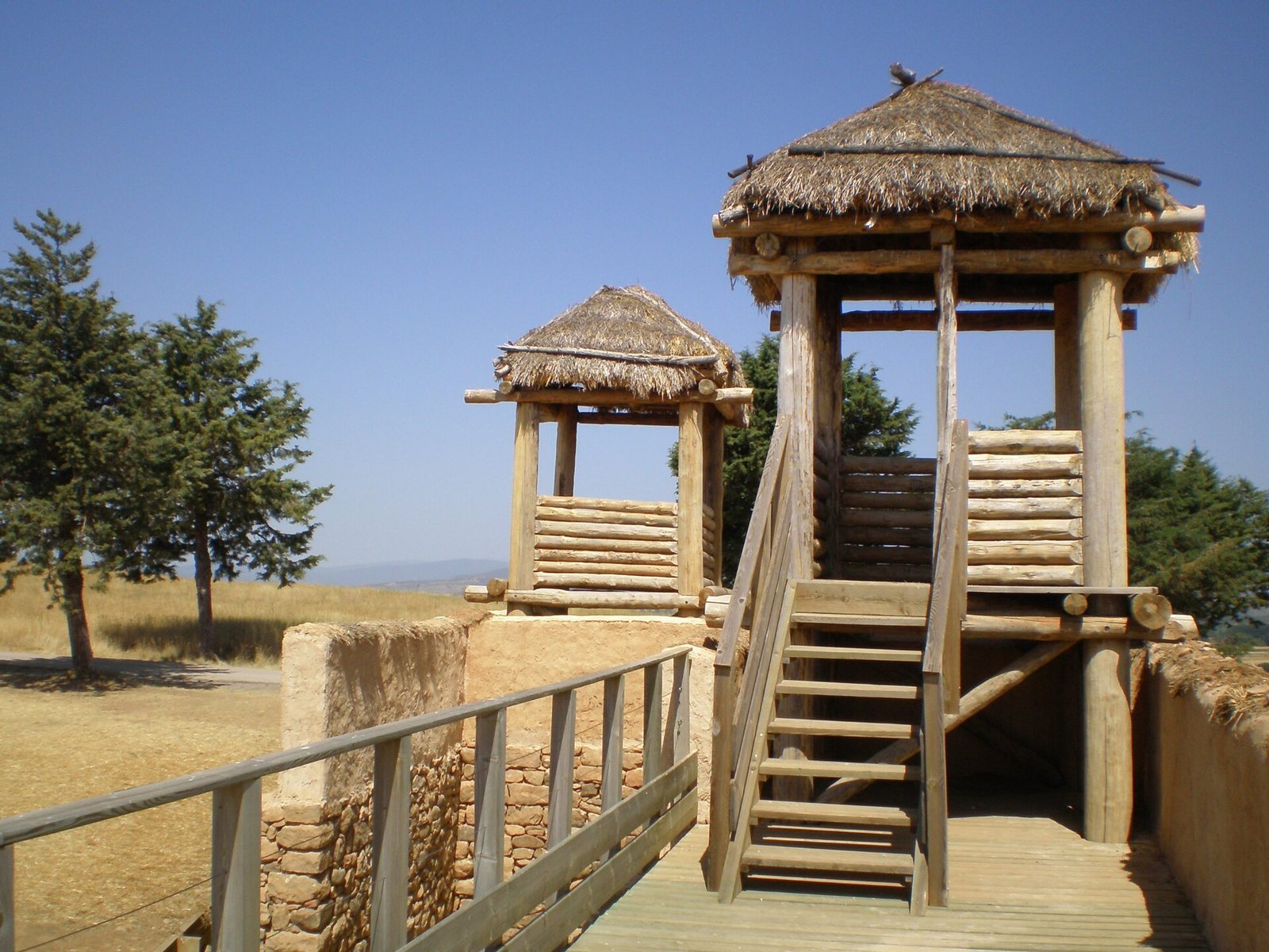
The Celtiberian settlement had a defensive wall strengthened by towers and pierced by four gates. Its original circuit measured about three kilometres, and the wall reached up to six metres in thickness. A reconstructed stretch marks its line. The wall enclosed the town whose remains lie beneath and alongside those of the later Roman settlement.
Streets and houses
Large, rounded stones paved the streets. Most ran east–west, with two main north–south routes. At intersections, streets shifted slightly rather than continuing in straight lines, a layout that allowed house corners to deflect the cold north wind. Raised sidewalks were paved with stone, and stepping stones set at intervals helped pedestrians cross the roads. House drains discharged water and mud onto the streets, while areas closer to the Duero were vulnerable to flooding.
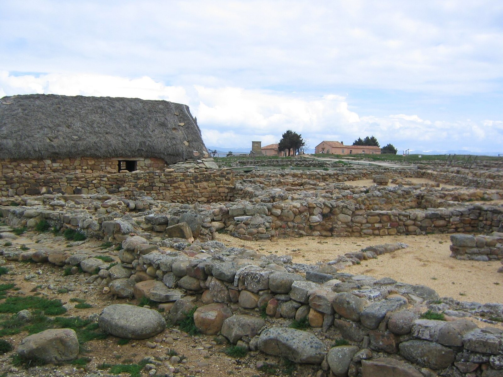
Houses stood in blocks, with some built along the town wall. They covered about 50 square metres and eventually had three rooms: a main space for eating and sleeping, a pantry, and an entrance room. Earlier Celtic houses had two rooms; a third, separated by a door, was added over time. Builders used mainly stone, alongside wood, adobe, earth, and straw. Floors were packed earth, roofs used bundled or woven rye, and rectangular animal pens adjoined some houses. The sunnier, more sheltered southern quarter contains remains of larger houses with columned patios.
Public and household features
Other excavated features include baths, cisterns, public buildings, drains, and hand mills. Reconstructed examples of Celtiberian and Roman dwellings show houses with the simple form of pastoral huts and roofs of rye straw.
Pottery and inscription
Early pottery includes handmade vessels from around the seventh century BC, among them biconical shapes with two cone-like sections joined at their widest point. Later pottery includes plain forms and vessels decorated with comb-impressed patterns or metal buttons. Celtiberian wares include wheel-made pieces with concentric designs and stamped decoration. A ceramic vessel bears the inscription nouantikum, possibly a plural possessive form connected with the city’s name.
Roman siegeworks and camps
Encircling defenses
Roman forces built a siege circuit roughly nine kilometres long, defended by seven camps. Its works included a wall, towers, ditches, earthworks, and palisades. The wall was described as eight feet wide and ten feet high, with towers spaced about 30.85 metres apart. A further ditch was strengthened with stakes. The network was designed to contain the city while Roman forces maintained the blockade.
Barrier across the Duero
Two forts guarded a barrier intended to prevent Numantines from crossing the Duero unseen. Long beams stretched between the forts were suspended on ropes. Stakes and arrows fixed to the beams turned in the river current, obstructing passage by swimming, diving, or boat.
Peña Redonda, Peñas Altas, and Saledilla
Peña Redonda lies southeast of the hillfort, across the Merdancho, in a high position on a ridge. At Peñas Altas to the east, remains include a broad wall and a substantial square tower that may have held a catapult. Below, at Saledilla, traces of burning point to a possible suburb about 150 metres from the catapult bastion.
Valdevortón
At Valdevortón, farther northwest, a former drainage channel led to the discovery of scant remains of a Roman camp.
Camp headquarters and kitchen
At one camp, a line of rooms formed part of the headquarters building. A kitchen with two hearths stood outside, reducing the danger of fire in the camp. The camp may have covered about four hectares and had capacity for 5,000 soldiers, although its actual garrison is thought not to have exceeded 2,500. Its barracks appear to have been intended for Italian troops. Two large towers protected the main gate from inside. Finds included precious-metal objects, a catapult bolt, a dagger, and a coin.
Fort at the river confluence
A Roman fort stood where the Merdancho meets the Duero. Ditches about three metres deep and five to ten metres wide defended its eastern and western sides. A thick deposit of soil helped preserve its remains despite later farming. Around 400 soldiers were stationed there to guard the river, its gorges, and the hills from which Numantines might attack after crossing the Merdancho.
Camp overlooking the southern slope
An exposed camp between the Merdancho slopes and the city ruins commanded a broad view over Numantia’s southern slope. Its remains include part of a wall about four metres thick and a steep ravine. The camp’s principal roads, leading to the main gate, crossing the camp, and running toward the rear gate, can also be identified.
Fortification between the Duero and Peñarredonda
A separate fortification defended the heights between the Duero and Peñarredonda. About 300 metres of its wall survive, and the defended area may have covered six hectares. Iberian troops may have occupied the position in rough huts made from branches.
Largest Roman camp
The largest camp occupied a plateau surrounded by the Duero at about 1,050 metres. Covering 14.6 hectares, it overlooked Numantia and the full siege circuit. The beginnings of a wall survive on both sides of the plateau, and a cut about six metres wide may mark the rear gate. Part of an excavated barrier reached about four metres in height.
Alto Real
At Alto Real, a plateau near the ruins above the Duero, Roman vessels have been found, including an amphora disturbed by farming. Irregular structures there have been interpreted as possible quarters for Iberian auxiliary troops. If the camp occupied the entire hill, it may have covered eight hectares.
Finds and memorial
A copper brooch shaped like a horse, found during excavations in the early 1990s, relates to the Horse of Numantia motif, which also appears on pottery and other objects. The horse was associated with Epona, a Celtic goddess linked to horses, and represented wealth and social standing. Objects recovered at Numantia are displayed in the Numantine Museum in Soria and the museum at Mainz; Schulten took some finds to Germany.
An obelisk erected in 1886 commemorates the Numantines. It was raised by the Second Battalion of the San Marcial Regiment.