Neideck Castle: A Medieval Noble Fortress in Bavaria


Site at a Glance
- Rating
- 4.7
- Popularity
- Medium
- Country
- Germany
- Primary era
- Medieval
- External website
- Open
- Eras represented
- Medieval, Early Modern
- Civilizations
- Holy Roman Empire
- Site type
- Military
- Remains
- Castle
On this page13 sections
History
Neideck Castle is a former high-medieval noble castle in Germany, standing above Streitberg in the Wiesent valley of Bavaria. Probably established in the twelfth century, possibly around 1150 to 1160, it occupied an exposed rock spur and later became a symbol of Franconian Switzerland.
Early occupation and foundation
The plateau above the valley had been settled long before the medieval castle was built. Archaeological evidence places activity there during the Urnfield period, an earlier Iron Age culture associated with cremation burials and urn deposits, followed by the Hallstatt and La Tène periods, successive Iron Age cultures in central Europe. Settlement also continued during the early Roman Imperial period and the Migration Period. The castle’s large size and two extensive outer baileys may point to an earlier medieval hillfort.
The fortress was probably founded in the twelfth century. A man named Henry of Neideck appears in a record from 1219, while the castle itself was first recorded in 1312 as the property of the free noble Schlüsselberg family. Neideck had been associated with the family since at least the middle of the thirteenth century and became particularly closely connected with Conrad II of Schlüsselberg, its most important and final representative.
The Schlüsselberg fortress and its destruction
Conrad II expanded Neideck into a fortress. In 1347, he became involved in a feud with the bishops of Würzburg and Bamberg and the Burgrave of Nuremberg over the establishment of a toll station. Their forces attacked and defeated him during a siege. On 14 September 1347, Conrad was killed by a stone projectile fired from a trebuchet, and the castle was destroyed.
After the siege, Neideck became the seat of an administrative office belonging to the bishops of Bamberg. The tower house in the inner bailey was rebuilt from 1347 onward, using older foundations and sections of earlier walls. Further expansion and reinforcement took place around 1480 after another siege.
Early-modern destruction and later quarrying
Neideck survived the Peasants’ War of 1525, a widespread uprising by rural communities in the German lands. In 1553, however, mercenaries serving Margrave Albert Alcibiades of Brandenburg-Kulmbach captured and burned it during the Second Margrave War, a sixteenth-century conflict between Albert and several imperial princes and ecclesiastical territories. The castle has remained a ruin since that destruction.
Residents of the valley quarried stone from the ruins until the early nineteenth century. The deterioration accelerated between 1737 and 1743, when the castle rock itself was quarried for marble. Conservation began shortly after the Second World War, when the municipality of Streitberg undertook initial measures. The county of Forchheim carried out comprehensive renovation from 1996 to 2008, accompanied by archaeological excavation and the creation of an archaeological park. Some of the conservation methods used during this work did not follow current heritage practice.
The Bavarian State Office for Monument Protection protects the site as an archaeological monument. This protection includes prehistoric settlement remains and buried parts of the medieval and early-modern castle. A separate monument designation covers the remains of a watchtower on the higher ridge at Wartleiten, where its surrounding ditch can still be seen.
Remains
Layout and defensive works
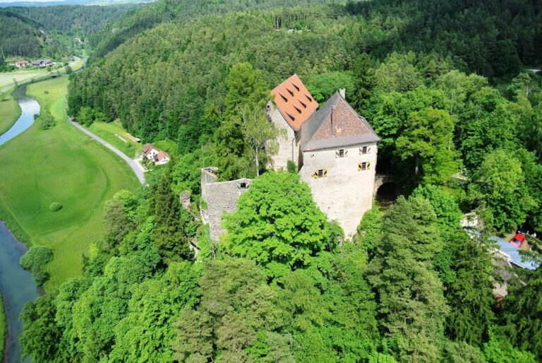
Neideck is a hill or spur castle on a rock projection above the Wiesent valley, approximately 402.9 metres above sea level and about 800 metres east of the church at Streitberg. The complex measures about 140 by 200 metres and is divided into three sections by deep neck ditches, which are ditches cut across a narrow ridge or spur to isolate and defend a castle. Rubble stone masonry forms most of the surviving construction, with quoins reinforcing some walls.
Outer bailey
The outer bailey was defended by a moat about 100 metres long, 22 metres wide, and approximately 7 metres deep. Behind it stood a high shield wall, a heavily reinforced defensive wall protecting the most vulnerable approach, built around 1300. Only small foundation traces remain from most of the buildings that once occupied this section.
Middle bailey
The middle bailey was strengthened in the early sixteenth century with two artillery roundels, rounded fortifications designed to accommodate firearms and reinforce a wall or gate. Parts of both survive. The eastern roundel has cross-key-shaped embrasures for arquebuses and crossbows, while the western roundel has rectangular embrasures probably added around 1531 to 1532. The western structure flanked the approach road. The curtain walls between the roundels and the middle-bailey gate have almost entirely disappeared.
Inner bailey structures
Tower house
The inner bailey occupies a rock spur projecting toward the northeast. Its three-storey tower house rises above its foundations and incorporates older foundations and wall sections in the rebuilding undertaken after 1347. The former ground-floor barrel vault probably dates from the early thirteenth century. Above the surviving storeys, the building originally had a fourth stone storey and possibly another timber-framed structure.
The elevated entrance on the first floor survives, while the entrance at ground level was created in modern times. Since 2008, a staircase has reached the wall crown, approximately 10 metres above ground. The tower house now functions as a viewing point.
Cellar and entrance
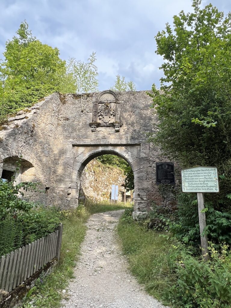
Most of the other inner-bailey features belong to the expansion around 1480. They include the barrel-vaulted cellar of a building and the shaft of a filter cistern, a water-storage installation that collects and filters rainwater. The historical approach entered through a late-medieval gatehouse and crossed the deep neck ditch by a stone bridge preceded by a short drawbridge.
Water supply
One interpretation proposed that water reached the castle from the Trainmeusel Spring through an approximately 1,300-metre wooden pipeline made from oak trunks. Later excavation in the inner bailey identified the feature once thought to be a well as a filter cistern instead. Wooden pipes supplied it with rainwater collected from the roofs of buildings adjoining the tower house and from other nearby structures.
Wartleiten watchtower
Because the castle occupied a low corner of the ridge that was militarily unfavorable, a stone watchtower was built on the higher ridge above it. The tower has nearly disappeared, but its enclosing ditch remains visible on the Wartleiten ridge. The place name commemorates the feature, which is registered separately from the main castle site.
Steel engravings made in 1834, 1840, and 1858, together with a lithograph from around 1840, preserve historical views of the ruins.
Nearby sites