Monte Viso Tunnel: A Medieval Alpine Trade and Military Passage

Site at a Glance
- Rating
- 4.8
- Popularity
- Low
- Country
- France
- Primary era
- Medieval
- External website
- Open
- Eras represented
- Medieval, Early Modern
- Civilizations
- French
- Site type
- Infrastructure
- Remains
- Tunnel
On this page7 sections
History
Monte Viso Tunnel is a medieval Alpine pedestrian gallery in France, excavated under the initiative of Ludovico II Del Vasto, Marquis of Saluzzo, between 1479 and 1480. Conceived during the fifteenth-century political struggle between the Marquisate of Saluzzo and Savoy, it created a lower route beneath Monte Granero between the upper Po Valley and the French Queyras, offering a safer alternative to the high Col de la Traversette.
Creation and political purpose
Ludovico II promoted the tunnel as part of a pro-French policy intended to resist Savoyan pressure on his marquisate’s autonomy. He reached an agreement at Arles on September 22, 1478, with René of Anjou, King of Naples and Count of Provence, who was a vassal of Louis XI of France. Excavation began after the snow had melted in the summer of 1479. Work stopped during winter and resumed the following season, reaching completion near the end of summer 1480 under the engineers Martino di Albano and Baldassarre of Piasco. The project cost approximately 12,000 florins.
The passage was designed to encourage direct trade between Saluzzo, Provence, and the Dauphiné. Its lower elevation allowed merchants to cross the Alps for a longer part of the year, since early snowfall made the surface pass difficult to use. The route also offered a possible passage for military units when circumstances required it.
Trade and military use
Commercial traffic increased after the tunnel’s completion in 1481. Saluzzo sent wine, rice, hemp, and walnut oil toward France, while fabrics, brocade, and horses travelled in the opposite direction. Salt was especially important because the marquisate had no maritime outlet. From 1482, the salt-tax office at Revello recorded the annual passage of more than 20,000 sacks from Aigues-Mortes, in addition to other merchandise.
The tunnel also became part of the movement of armies across the Alps. Ludovico II used it in 1486 while fleeing from Saluzzo to France. Charles VIII of France crossed it with his army and artillery in connection with the Battle of Fornovo. Louis XII used the passage in 1499, and François I crossed it with his army in 1525 while travelling to fight Emperor Charles V. On that occasion, the tunnel and its approach path were enlarged to assist the movement of artillery.
Closure and renewed use
The Treaty of Lyon in 1601 annexed the Marquisate of Saluzzo to the Duchy of Savoy, ending the political conditions that had made the tunnel strategically valuable to Saluzzo. Duke Carlo Emanuele I of Savoy ordered its closure in order to protect traffic and customs income on the Moncenisio and Monginevro routes. The passage subsequently alternated between occasional openings and lengthy closures, while landslides and rockfalls repeatedly blocked it.
The tunnel remained useful to nearby communities, but conflicts between Savoy and France, including the War of the Grand Alliance and the War of the Spanish Succession, contributed to its prolonged closure. In 1837, inhabitants of the Po Valley undertook a partial and rough restoration during a period of increased migration toward France. The work made passage possible again, although some sections could be crossed only on hands and knees, and pack animals could not pass through.
A definitive reopening took place on August 25, 1907, with support from the Italian government under Giovanni Giolitti and a contribution from the Turin section of the Italian Alpine Club, then chaired by Ubaldo Valbusa. In 1998, stone debris was cleared under the auspices of the Rotary Club of Saluzzo, making the passage usable again and adding information panels at both entrances. Major reinforcement works preceded another reopening on October 15, 2014. The tunnel remains part of the mountain-path network linking the Monte Viso area, the Queyras, and the upper Po Valley, although rockfalls can obstruct access and snow normally closes the passage from about October to June.
Remains
The surviving tunnel is cut through the slopes of Monte Granero, a mountain of the Cottian Alps, approximately eight kilometres north of Monviso. It lies beneath the ridge separating the Po Valley from the Queyras, linking Crissolo in Italy’s Cuneo province with Ristolas in France’s Hautes-Alpes department. At an elevation of about 2,882 metres, it is roughly 80 metres below Monte Granero’s crest and slightly lower than the Col de la Traversette, which reaches about 2,950 metres. The gallery runs approximately east to west and slopes toward the Italian side.
The rock gallery
The passage is about 75 metres long, although its original length was approximately 100 metres. Erosion on the mountain sides at both approaches accounts for the reduction. Its slightly curved plan follows foliation zones, which are planar layers or alignments formed within the rock. The surrounding stone consists mainly of chloritic-amphibolic schists, metamorphic rocks containing chlorite and amphibole minerals. The gallery is listed as about 2 metres in diameter and approximately 3 metres wide, with an average interior height of 2.5 metres. In places the roof drops to about 1.70 metres, reaching approximately 1.40 metres at one point.
The medieval excavation proceeded without explosives or accurate surveying equipment. The work probably advanced from only one end, and the narrow working face allowed no more than two or three men to work at a time. Workers piled wood against the rock and set it alight, causing the stone to calcine and crack. They then poured large quantities of boiling water and vinegar into the fissures before breaking the softened rock with hammers, picks, and wooden poles inserted into the cracks. Diodorus Siculus, an ancient Greek historian, described this fire-and-vinegar method for fracturing rock.
Entrances and mountain approaches
The interior is unlit, humid, and considerably colder than the exterior. Passage requires a torch, while a protective helmet is recommended and large backpacks can be difficult to carry through the narrow sections. The Italian entrance is easier to reach. On the French side, the entrance is narrower and may be blocked by rock debris and lingering snow until late summer; the tunnel floor there is reached by descending over fallen rocks. An avalanche-protection structure at the French entrance was installed to reduce the accumulation of debris carried down during thaw.
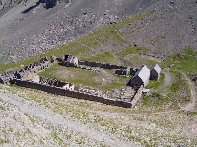
The approach from the Italian side begins at Pian del Re, near the source of the Po at approximately 2,020 metres, and follows the V16 path toward the Col de la Traversette. In the detrital area of Pian Mait, about 2,700 metres above sea level and slightly downstream from the Italian entrance, are the remains of a small Border Guard barracks.