Merheleva Ridge: An Eneolithic and Bronze Age Archaeological Complex in Ukraine
Site at a Glance
- Rating
- 4
- Popularity
- Very Low
- Country
- Ukraine
- Primary era
- Bronze Age
- External website
- Open
- Eras represented
- Stone Age, Bronze Age
- Civilizations
- Unclassified
- Site type
- Religious
- Remains
- Sanctuary
On this page6 sections
History
Merheleva Ridge is an Eneolithic and Bronze Age archaeological complex in Ukraine, near Stepanovka and Perevalsk in Luhansk Oblast. Its kurgans, or prehistoric burial mounds, are approximately 5,000 years old and belong to a sequence broadly dated from the fourth to the second millennia BC. The ridge itself is a much older geological formation, preliminarily dated to more than 10 million years ago. The complex may have served different regional tribes as a place for sanctuaries and funerary activities over several thousand years.
Discovery and archaeological research
The circumstances of the site’s discovery are reported with two dates. In 1976, pupils from Alchevsk Secondary School No. 23 worked on the ridge under Vladimir Paramonov, the founder of an archaeology club. Another account places the identification in 2004, when schoolchildren at an archaeology camp organized by Paramonov recognized the site. Paramonov had arranged school expeditions to Merheleva Ridge since 1995.
Detailed archaeological research began in 2005 under Viktor Klochko, a Kyiv archaeologist and Doctor of Historical Sciences, with support from Ukraine’s Ministry of Culture and Tourism. Extensive press coverage followed in September 2006. Early publicity called the complex the “Ukrainian Pyramids,” “Luhansk Stonehenge,” and the “Second Great Wall of China.” It also claimed that stone pyramids inside some kurgans predated the oldest Egyptian pyramid by about 300 years and the earliest construction horizon at Stonehenge by about 500 years.
Interpretations and chronology
Later statements stressed that no Egyptian-style pyramid had been found. Klochko interpreted Merheleva Ridge as the first known Eastern European sanctuary associated with a solar cult, meaning religious practices that gave the sun a central sacred role. He also proposed that the wider Donbas had been inhabited around 5,000 years ago by a highly developed civilization comparable with Egypt, an interpretation that was not generally accepted.
At a conference in Luhansk in late 2007, geological and archaeological specialists concluded that the ridge contained ordinary Donbas kurgans but no other artificial structures. An archaeological discussion that year likewise found no clear evidence that the reported walls, roads, and platforms were human-made. Preliminary dating places activity at the complex between the Late Neolithic or Late Eneolithic and the Bronze Age, while another interpretation extends use into the Iron Age, possibly as late as the fifth century BC.
Excavation has covered only a small part of the ridge. Work there produced burials, sacrificial installations, more than a dozen vessels, and numerous human remains. Some graves have been interpreted as evidence of human sacrifice rather than ordinary burial, but that conclusion remains uncertain. An archaeological-site passport was prepared for submission to the Luhansk regional heritage-protection inspectorate, together with proposals to recognize the site as a monument of local and potentially national importance.
Remains
The complex occupies a rocky natural plateau and includes earthen and stone features, especially kurgans and a possible sanctuary. The area of the site is given as 10 hectares, while the broader complex has been described as covering 1.3 square kilometres. Its physical organization is difficult to establish because the human origin of the larger stone formations remains disputed.
The ridge and reported stone formations
Merheleva Ridge extends from southwest to northeast and reaches 242 metres above sea level, the highest point in the locality. It consists of weathered argillite, a hardened clay-rich sedimentary rock, and limestone or marlstone, a clay-bearing carbonate rock. The landscape had not undergone technological or industrial alteration.
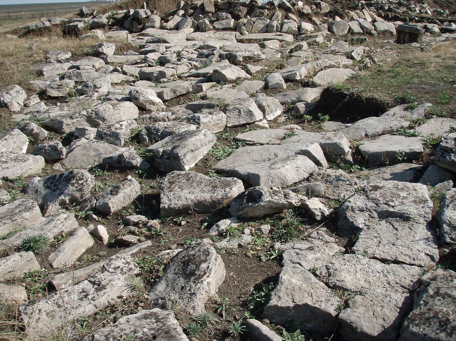
The principal feature has been described as a possible sanctuary. It appears as a rise covered with worked stone slabs and blocks, and its northwest side is bounded by a chain of upright slabs extending about 300 metres or slightly more. Other interpretations regard the slabs as natural formations created by fractures in large stone platforms, pointing to the matching shapes of neighbouring edges. The hill has also been described as having stepped sides, although that interpretation is not securely established.
Within the excavated area are regularly shaped stone circles, together with reported altars and burial places. Lines made from stone slabs have been described as roads and rays. A proposed construction method involved shaping slabs and filling the gaps with dense clay mortar containing stone fragments, sometimes called “clay concrete.” The second and third courses were said to use staggered joints comparable to modern brickwork, but the artificial character of the broader formations remains unresolved.
Kurgans and excavated graves
Four kurgans are recorded, each between 1.3 and 2 metres high. One retains a well-preserved cromlech, a circular stone arrangement often linked with prehistoric ritual or funerary use. The burials are associated with the Catacomb culture, an Early Bronze Age steppe tradition that placed graves in side chambers cut into burial pits, and with the later Srubna or Timber-Grave culture, known for timber-framed burial structures.
Kurgan No. 4 contained thirteen graves and sacrificial pits. Three graves attributed to the Berezhnovsko-Maevskaya group of the Late Bronze Age Srubna culture lay above three graves of the Early Bronze Age Catacomb culture. One skull was dated to approximately 3000 BC, and four stone statues were found near the graves. Excavated material also includes ashes and ceramics, as well as human remains.