Markeli: A Byzantine-Bulgarian Frontier Fortress in Bulgaria




Site at a Glance
- Rating
- 4.3
- Popularity
- Low
- Country
- Bulgaria
- Primary era
- Medieval
- Eras represented
- Classical, Medieval
- Civilizations
- Byzantine, First Bulgarian Empire, Roman
- Site type
- Military
- Remains
- Fort
On this page16 sections
History
Markeli is a Late Antique and medieval Byzantine-Bulgarian frontier fortress in Bulgaria, about 7.5 km west of modern Karnobat. Built during the early Byzantine period between the late fifth and mid-sixth centuries, it became strategically important after the rise of the First Bulgarian Empire, the medieval Bulgarian state established in the late seventh century. Its position on the routes between Constantinople, the Balkan passes, and the Bulgarian capitals made it a base for campaigns and a contested stronghold between Byzantium and Bulgaria.
Frontier stronghold and Bulgarian rule
Markeli stood on the route from Constantinople through Adrianople and the Balkan passes toward Pliska and Preslav, the political centers of the Bulgarian state. It also controlled a branch of the Via Militaris, a major Roman and Byzantine communication route, leading toward the Rish and Varbitsa passes and the Danube. Routes eastward reached the Via Pontica, the coastal road along the western Black Sea.
The fortress first came under Bulgarian rule in 705, when the Byzantine emperor Justinian II ceded Markeli and the surrounding region of Zagore to Bulgaria. It later served both empires as a military base for operations to the south and north, changing hands repeatedly during the prolonged Byzantine-Bulgarian conflict.
The battles of Marcellae
In 756, Byzantine forces led by Emperor Constantine V defeated the Bulgarians commanded by Vineh at the Battle of Marcellae. To prevent another invasion, Vineh was required to send hostages to Constantinople. A second battle at Marcellae in 792 produced the opposite result. Bulgarian forces under Khan Kardam heavily defeated the army of Emperor Constantine VI. Bulgarian troops killed some of the emperor’s personal servants and senior generals and seized his tent, treasury, and horses. Constantine VI then agreed to a peace treaty and tribute.
Krum’s military camp and later destruction
In 811, Khan Krum turned Markeli into a strongly fortified military camp. It became the largest Bulgarian army camp south of the Balkan Mountains and served as a base for campaigns against the Byzantine Empire. A Byzantine expedition under Emperor Nikephoros I captured Markeli and departed from it during the same year. The campaign ended disastrously for Byzantium when Nikephoros was killed by the Bulgarians at the Battle of Pliska, after which the Byzantine force abandoned the fortress.
Markeli remained inhabited and garrisoned until sometime in the twelfth century. Anna Komnene wrote that Pechenegs and Cumans, steppe peoples active across the northern Balkans, camped there in 1089 while negotiating with her father, Byzantine Emperor Alexios I Komnenos. The fortress was probably destroyed during a Cuman attack on the Byzantine Empire around 1090.
Markeli and its church were destroyed again during a punitive expedition led by Henry of Flanders after the death of his brother Baldwin, the Latin emperor of Constantinople. Baldwin had been defeated and captured by Tsar Kaloyan of Bulgaria at the Battle of Adrianople in 1205 and died while imprisoned at Tarnovo.
Archaeological investigation and presentation
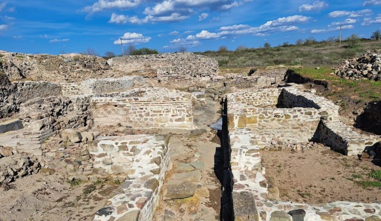
Archaeological investigations at Markeli have continued since 1986 and established that the fortress originated in Late Antiquity, during the early Byzantine period. Restoration, conservation, and archaeological presentation are now being carried out through the Medieval Park Markeli, with support from a regional-development program and co-financing from the European Regional Development Fund.
Remains
Fortress setting and defenses
Markeli occupied the western end of the Hisar Heights near the Mochuritsa River, a major tributary of the Tundzha. The heights form part of the southeastern Balkan Mountains, while the river emerges from the Karnobat Valley at this point. The position provided direct lines of sight toward the Rish, Varbitsa, and Mokren mountain passes. The river supplied water and protected the site, while a rocky slope strengthened its northwestern side. Much of the surrounding riverbank was marshy, making the nearby ford, controlled by the fortress, the principal crossing point.
The fortress formed the southern starting point of a chain of Bulgarian fortifications extending northward toward Pliska, about 100 km away, across the Balkan Mountains. Lines of sight connected Markeli with fortified settlements around Simen, Voynishki Bakadzhik near Vojnika, the Marash Pass near Sedlarevo, the Small and Large Kale near Vezenkovo, Obrasloto Kale near Podvis, and Great Bakadzhik. Settlement traces from prehistoric and Iron Age communities, together with ancient Roman burial mounds, have also been identified in the surrounding area.
Walls, ramparts, and enclosed areas
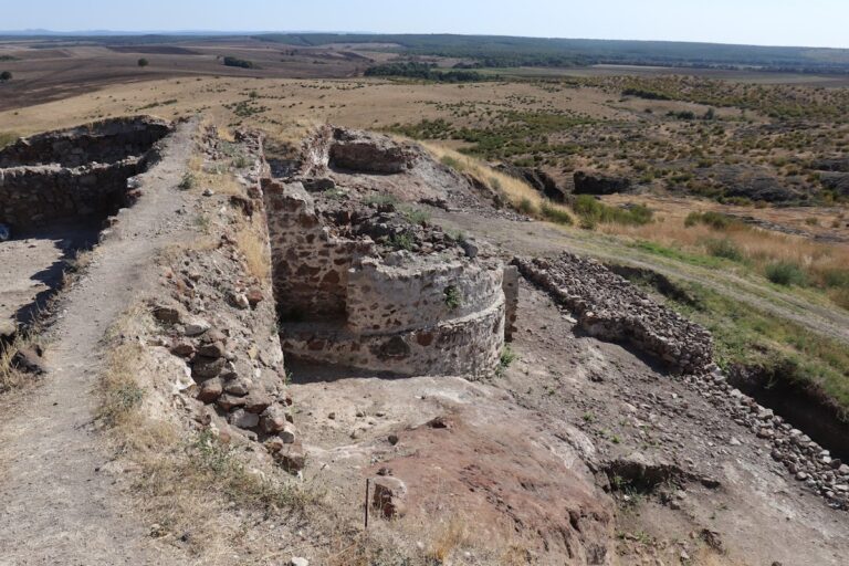
The Byzantine-style fortifications were built with crushed stone and horizontal rows of brick. Construction took place between the late fifth and mid-sixth centuries, probably during the reign of either Anastasius I, who ruled from 491 to 518, or Justinian I, who ruled from 527 to 565. The Late Antique fortress probably consisted initially mainly of a curtain wall, a continuous defensive wall enclosing the stronghold.
Large defensive embankments were added during the medieval period, including extensions from the early ninth century. The ramparts rose as high as 10 m and were preceded by ditches more than 3 m wide. The original fortress contained 12 defensive towers. Its main walled area covered about 1.5 hectares, while an eastern extension covered approximately 3.8 hectares. The defensive embankments enclosed about 4.6 hectares in total, and the wider fortress complex, including the early ninth-century embankments, covered about 0.7 square kilometers.
The main fortress wall was approximately 530 m long, although its course is not fully certain. The eastern extension had a wall about 150 m long, and the highest point of the fortress, beside the eastern wall, stood 225 m above sea level. The ground varied sharply along the defenses, with height differences of 15 m along the northern wall, 17 m along the southern wall, and 2 m along the eastern wall. Along the western wall, the ground fell 9 m from the north to its lowest point before rising 7 m toward the southwestern tower.
Water supply and river crossing
Water-supply tower
A water-supply tower stood on the left bank of the Mochuritsa beside the area’s only nearby ford. It controlled access to the fortress and supplied its defenders through a complex of tower, water reservoir, and underground tunnel connecting the installation with the river. The marshy banks hindered movement at other points, giving the tower both a practical water function and a role in controlling passage.
Bridge and underground passage
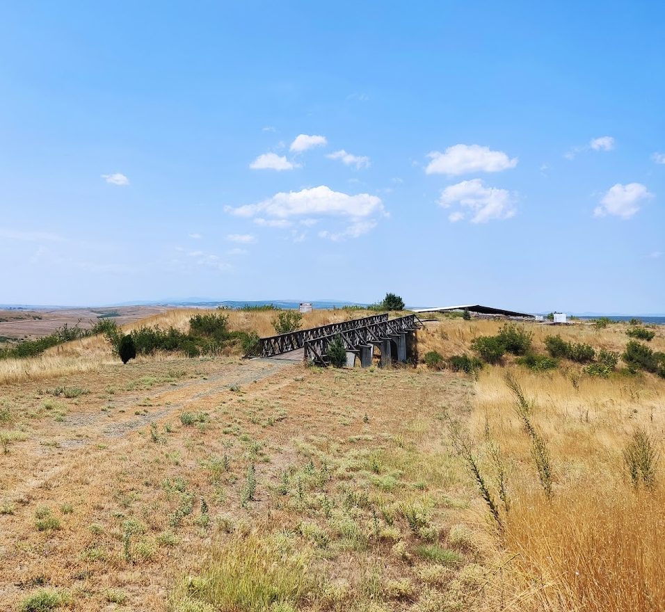
An ancient bridge crossed the river near the water tower. An underground passage provided another way for inhabitants to enter or leave the fortress, linking the river-side defenses with the wider fortified complex.
Christian buildings
Early Christian chapel
The elevated northwestern part of the fortress contained four successive Christian buildings on the same site. The earliest was a chapel measuring 3.8 by 4 m, built in the fourth century in memory of early Christian martyrs. It was partly destroyed during the second half of the sixth century.
Three-aisled basilica
A large three-aisled basilica, a longitudinal Christian church divided into three internal passages, replaced the chapel. It was built in the late fifth or early sixth century at the same time as the principal fortifications, placing the church within the fortress’s early Byzantine phase.
Medieval Bulgarian church
The basilica was followed by a medieval Bulgarian church built in the late ninth or early tenth century. Its construction reflects the continued religious use of the elevated northwestern area after Markeli had become an important Bulgarian military stronghold.
Cross-domed church
The final church was a cross-domed building, organized around a central dome intersected by the arms of a cross, erected in the late eleventh century. It was richly decorated with mosaics and marble sculpture and stood until the beginning of the thirteenth century. Its remains are covered and connected by a visitor path.
Nearby sites