Los Millares: A Copper Age Settlement in Spain
Site at a Glance
- Popularity
- Very High
- Country
- Spain
- Primary era
- Stone Age
- Eras represented
- Stone Age, Bronze Age
- Civilizations
- Unclassified
- Site type
- City
On this page19 sections
History
Los Millares is a major settlement built by Copper Age communities in Santa Fe de Mondújar, Almería, Spain. The Copper Age was the period when copper use became established before bronze became widespread. Los Millares gave its name to an archaeological culture of southeastern Iberia and serves as its reference site. Often described as the earliest city on the Iberian Peninsula, it had an estimated population of 1,000–1,600.
Origins and expansion
The first burials date to about 3220–3125 BC, while the earliest evidence for settlement falls around 3090–2955 BC, roughly two centuries later. This sequence has prompted the suggestion that the location already held ritual importance before people established the settlement. One wall collapsed and was rebuilt around 3025 BC, a separate event within the early settlement period.
After a period of expansion, the settlement reached its greatest extent near the beginning of the third millennium BC. Around 2500 BC, much of it was abandoned, although the inner citadel remained occupied as outlying forts were built and used. The settlement and forts coexisted for less than a century. In a later Copper Age phase, the forts reached their greatest known number, as many as 13, and Bell Beaker pottery appeared. The Bell Beaker tradition takes its name from distinctive bell-shaped vessels, decorated with patterns that varied between regions.
Regional society and economy
Los Millares served as a regional center for the Andarax Valley and nearby areas, including the Tabernas corridor, Campo de Níjar, and Cabo de Gata. The wider culture extended across present-day Almería, Murcia, and Granada, and into part of Alicante. Proposed exchange goods included salt, copper ore, siliceous and volcanic rocks, and knapped stone tools. Ivory and ostrich eggshell point to connections reaching North Africa.
Animal husbandry underpinned the economy, providing food, materials, animal power, and a store of wealth. Sheep and goats made up 37.5 percent of analyzed animal remains, with adult females prominent; cattle accounted for 37.7 percent and pigs, raised for meat, 22.8 percent. Cattle remains were less common at the forts than in the settlement. Other identified animals included rabbits, red deer, Iberian ibex, wild boar, foxes, badgers, lynx, water rats, capercaillie, and mallards.
Plant remains include barley, wheat, beans, peas, olives, grapes, and acorns. The scarcity of sickle elements has led to the suggestion that wheat and barley sometimes arrived already harvested and threshed, ready to be ground. Esparto served in making baskets, utensils, containers, cordage, and sandals. Craftspeople worked copper, knapped flint, made arrowheads, and produced polished-stone tools. Evidence points to specialist artisans, particularly in metalworking and arrowhead production. Metallurgy has been proposed as one influence on social change; copper and arsenic were known.
Tree felling for cooking, construction, smelting, and cultivation, alongside sustained grazing, changed the surrounding vegetation over the long period of occupation. Charcoal, seeds, animal remains, and geological evidence indicate a landscape unlike the present one. Although rainfall was broadly similar, deeper soils and plant cover retained moisture and supported cultivation. Woodland and scrub grew nearby, and river and streamside species point to more continuous watercourses than exist today.
Grave types, their locations, and their contents have been read as evidence of social distinctions, perhaps among family or other social groups, though the meaning of these patterns remains open to interpretation. More broadly, research has examined whether changes in Copper Age southeastern Iberia came from eastern Mediterranean influence or local development. Radiocarbon dating placed Iberian collective tombs and fortifications earlier than their eastern Mediterranean counterparts. The prevailing interpretation is that social and cultural changes developed locally, although the extent of that development remains uncertain.
Decline and end of occupation
The cemetery, inner settlement, and forts reached the end of their use around 2200 BC, amid cultural changes associated with the El Argar culture, a later Bronze Age culture of the region. The reason for the final contraction is uncertain. Suggested explanations include social or political crisis, conflict, earthquakes or other natural disasters, and the displacement of water sources.
Discovery and modern research
Railway construction on the Almería–Linares line brought the site to attention in 1891. Luis Siret and Pedro Flores investigated the settlement and cemetery, recording structures and preparing plans of the site and some forts. In the 1940s, Georg and Vera Leisner organized earlier findings and published a study of southern Iberian megalithic tombs in 1943. After decades of neglect, Antonio Arribas and Martín Almagro excavated parts of the cemetery and began the first excavation of the central section of Wall Line I, revealing the settlement’s scale and defensive complexity.
From the 1980s, the University of Granada carried out systematic research under Arribas and Fernando Molina. Work examined the settlement’s internal organization and chronology, with particular attention to Forts I and V. Studies of charcoal, seeds, animal remains, and geology also developed understanding of the ancient environment and economy. The site received historic-artistic monument status in 1931, before Spain’s Asset of Cultural Interest designation; in 1996 its protected area was defined as an archaeological zone. Later conservation consolidated wall lines, huts, and other structures, including work at Forts I and V.
Remains
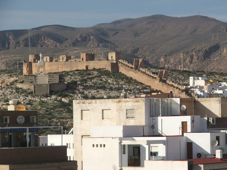
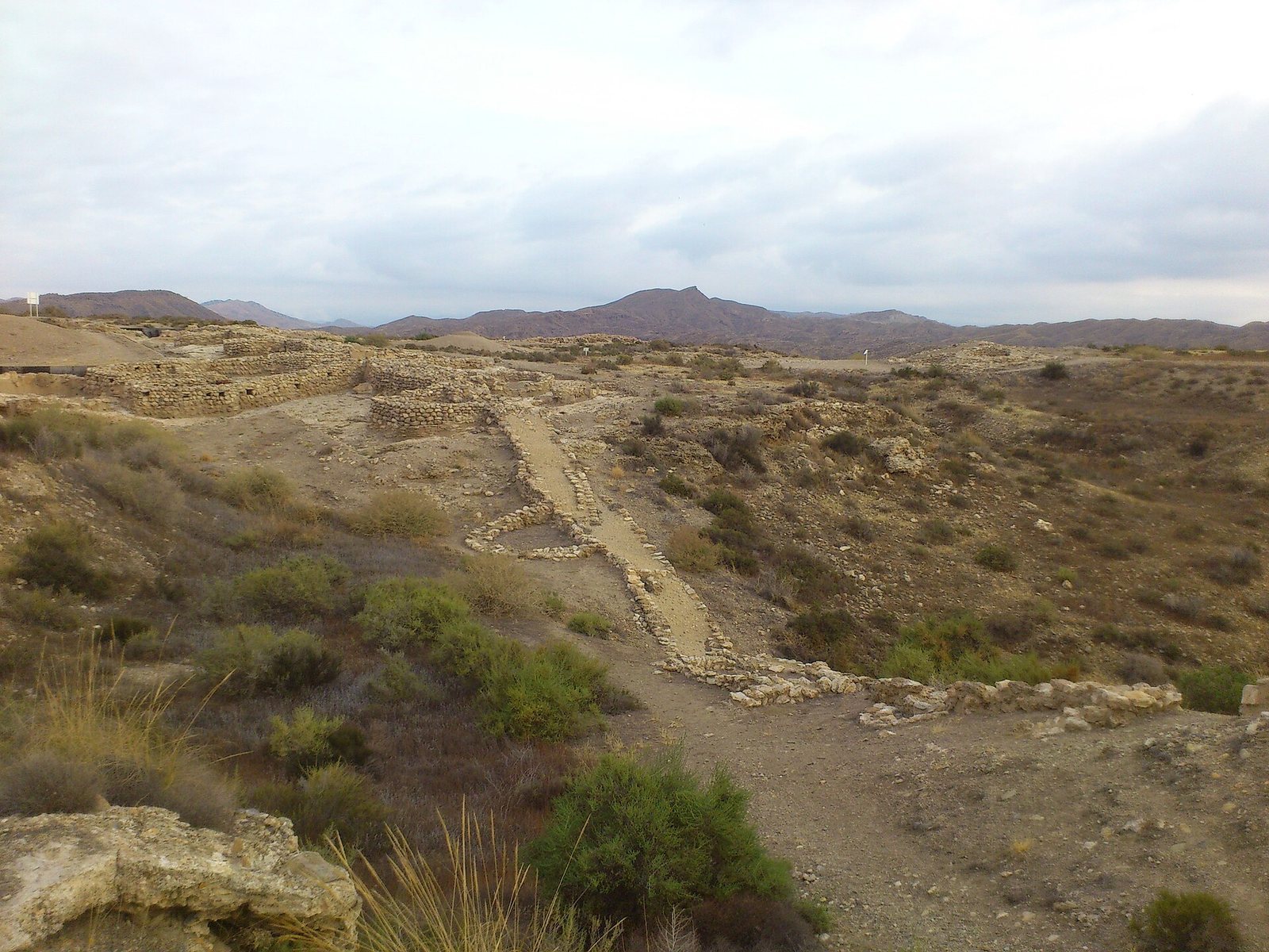
The site occupies a plateau-topped spur formed by the Andarax River and Huéchar ravine. Its settlement covers about six hectares, while the cemetery occupies about 13 hectares to the west, beyond the outer wall. The settlement’s defenses combine three main concentric wall lines with a separately enclosed inner citadel, counted as four lines in total. Within and around these enclosures are domestic, craft, water-related, funerary, and defensive remains.
Settlement defenses
The outer wall extends for more than 200 metres and includes 19 projecting bastions, defensive sections that extend outward from a wall. Several entrances pierce the defenses. A monumental central gate developed from a simpler opening and has projecting wall arms. A southern entrance, about 100 metres away, has a smaller barbican, a projecting structure protecting a gate, and approaches along its sides.
Buildings and water features
Huts
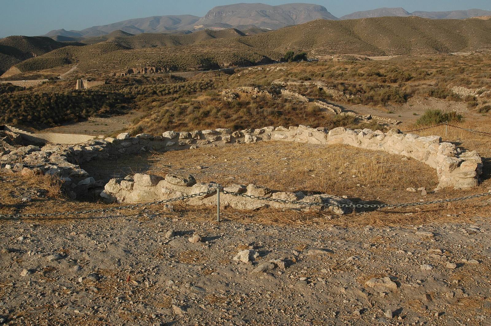
Round huts inside the walls measure about 2.5–6.2 metres across. Stone foundations were bonded with mud, while the walls were made from mud and reeds. Roofs of branches, plant materials including esparto and tamarisk, and mud rested on the walls and interior posts. Inside, hearths and benches stood near the walls; upright stone slabs marked storage areas, and some spaces were used for grinding grain. Pits associated with huts may have served as storage silos or cisterns.
Metalworking building
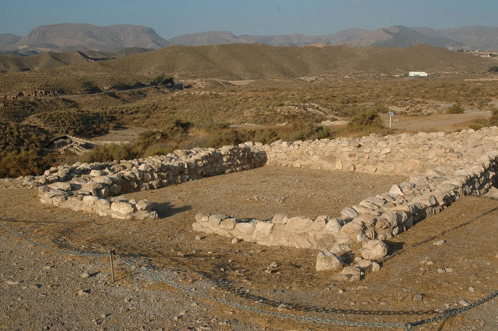
A rectangular building beside Wall Line III measures 8 by 6.5 metres. A pit held copper ore, and a furnace had a fire-hardened clay ring with a central opening for a crucible. The furnace measured about 1.2 metres across. Slag and crucibles were also found, along with a stone-slab feature near a corner entrance.
Central building
A larger, distinctive building stands in the center of the innermost open area within Line III. Its purpose is uncertain: interpretations include a palace-storehouse, a religious building, or another kind of special structure.
Water channel and cisterns
A surviving water channel runs through the cemetery toward the inner settlement. Several unexcavated spaces may have been cisterns, and Siret’s excavations identified a cistern in the citadel.
Cemetery
About 80 collective tombs form groups across different parts of the plateau west of the settlement. Most are tholos tombs, circular burial chambers commonly reached by a passage and roofed with overlapping courses of stone.
Tomb construction
Many tombs have circular chambers about 3–6 metres in diameter, built of irregular masonry. Some chambers have a base lined with schist, a layered rock, and decorated with paintings. Overlapping stone courses formed domed roofs, at times supported by a central pillar; other tombs had flat roofs made from organic materials. Passages of varying length and width led to the chambers. Perforated schist slabs could divide a passage into ring-like sections, while some tombs included side niches. A trapezoidal entrance space often preceded the tomb, and earth mounds reinforced with concentric rings of stone slabs covered the structures.
Other forms include chambers partly or wholly cut into rock and three tombs built with large upright stones. Some cist graves, a separate form of individual burial, lie farther from the settlement and belong to the Final Bronze Age.
Burials and objects
Tombs held between 20 and 100 people. Burials could fill chambers, niches, and passages. Objects placed with the dead included symbolic and Bell Beaker pottery, ivory, ostrich eggshell, copper objects, arrowheads, flint blades, axes, and bone idols. Small cylindrical stone objects called betyls, possibly representing the buried individuals, occur in some entrance spaces.
Handmade domestic pottery includes orange-paste plates, dishes, and cooking pots. Other vessels bear painted or incised deer, eye-and-sun motifs, zigzags, and triangles; carved stone idols also have eye-like designs. Bell Beaker pottery features incised or impressed bands and metope patterns, in which decoration is divided into framed panels. Some early examples have been traced to the Tagus estuary in Portugal.
Outlying forts
A double line of forts guarded approaches to the settlement, including routes from the coast and passes through the Sierra de Gádor and Huéchar ravine. Forts generally had concentric walls, projecting bastions, and entrances protected by projecting structures. Their remains vary in plan and complexity.
Fort I
Fort I has two concentric walls and two surrounding ditches; the inner ditch reaches 6 metres deep. The inner wall is earlier. After the inner enclosure was abandoned, an outer wall nearly 30 metres in diameter was built. Towers and bastions extend from the walls, and two bent-entry barbicans make the entrances less direct. Spaces between the walls contained oval huts, a flint arrowhead workshop, grain-grinding areas, a salt-processing area, large storage jars, and a water cistern. Proposed functions for the fort include military or strategic, productive, educational, and ritual or symbolic uses.
Fort V
Fort V stands on the right bank of the Huéchar ravine. Its roughly oval wall has two bastions and entrances to the north and south; barbicans were added later. Grinding installations and hearths stood inside, and the fort was affected by fire.
Other forts
Fort 4 has a polygonal plan, while Forts 3 and 6 are circular. Other forts remain less complex in form or have not been excavated.