London Wall: Roman and Medieval Defences of London
Site at a Glance
- Popularity
- Very High
- Country
- United Kingdom
- Primary era
- Classical
- Eras represented
- Classical, Medieval
- Civilizations
- Anglo-Saxon, English, Norman, Roman
- Site type
- Military
- Remains
- Wall
On this page19 sections
History
Roman origins and expansion
London Wall is the surviving Roman and medieval defensive circuit of Londinium, built in what is now London, United Kingdom, with work on the city wall beginning around AD 200. An earlier earthwork and ditch had surrounded the Roman settlement from about AD 100. Around AD 120–150, the Romans constructed a large fort on the settlement’s north-west side, later known as Cripplegate Fort. Its north and west walls were strengthened and incorporated into the wider city defenses.
The reason for building the city wall is uncertain. Possible explanations include incursions by the Picts, peoples of ancient northern Britain, and the political struggle between Clodius Albinus, a governor in Britain who claimed the imperial throne, and Septimius Severus, the Roman emperor who campaigned in Scotland. Construction continued at least into the late fourth century. The wall was one of Rome’s last major building projects in Britain before Roman rule ended around 410. Wall-building and Severus’s campaigns in Scotland also contributed to Londinium’s economic prosperity in the early third century.
After Saxon pirate raids on Londinium in the late third century, work on a riverside wall began in phases around 280, with repairs around 390. The barrier may have restricted commercial and other access to the Thames, perhaps reflecting a decline in activity in the city. Roman rule ended around 410, and the defenses gradually deteriorated.
Anglo-Saxon London
The Anglo-Saxon Chronicle, a collection of annals written centuries after the events it describes, says that Romano-British forces withdrew to London after their defeat at the Battle of Crecganford near Crayford in 457. The account names the Saxon leaders Hengist and Horsa, but whether the battle took place is uncertain. From about 500, the Anglo-Saxon settlement of Lundenwic grew west of the abandoned Roman city.
In 886, Alfred the Great, king of Wessex, reached an agreement with Guthrum, a Danish leader who controlled territory in England. That year London was refounded within the old Roman walls as part of Alfred’s policy of resisting Viking expansion. Lundenwic was abandoned, while life and trade revived inside the defenses. Repairs accompanied the city’s growth to about 950, when urban activity increased markedly. A Viking army attacking London was defeated in 994.
Medieval defenses and a growing city
By the eleventh century, London had become England’s largest town and an important centre of foreign trade and wartime defense. After the Norman Conquest, the Norman takeover of England in 1066, the fortifications underwent extensive repairs and development. Work added gates and towers, battlements, and projecting defensive structures called bastions. Rebuilding and repairs to the Roman wall and its gates continued from the twelfth through the seventeenth centuries.
The ditch beside the wall appears to have been recut in 1213. This may have diverted some of the Walbrook’s water, while the wall itself partly obstructed the stream and contributed to marshy ground at Moorfields. As London spread beyond its defenses, the wall helped define the City’s boundaries and the distinction between areas described as within and without. The few gates and the roads passing through them also influenced development on either side; with limited exceptions, modern roads into the former walled area follow routes that passed through medieval gates.
With permission from Edward I, Dominican friars, members of a Catholic religious order of preaching friars, demolished and rerouted the section between Ludgate and the Thames in stages from 1284 to 1320. The change extended the enclosed area to the River Fleet to include their precinct and may also have strengthened the approach to Ludgate. Towers were added to the wall’s western section during the thirteenth century, including examples at the Barbican.
The city had seven principal gates and four bars, entrances beyond the old wall that helped control access. Thirteen water gates along the Thames allowed goods to be unloaded from ships; Billingsgate and Bridge Gate were among them. Smaller pedestrian entrances included Tower Hill Postern, a secondary gate. Holborn, Temple, West Smithfield, and Whitechapel bars controlled important approaches and helped preserve the City’s privileges over certain trades. The City’s jurisdiction also reached beyond parts of the former wall, including westward across the Fleet.
Decline, demolition, and rediscovery
Near the turn of the seventeenth century, the defensive ditch was filled and its site used for gardens. The historian John Stow linked the name Houndsditch to rubbish thrown into the ditch, particularly the bodies of dead dogs. In September 1666, the Great Fire of London destroyed almost all of the medieval City inside the wall, but the wall and gates survived. As the city expanded and its defenses became unnecessary, all seven principal gates were demolished between 1760 and 1767. Removal of the wall continued into the nineteenth century, although substantial stretches became part of later buildings.
Bombing during the Second World War exposed and damaged sections of the wall. On 28 August 1940, buildings and wall sections between Fore Street and the gardens of St Alphage’s churchyard near Cripplegate were destroyed; clearing the rubble revealed masonry that had been concealed for more than three centuries. Heavy bombing on 29 December exposed another section at Noble Street. Postwar conservation and scheduled-monument protection helped safeguard surviving remains.
Work on the modern London Wall road uncovered a 64-metre stretch in 1957. Most of it was removed during road alterations and the construction of a car park, while 11 metres were retained. The road’s alignment resulted from rebuilding carried out between 1957 and 1976. Today, the street called London Wall follows the old northern defenses only approximately.
Remains
The Roman circuit enclosed about 330 acres, or 130 hectares, and extended roughly two miles around Londinium. Its surviving fabric combines Roman stonework with medieval repairs and heightening. Fragments, buried features, and the courses of former gates preserve parts of the defensive layout within the modern city.
Roman circuit and defenses
Wall, rampart, and ditch
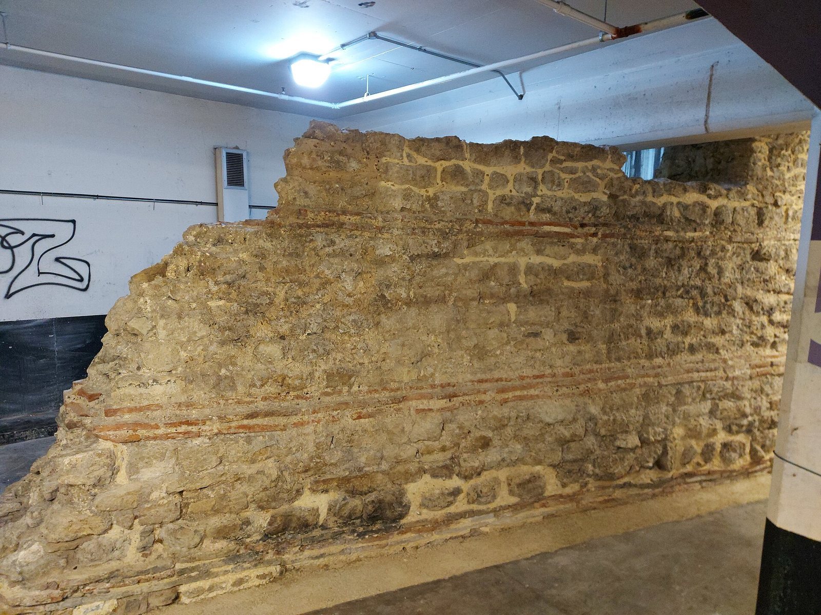
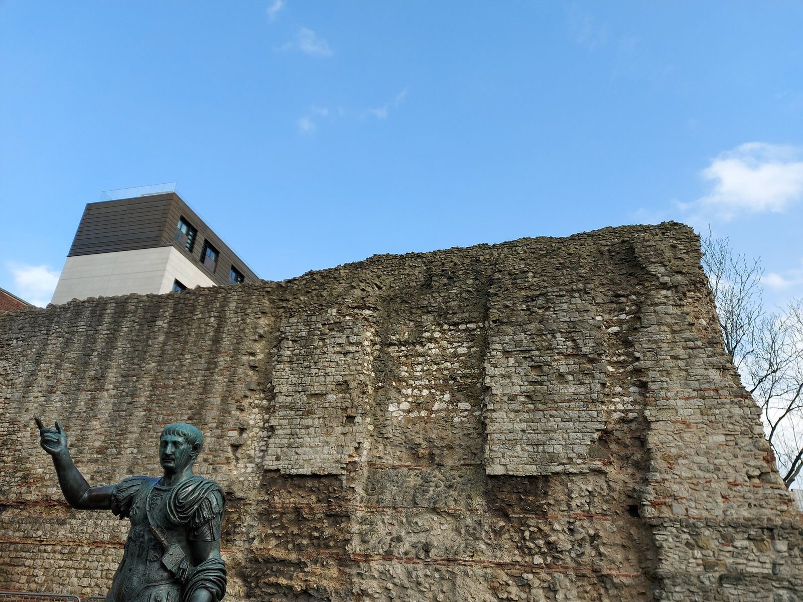
The Roman wall was generally 8–10 feet thick and reached about 20 feet in height. Coursed blocks of Kentish ragstone, a hard stone quarried in Kent, enclosed a core of rubble and mortar. Flat red tiles formed horizontal bonding courses at intervals. Barges carried the stone from quarries near Maidstone. An earth rampart reinforced the inner face, while a defensive ditch lay outside. The original ditch was about 6 feet 7 inches deep and up to 16 feet wide; the medieval ditch had a V-shaped profile and measured about 6 feet deep and 9–15 feet across. Houndsditch recalls part of its former course.
Towers and bastions
At least 22 towers stood along the wall. On the eastern section they were spaced about 210 feet apart, and towers were added there in the fourth century to strengthen the defenses. A separate group of 21 bastions, projecting defensive structures, is known around the perimeter. They are irregularly spaced and were not bonded to the wall, indicating that they were later additions, probably built after the Roman period. Ten lie between the Tower of London and Bishopsgate, one is west of Bishopsgate, and ten are in the western section. No bastions are recorded along a 731-metre stretch of the northern wall between the eastern and western groups.
Gates and routes
The original Roman gates, from west to east, were Ludgate, Newgate, Cripplegate, Bishopsgate, and Aldgate. Aldersgate was added around 350, while Moorgate was a later medieval entrance. Tower Hill Postern also belonged to the medieval defenses. The city gates aligned with the Roman road network, connecting the enclosed settlement to routes beyond it.
Surviving areas and structures
Cripplegate Fort
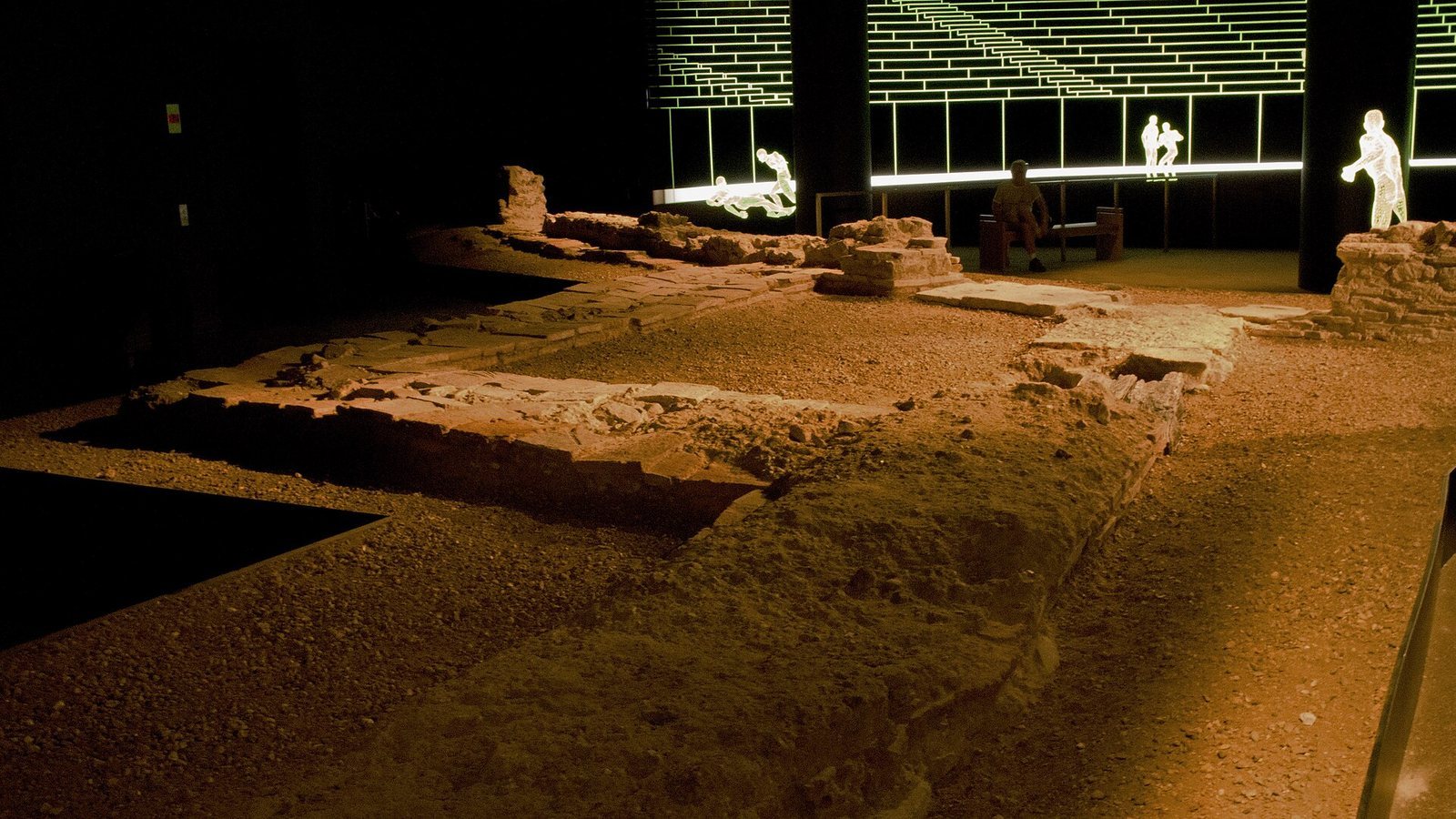
The west gate of Cripplegate Fort was built around AD 120 with two passages flanked by square towers. The surviving northern tower served as a guardroom and gave access to the wall-top sentry walk. Large sandstone blocks formed its base, some weighing more than half a ton, while the remaining masonry used Kentish ragstone. The guardroom opened onto a gravel road through the gate. Each passage was wide enough for a cart and had a pair of heavy wooden doors. The fort wall ran north from the gate and was about 4 feet thick before it was strengthened around AD 200. The gate was probably blocked during the troubled later fourth century, and its location had been forgotten by the medieval period.
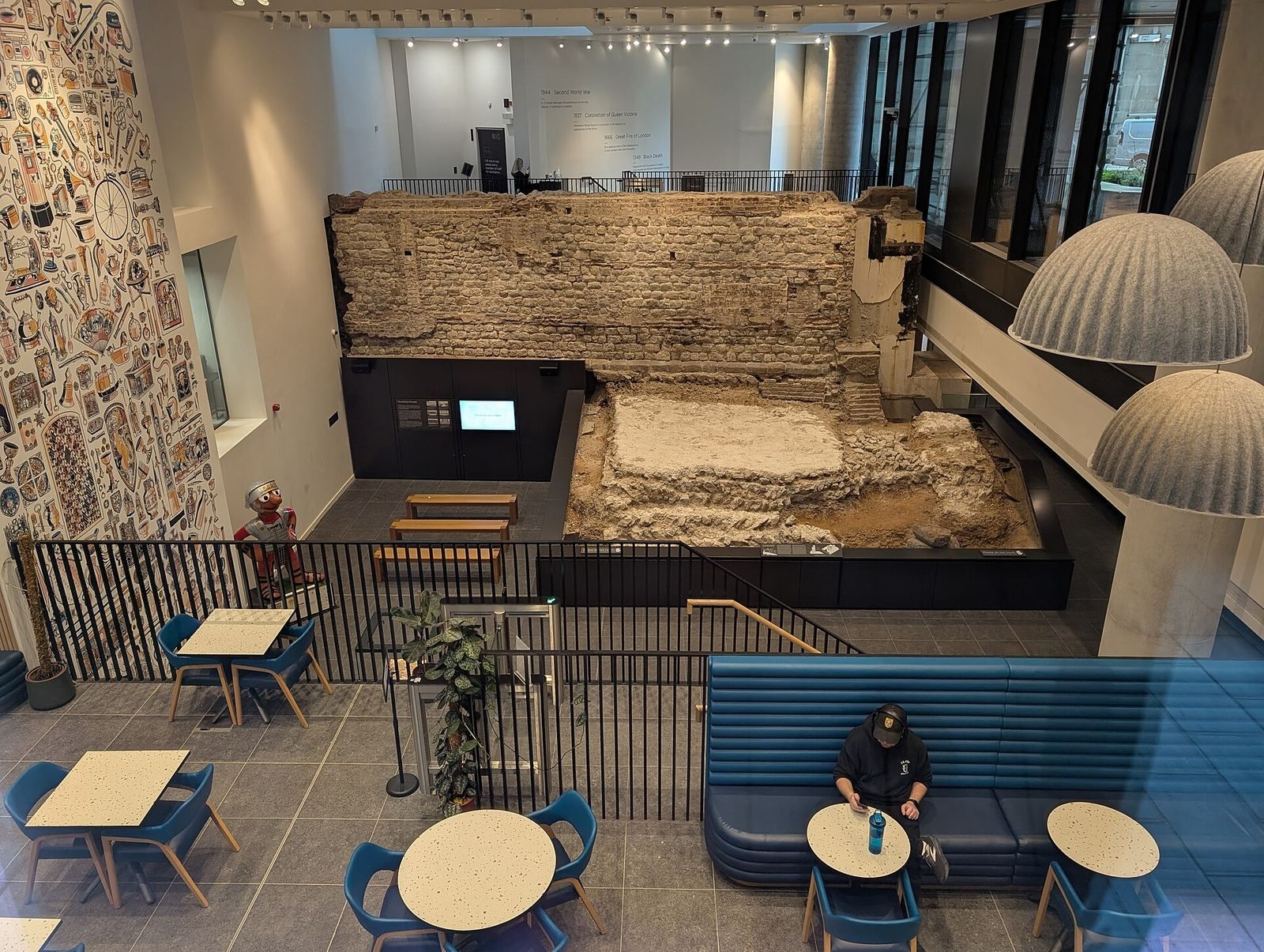
Remains of the fort’s western gate and nearby walls are preserved in the London Wall underground car park near Noble Street. Roman and medieval wall sections and bastions also survive at Noble Street and west and north of Monkwell Square, around the former Cripplegate gateway.
Tower Hill and the eastern circuit
A surviving wall section at Tower Hill stands about 35 feet high. Roman masonry reaches the level of the sentry walk, about 14.5 feet above the ground, while medieval stonework rises above it. The original battlements would have brought the Roman wall to about 20 feet high. Medieval repairs raised it further and included a sentry walk about 3 feet wide. Excavation on the inner face found a small Roman turret that probably contained a staircase to the walkway.
The site of a fourth-century tower lies north of this section. Stone recovered from its foundations in 1852 and 1935 included part of the memorial inscription from the tomb of Julius Classicianus, a Roman provincial official responsible for financial administration. At the Tower of London, paths mark the former course of the eastern defenses, much of which was removed when the fortress was enlarged. The wall met the Tower’s moat at Tower Hill Postern, whose foundations remain visible in the Tower Hill pedestrian subway. Further substantial fragments survive in Tower Hill Gardens.
Aldgate
A Roman gate at Aldgate may have preceded the city wall and crossed the road leading to Colchester. It probably had two entrances between guard towers, with a cemetery outside the gate on the south side of the road. The gate may have been rebuilt in the later fourth century as a platform for catapults. It appears to have survived into the medieval period, when it was rebuilt in 1108–47 and again in 1215. The medieval structure had a single entrance between two large semicircular towers. Further rebuilding took place in 1607–09, and the gate was demolished in 1761.
Moorgate
Moorgate had no Roman predecessor. It began as a small secondary gate giving access to marshy Moorfields. It was rebuilt in 1415 and again in 1672 as a ceremonial entrance, then demolished in 1761. Its foundations lie beneath the modern London Wall road.
Other wall sections
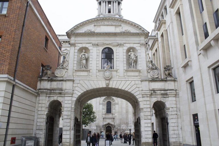
Roman and medieval remains survive at locations including Amen Court, the Central Criminal Court at the Old Bailey, Postman’s Park, King Edward Street, Aldersgate, and the area around Monkwell Square. A western stretch runs from the boundary of Stationers’ Hall to Ludgate Hill. Sections also stand in St Alphage Garden, where parts of the wall incorporate remains of St Alphage’s Church, and beside All Hallows churchyard. Other fragments are found at Camomile Street, Goring Street, Bevis Marks, India Street, Roman Wall House, and Crutched Friars. Sections also survive beneath Crosswall, One America Square, and Fenchurch Street railway station, including in the basements of One America Square and the Old Bailey.
The eastern line ran from the Tower of London towards Aldgate, east of the Walbrook, then north between the present Aldgate School and Aldgate Square. From Aldgate it continued north-west towards Bishopsgate. The northern wall ran from Bishopsgate towards Moorgate, with routes leading north into Finsbury. A stretch of Roman and medieval wall extends about 75 yards north from Trinity Place towards the railway. A Roman and medieval gateway site lies beneath the junction near Jewry Street at Aldgate, while the A10 passes over the foundations of Bishopsgate. A medieval secondary gate, Roman wall, and conduit are also recorded between Bloomfield House and the former Moorgate site.
Riverside remains
Roman river defenses
Excavations at the Tower of London identified the inner defensive wall between Lanthorne and Wakefield Towers, south of the White Tower, as the eastern section of the Roman riverside wall. This part was built or rebuilt in the late fourth century. Elsewhere at Tower Hill, a fragment of the wall stands outside the Underground station.
Waterfronts and bridge evidence
Excavations traced about 980 feet of timber-framed waterfronts east and west of the modern London Bridge site. Built between the late first and mid-third centuries, these structures extended about 115 feet into the Thames and show that a wall did not then stand against the river. A piece of a wooden bridge was found at the end of Fish Street Hill.