Kition: An Ancient Greek and Phoenician City-Kingdom in Cyprus


Site at a Glance
- Rating
- 4
- Popularity
- Low
- Country
- Cyprus
- Primary era
- Classical
- External website
- Open
- Eras represented
- Bronze Age, Iron Age, Classical
- Civilizations
- Ancient Greek, Mycenaean, Phoenician, Ptolemaic, Roman
- Site type
- City
On this page13 sections
History
Kition was an ancient Greek and Phoenician city-kingdom in Cyprus, within modern Larnaca, conventionally dated from the twelfth century BC until its destruction by earthquakes in AD 322 and 342. It was one of Cyprus’s ten petty kingdoms, where Greek and Phoenician were used, and it became one of the island’s principal powers alongside neighbouring Salamis.
Late Bronze Age Beginnings
During the Late Bronze Age, Mycenaean Greeks settled at Kition and exploited local copper deposits. The settlement was destroyed around 1200 BC, then rebuilt on a larger scale. Around 1000 BC, the religious quarter was abandoned while occupation continued elsewhere, a pattern reflected by tomb finds.
Literary evidence places Phoenician, probably Tyrian, settlement and political influence at Kition in the early tenth century BC. After approximately 850 BC, Phoenician settlers rebuilt and reused the city’s sanctuaries, adding a new political and religious dimension to the earlier Greek settlement.
Egyptian and Persian Rule
Kition came under Egyptian domination from 570 to 545 BC and then remained under Persian rule until Persian control of Cyprus ended in 332 BC. From about 500 BC onward, Phoenician inscriptions and coins name the kings of Kition, providing evidence for the city’s royal government and political identity.
In 499 BC, Kition joined the Cypriot kingdoms that took part in the Ionian Revolt, an uprising of Greek cities in Asia Minor and their allies against Persian rule. By the Classical period, Kition was one of the leading local powers on Cyprus, together with Salamis.
End of the City-Kingdom
In 312 BC, Ptolemy I conquered Cyprus during the struggles among the successors of Alexander the Great. Ptolemy was the Macedonian ruler who established the Ptolemaic dynasty in Egypt. He killed Pumiathon, the Phoenician king of Kition, and burned the temples. Pumiathon had supported Antigonus, a rival successor of Alexander, and his defeat ended both Kition’s political independence and its Phoenician dynasty. The Cypriot city-kingdoms were subsequently dissolved, and Kition lost its earlier religious character.
Kition’s wider connections are illustrated by a community of Kitian merchants in Athens. In 333 or 332 BC, they received permission to acquire land, probably in Piraeus, and build a temple to Aphrodite, the Greek goddess identified here with the Phoenician Astarte. A stele recorded the permission, while an inscription dedicated by Aristoklea of Kition to Aphrodite Urania probably came from that temple.
Roman Kition and Destruction
Cyprus was annexed by the Roman Republic in 58 BC. Kition remained prosperous during the Roman period despite major earthquakes in AD 76 and 77. Under the emperor Septimius Severus, who ruled from AD 193 to 211, Rome sent a curator civitatis, a financial administrator for the city.
Further earthquakes destroyed Kition in AD 322 and 342, along with Salamis and Paphos. The city’s long sequence of Greek, Phoenician, Hellenistic, and Roman phases is now traced through the archaeological areas of Kathari and Bamboula, together with additional excavated locations across the ancient urban area.
Excavation and Archaeological Work
British archaeologists began excavating Kition in 1894. The Swedish Cyprus Archaeological Expedition, directed by Einar Gjerstad, conducted the first systematic excavations from October 1929 to April 1930. The Department of Antiquities, directed at Kathari by Vassos Karageorghis, excavated there from 1959 to 1981. After the events of 1974, a French expedition from the University of Lyon undertook excavations at Bamboula. Continuing archaeological work has clarified the city’s Late Bronze Age, Geometric, Phoenician, Classical, Hellenistic, and Roman phases.
In 2016, sewer work beneath Kyriakou Matsi Street revealed a Roman mosaic in a bath building near the Kathari area. The mosaic depicts the labours of Hercules and forms part of the evidence for Kition’s Roman urban life.
Remains
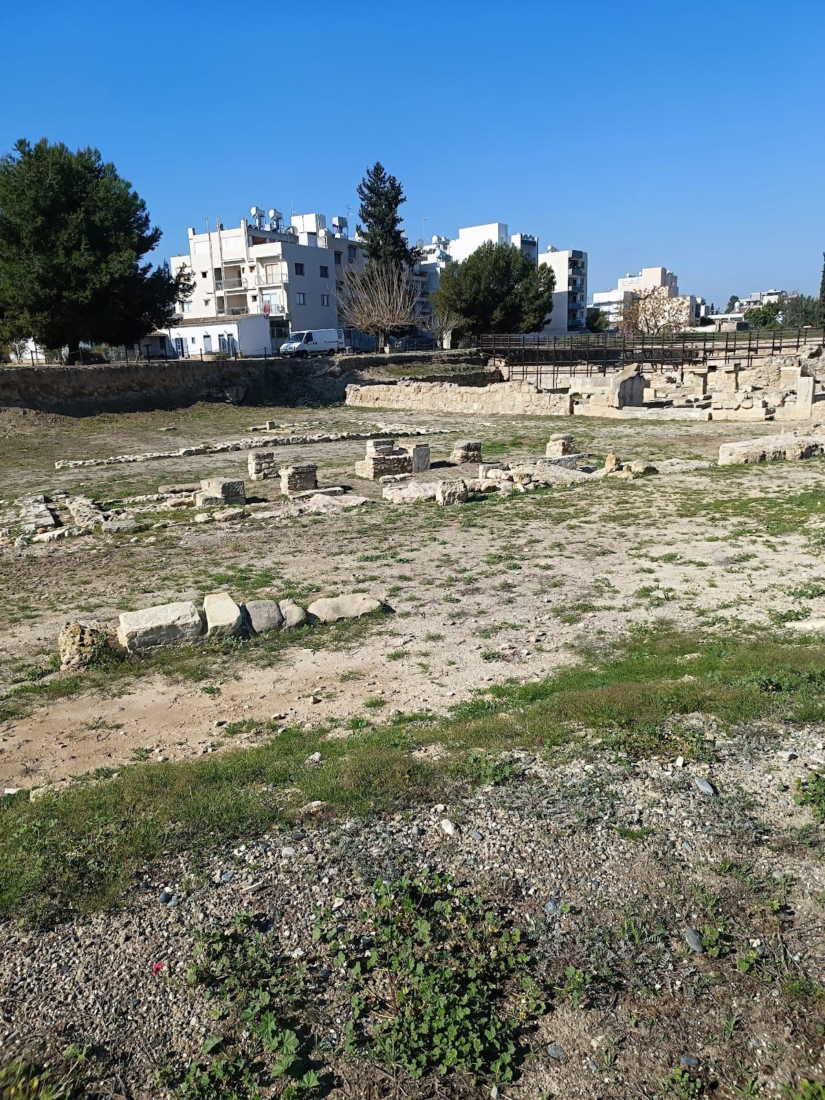
The ancient city was enclosed by massive walls whose course can still be traced. Bamboula Hill occupied the northeastern part of Kition and carried the acropolis, while the ancient harbour lay between the acropolis and the modern seashore. The principal archaeological areas are Kathari, also called Kition Area II, and Bamboula, approximately 500 metres apart. Together with residential areas, cemeteries, tombs, gates, and later discoveries, they reveal an urban settlement with religious, industrial, commercial, military, and domestic spaces.
Kathari Settlement and Temples
Kathari contains the earliest known phases of habitation and religious activity at Kition. A defensive wall dating from the thirteenth century BC was built there, alongside workshops for smelting copper that operated from the end of the thirteenth to the end of the eleventh century BC. Five successive temples occupied the area. The largest measured approximately 35 by 22 metres and used carefully cut ashlar blocks, while Temple 2 was rebuilt around 1200 BC. Late Bronze Age graffiti showing ships survives on the facade of Temple 1’s south wall.
Bamboula Sanctuaries
At Bamboula, a settlement dating from the end of the Late Cypriote II period and the beginning of the Cypro-Geometric I period later developed into a sanctuary. During the Cypro-Archaic I period, the sacred area was open to the sky. Excavators found the feet of a probably large statue on a rectangular base, possibly representing the city’s cult statue, as well as a later altar made from rubble and stone chips.
The first sacred precinct, or temenos, remained in use until the end of the Cypro-Archaic II period. A second precinct was then built over it, enclosed by a massive peribolos, or boundary wall. The later complex contained an inner sacred area, a low square altar, and a pillar altar outside it. Ash and carbonized material lay on and near the altars. Votive sculptures were moved as the sanctuary floor was raised.
During the Cypro-Classical I period, the precinct was completely rearranged and given a more monumental form. The sanctuary was demolished during the Hellenistic period, its votive sculptures were buried, and secular buildings were erected over the site. The sanctuary is identified with Heracles-Melqart. Many sculptures show a figure wearing a lion skin and holding a club, representing a Cypriot form of Heracles associated by the Phoenicians with Melqart, the city god especially linked with Tyre.
Bamboula Urban and Industrial Buildings
Bamboula lies approximately 50 metres north of the Larnaca Museum. Settlement remains dating from the tenth century BC stand beside the ramparts and harbour, while sanctuaries dedicated to Astarte and Melqart formed part of the religious complex. The earliest sanctuary dates from the ninth century BC. During the Archaic and Classical periods, the complex expanded with rooms, open courts with stoas, or covered colonnades, shrines, offering hearths, and installations for copper smelting. Finds indicate worship of Astarte, Melqart, Esmoun, and the Egyptian deities Hathor, Bes, and Horus.
A Hellenistic building replaced the sanctuary area and was divided into two parts. It contained a basalt press, probably used for wine or oil, rectangular drainage outlets, and a storage vessel. These features belong to the later secular use of the Bamboula site.
Harbour Facilities and Public Works
The harbour at Bamboula had separate commercial and military facilities, although the excavated remains come from the military harbour. Built in the fifth century BC, it consisted in its final phase of ship sheds. Six have been recorded, each approximately 6 metres wide and 38 to 39 metres long. Tiled roofs covered the shipways, where triremes could be hauled out for drying, repair, or safekeeping.
During the Classical period, major public works included the drainage of Bamboula’s marshland, the construction of a sanitary system, and the development of the two harbours. These works formed part of the extensive urban infrastructure preserved across the Kathari and Bamboula areas.
Tombs, Cemeteries, and Residential Areas
Five built tombs, or hypogea, have been identified at Kition. They include the Vangelis Tomb, Godham’s Tomb, the Phaneromeni, and the Turabi Tekke Tomb. Two Phoenician-inscribed stelae from the Turabi Tekke cemetery are now in the British Museum. The wider necropolis includes the Mnemata Site and the Agios Georgios Kontou cemetery, with burials from several periods.
Kition Area I, near the western wall of the pre-Phoenician city, appears from its buildings and movable finds to have been residential. Areas III and IV are additional archaeological zones. A city-wall gate known as the mound gate stood near the Phaneromeni Tomb.
Inscriptions and Roman Mosaic
The Sargon Stele was discovered at Bamboula in 1845 together with a gilded-silver plaque now in the Louvre. Associated with the Assyrian king Sargon II, the stele is now in Berlin, while a plaster cast is exhibited in the Larnaca Museum.
The Roman bath building near Kathari contained a mosaic approximately 20 metres long, showing the labours of Hercules. It was found beneath Kyriakou Matsi Street during sewer work in 2016, adding a substantial Roman decorative feature to the physical remains of ancient Kition.