Katayama Temple Ruins: The Ancient Suruga Provincial Buddhist Temple

Site at a Glance
- Rating
- 4.7
- Popularity
- Very Low
- Country
- Japan
- Primary era
- Medieval
- External website
- Open
- Eras represented
- Medieval
- Civilizations
- Unclassified
- Site type
- Religious
- Remains
- Temple
On this page13 sections
History
Katayama temple ruins in Shizuoka, Japan, preserve an ancient Buddhist temple associated with Suruga Province, used from the latter half of the eighth century through the first half of the tenth century during the late Nara and early Heian periods. The temple is traditionally identified as the provincial kokubunji, part of a network of state-sponsored Buddhist temples established throughout Japan under Emperor Shomu. Another interpretation identifies it as the clan temple of a powerful local clan in the ancient Udo District.
Foundation and Use
A kokubunji was a provincial Buddhist temple established during the Nara period, Japan’s eighth century, as part of a nationwide religious system. Each province was expected to maintain such a temple, generally with major halls and a pagoda. The substantial scale and formal arrangement of the Katayama complex support its association with this system, although the alternative interpretation connects it with local clan patronage.
The temple complex remained in use across the late Nara and early Heian periods. Its principal buildings were later destroyed by fire, whose exact date is unknown, and the complex appears to have entered a final phase of abandonment after the destruction.
Rediscovery and Interpretation
The ruins were known during the Edo period through their association with Kuno-ji Temple. Their identification as an ancient temple site followed the discovery of roof tiles and groups of foundation stones during improvements to the Oya Road in 1930. The site was named after the local place name, Katayama.
Investigations in 1948 and 1956 confirmed the remains of a main hall, lecture hall, and monks’ quarters. Their layout and substantial dimensions supported the identification of the site as the Suruga provincial kokubunji. A 2009 investigation found compacted-earth remains interpreted as the foundation of a pagoda, providing further support for that interpretation.
Protection and Changing Landscape
Katayama temple ruins became a National Historic Site in 1965. The protected area was enlarged in 1974 to include the associated tile-kiln remains and a refuse deposit containing roof tiles from the abandoned temple, and it was expanded again in 2017. In 2025, the official designation name was changed to “Suruga Kokubunji ruins.”
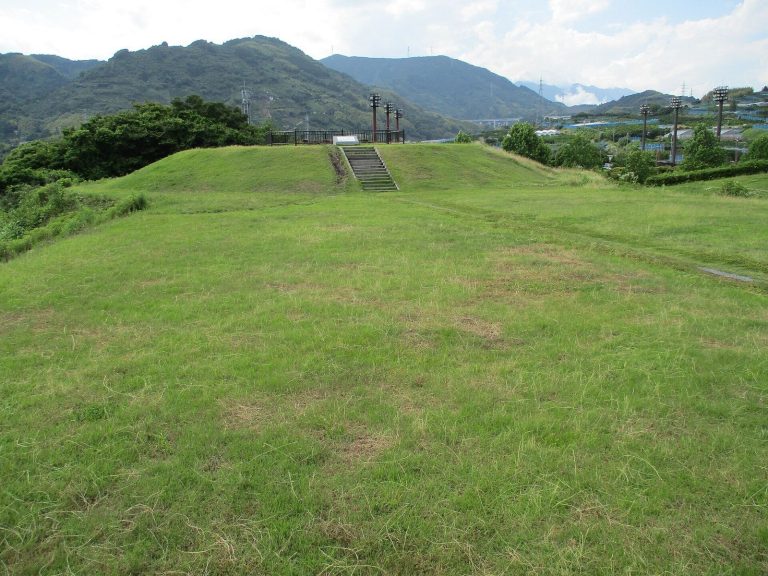
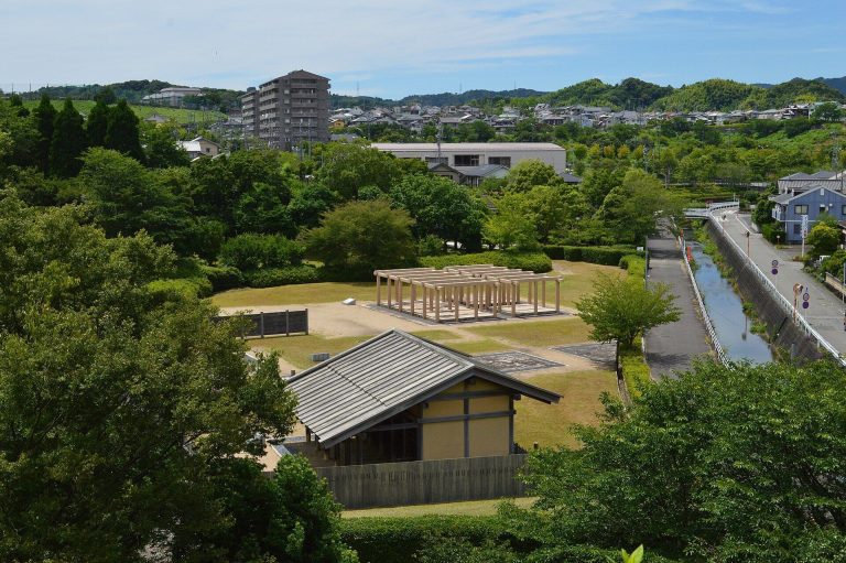
The ruins lie beneath an overpass of the Tomei Expressway, while a prefectural road passes through the middle of the site. Development of the area as a park is underway. The associated Miyagawa kiln site and the tile refuse deposit remain part of the protected archaeological complex.
Remains
The temple precinct formed an approximately square enclosure, about 160 meters on each side. At its center, the main hall, lecture hall, and monks’ quarters stood in a straight line from south to north. A north-south line of pillar holes along the western side marks the position of a wooden boundary fence. The surviving archaeological evidence includes building foundations, pillar holes, compacted-earth remains, and excavated roof-tile material.
Central Temple Buildings
Main Hall
The main hall, the principal Buddhist worship building, measured approximately 30.9 meters across and 17 meters in depth. It was a seven-bay by four-bay structure, meaning that its plan was divided into seven units across the front and four along the sides. The building stood on a platform measuring about 37 meters by 23 meters, whose foundations preserve the scale of the hall.
Lecture Hall
The lecture hall, used for teaching and religious instruction, was also arranged as a seven-bay by four-bay building. It measured approximately 25.5 meters wide and 15.8 meters deep, with a platform about 30.3 meters by 20.6 meters. Its position directly north of the main hall formed part of the central south-to-north arrangement.
Monks’ Quarters
The monks’ quarters served as residential and administrative buildings for the temple community. They formed an approximately 23-bay by three-bay structure, measuring about 68.2 meters across and 9.1 meters deep. The platform was estimated at 70.3 meters wide and 10.9 meters deep, making it a substantial element of the central complex.
Pagoda Foundation
Compacted earth, formed by placing and compressing layers of soil to create a strong platform, was found during the 2009 investigation. These remains are interpreted as the foundation of a pagoda, a Buddhist religious structure that commonly formed part of a kokubunji complex. The discovery strengthened the identification of Katayama as the Suruga provincial temple.
Boundary and Tile Production
Western Boundary
North-south rows of pillar holes on the western side of the precinct represent a wooden fence that marked the temple boundary. These post positions help define the extent and organization of the approximately square enclosure.
Miyagawa Kiln Site
The associated Miyagawa kiln site contains two climbing kilns, built as stepped chambers along a slope, and one flat kiln constructed on relatively level ground. Roof-tile fragments from these kilns correspond to tiles recovered from a refuse deposit south of the temple. The kiln remains and the deposit connect local tile production with the construction and later abandonment of the Buddhist complex.