Jardin aux Moines: A Neolithic Long Barrow in France
Site at a Glance
- Popularity
- Low
- Country
- France
- Primary era
- Stone Age
- Eras represented
- Stone Age, Bronze Age
- Civilizations
- Unclassified
- Site type
- Burial
- Remains
- Burial Mound
On this page7 sections
History
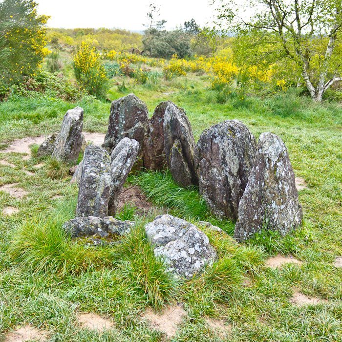
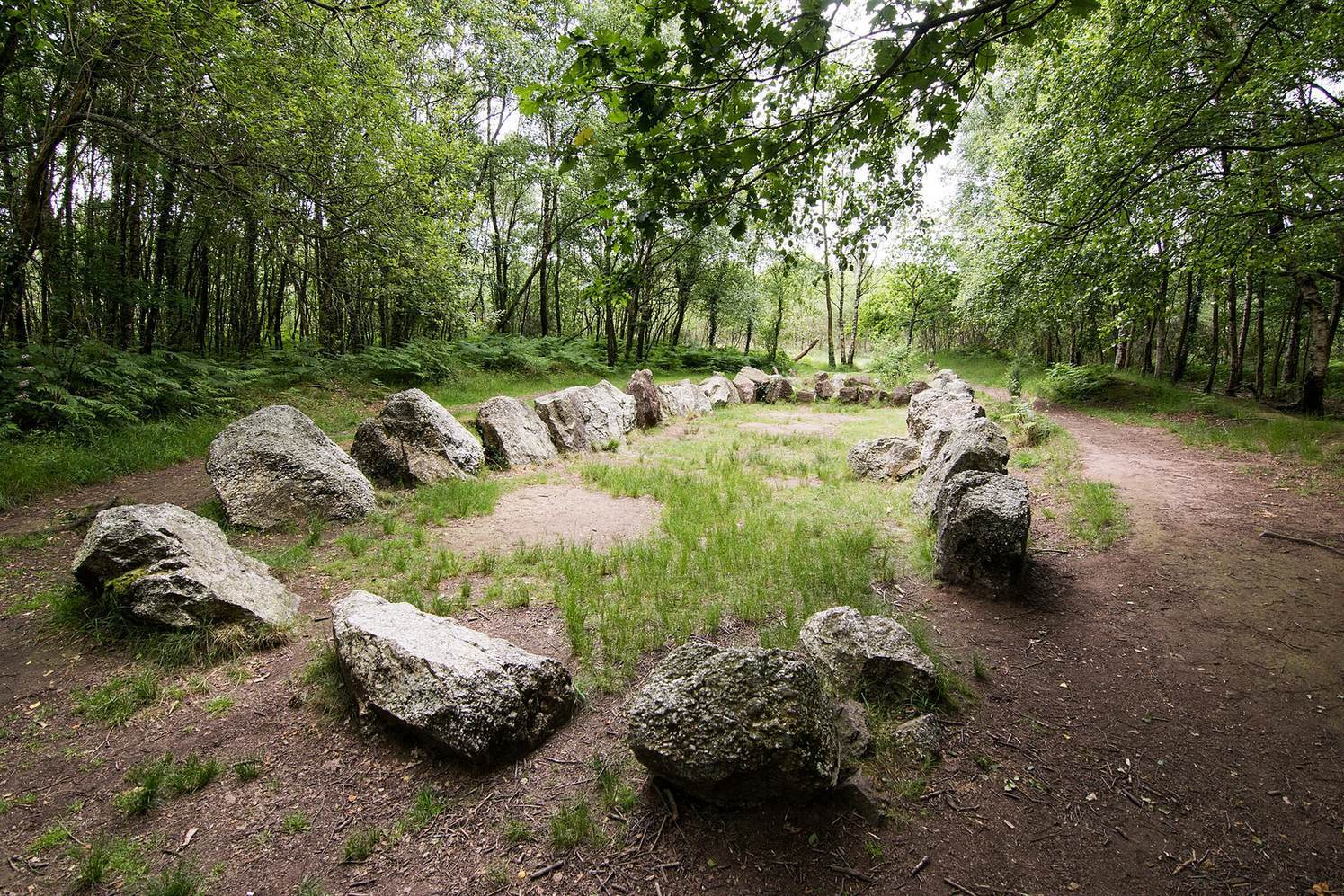
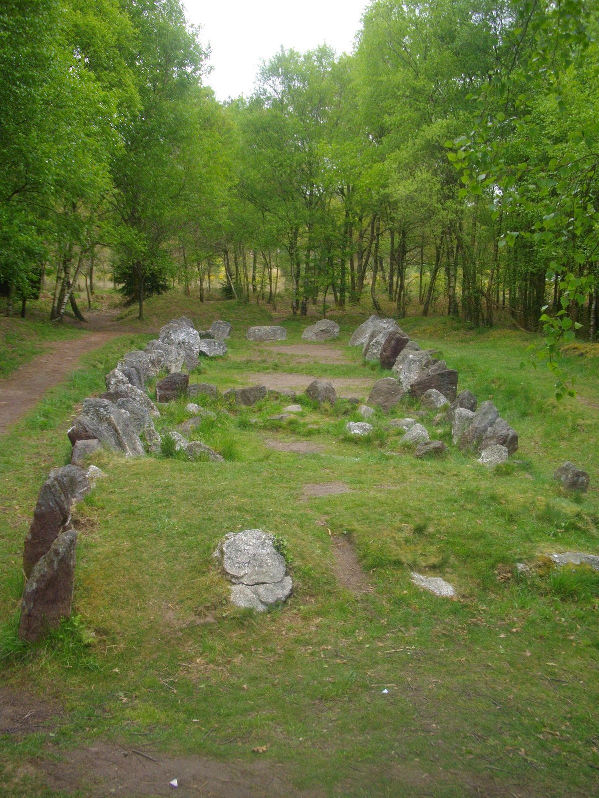
Jardin aux Moines, also called Jardin des Tombes, is a Neolithic long barrow, an elongated prehistoric burial mound, in the Paimpont forest in the commune of Néant-sur-Yvel, France. Its enclosure has a rare four-sided plan.
Prehistoric activity
Activity at the site began before the mound was built, during the Mesolithic, an earlier prehistoric period. The mound itself was probably constructed in the Neolithic. Later, the site was used as a burial place or cult site.
Recognition, excavation, and local traditions
By the mid-nineteenth century, Jardin aux Moines was one of several prehistoric mounds noted around the boundaries of Néant-sur-Yvel and Tréhorenteuc. In 1847, Cayot-Delandre, an antiquarian and writer on Breton history and archaeology, made the first detailed description of the monument. Around 1920, local residents may have taken stones from it for house building. The site was then forgotten and became overgrown. French prehistorian and archaeologist Jacques Briard excavated it in 1983 and 1984.
Although the Paimpont forest is also called Brocéliande, Jardin aux Moines is not associated with Arthurian legend, the medieval stories about King Arthur and his court. One local tale says that the lords and monks of Tréhorenteuc were turned to stone after Saint Méen, a Christian saint associated with early medieval Brittany, caught them feasting and ordered them to confess and end their revelry. Another identifies the stones as a hunting party led by Lord Gastern of Tréhorenteuc on All Saints’ Day.
Remains
Mound and stone enclosure
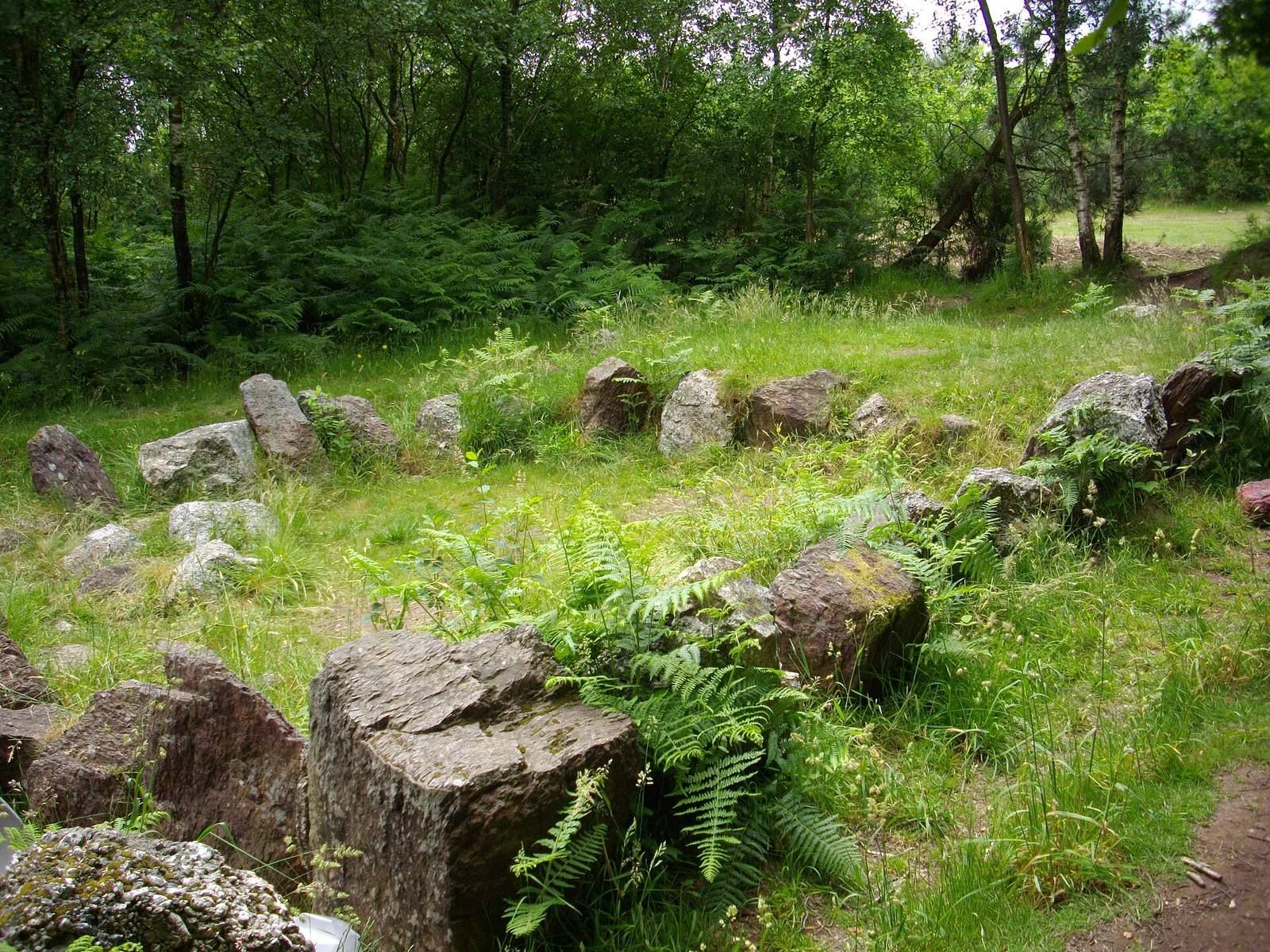
The low mound rises about 0.8 m above the natural ground and runs east-northeast to west-southwest. Its enclosure measures 25 m along the north side and 23 m along the south, with a width of 5–6 m. The north boundary has 26 blocks and the south has 27. These stones include local red schist and white puddingstone, a conglomerate of rounded rock fragments cemented together. The materials alternate especially along the south side. On the north, puddingstone blocks are taller and more numerous; the nearest puddingstone source lies at least 3 km away in the Tréhorenteuc valley.
Chamber and disturbance
The chamber is non-megalithic, meaning it was not built from large standing stones. Two crosswise divisions made from schist slabs occupy its northern part. They suggest that the structure was enlarged in stages, although the mound may also have been built in successive stages. Alterations and unauthorized digging have substantially disturbed the monument. A description from 1847 gives a trapezoidal plan measuring 24 by 5 m, formed by about 60 stones 1.3–1.6 m high, some already overturned.
Hearth and excavated finds
Excavation revealed hearth remains in the northern part of the chamber. Calibrated radiocarbon dating of its charcoal places the hearth between 2290 and 1695 BC. It may represent reuse during the Bronze Age, a later prehistoric period, or a later intrusion. Finds include two flint arrowheads with tangs and barbs, a scraper, flint-knapping flakes, and several quartz hammerstones. A small elongated flint trapezoid is of the Téviec type, a form named for a Mesolithic site in Brittany. This object is associated with Mesolithic activity, while the other flint tools are attributed to Neolithic activity. Coarse, undecorated pottery from the site is also broadly dated to the Neolithic.