Iso Linnamäki: A Medieval Fortification in Porvoo, Finland


Site at a Glance
- Rating
- 4.4
- Popularity
- Low
- Country
- Finland
- Primary era
- Medieval
- External website
- Open
- Eras represented
- Iron Age, Medieval
- Civilizations
- Swedish
- Site type
- Military
- Remains
- Castle
On this page8 sections
History
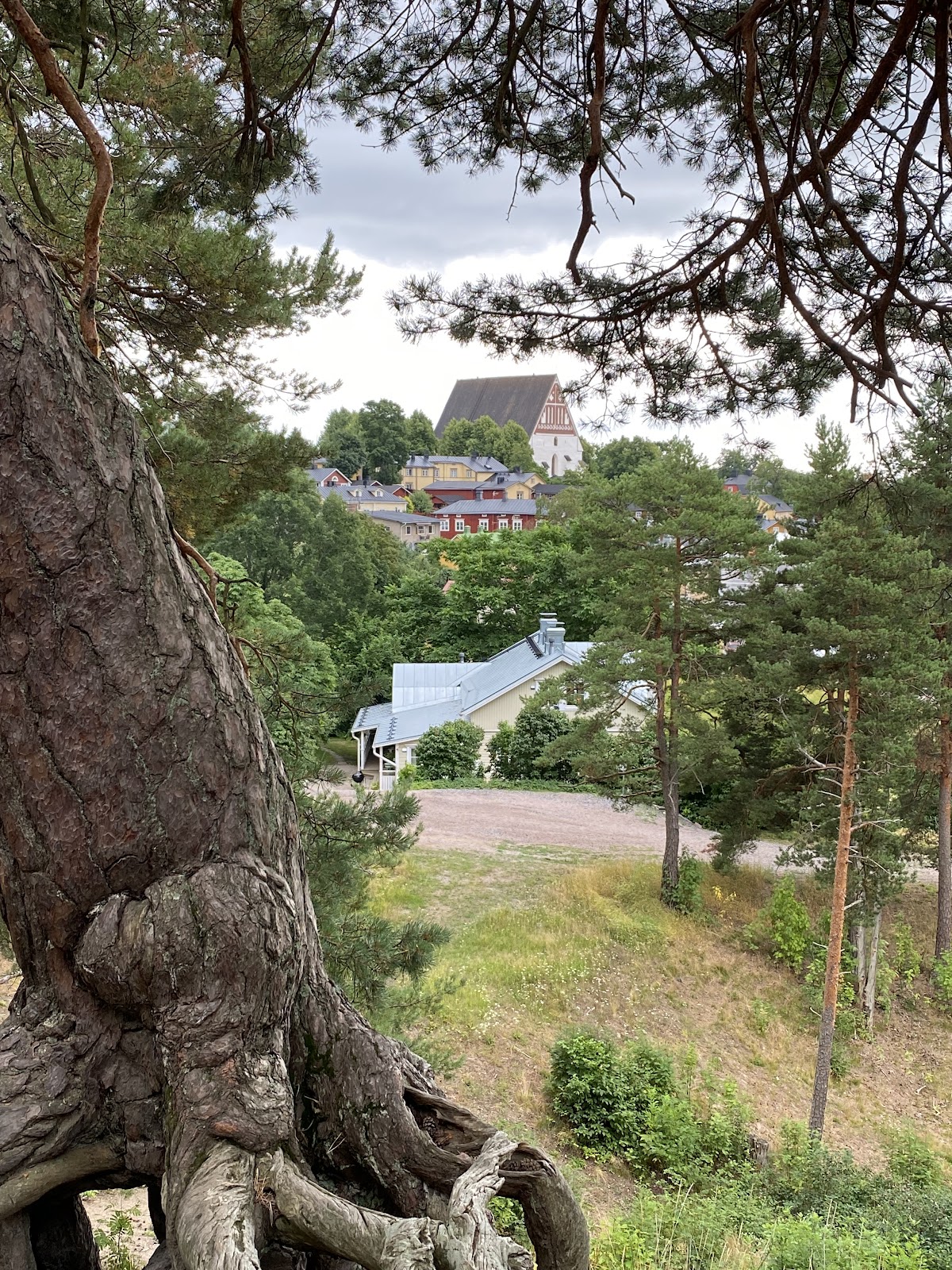
Iso Linnamäki is a medieval fortification in Porvoo, Finland, built on a moraine ridge beside the Porvoonjoki River at the edge of Old Porvoo. Its construction is generally placed in the Middle Ages, while archaeological evidence indicates that the hill was used much earlier during the Iron Age. The fortification was modified several times and remained connected with military activity after the medieval period.
Iron Age activity and early construction
Burnt-earth layers excavated on the hill date from approximately the seventh to ninth centuries and show human activity during the Iron Age. The earliest construction phase may belong to the eighth century. It may have been associated with a contemporary settlement nearby and with the cemetery at Pikku Linnamäki. During the cemetery’s period of use, Pikku Linnamäki stood on an island in the Porvoonjoki estuary, which later became connected to the mainland through the accumulation of land.
The later history of the site has sometimes been linked with Danish crusades into Uusimaa in 1191 and 1202. This interpretation remains unconfirmed. Iso Linnamäki first appears in written records in 1555–1556, in Jakob Teit’s complaint register.
The medieval fortification
The surviving fortifications are generally dated to the late fourteenth century. Bo Jonsson Grip, a fourteenth-century Swedish nobleman and political figure, and Jeppe Djäkn, a less securely identified late-medieval figure, have both been proposed as possible builders. The attribution is uncertain. Iso Linnamäki may also have been the fortress called Wartholm in medieval sources.
The fortification probably served for only a few years or several decades. A bay known as Maarin Harbour lay south of the hill during the medieval period, but it later silted up. The site continued to be used for military purposes after the Middle Ages, and its medieval form was altered over time.
Later changes and archaeological investigation
The ditches were deepened in the early twentieth century, and sand was extracted from the southern slope. The rampart was later restored, further affecting the medieval topography. Cajander investigated Iso Linnamäki in 1864. J. R. Aspelin excavated the site in 1886, Torsten Edgren carried out smaller excavations beside the outer edge of the inner ditch in 1971, and Sirkka-Liisa Seppälä inspected it during a regional inventory in 1994.
For several decades Iso Linnamäki has been maintained as a park-like area, although it has been visited for centuries. The maintained and protected area follows the foot of the hill. Together with Old Porvoo, the hill forms part of Finland’s nationally significant built cultural environments, and Iso Linnamäki is also a registered archaeological site.
Remains
Iso Linnamäki occupies a pine-covered moraine ridge beside the Porvoonjoki, which flows toward the Gulf of Finland approximately three kilometres away. The hill rises just under 30 metres above sea level and now stands at the edge of Porvoo’s regular street grid. On the summit, an almost rectangular central plateau measures approximately 32 by 47 metres. Two dry ditches enclose it, their formation requiring extensive earthmoving. The ramparts are thought to have carried wooden defenses, and later ditch deepening and rampart restoration have altered the original topography.
Courtyard and buildings
The castle courtyard contains two pits, each approximately 10 metres across and about 2 metres deep. They have been interpreted as storage cellars. The plateau also held a castle hall, a cooking building, and a smithy. Small-stone hearths were exposed during excavation, providing evidence of activity within the fortified area.
Excavated objects
Aspelin’s excavation covered almost the entire castle courtyard, although it may not have reached the bottom of the cultural layer. The finds included iron tools and weapons, thirteen armour-piercing crossbow bolt heads, and fragments of a German stoneware jug. The bolt heads belong to a type generally used from the thirteenth to the fourteenth century, while the jug dates to the mid-fourteenth century. Coins from the site are later than the Great Wrath, the Russian occupation of Finland during the Great Northern War, principally from 1713 to 1721. Parts of gunlocks also date to the post-medieval period.
Plants near Maarin Harbour
Archaeophytes, plant species introduced relatively late through human activity, grow between Maarin Harbour and the hill. They include small-flowered bittercress, yellow whitlow-grass, wormwood, field wormwood, greater knapweed, goutweed, and dark mullein. Several of these plants were formerly used as spices or medicinal plants.