Hünenburg bei Watenstedt: A Late Bronze Age Hillfort in Germany
Site at a Glance
- Rating
- 5
- Popularity
- Very Low
- Country
- Germany
- Primary era
- Bronze Age
- Eras represented
- Stone Age, Bronze Age, Iron Age, Medieval
- Civilizations
- Unclassified
- Site type
- City
On this page15 sections
History
Hünenburg bei Watenstedt is a prehistoric hillfort in Gevensleben, Germany, settled from the 14th century BC and fortified around 1100 BC during the Late Bronze Age. It developed into a regional center and seat of an elite, with evidence of specialist metalworking and far-reaching contacts.
Late Bronze Age settlement
People lived at Hünenburg from the 14th century BC. The inhabitants are associated with the Saale Estuary cultural group, an archaeological grouping recognized through shared material traditions. Its territory extended from the Brunswick region across the northern Harz area to the Elbe-Mulde region, approximately 1300–750 BC. The fortification was established around 1100 BC and remained in continuous use from the 11th to the 7th centuries BC.
The hillfort and its settlement below have been interpreted as a town-like center for trade and regional activity. Hünenburg may have housed about 500 permanent residents and may have been among Central Europe’s largest Bronze Age settlements. Its wealth could have come from exchanging ore, metal goods, and salt. Finds also point to contacts reaching the Mediterranean. People from southern Scandinavia may have lived at the site, which may have served as a trading post for metals used to make bronze.
A richly decorated bronze basin cast at Hünenburg points to the presence of skilled metalworkers within the fortification. Similar vessels appear to have circulated around the wider region. The nearby Beierstedt burial ground was used from 900 to 600 BC. Richly furnished graves found in 2007 and 2008 led to the proposal that Hünenburg’s rulers were buried there.
Renewed use and the possible Hoohseoburg
After an interval of roughly a thousand years, people returned during the Migration Period, an era of population movements spanning late antiquity and the early Middle Ages. The fortifications were renewed, although the relationship between this rebuilding and the 8th-century conflicts between Saxons and Franks remains uncertain.
Hünenburg may have been the Hoohseoburg mentioned in early medieval Frankish chronicles, but the identification remains unproven. The fortress’s former importance, its renewed defenses, and its destruction in the 8th century support the proposal. Its position in central Eastphalia, the eastern part of Saxon territory, and beside the Deitweg also fits: this major military and trading route ran from Ohrum on the Oker through Schöningen toward Magdeburg. The chronicles do not specify the Hoohseoburg’s location, and the Seeburg in present-day Saxony-Anhalt has also been proposed. The Hünenburg identification was put forward in 1927, remained disputed among researchers into the late 20th century, and gained support from later excavations without being settled.
The Royal Frankish Annals, a chronicle of Frankish royal affairs, report that Karlmann, a senior official of the Frankish court, campaigned in Saxony in 743, captured the Hoohseoburg, and took the Saxon nobleman Theoderic prisoner. Theoderic was required to pay tribute to the Frankish kingdom. After he rebelled in 744, Frankish forces defeated him and took him captive into Frankish territory; the fortress was destroyed. These events relate to Hünenburg only if it was the Hoohseoburg.
Archaeological investigation
The earthwork appeared on maps by the mid-18th century, and pottery and other finds were collected at the site from the early 19th century. A remaining ditch was noted around 1850. The Brunswick Historical Society conducted a small excavation in 1878, followed by investigations in 1892 and 1897 led by Friedrich Grabowsky, director of the Municipal Museum of Brunswick.
Excavations resumed from 1998 to 2000 and began again in 2005. Research by archaeologists and university teams continued through 2020. Work on the outer settlement’s southern slope began in 2001, progressing from aerial and geophysical surveys to excavation. A permanent exhibition about Hünenburg and its surroundings, including the fortification, settlement, and burial ground, opened at the Heeseberg Museum in Watenstedt in 2013.
Remains
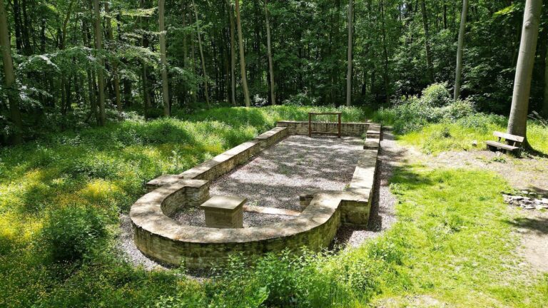
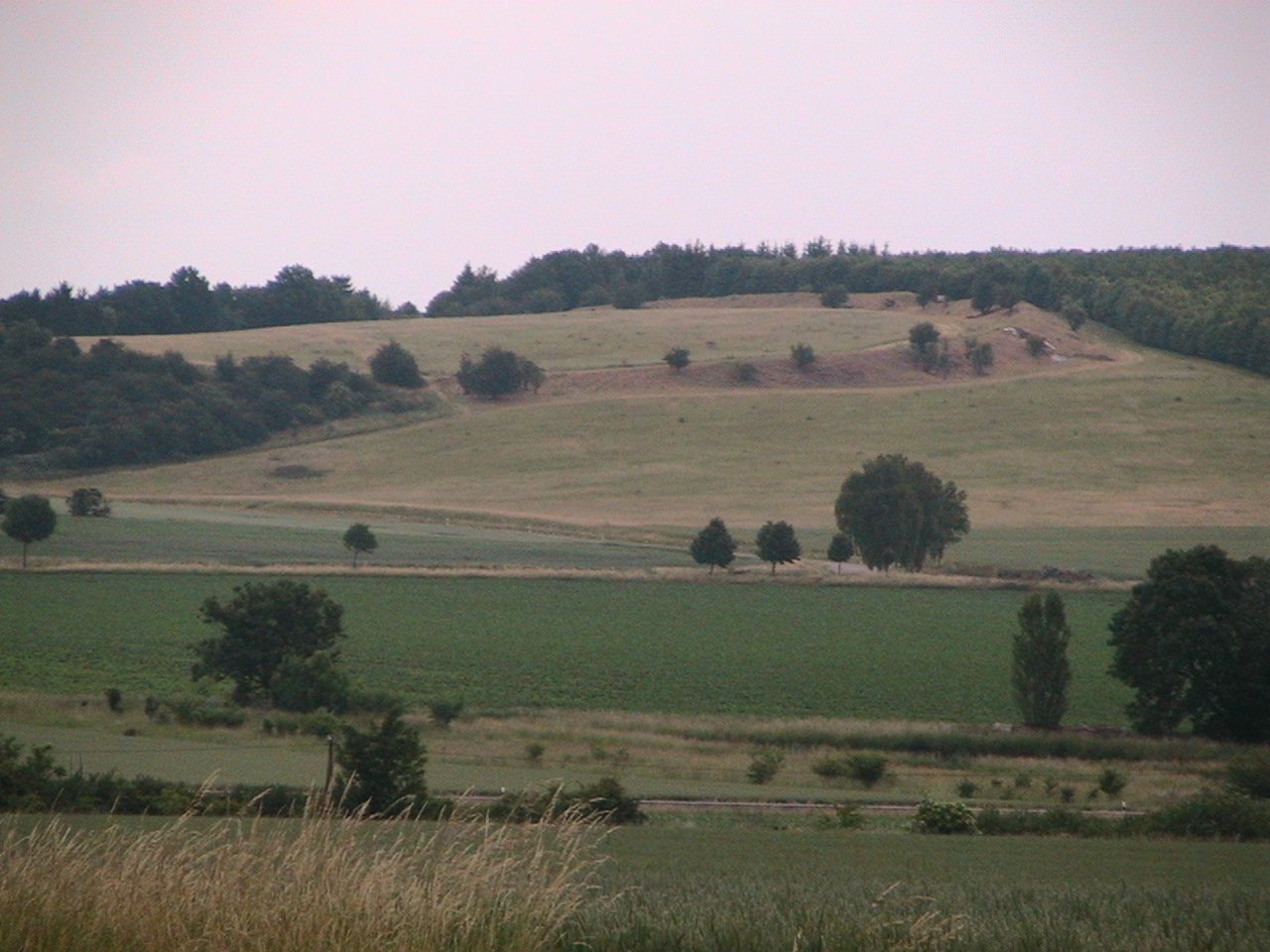
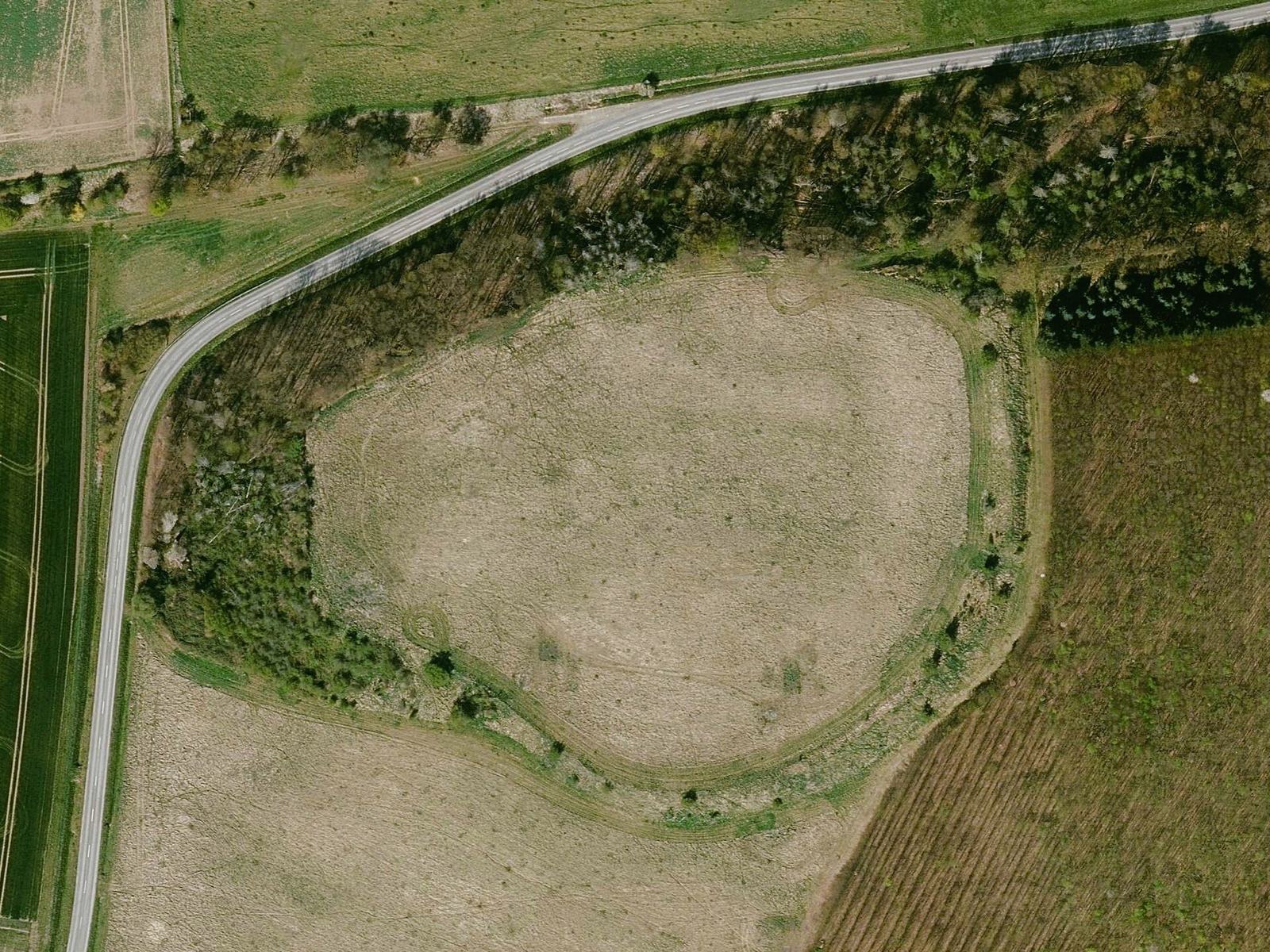
The hillfort occupies a rise at 133 m above sea level on the western edge of the Heeseberg, between the Elm upland and the Great Bruch lowland. Its irregular, oval enclosure covers about 2.5 hectares and measures approximately 160 by 220 m. The plateau-like interior slopes across a height difference of about 13 m. The defenses combine an earthen rampart, steepened slopes, and ditches.
Fortification
Enclosure and rampart
An earthen defensive bank survives above ground on the eastern side. It consists of several layers, reaches up to 5.5 m high, and contains remains of a stone wall. The layers represent eight building phases from the Late Bronze Age and Saxon period. On the north and west, the slopes descend by as much as 25 m and were probably made steeper by people.
Entrance and defensive ditch
Old aerial photographs show a former entrance in the southern part of the enclosure, aligned with an ancient road. Two major long-distance routes crossed at the site as they passed through natural barriers. A ditch, originally about 8 m wide and 3 m deep, was cut through the fortification around 1100 BC, before the rampart was built. It was later partly filled. The remaining portion is about 1.5 m deep and stayed open throughout the fort’s occupation. It may have included a wooden structure and may have separated a ruling or religious area within the enclosure.
Earlier earthwork and possible building
A geomagnetic survey, which detects buried features through changes in soil magnetism, traced a double system of shallow ditches with occasional openings across the enclosure’s middle in 2017. The feature is interpreted as a Neolithic, or New Stone Age, earthwork that predates the Bronze Age fort by millennia. Measurements in 2019 also suggested that a larger building may lie inside the enclosure.
Outer settlement
Houses and occupation remains
The settlement contemporary with the hillfort extended across about 27 hectares on the southern slope below it. Excavations had recovered roughly three tonnes of pottery by the end of 2014. The remains include wooden houses about 11 by 5 m, supported by upright posts. Their walls used wattle, branches woven between supports, and they had hearths and a form of stone paving. Storage and refuse pits beside the houses reached depths of 1.8 m.
Watercourse and animal remains
A former watercourse found in the settlement in 2011 contained animal bones and skulls that may have been offerings. An excavation in 2014 uncovered a horse skeleton lying on its back at a depth of 1.6 m. Whether the animal had been offered or deliberately buried remains uncertain.
Associated finds and burial ground
Bronze basin
The richly decorated bronze basin cast at Hünenburg was found in the early 20th century. It is now displayed in the archaeology department of the Brunswick State Museum at the Neue Kanzlei in Wolfenbüttel.
Beierstedt burial ground
The Beierstedt burial ground lies about 700 m southeast of Hünenburg. Its richly furnished graves, excavated in 2007 and 2008, prompted the proposal that rulers of the hillfort were buried there.