Hoge Woerd Fort: A Roman Castellum on the Rhine Frontier


Site at a Glance
- Rating
- 4.4
- Popularity
- Medium
- Country
- Netherlands
- Primary era
- Classical
- External website
- Open
- Eras represented
- Classical
- Civilizations
- Roman
- Site type
- Military
- Remains
- Fort
On this page10 sections
History
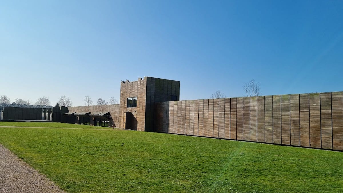
Hoge Woerd Fort is a contemporary reconstruction of a Roman military fort in Utrecht, Netherlands, on the northern frontier of the Roman Empire. The original castellum, the Roman term for a military fort, stood beside a southern branch of the Rhine as part of the Lower Germanic limes, the connected frontier zone of forts, roads, rivers, settlements, and military infrastructure along the lower Rhine.
The Roman frontier
At Hoge Woerd, the Rhine and its branches formed a natural defensive boundary while also carrying troops and supplies. The river network helped transport provisions to Roman forces in Britain after the invasion of AD 43. The fort stood beside a south-flowing branch of the river, with a small civilian settlement, or vicus, immediately outside its walls. Its inhabitants provided services for the garrison.
The fort was connected to the limes road between Utrecht and Woerden. This route served military movement and trade, with side roads linking it to other locations. The surrounding landscape also contained indigenous settlements whose inhabitants served in the Roman army. Research at Hoge Woerd and nearby sites has helped establish the former courses of the Rhine and its branches, placing the fort and road within a changing river environment.
Archaeological investigation and reconstruction
Excavations in 1940 exposed part of the Roman bathhouse on De Woerd. Work before construction in Veldhuizen in 1997 revealed a section of the limes road and the river vessel De Meern 1. Excavations around De Meern and Vleuten around 2000 located several Roman watchtowers, while a 2009 excavation in Meentpark uncovered further Roman remains, including another section of the road. Roman and possibly early medieval vessels were also found in the region during the early twenty-first century.
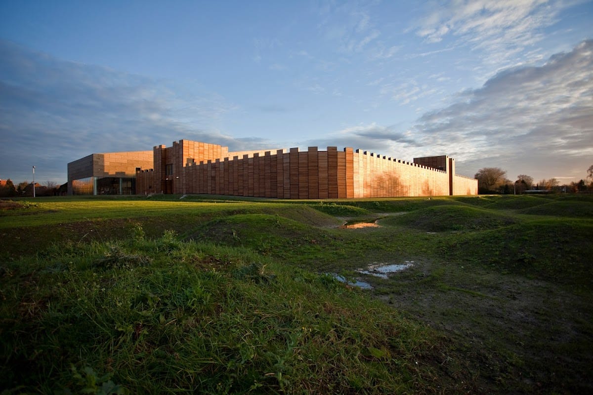
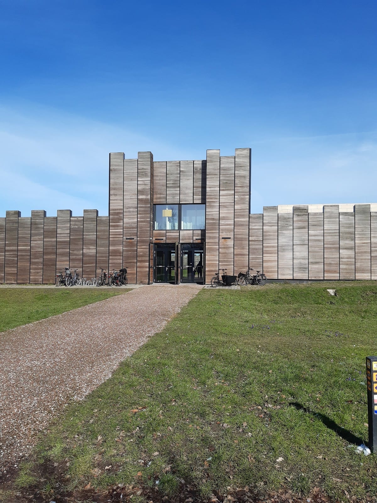
The present fort opened in 2015 on the original location and follows the Roman fort’s length, width, and height. Designed by Skets Architectuurstudio, it incorporates Museum Hoge Woerd, Podium Hoge Woerd theatre, a nature and environmental education centre, and a cafe-restaurant. The ground was raised by about 60 to 80 centimetres before construction to protect the archaeological remains below.
De Meern 1 was raised from the former riverbed and received a lengthy conservation treatment before entering the museum hall in 2015. On 27 July 2021, the fort and the section of limes road west of it became part of the UNESCO World Heritage designation for the Lower Germanic limes. The site is valued as one of the relatively complete Roman military complexes, with riverside refuse deposits and richly layered remains that preserve evidence of daily life on the frontier.
Remains
Fort and frontier landscape
The Roman fort occupied an area of approximately 85 by 120 metres on the eastern bank of a southern Rhine branch. It stood several metres above the surrounding land, probably on a natural river levee that was further raised artificially. The reconstructed castellum occupies the same site and retains the Roman fort’s dimensions. Walkable ramparts and a defensive wall give the structure its full-scale military form, while the former defensive ditch is marked around it.
The archaeological monument beneath the reconstruction covers about 10 hectares. Within the site, the former river channel, the limes road, harbour works, the civilian settlement, the bathhouse, and nearby burial grounds are marked or interpreted in relation to the fort. Thick settlement deposits accumulated beside the former river channel, preserving evidence for Roman settlement, infrastructure, water management, transport, and military life.
Bathhouse and road
Roman bathhouse
The Roman bathhouse stood outside the fort walls, in the area now marked on the forecourt. Its foundations are exceptionally well preserved for the Netherlands. Around AD 200, the complex contained high vaulted rooms, underfloor heating, and decorated walls. Underfloor heating circulated hot air beneath raised floors, providing warmth within the bathing complex.
Limes road
The section of limes road west of the fort included timber construction. Preserved carpentry details and tree-ring patterns provide a detailed chronology for the road’s construction. Its survival helps explain how the military route connected the fort with the wider frontier network and its associated side roads.
De Meern 1
De Meern 1 is a Roman river vessel about 25 metres long, dating to the second century. It was found in relatively good condition on the bed of the former southern Rhine branch and is preserved in the museum hall at Hoge Woerd. Its inventory and private possessions remained aboard when it was discovered. The vessel may have stranded on a shallow part of the river, although the exact cause of its loss is uncertain. Its hull and associated contents make it the most complete Roman inland vessel found in northwestern Europe.
Reconstructed watchtower
A reconstructed Roman watchtower forms part of the site’s interpretation of the frontier. It represents an outpost occupied by a small group of soldiers and conveys the conditions and daily duties associated with guarding the Roman boundary. Together with the fort, road, river channel, and other marked features, it presents the military complex within its former riverine setting.