Hexamilion Wall: A Late Antique Fortification of the Isthmus of Corinth
Site at a Glance
- Popularity
- Very High
- Country
- Greece
- Primary era
- Classical
- Eras represented
- Classical, Medieval
- Civilizations
- Byzantine, Roman
- Site type
- Military
- Remains
- Wall
On this page11 sections
History
The Hexamilion Wall is a late antique fortification across the Isthmus of Corinth in Greece, built by the Eastern Roman Empire between AD 408 and 450 to defend the Peloponnese from invasion by land. It was the latest in a series of efforts to secure this narrow land passage.
Earlier plans and Roman construction
Attempts to fortify the isthmus may reach back to the Mycenaean period, the Late Bronze Age civilization of mainland Greece. During the Persian invasion of 480 BC, and again in plans made before the Battle of Salamis, Peloponnesian cities considered withdrawing behind the isthmus rather than defending Thermopylae. The strategy was understood to be ineffective without control of the sea.
The wall was built during the reign of Theodosius II, an Eastern Roman emperor. Earlier events may have helped prompt the project: Alaric’s attack on Greece in 396 or the Visigothic sack of Rome in 410. The wall restricted movement by land into the Peloponnese, while its guarded gates enabled officials to tax trade passing through the area.
Garrisons and changing defenses
Building the defenses required land and the removal of existing buildings, provoking disputes with property holders. Corinthians of different political views and religious affiliations took part in construction and supported the garrisons. The project may also have reinforced imperial control over local affairs. Repairs supplied work for residents and drew skilled laborers to the area.
During the fifth century, the garrison at the Isthmia fortress probably comprised four to eight military units. Local farmers initially served there, but Justinian replaced them with professional soldiers as part of his repairs. Soldiers supplemented their provisions by farming south of the wall and relied on local farmers, merchants, artisans, laborers, and rural villas for other needs. Their skilled work supported local granaries and economic activity, though demand changed with the seasons and could strain local resources during the off-season.
Under Justinian, the defenses gained additional towers and a fortress at Isthmia. Military use appears to have diminished after the seventh century, and domestic buildings had been constructed within the wall by the eleventh. Earthquakes probably contributed to damage and decline between Justinian’s repairs and those of Manuel II; the earthquake of 551 may have been particularly destructive. In the late sixth or early seventh century, the Northeast and South Gates of the Isthmia fortress were blocked, closing routes between Athens, Corinth, and Epidaurus. The reason is uncertain, though opposition to changes in land use and roads is one possible explanation.
Medieval repairs and abandonment
In 1397, an Ottoman army led by Evrenos and Yakub Pasha destroyed surviving fortifications. Manuel II, a Byzantine emperor, personally supervised repairs in 1415. The work lasted about 40 days and caused unrest among local elites, which developed into an open revolt suppressed by force. Manuel viewed the opposition as resistance to renewed imperial authority, while contemporary criticism connected local frustration with repeated spending on the defenses.
Ottoman forces breached the wall in 1423 and again in 1431, when Turahan Bey commanded the attack. Constantine Palaiologos, then ruler of Byzantine Morea, and his brother Thomas restored it in 1444, but it was breached again in 1446 and October 1452. Murad II, the Ottoman sultan, began his attack on November 27, 1446. His army may have numbered 50,000 to 60,000 and used heavy long-range cannons, siege engines, and scaling ladders. After five days of fighting, Murad signaled a final assault. By December 10, the wall had been reduced to ruins.
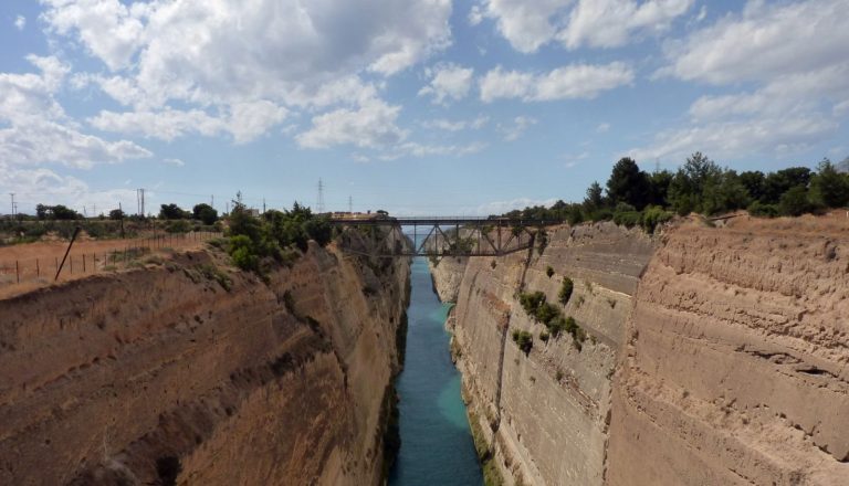
The wall was abandoned after the Ottoman conquest of the Peloponnese in 1460. It did not achieve its intended purpose of stopping a land invasion, although it may have acted as a deterrent. Sections remain south of the Corinth Canal and at the Sanctuary of Poseidon at Isthmia.
Remains
The cross-isthmus wall
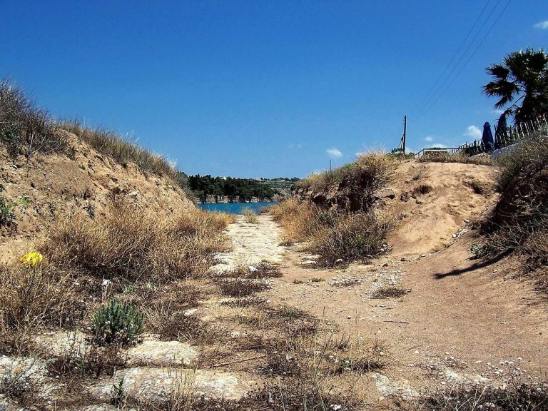
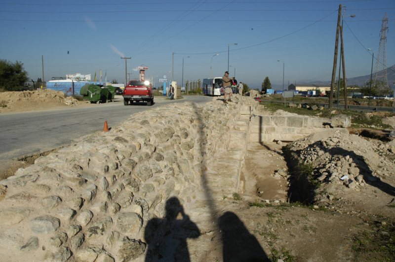
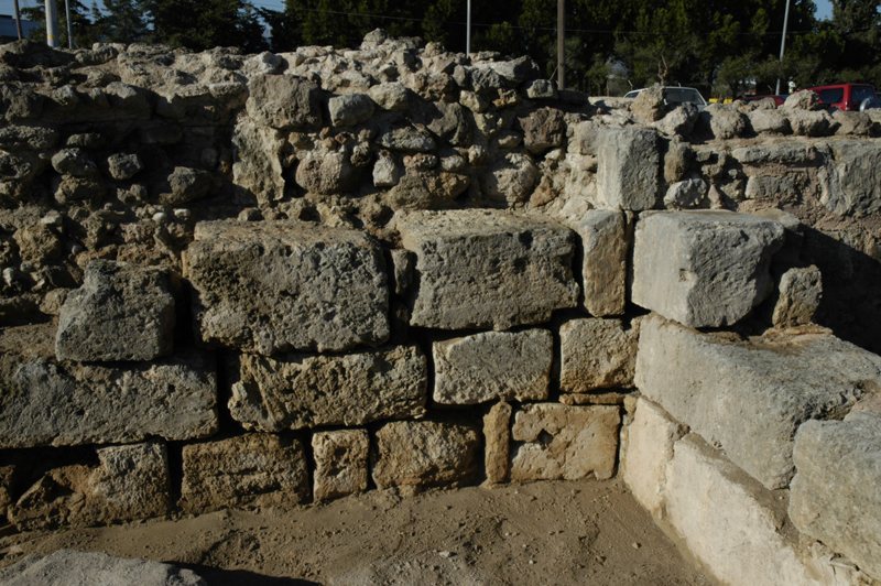
The wall crossed the isthmus between the Gulf of Corinth and the Saronic Gulf, guarding the principal land route from mainland Greece to the Peloponnese. It measured approximately 7.5 km long, 7–8 m high, and about 3 m thick. Its rubble-and-mortar core was enclosed by squared stone facing. The northern face used larger blocks with more carefully finished edges, while the southern face had smaller stones set in mortar. The defensive system included towers and forts at both ends; during Justinian’s strengthening work, the number of towers reached 153. The wall did not extend into the sea at either end and was not designed to stop attacks from the water. At approximately 7.5 km long, it is Greece’s largest archaeological structure.
The fortress at Isthmia
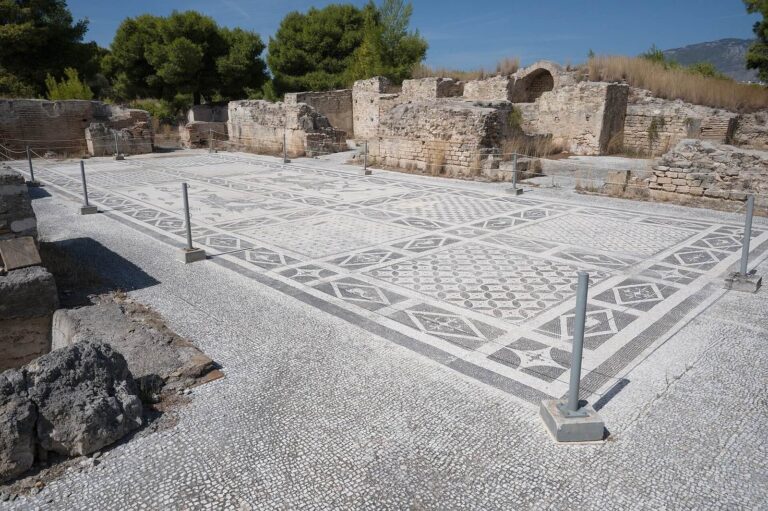
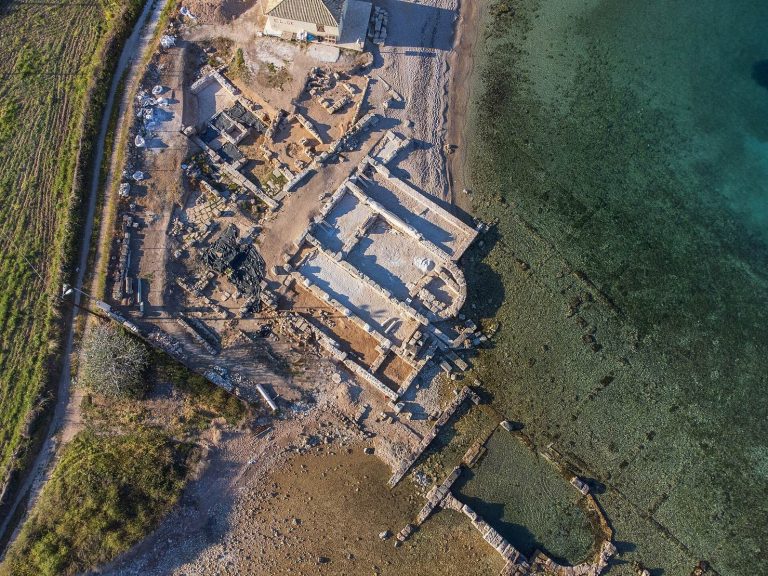
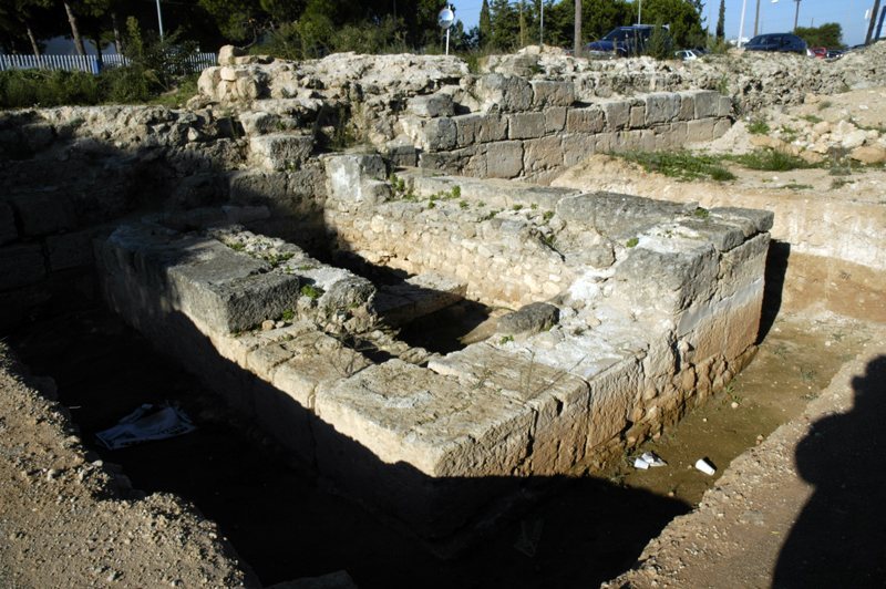
Set on the south side of the wall, northeast of the Sanctuary of Poseidon, the Isthmia fortress covered 2.7 hectares. Its defenses included 19 rectangular towers. The main land route passed through the fortress, whose northeast gate served as the principal entrance; a gate on the north side was the formal entrance to the Peloponnese. The northeast and south gates were later blocked. Drainage channels formed part of the northeast gate.
Reused building materials
Construction incorporated material from nearby ancient sites. The Temple of Poseidon, the Greek god associated with the sea, at Isthmia was incorporated into the defenses, and stone from the sanctuary was used at the main entrance in facing-and-core construction. Material from the Sanctuary of Hera, the Greek goddess and queen of the gods, at Perachora, along with ancient statues from Corinth, was burned to produce lime. Wedge-shaped arch stones, cylindrical sections of columns, and inscribed blocks were also reused in the wall and its roadway.
Construction graffiti
Scratched into mortar on the wall’s rear face, just west of Tower 15, are images of two galleys and a third vessel interpreted as a boarding device. The mortar was still soft when the marks were made, placing them during initial construction or a repair. They may refer to naval fighting or the wall’s vulnerability from the sea, though they could also have been playful drawings.
Burials beside a defensive stairway
Graves lay at the foot of a stairway leading to an upper fighting platform. One burial cut away the lowest stair tread, impairing an important defensive position. Women and children were among the people buried there. The graves appear to date from roughly a decade after the wall’s initial completion and were used for several decades. Excavations between 1954 and 1976 led to interpretations that the burials might reflect local resistance or a transfer of maintenance duties to residents.
Surviving sections
Surviving remains include a section with a tower base, a stretch facing northwest, and areas where the rubble core and worked-stone facing are exposed. A tower foundation incorporates a reused architectural piece with carved molding.