Diolkos: The Ancient Greek Ship-Transport Trackway Across the Isthmus of Corinth
Site at a Glance
- Popularity
- Very High
- Country
- Greece
- Primary era
- Iron Age
- Eras represented
- Iron Age, Modern
- Civilizations
- Ancient Greek, Greek
- Site type
- Infrastructure
- Remains
- Road
On this page14 sections
History
Construction and commercial use
The Diolkos was an ancient Greek trackway for hauling ships and cargo across the Isthmus of Corinth, at present-day Posidonia in Greece. Archaeological evidence places its construction in the late seventh or early sixth century BC, during the rule of Periander at Corinth. It was in regular use from about 600 BC until at least the middle of the first century AD. The route let vessels traveling between the Ionian and Aegean seas cross overland, avoiding the hazardous passage around the Peloponnese and shortening the journey to Athens. Commercial freight was probably its chief purpose, although ships were also moved for military operations.
Thucydides, the historian of the Peloponnesian War, already regarded the trackway as old. Pottery and letters carved into stone blocks help place its construction in the early period. It may initially have served to move heavy materials, including marble, monoliths, and timber, as monumental building developed in Greece. Control of the crossing also gave Corinth a way to oversee trade by land and sea. A substantial settlement grew near the northwestern end, at present-day Posidonia, during the sixth and fifth centuries BC.
Aristophanes, a comic playwright, used a saying associating Corinthian identity with speed. It has been interpreted as a sign that the Diolkos was known for rapid passage. Its combination of guided wheeled transport and the overland movement of ships was exceptional in scale in antiquity. Historian of technology M. J. T. Lewis has called it a public railway, meaning a long track for wheeled transport that users could pay to use. The route extended for several kilometers and remained in operation for at least about 650 years.
Military transfers
Accounts of naval operations from the fifth to the first century BC describe fleets crossing the isthmus. They do not always name the Diolkos, so its use in these movements is often inferred from the route’s availability. In 428 BC, during the war between Sparta and Athens, the Spartans planned to move warships to the Saronic Gulf to threaten Athens. In 411 BC, they transferred a squadron for operations near Chios.
In 220 BC, Demetrius of Pharos, a ruler of the Hellenistic period, had about 50 ships hauled to the Gulf of Corinth. Three years later, Philip V of Macedon sent 38 warships across the isthmus, while larger vessels sailed around Cape Malea. An inscription records that Marcus Antonius the Orator, a Roman statesman distinct from Mark Antony, had the Roman fleet transported across in 102 BC.
After Octavian defeated Mark Antony at the Battle of Actium in 31 BC, he ordered some of his 260 Liburnian ships, a type of light Roman warship, across the isthmus to advance quickly against his rival. Later transfers may have used a different route. In 868 AD, Niketas Oryphas, a Byzantine naval commander, moved 100 warships across under Emperor Basil I. The Byzantine Empire was the medieval eastern Roman state. A further movement of warships around 1150 probably also bypassed the Diolkos.
Decline and archaeological investigation
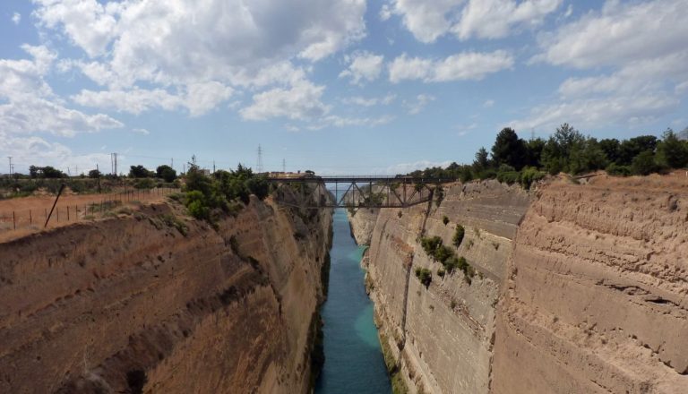
Nero’s unsuccessful canal project in 67 AD may have ended the Diolkos’ use. The excavation cut across the route in the northwest, and spoil covered parts elsewhere. A navigable passage across the isthmus was not completed until construction of the Corinth Canal in the nineteenth century, which destroyed sections of the ancient trackway.
In the late nineteenth century, Corinth Canal chief engineer Béla Gerster surveyed the isthmus without finding the Diolkos. Habbo Gerhard Lolling probably identified its remains in an 1883 guidebook. James George Frazer reported traces in 1913, and Harold North Fowler found part of the western quay in 1932. Greek archaeologist Nikolaos Verdelis excavated the route systematically from 1956 to 1962. His early death prevented full publication of the work, and Georges Raepsaet and Walter Werner later added field research.
Ship traffic in the nearby canal has eroded and damaged sections of the Diolkos. A protection and restoration effort began in 2022. Work in October 2024 reinforced the canal-side bank and added an earth-and-stone edging. By the end of 2025, a steep slope protected the landward side, and the adjacent road and curb had been raised to discourage vehicles from crossing the ancient surface.
Remains
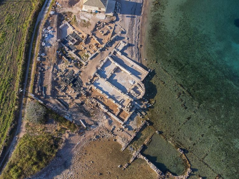
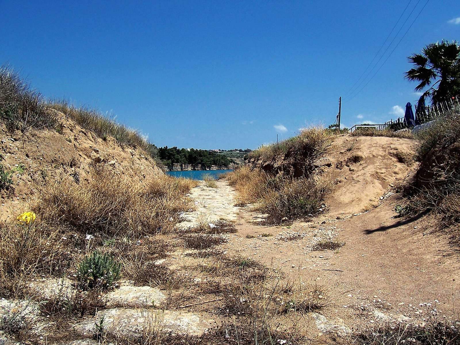
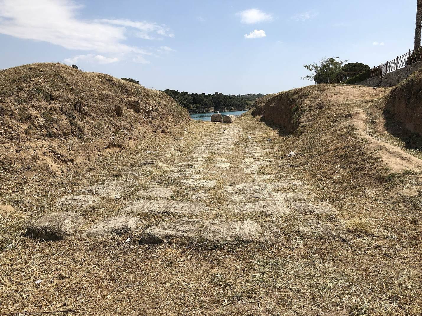
The Diolkos survives as a partly traced, limestone-paved corridor across the narrow isthmus, with grooves, edge walls, ditches, and loading features associated with the movement of wheeled carriers and vessels. Its course followed the land rather than a straight line, and the surviving traces lie mainly near the Gulf of Corinth.
Course and terrain
At its narrowest point, the Isthmus of Corinth is about 6.4 km wide. The Diolkos wound across it to avoid steep gradients, crossing the ridge at about 79 m above sea level. Its average gradient was approximately 1:70, while the steepest parts reached about 6%. Estimates of the full route range from 6 to 7 km to 8 or 8.5 km, depending on how many bends are included. Archaeological traces extend for about 1,100 m, mainly near the Gulf of Corinth. The western section began at a former landing southwest of the modern canal, ran beside it for several hundred metres, crossed to the opposite side, and continued in a slight curve. Beyond that stretch, proposed alignments either follow the canal or swing south in a broad arc. The eastern end lay at Schoinous, near present-day Kalamaki on the Saronic Gulf.
Roadway and guidance features
Paved surface and boundaries
The roadway was paved with hard limestone and measured between 3.4 and 6 m wide. Walls along both sides helped keep wheeled vehicles on course, while ditches beside the road allowed overseers to monitor the movement of loads. Excavations exposed a nearly continuous stretch about 800 m long, within the wider 1,100 m of traced remains.
Wheel grooves
Parallel grooves, about 1.6 m apart, ran along the paved surface. In the southeastern section, rectangular channels are generally understood as deliberate guides for cart wheels. In the northwest, some grooves are indistinct or may have resulted from wear, although the raised, gently curved surface may also have helped guide vehicles. Shallower lines along parts of the route have been interpreted as marks from rear wheels negotiating bends. Repairs and changes made during the Diolkos’ long working life may account for some differences between sections.
Loading and hauling
Northwestern landing ramp
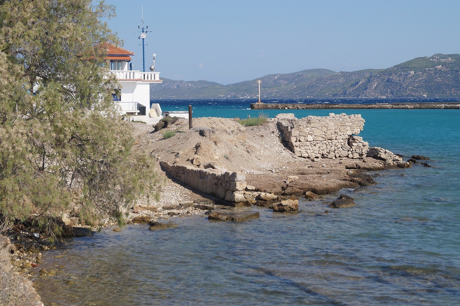
At the northwestern end, a ramp measuring about 10 by 8 m connected the route with the water. Its northwest end extended below water level. Ships were probably hauled from the water over wooden beams and then placed on wheeled carriers. From the fourth century BC, a wooden lifting device appears to have helped raise vessels for loading.
Stone guides on the slope
A separate feature on a slope between two stretches of the route consists of two parallel rows of stone blocks, roughly 60 cm apart and about 15 m long. It may originally have been twice that length. Raepsaet and Werner interpreted the rows as guides for moving loads. Raepsaet also proposed that they marked a place where loads were transferred between two types of carrier, but Lewis considered reloading there, about 600 m beyond the landing, impractical.
Carriers and hauling equipment
Archaeological evidence indicates that wheeled carriers were used, though their precise arrangement is uncertain. Ships and cargo may have travelled on separate carriers, or cargo alone may have crossed the isthmus and been loaded onto another ship at the far side. The vessels were probably more often boats than large ships. Technical analysis suggests that a trireme, a warship propelled by three tiers of oars, could have been moved, although with difficulty. Such a vessel was about 35 m long, 5 m wide, and 25 tonnes in weight.
Heavy ropes stretched from bow to stern probably helped stabilize a ship’s hull and reduce the danger of damage during hauling. People and animals likely pulled the loads with ropes and pulleys, perhaps assisted by capstans, rotating winches used to haul heavy objects.
Estimated effort
One calculation assumes a waterlogged vessel and carrier with a combined weight of 38 tonnes. At a sustained pulling force of 300 newtons per person, it estimates that 112 to 142 people would be needed, with nearly 180 required to start the carrier moving. At 2 km per hour, a 6 km crossing would take about three hours. Raepsaet’s alternative calculation, based on lighter loads and lower rolling resistance, estimates a maximum pulling force of 27,000 newtons and a smaller team. It also allows for oxen, whose usefulness Tolley disputed. Both estimates point to the substantial effort involved in moving vessels overland.