Hegra: A Nabataean Caravan City and Rock-Cut Necropolis in Saudi Arabia
Site at a Glance
- Rating
- 4.7
- Popularity
- Low
- Country
- Saudi Arabia
- Primary era
- Classical
- External website
- Open
- Eras represented
- Classical, Early Modern, Modern
- Civilizations
- Dadanite–Lihyanite, Nabataean, Ottoman, Roman
- Site type
- City
On this page21 sections
History
Hegra is a Nabataean caravan city and rock-cut necropolis in the Al-Ula area of northwestern Saudi Arabia, developed mainly during the first century AD in the Nabataean period. Also known as Al-Hijr and Mada’in Salih, it occupied an inland route linking southern Arabia with the Levant, Mesopotamia, Egypt, and the Red Sea. Its position, water resources, and cultivated land helped it become an important commercial centre and a major staging post for caravans.
Early traditions and Lihyanite occupation
Islamic tradition identifies Al-Hijr as the homeland of the Thamud, a people described in the Quran as carving dwellings in the mountains. The prophet Salih is associated with the name Mada’in Salih. This religious tradition does not provide a securely established chronology for settlement at Hegra. Rock writings and images conventionally classified as Thamudic occur at Hegra and elsewhere in central Arabia and date broadly from the sixth century BC to the fourth century AD. “Thamudic” is a modern scholarly label for a wide group of inscriptions that has not been fully classified.
Earlier Dadani and Minaean activity in the wider Al-Ula region formed part of the background to Hegra’s development, although the relationships between these polities and the later Lihyanite kingdom remain debated. Lihyanite occupation at Hegra is represented by rock art and inscriptions around Jabal Athlib, dated to the third and second centuries BC. The settlement had access to freshwater and fertile soil, allowing it to serve as a meeting point for goods moving from eastern, northern, and southern regions.
The Nabataean city
During the first century AD, Hegra came under the rule of Aretas IV Philopatris, also called Al-Harith IV, whose reign lasted from 9 BC to AD 40. He made it the Nabataean Kingdom’s second capital after Petra, and the settlement underwent extensive urban development. The Nabataeans, an Arab kingdom based in northwestern Arabia, were known for caravan trade, oasis agriculture, water engineering, and architecture cut directly into rock.
Hegra prospered on the north-south caravan route. Nabataean merchants controlled trade in incense, myrrh, and spices, while routes from the city extended toward Petra, Egypt, the Levant, Tayma, and Palmyra. Hegra was also connected with the Red Sea port of Egra Kome. Wells, rainwater tanks, channels, and cultivated plots enabled the inhabitants to manage water and grow crops in an arid environment. The city combined a residential zone with an oasis supported by wells and irrigation.
Roman annexation and later antiquity
In AD 106, during the reign of Emperor Trajan, the Roman Empire annexed the Nabataean Kingdom and incorporated Hegra into the province of Arabia. A Roman inscription dated to AD 175-177 calls the settlement the civitas Hegrenorum, indicating civic status. More than 30 Nabataean, Greek, and Latin inscriptions, together with evidence of Roman military activity and a fortified citadel, reflect the new political order.
The principal military unit identified at Hegra was the Third Cyrenaican Legion, although soldiers from other legions were also stationed there. The army abandoned the site by the late second or early third century, and civilian occupation of the fort ended by the fourth century. The wider civilian population continued at least into the sixth century. Under Roman rule, imports from the eastern Mediterranean increased, local food production expanded, and traders and artisans arrived partly in connection with the military presence. The principal sanctuary was upgraded, and the southeastern gate was rebuilt in the late second or early third century.
Hegra gradually lost commercial importance as maritime traffic through the Red Sea replaced the principal overland route. By late antiquity, its urban functions had largely disappeared, probably partly because of desertification, and the site was eventually abandoned as a major settlement. The period between the decline of Roman power and the emergence of Islam is poorly documented.
Islamic, Ottoman, and modern history
During the Islamic period, Hegra served intermittently as a station on the Hajj route, supplying pilgrims with water and provisions. Islamic tradition holds that the Prophet Muhammad passed through Al-Hijr in AD 630 during the expedition to Tabuk. It also preserves warnings against entering the dwellings of the punished Thamud. In the tenth century, Al-Maqdisi described Hegra as a small oasis centred on its wells. In the fourteenth century, Ibn Battuta mentioned its red stone-cut tombs without describing substantial activity.
Under Ottoman rule, a fort was built at Al-Hijr between 1744 and 1757 on the orders of As’ad Pasha al-Azm, governor of Damascus. It formed part of a chain of defenses protecting the pilgrimage route to Mecca, and Hegra functioned as a one-day stopping place for pilgrims. In the nineteenth century, settlers from nearby Tayma periodically used the existing wells and agricultural land.
During the First World War, the Hejaz Railway was destroyed in a local revolt. Archaeological investigations continued from the war period through the establishment of Saudi Arabia in the 1930s and into the 1960s. The discovery of numerous inscriptions in 1962 renewed research. Hegra was formally identified as an archaeological site in 1972, after which Bedouin communities were relocated north of the site boundary and new agricultural land and wells were developed outside the archaeological area.
Saudi Arabia invited renewed archaeological expeditions from 2000 as restrictions on archaeological activity eased. Later work concentrated on documenting and conserving the remains. Hegra was inscribed on the UNESCO World Heritage List in 2008 under criteria ii and iii, becoming Saudi Arabia’s first World Heritage Site. The inscription recognized the exceptionally preserved late-antique remains, especially the monumental Nabataean rock-cut tombs. The former Hejaz Railway station has also been restored.
Remains
Hegra occupies an inland plain at the foot of a basalt plateau belonging to the Hejaz Mountains. Desert dunes surround isolated sandstone outcrops of different sizes and heights, with stone ranging from reddish-brown Cambrian layers to lighter Ordovician formations. Annual rainfall is less than 50 millimetres, but a natural drainage gully collects runoff from surrounding massifs and recharges groundwater. In the western and northwestern parts of the site, groundwater lies at roughly 20 metres below the surface.
Necropolises and rock-cut tombs
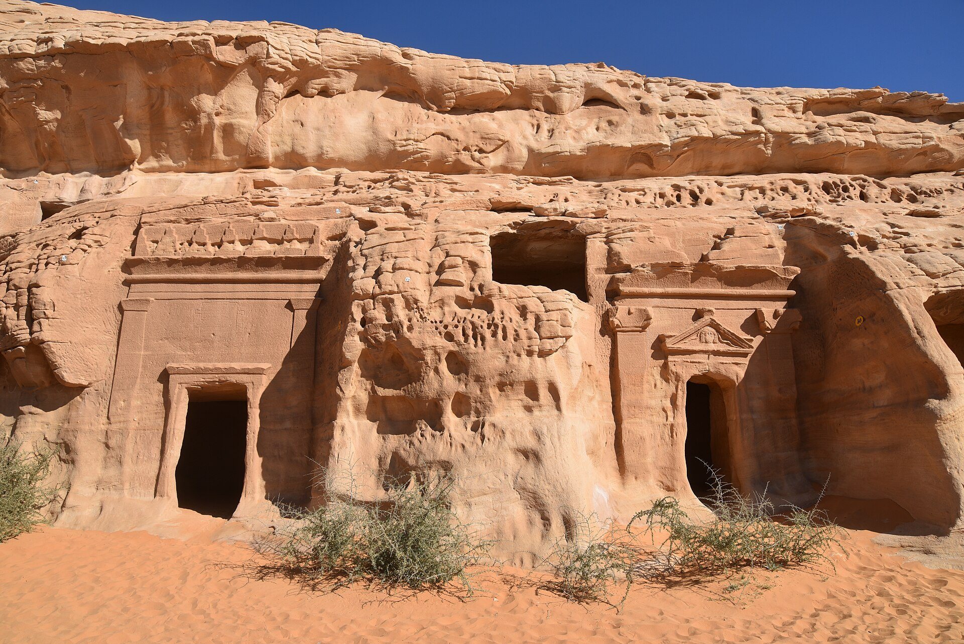
The Nabataean city included four major necropolises, or cemetery areas, containing 131 monumental rock-cut tombs spread across approximately 13.4 kilometres. Another inventory counts 153 carved façades. Around 2,000 less monumental burials are also associated with Hegra, including trenches cut into bedrock and tumuli, which are burial monuments formed as mounds of earth or stone. The variety of burial forms reflects differences in status and funerary practice.
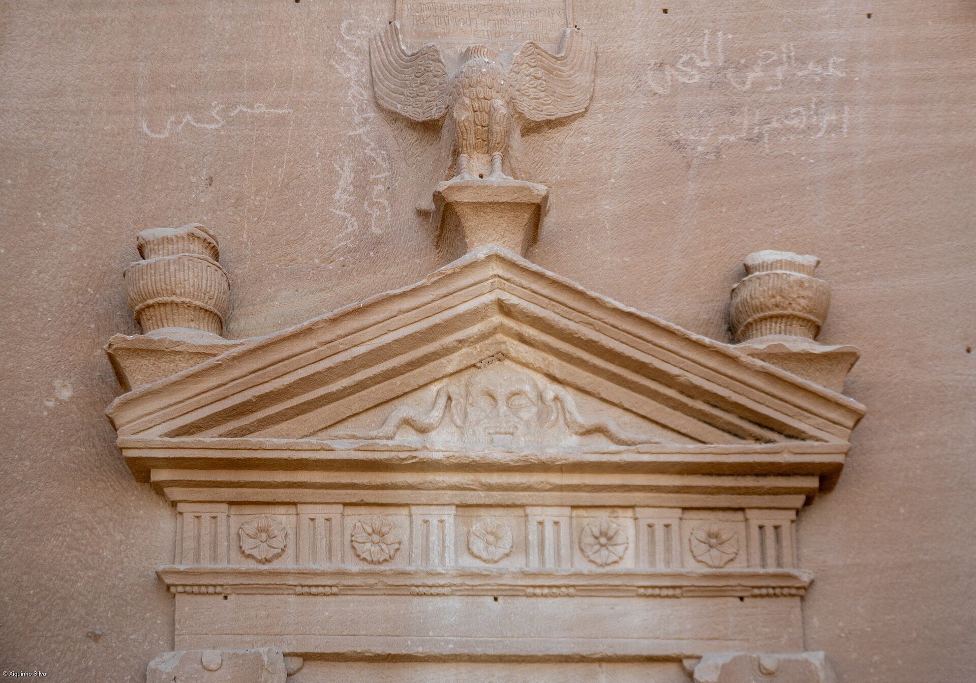
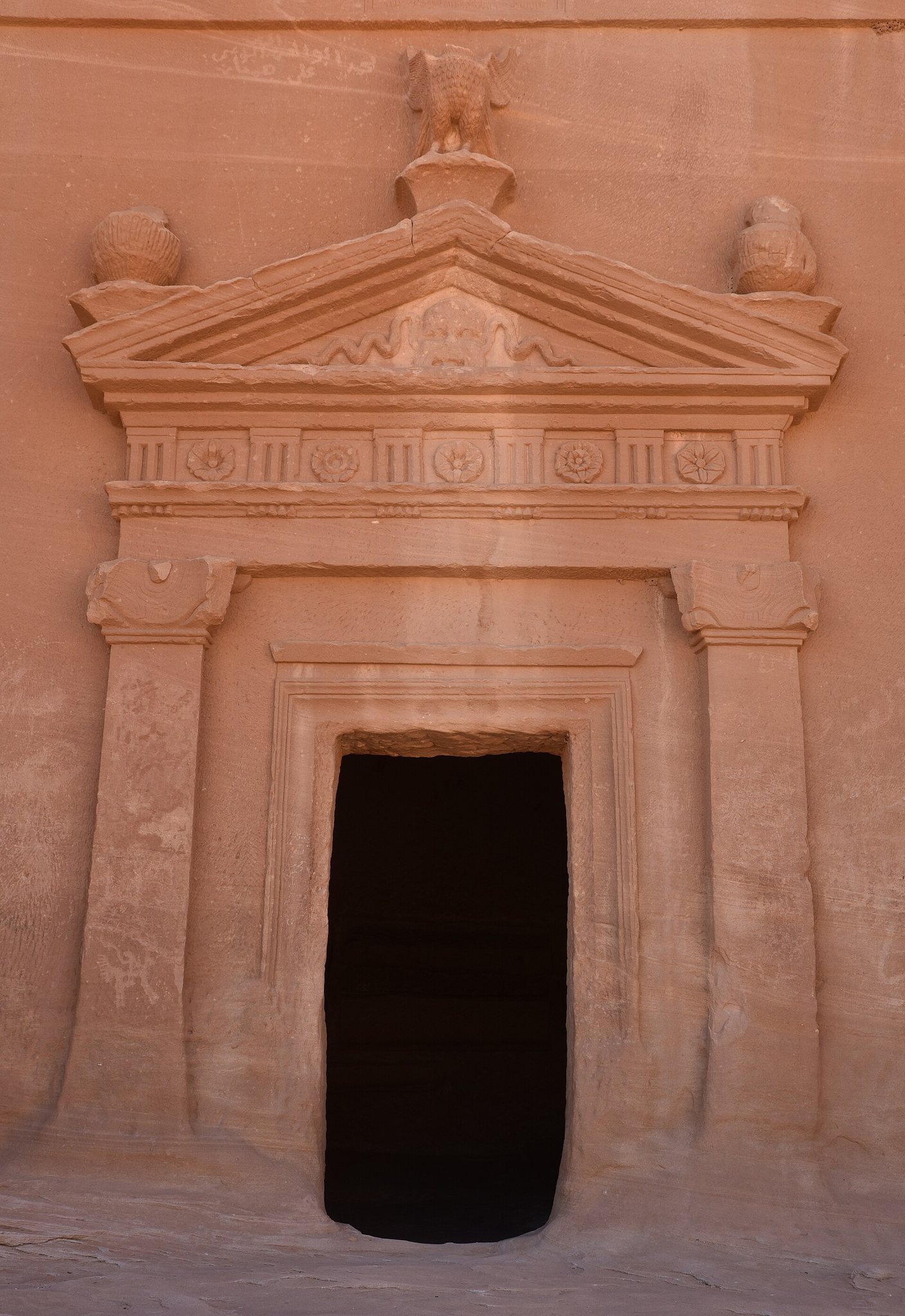
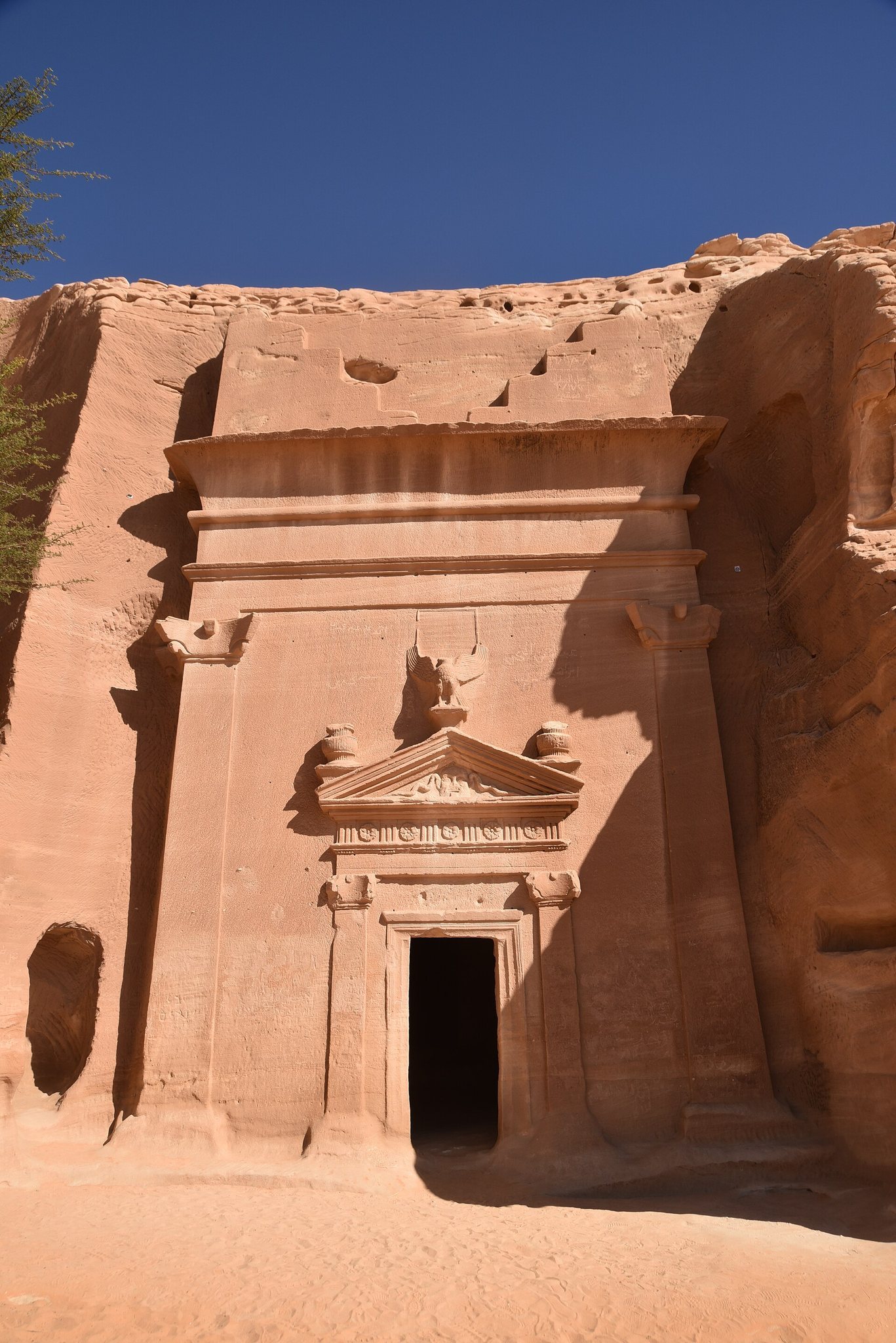
The tombs were carved directly into sandstone outcrops rather than built as freestanding monuments. Their façades combine Nabataean architectural forms with motifs derived from Assyria, Phoenicia, Egypt, Hellenistic Alexandria, and local traditions. Roman decorative details and Latin inscriptions were added during the period of Roman rule. Some façades exceed 20 metres in height, and their scale and ornamentation express the wealth and status of the people commemorated.
Inscriptions above entrances could identify owners, establish burial rights, state religious rules and penalties, give dates, or name masons. The interiors are generally simpler than the façades. Family burial chambers contain graves cut into walls or floors, with additional burials made over successive generations. Common façade details include stepped crenellations, Egyptian-style cornices, entablatures, column capitals, carved eagles, vessels, and other architectural or symbolic motifs. Traces of black or red plaster survive on some examples.
Work generally proceeded from the top of an outcrop downward. Natural platforms formed by changes in the sandstone layers helped the carvers, while horizontal channels above some façades diverted rainwater. Pointed picks, chisels, hammers, plumb lines, squares, ropes, and occasionally compasses were used. Salt layers, hidden cracks, and gravel-bearing strata sometimes interrupted the work, leaving façades or chambers unfinished. A medium-sized tomb could require about one year and two months, with façade carving taking up to seven months.
Jabal Al-Mahjar and Qasr Al-Bint
The Jabal Al-Mahjar group, also called Area A, lies north of the Qasr Al-Bint tombs. Three rock masses contain 14 Nabataean tombs, with six on the first mass, five on the second, and three on the mass known as Jabal Al-Mahjar. The Qasr Al-Bint group, or Area B, lies west of Jabal Athlib. Its larger mountain contains 31 tombs, while a smaller mountain to the northwest has two tombs on its eastern façade.
Jabal Al-Ahmar and Area D
The Jabal Al-Ahmar group, or Area C, lies southwest of Qasr Al-Bint and northwest of Area D. One rock mass contains 18 tombs and a second mass to the south contains one. Area D lies east of Qasr Al-Sane, with one tomb on each of its two mountains. Tomb 109 has a completed burial chamber but an unfinished lower façade. Tomb 111 has a completed façade while its burial chamber remains unfinished.
Al-Khuraymat and Qasr Al-Sane
Southwest of Hegra, the Al-Khuraymat area contains 53 tombs distributed among nine mountains. Its façades display varied architectural and decorative forms, while erosion and floods have affected the low-lying area. In the southern part of Hegra, the Qasr Al-Sane group consists of two rock masses. The western mass contains the tomb called Qasr Al-Sane, with stepped crenellations, two cornices, entablatures, Nabataean column capitals, and a central entrance. Six more simply carved tombs occupy the eastern mass.
Al-Farid
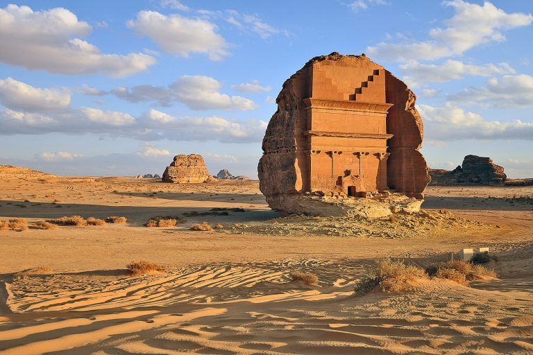
Al-Farid, meaning the “Unique Palace,” stands alone on an isolated rock mass. Its façade has two Nabataean columns in the centre of the lower section as well as side columns. It includes stepped crenellations, two cornices, an entablature, Nabataean capitals, an eagle with outspread wings, and vessel motifs. The monument is unfinished, particularly in the lower façade and the forecourt before the entrance. Its undated foundation inscription names Lihyan ibn Kuza and his descendants.
Religious buildings at Jabal Athlib
The religious area occupies the northern part of Hegra, especially the surroundings of Jabal Athlib. It contains the Diwan, temples, rock-cut sanctuaries, niches, and Qasr Al-Ajuz. Together these spaces formed a Nabataean religious centre. The complex is sometimes interpreted as being dedicated in part to Dushara, a principal Nabataean deity, but that identification remains uncertain.
The Diwan and Siq
The Diwan is a rectangular chamber cut into the mountain. Its open entrance is framed by two columns with Nabataean capitals and an entablature. Three connected raised benches occupy the interior and are reached by carved steps. Four corner columns with Nabataean capitals support a projecting frieze. Beside the chamber, a narrow passage called the Siq extends for approximately 40 metres and has inscriptions and niches along its sides.
Sanctuaries and Qasr Al-Ajuz
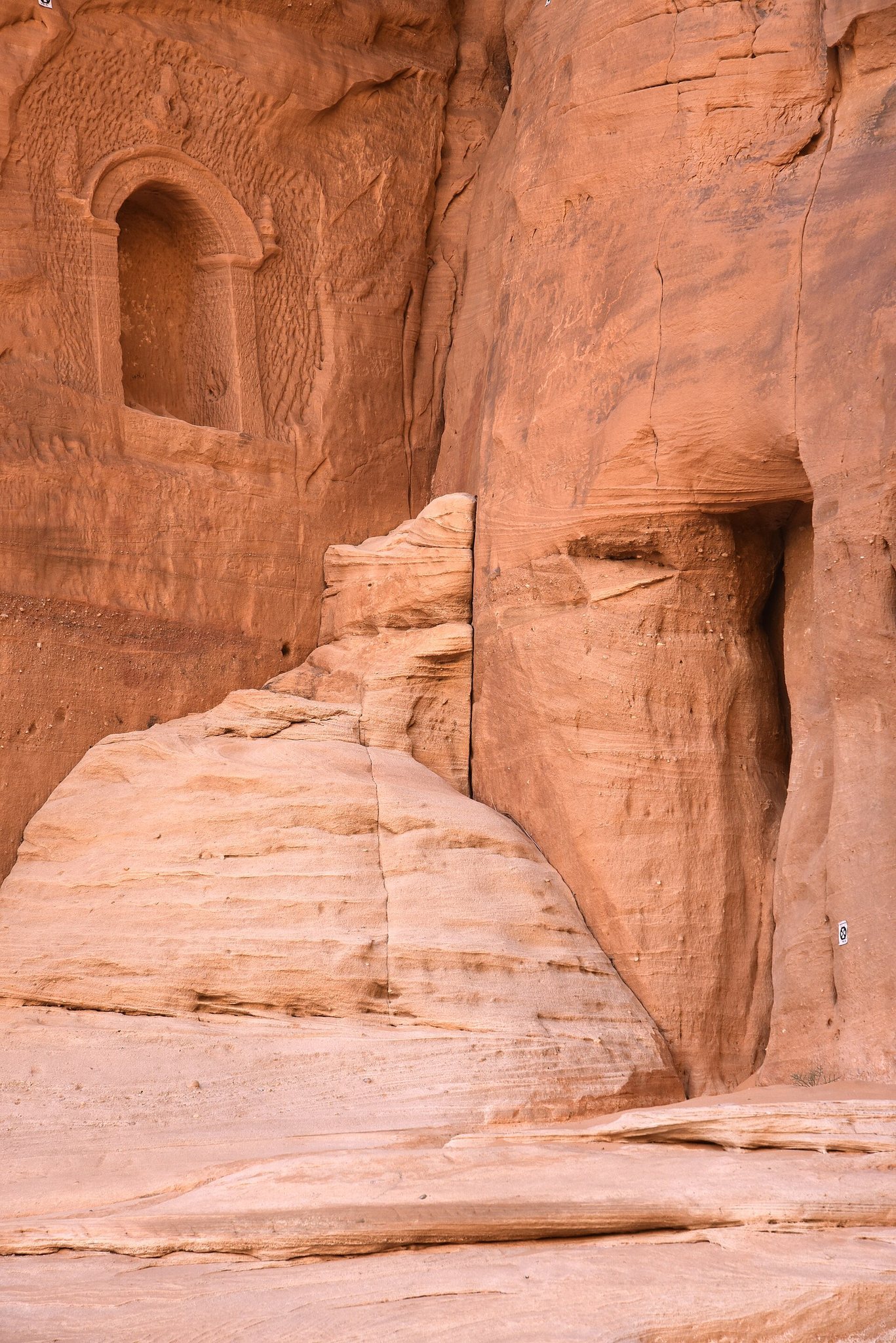
Temples and small sanctuaries are distributed across the elevations of Jabal Athlib and within the rocky depression. Some niches are recesses flanked by two columns supporting a semicircular arch, with raised representations of deities in or above them. Other niches are undecorated. South of Jabal Athlib, Qasr Al-Ajuz is described as a temple or centre for priests. Its open entrance is as wide as the carved chamber, which contains two square niches in one wall and five in the opposite wall. An additional entrance leads to a small chamber.
Residential area and water management
The residential area occupied the middle of the plain, away from the sandstone outcrops. A wall enclosed the settlement, with surviving traces on its northern, southern, and western sides. Excavation revealed several building phases, mudbrick structures on stone foundations, stone basins, columns, and capitals. Stone for construction was quarried from Jabal Al-Mahjar and neighbouring mountains. Finds included Nabataean-period coins, pottery, lamps, censers, figurines, and other objects, although only limited remains of the houses survive.
Wells, channels, and cultivation
More than 60 rock-cut wells are known at Hegra, some deeper than 30 metres. They are generally circular and narrow toward the bottom; several were lined or reinforced. Stone channels and underground cisterns formed part of the same engineered system for drawing, storing, and controlling water. Near the Nabataean well by Jabal Al-Mahjar, a channel cut into the rock carried water from the mountain toward the well.
The wells and irrigation works supported oasis agriculture. Crops included date palms, wheat, barley, olives, pomegranates, figs, lentils, peas, alfalfa, and possibly cotton. These installations made it possible to sustain the settlement and its caravan activity within a landscape receiving less than 50 millimetres of rain each year.
Earlier and later burials
Tumuli are concentrated mainly on the summits of rock formations in the southern and western parts of Hegra. More than 325 locations have been recorded, with stone mounds ranging from approximately 1.5 to 10 metres in width and some reaching about 1 metre in height. Excavation of one tumulus in 2008 revealed a tower-shaped tomb about 7.30 metres in diameter. A stone-filled partition 1.90 metres wide divided it into two units.
The tomb may date to the second or third millennium BC and differs from Nabataean burial forms, suggesting an association with another culture. It was apparently reused between the first century BC and the early third century AD. In the central residential area, prominent religious symbols also appear among the tombs.
Ottoman and railway remains
Al-Hijr fort
The Ottoman fort at Al-Hijr is a square, two-storey building. Its northern entrance opens into an internal courtyard containing a lined well, with rooms arranged around all four sides and a small prayer area to the south. The upper floor has corner towers and numerous arrow slits. A pond south of the fort was supplied by the well.
Hejaz Railway station
The Hejaz Railway station was built north of Hegra as part of the line constructed between 1901 and 1908. The complex contained 16 buildings, including locomotive and engine workshops, guard buildings, baggage stores, staff housing, rest facilities, separate toilets, and a water tank. The railway remains extend along approximately 13 kilometres of track and include locomotives, maintenance facilities, workshops, and fuel-storage structures. The restored station complex occupies an alignment about 400 metres long.
Inscriptions and recent settlement
Inscriptions at Hegra use southern Arabian, Lihyanite, Thamudic, Nabataean, Latin, and Islamic scripts. Their subjects include religious, foundation, commemorative, royal, legal, ownership, and funerary texts. Nabataean inscriptions are especially numerous on mountain and tomb façades, where they help identify ownership, burial rights, dates, and religious obligations.
The archaeological area also contains scattered one-storey mudbrick houses formerly occupied by members of the Anizah tribe. These buildings represent relatively recent settlement patterns at Hegra and are distributed separately rather than forming a continuous urban fabric.