Hague-Dick: A Defensive Earthwork on the Hague Peninsula, France
Site at a Glance
- Popularity
- Medium
- Country
- France
- Primary era
- Bronze Age
- Eras represented
- Bronze Age, Medieval
- Civilizations
- French, Norse
- Site type
- Military
- Remains
- Wall
On this page9 sections
History
Hague-Dick is a defensive earthwork on the Hague peninsula in France, attributed to the Late Bronze Age and later reused as a fortified camp by Vikings, Scandinavian seafarers who raided and settled parts of Europe during the early medieval period. Charcoal dating places the earthwork at least as early as the ninth century BC. Its barrier was intended to hinder access to the Cape de la Hague and provide a defensive stronghold behind the line.
Late Bronze Age and Viking use
Charcoal from investigations in 1951–1953 yielded a radiocarbon range of 900–800 BC. Later samples collected in 1983–1984 and 2004 produced ranges of 918–802 BC and 1206–925 BC, respectively. These results support the earthwork’s attribution to the Late Bronze Age.
During Scandinavian incursions, Vikings reused the barrier as a fortified camp. The earthwork was probably enlarged and strengthened in the ninth century.
Recorded names and proposed origins
The name also appears as Hague-Dike and Haguedic. The Vauville cartulary, a collection of copied charters and legal records, records Haguedith in 1232. A notarial office at Haguedic is recorded in 1574.
The first element has several proposed origins. Old Norse, a medieval Scandinavian language, offers hagi, meaning pasture, meadow, or enclosed cattle ground, and haka, meaning chin, cape, or promontory. Old English haga means cattle enclosure, and the 1327 English form Alano atte Haggedik has been cited in support of this possibility. Related Hague names are concentrated in Normandy, where hague was also used as a common noun in parts of Normandy and Jersey. Other comparisons point toward a Scandinavian origin: Estohague near Beaumont-Hague is recorded in 1456, and Étohague in Imbleville in 1262. Old Norse stóð-hagi, meaning horse enclosure, is considered a closer sound match than the English comparisons Stodday, recorded around 1200, and Stody, recorded in the late eleventh century. The second element, -Dick or -dic, derives from Old Norse dík or díki, meaning ditch or earthwork. The whole name is interpreted as ditch or earthwork of the Hague.
Demolition and archaeological investigation
During the reign of Henry III, king of France in the late sixteenth century, the French nobleman and military commander Anne de Joyeuse ordered the demolition of a large part of the earthwork.
Holger Arbman, Michel de Boüard, and Thorkild Ramskou excavated six sections between 1951 and 1953. Widening of the D 901 prompted further work in 1983–1984, and additional samples were collected in 2004. After archaeological research, the parcels containing remains were entered on France’s register of historic monuments in 1988.
Remains
Cross-peninsula line and rampart
The defensive line crosses the Hague peninsula from west to east, separating its tip from the rest of the peninsula. It occupies the peninsula’s narrowest point, between Vauville Bay and Quervière Bay. The full line extends about six kilometres, from Herqueville in the Vauville cove to the Sabine River at Éculleville, passing through Beaumont-Hague. The rampart itself runs for about 2,700 metres across the plateau, with a clearly visible stretch of approximately 2.6 kilometres. At its western and eastern ends, the bank gives way to small valleys with defensive potential: the Herquemoulin stream valley near Herqueville and the Sabine valley near Éculleville. The area associated with the fortification encompasses eight municipalities and two natural harbors.
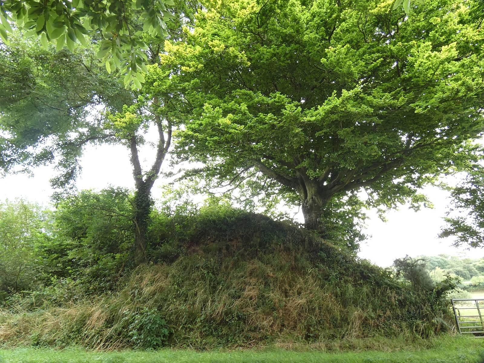
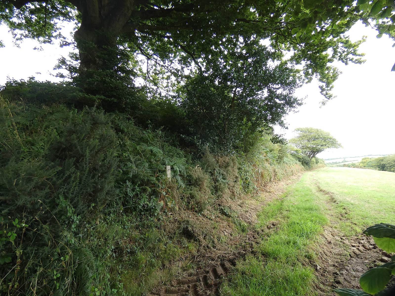
The remains include a substantial bank and ditch. The bank measures about seven to eight metres across at its base and about two metres at the top, while its height varies from 80 centimetres to seven metres. Its profile is now uneven, and trees and hedges cover much of it, blending the earthwork into the bocage landscape of small fields enclosed by hedges and trees. The best-preserved stretch lies in a meadow at Petit Parc, northwest of Beaumont, near Beaumont Castle and on its property. A test trench in the earthwork remains in its excavated state.
Associated features and archaeological evidence
Glacis, platforms, and drainage
The defensive system also included a glacis, a broad slope intended to strengthen a fortification, and two platforms that may have been divided by a wooden palisade, or stake fence. In sections prone to flooding, slabs or covered bridges allowed water from higher ground to drain away.
Excavated remains
Excavations recovered charcoal, flint, and pottery fragments. Dwellings along the earthwork date to the thirteenth and fourteenth centuries.