Great Wall of China: A Multi-Period Frontier Defense System
Site at a Glance
- Rating
- 4.4
- Popularity
- High
- Country
- China
- Primary era
- Medieval
- External website
- Open
- Eras represented
- Iron Age, Classical, Medieval, Early Modern
- Civilizations
- Han, Jurchen Jin, Liao, Ming, Qin, Zhou
- Site type
- Military
- Remains
- Wall
On this page25 sections
History
The Great Wall of China is a multi-period system of fortifications in Huairou District, China, built and repeatedly expanded by Chinese states and dynasties from the seventh century BC onward. Its earliest components belong to the Spring and Autumn and Warring States periods, while the best-known surviving sections were built or rebuilt mainly during the Ming dynasty between 1368 and 1644. Rather than a single continuous barrier, it developed as a network for defense, frontier control, communication, and the protection of imperial territory.
Early State Walls and Qin Unification
During the Spring and Autumn and Warring States periods, successive Chinese states built separate defensive walls along their borders. Zheng, Chu, Qin, Wei, Zhao, Qi, Lu, Han, Yan, Zhongshan, and Zhou each constructed fortifications to protect their territories from rival states and from peoples living north of the settled agricultural zones. These early defenses used local materials and often followed natural features such as mountains, rivers, and ridges.
In 221 BC, Qin Shi Huang unified China and became the first emperor of the united empire. He ordered the removal of walls dividing the former states and directed the construction or connection of northern defenses against the Xiongnu, a powerful people active across the northern frontier. Meng Tian, a senior Qin commander, led the northern campaign and the associated frontier-wall project. The resulting defense extended approximately from Lintao in the west to Liaodong in the east, lay farther north than the later Ming Wall, and enclosed the Ordos region within the Qin frontier.
The Qin system incorporated some earlier fortifications but was built rapidly from local materials and with the help of natural barriers. Its exact course and length remain uncertain, and much of it later eroded. The walls supported military operations as well as defense, since frontier fortifications could help armies advance, hold territory, and control movement rather than simply form a fixed boundary.
Han and Northern Dynasties
The Han dynasty repaired and extended earlier defenses after campaigns against the Xiongnu. Its walls and fortresses reached westward to Yumen Pass and the Lop Nor region, helping secure Chinese-controlled sections of the Silk Road, the network of long-distance routes linking China with Central Asia and lands farther west. These projects required extensive compulsory labor and heavy expenditure. Frontier walls also regulated movement, migration, trade, and taxation along routes connected with imperial territory.
The Northern Wei dynasty built major defenses against the Rouran, another frontier power of a later period. A wall constructed in 423 extended for more than 2,000 li, a traditional unit whose length varied historically. In 446, the Northern Wei established another defensive line intended to protect the capital if the outer wall fell. Garrisons were placed along the frontier, but long supply lines, military revolts, and the relocation of the capital weakened the system.
The Northern Qi dynasty built approximately 3,300 kilometers of walls between 552 and 564 across Shanxi, Hebei, and Henan. In 555, nearly two million laborers were reportedly mobilized for a section about 450 kilometers long. The Sui dynasty repaired and extended northern defenses in major projects carried out in 581, 585, 587, 607, and 608. These works did not prevent later large-scale incursions from the north.
From the Tang to the Jin
The Tang dynasty did not undertake a comparable major wall-building program. It relied instead on military campaigns and diplomacy in dealing with northern Turkic groups. Later, the Liao dynasty began new walls and military camps in 908. The Jurchen Jin dynasty then constructed extensive frontier defenses between 1166 and 1201, including several defensive lines.
Mongol forces led by Genghis Khan bypassed or captured parts of the Jin defenses from 1211 onward. The Yuan dynasty, founded by the Mongols, did not need the earlier northern walls as its principal defense because its rule included Mongolia and the territories from which earlier nomadic threats had emerged. The military and political purpose of the frontier system therefore changed with the extent of imperial control.
Ming Defensive Transformation
At first, the Ming dynasty relied mainly on mobile armies and frontier fortresses rather than on a continuous wall. This policy changed after the Ming defeat by the Oirats at the Battle of Tumu in 1449 and the continuation of Mongol raids. The Ming increasingly organized the northern frontier around walls, passes, garrisons, and signal stations, particularly near Beijing and along the southern edge of the Ordos Desert.
The Liaodong Wall, built mainly during the mid-fifteenth century, enclosed agricultural areas of Liaodong against Jurchen and Mongol groups. It consisted largely of an earthen embankment with moats rather than a uniformly masonry-built barrier. In the late fifteenth century, Yu Zijun directed the construction of a defensive line south of the Ordos loop. It extended for roughly 910 kilometers and included a wall about nine meters high, a protective ditch, and approximately 800 forts, towers, signal towers, and observation posts. Sandstorms later eroded much of it, while bricks were removed for reuse.
During the mid-sixteenth-century conflict with Altan Khan and other Mongol groups, Ming commanders built about 850 kilometers of additional walls southwest of Beijing. Altan Khan bypassed these defenses and reached the outskirts of Beijing in 1550, prompting further construction. From 1567, Qi Jiguang supervised the construction of about 1,200 watchtowers between Shanhaiguan and Changping and strengthened major sections of the wall. The principal surviving Ming defenses were completed or substantially rebuilt during the sixteenth and seventeenth centuries.
End of Ming Military Use
By 1644, rebellion, military failures, and the loss of frontier positions had weakened the Ming state. Li Zicheng, a rebel leader, captured Beijing. Wu Sangui, the Ming commander controlling Shanhai Pass, opened the pass to Manchu forces. The Manchus defeated Li’s army and established the Qing dynasty.
Under the Qing, the incorporation of Mongolia moved the imperial frontier north of the Great Wall and reduced the wall’s military importance. Large-scale defensive work largely ceased. The Qing instead built the Willow Palisade to restrict Han migration into Manchuria. The wall remained a major physical and historical feature, but it no longer served as the principal military boundary of the empire.
European Knowledge and Twentieth-Century History
European knowledge of the wall spread gradually through accounts from the sixteenth and seventeenth centuries. Bento de Góis, a Portuguese Jesuit traveler, entered China through Jiayu Pass in 1605 and is regarded as the first recorded European to do so through the wall. Later European writers often exaggerated the wall’s age, continuity, and uniformity, and incorrectly identified the visible Ming defenses as the work of the Qin dynasty.
During the Japanese invasion of 1933, the wall and its passes became battlefields. Japanese forces attacked with infantry, armor, aircraft, and naval artillery, and Chinese forces eventually withdrew under the Tanggu Agreement. After 1949, the wall increasingly served as a national symbol in China. A 1,300-meter section at Badaling was restored between 1953 and 1957. Further restoration and reconstruction followed the 1984 campaign associated with Deng Xiaoping, including another 750 meters at Badaling and work at a pass near Beijing.
The Great Wall was inscribed on the UNESCO World Heritage List in 1987 under cultural criteria i, ii, iii, iv, and vi. It was also voted one of the New Seven Wonders of the World in 2007. Its heritage status applies to a multi-period system whose individual sections differ greatly in date, construction, preservation, and condition.
Conservation and Damage
Conservation has been hindered by the removal of bricks and stones for houses and roads, quarrying, construction, graffiti, vandalism, erosion, sandstorms, flooding, desertification, and industrial development. A 2012 assessment found that approximately 22 percent of the Ming Wall, or 1,961 kilometers, had disappeared. Other assessments have identified further deterioration and loss.
A 2006 law made damage to the wall a criminal offense, although enforcement has remained difficult. Research and conservation have also been carried out by the China Great Wall Society, founded in 1987, and by volunteer organizations. In 2014, a section near the Liaoning-Hebei border was repaired with concrete, a method widely criticized. In 2023, construction workers widened an existing gap in a Shanxi section for an excavator, causing what was described as irreversible harm to the integrity of the Ming Great Wall and its cultural relics.
Remains
The surviving Great Wall consists of an extensive defensive network rather than one uninterrupted masonry structure. It includes walls, earthen ramparts, trenches, ditches, natural barriers, forts, passes, watchtowers, signal towers, camps, and associated buildings. A comprehensive survey counted 10,051 wall sections, 1,764 ramparts or trenches, 29,510 individual buildings, and 2,211 fortifications or passes. The associated walls and trenches together extend for approximately 21,196.18 kilometers.
Extent and Construction
The Ming defensive system measures approximately 8,850 kilometers, including about 6,259 kilometers of wall, 359 kilometers of trenches, and 2,232 kilometers of natural barriers such as hills and rivers. Qin, Han, and earlier wall sites together measure about 3,080 kilometers, while the Jin frontier fortifications measure about 4,010 kilometers. The system extends broadly from Liaodong in the east to Lop Lake in the west, and from the present Sino-Russian border region in the north toward the Tao River in the south.
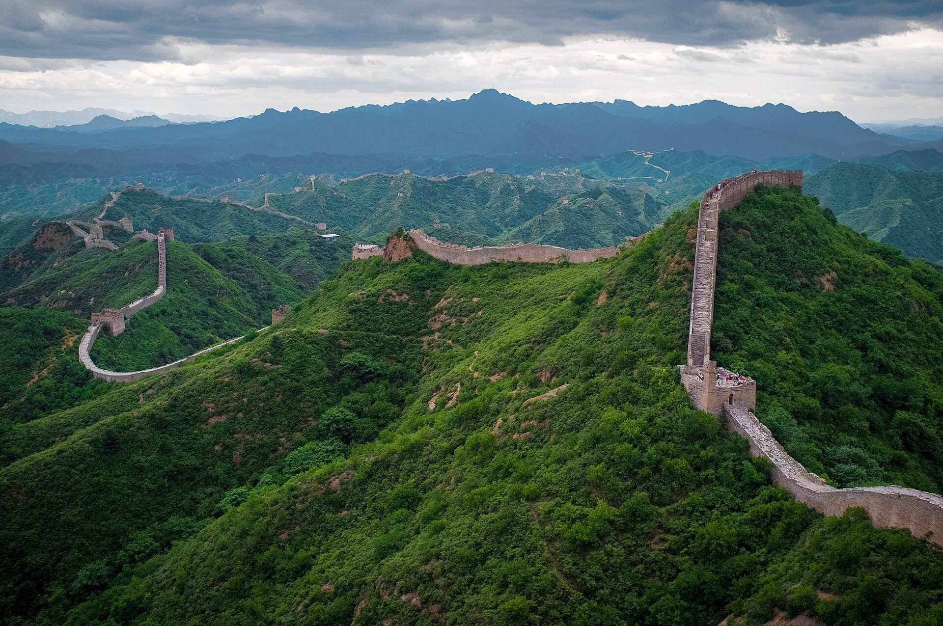
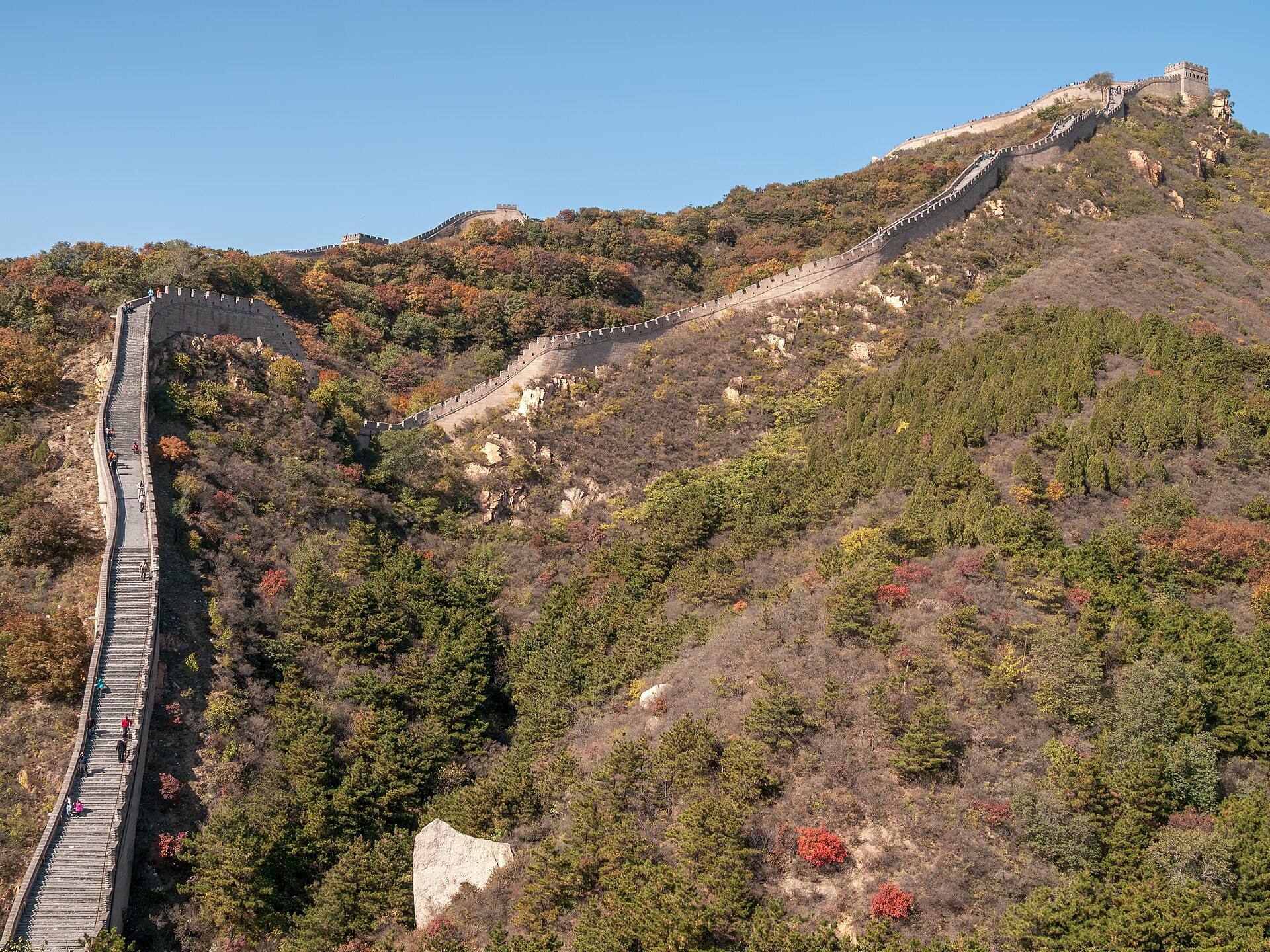
Individual lines often follow mountain ridges, with branches extending from a principal wall. Some frontier zones contain two or three parallel lines. Mountains, rivers, ravines, and ridges form part of the defense, so the masonry or earthen wall is discontinuous in many areas. Ditches, river crossings, fortified passes, and earthworks supplement the main lines. At Jiumenkou, the wall itself forms a bridge over a river.
Early construction used rammed earth, stone, wood, and locally available rubble. In mountainous terrain, builders quarried stone, while on plains they compressed damp earth, sand, gravel, and clay between timber frames. Rammed earth was laid in successive layers about 10 to 15 centimeters thick and compressed to approximately half its original height. The technique was economical and rapid, but its surfaces were especially vulnerable to erosion.
Ming builders made greater use of fired brick, dressed stone, tile, lime, and mortar. Many Ming walls have an earthen core faced or enclosed by stone or brick. Sticky-rice mortar, made by mixing sticky-rice soup with slaked lime, was used extensively to bind bricks. Some bricks were fired in kilns near the construction site, while others were transported from locations as far as 80 kilometers away.
Walls, Towers, and Military Facilities
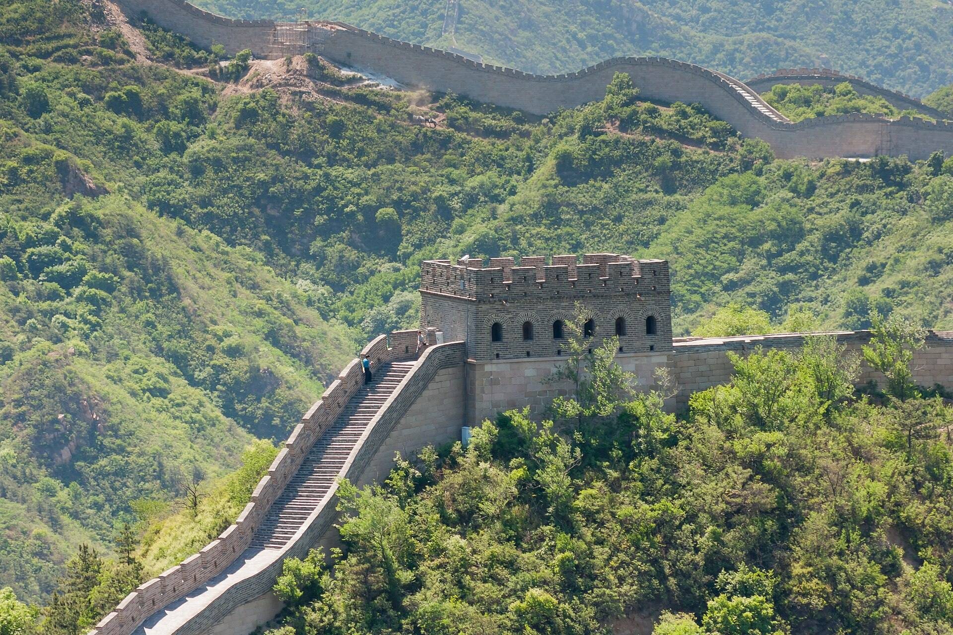
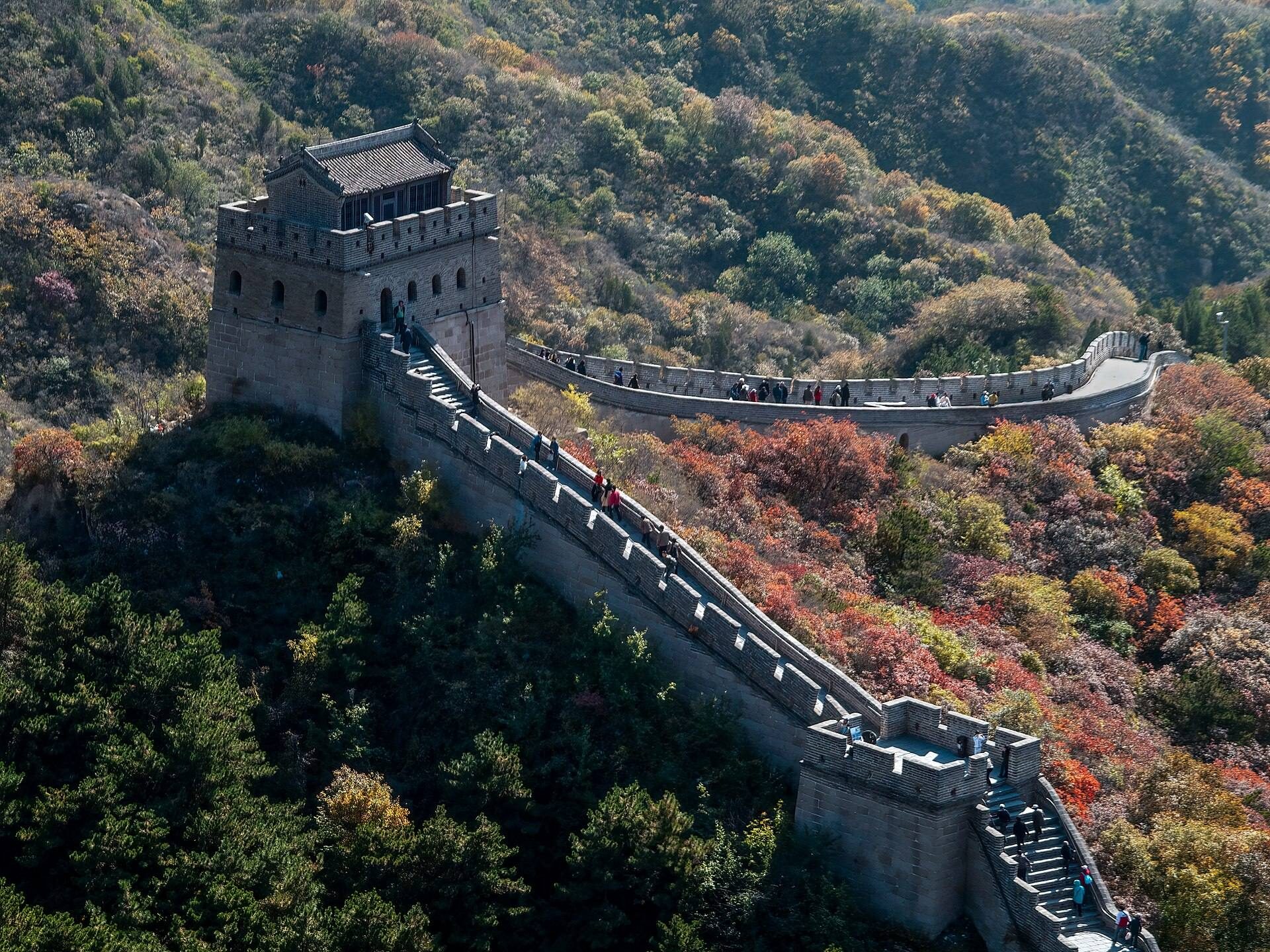
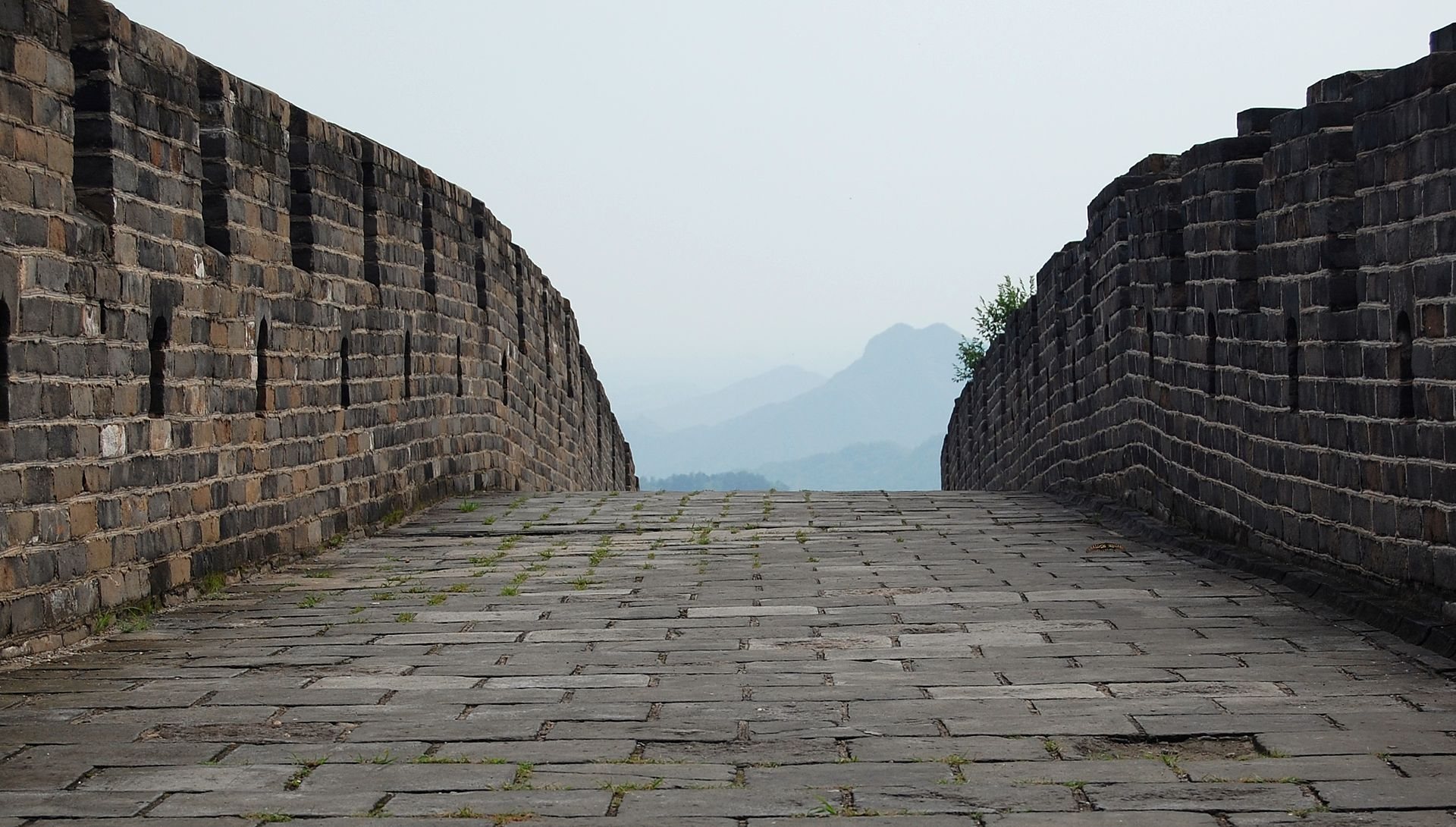
The upper surface was broad enough for military movement and transport. At the broadest stone sections north of Beijing, five horses could ride abreast. Battlements generally line the upper edges, with defensive openings slightly more than 30 centimeters high and approximately 23 centimeters wide. Height varied with the terrain. On plains, walls commonly rose seven to eight meters, while sections on steep ridges could be only about two meters high because they continued the natural slope. Other Ming sections reached approximately 14 meters in height and nearly six meters in width.
Watchtowers and signal towers served for observation, communication, defense, shelter, storage, and garrisoning. Towers were commonly spaced between about 500 meters and four kilometers apart, while high-risk areas could have towers only 30 to 50 paces apart. Signal towers used smoke by day and fire by night, with signals arranged within visual and audible range. Towers ranged from approximately the height of the wall to twice its height. Some were open platforms reached by external ladders, while others contained rooms for food, fuel, and accommodation.
Signal towers could be staffed by five to ten people, whereas larger garrison towers could house 50 or more. The Tower for Receiving Distant Nations at Sifengkou reportedly accommodated up to 10,000 people. Barracks, stables, armories, camps, garrison stations, administrative buildings, and storage facilities stood along or immediately inside the wall. Wooden gates could function as defensive traps, and the wall also served as a military transportation route.
Western and Eastern Passes
Jiayu Pass
Jiayu Pass in Gansu forms the western terminus conventionally assigned to the Ming Great Wall. Its trapezoidal fortress covers about 33,500 square meters, has walls approximately 733 meters in circumference and 11 meters high, and contains eastern and western gates. It was first built in 1372 and later expanded in anticipation of a possible invasion by Timur, which did not occur.
Shanhai Pass
Shanhai Pass in Hebei forms the traditional eastern terminus. Its square fortress has a circumference of about four kilometers, walls 14 meters high and seven meters thick, moats on three sides, drawbridges, and gates on all four sides. The remaining eastern gate carries the inscription “First Pass Under Heaven.” At the Old Dragon Head, the wall extends approximately 20 meters into the Bohai Gulf. Jiaoshan Great Wall, about three kilometers north of Shanhai Pass, is identified as the first mountain climbed by the Great Wall.
About 15 kilometers northeast of Shanhai Pass, Jiumenkou is a section where the wall forms a bridge over a river. These structures show how the defensive system incorporated water crossings and varied terrain into its design.
Sections Near Beijing
Badaling
Badaling, northwest of Beijing, extends for about five kilometers and contains 19 watchtowers. Its wall is approximately eight to ten meters high, six meters wide at the base, and five meters wide at the top, allowing five horsemen to ride abreast. Watchtowers and observation towers occur at intervals of about 500 meters.
Juyong Pass
Juyong Pass lies south of Badaling and controlled a major valley route toward Beijing. Its associated wall is approximately 7.8 meters high and five meters wide. Stone and brick for the construction were quarried from the surrounding hills.
Jinshanling
Jinshanling is a steep, mountainous Ming section about 11 kilometers long. It is five to eight meters high, six meters wide at the base, and about five meters wide at the top. Wangjing Lou, one of its 67 watchtowers, stands approximately 980 meters above sea level.
Mutianyu
Mutianyu extends for approximately 2.25 kilometers through rugged mountains between Juyong Pass and Gubeikou. Built in 1569 over an earlier Northern Qi wall and restored in 1988, it is made of granite, rises about seven to eight meters, and is four to five meters wide at the top. A passage through the wall between three towers protects the Mutianyu pass.
Jiankou and Huanghuacheng
Jiankou follows a cliff edge and is partly ruined, with only a small portion restored. Huanghuacheng, another section north of Beijing, also remains partly ruined and had not been restored by 2020. Their surviving fabric reflects the varied condition of different sections within the wider system.
Earlier and Earthen Frontier Sections
Han Passes
The Han frontier system included Yumen Pass and Yang Pass southwest of Dunhuang in Gansu. The remote Han border post at Mamitu near Yumen Pass is among the known remains of this earlier defensive network.
Liaodong Wall
The Ming Liaodong Wall was chiefly an earthen embankment with moats on both sides. Stone and tile were used in some locations. Its construction enclosed agricultural territory and demonstrates that the Ming frontier was not uniformly made of high masonry walls.
Western Earthen Walls
Many western sections were built from mud or rammed earth rather than brick and stone. In some places, walls that originally stood more than five meters high have been reduced to less than two meters, while square lookout towers have disappeared. Sections north of Beijing and near major visitor centers have been extensively preserved or reconstructed, whereas remote sections are ruined, partly vanished, or entirely lost.
Branches, Discoveries, and Changing Condition
The Ming Wall divides near Piantou Pass into an Outer Great Wall running along the Inner Mongolia and Shanxi border toward Hebei, and an Inner Great Wall running approximately 400 kilometers southeast through Pingxing Pass and Yanmen Pass before rejoining the outer line near Sihaiye in Beijing’s Yanqing area.
Previously unknown Ming sections totaling about 180 kilometers were identified in 2009 among hills, trenches, and river areas through the use of infrared range finders and GPS. In March and April 2015, nine additional sections totaling more than 10 kilometers were identified along the Ningxia-Gansu border. These discoveries add to the understanding of a defensive system whose individual lines, branches, and outlying fortifications were built in different periods and survive in sharply varied conditions.