Archaeological Site of Gisacum: A Gallo-Roman Sanctuary Town in France


Site at a Glance
- Rating
- 4.3
- Popularity
- Low
- Country
- France
- Primary era
- Classical
- External website
- Open
- Eras represented
- Classical, Medieval
- Civilizations
- Celtic, Roman
- Site type
- City
On this page15 sections
History
Archaeological Site of Gisacum is a Gallo-Roman sanctuary town in France, founded by the Aulerci Eburovices near their political and economic capital, Mediolanum Aulercorum, now Evreux. Developed from the mid-first century BC into the early third century AD, it combined local Gallic traditions with Roman urban, religious, and architectural practices. Mediolanum served as the secular capital, while Gisacum became the religious center of this Celtic people of northern Gaul.
Origins and urban development
The earliest remains in Gisacum’s central sanctuary postdate the Roman conquest of the region in the mid-first century BC. Their exact function is uncertain, although a sacred place is considered likely. Occupation became substantial during the Augustan period, the reign of Augustus, Rome’s first emperor, and the sanctuary was extensively reorganized under Tiberius, who ruled from AD 14 to 37.
A first urban plan emerged during the third quarter of the first century AD. Residential districts developed west of the sanctuary and north of the Champ des Des, a public complex interpreted as a forum or equipped square. In the early second century, these areas were demolished during a major reorganization. Gisacum was then arranged as an unusually planned city, with monumental public buildings concentrated in the center and housing, workshops, and commercial activity moved to the perimeter.
The settlement covered approximately 230 to 250 hectares and flourished from the middle of the second century into the early third century. It was among the largest urban settlements in Gaul. Its three principal public monuments, the sanctuary, baths, and theatre, were associated with religious festivals. Pilgrims bathed, offered tribute to the gods, and attended performances that were probably religious in character. A marketplace and additional Gallo-Roman temples supported this religious center.
The sanctuary and religious life
The sanctuary reached its latest monumental form during the Severan period, the Roman imperial dynasty that ruled mainly from AD 193 to 235. It probably honored Apollo Gisacus, a local deity identified by the Romans with Apollo, together with Jupiter and a third deity whose identity remains unknown. Other evidence points to the worship of Mercury, Mars, and possibly the Roman emperor.
Gisacum’s religious role continued alongside its urban functions until activity declined and apparently ceased around the middle of the third century. The baths were abandoned at that time. The central sanctuary was later converted into a castellum, a fortified enclosure, with a broad, deep ditch and a substantial inner earth rampart. At the end of the third century or during the fourth century, the complex was destroyed, probably through a public decision to recover stone for the defensive wall of nearby Evreux. The population appears to have moved toward Mediolanum, and the buildings became a source of construction material.
Medieval reuse and archaeological investigation
The former sanctuary was reused as a necropolis from the sixth century. Its mound of demolition debris and partly filled defensive ditch were later incorporated into a fortified residence, probably during the twelfth century. The site became associated with the medieval seigneurs of Le Vieil-Evreux, whose lordship was attached to the bishopric of Evreux, and a parish church was built at the angle of the former sanctuary.
The ruins were discussed in the seventeenth century by Louis de Boislambert, the parish priest of Le Vieil-Evreux. Stone was quarried from them between 1765 and 1770 for the Paris to Lisieux road. François Rever conducted the first excavations from 1801 to 1804 and published a report in 1827. Charles de Stabenrath excavated in 1829, followed by major investigations by Theodose Bonnin from 1838 to 1841. Bonnin was the first to use the name Gisacum officially in an excavation report and recovered statues of Jupiter and Apollo.
Émile Espérandieu and Henri Lamiray excavated from 1911 until the First World War, and further work took place from 1933 to 1939. Marcel Baudot identified the Fanum of the Spring near the baths in 1936. Research continued later in the twentieth century, including work by Joël Le Gall, while recent archaeological campaigns began in 1996. Aerial archaeology during the drought of 1976 revealed the scale of the buried settlement.
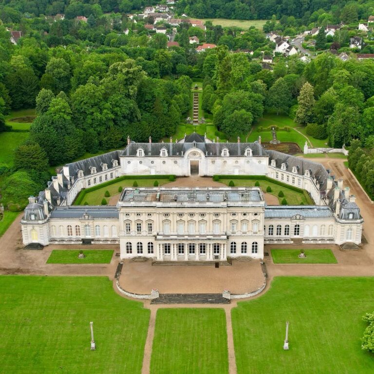
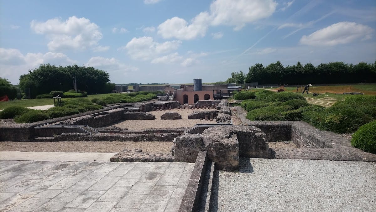
The name Gisacum was adopted in the nineteenth century after the discovery of an inscription mentioning the deity Gisacus. Auguste Le Prevost associated the ruins with the “villa of Gisai” named in the ninth-century Life of Saint Taurin, but the settlement’s exact ancient name remains uncertain. The large sanctuary at Cracouville, identified with Gisacum’s principal sanctuary, was classified as a French historic monument in 1951. The thermal complex was acquired by the Eure department during the 1830s, later incorporated into an archaeological garden opened in 2002, and accompanied by an archaeological interpretation center opened in 2005.
Remains
Urban layout and setting
Gisacum occupied a high plateau near the head of a slight valley, at approximately 133 metres above sea level. Its distinctive plan placed a monumental center within open areas and surrounded it with an almost hexagonal peripheral road approximately 5.6 kilometres long. Houses stood along this road, with their porticoes and fronts facing inward toward the sanctuary. The built peripheral belt covered approximately 60 hectares.
The central area contained the sanctuary, baths, theatre, forum or marketplace, and other temples. Three roads led from the settlement toward the south, east, and Evreux. This arrangement separated the principal public and religious buildings from the residential, craft, and commercial districts established around the edge of the town.
The sanctuary complex
Severan temples and enclosure
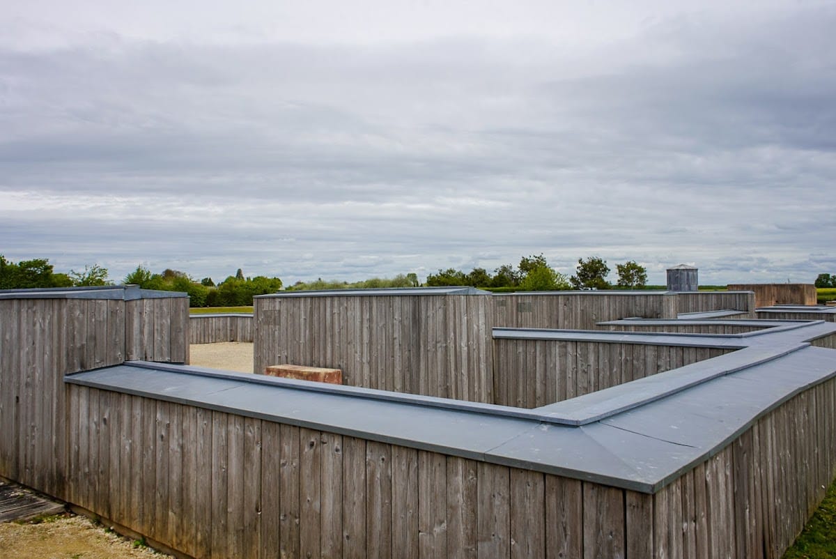
The sanctuary stood at the center of Gisacum inside a consecrated enclosure measuring approximately 6 to 8 hectares, with one reconstruction giving an area of 6.8 hectares. In its Severan form, three colossal temples occupied connected podiums and were joined by galleries. The central temple was slightly taller than the northern and southern buildings and probably reached about 25 metres. Their podiums are reconstructed at nearly 6 metres above ground level.
Each temple combined a Gallo-Roman plan, with a central cella, the principal enclosed chamber, surrounded by a gallery, with an outward-facing Italic entrance design. The projecting portico had a single row of eight columns, a form known as prostyle octastyle. Exterior walls were approximately 2 metres thick and built from large limestone blocks. Later destruction removed most of the blocks, leaving foundation impressions and fragments of capitals, cornices, and figured friezes.
The central temple was connected to the northern and southern temples by galleries. On the eastern side, a terrace overlooked the court by nearly 6 metres. Two very large wells were identified on the southern terrace, including one with an opening approximately 1.70 metres wide.
Earlier temple phases
Earlier sanctuary phases included a circular masonry temple probably built around the middle of the first century. It had a central chamber and a columned gallery. The chamber had a chalk floor, while the gallery used concrete made from limestone aggregate and lime mortar.
Two square twin temples of the fanum type, each consisting of a central chamber surrounded by a gallery, were added soon afterward. Their galleries initially had pink concrete floors containing fragments of tile. During a later phase, probably in the second century, monumental limestone paving was installed. Some slabs survive, together with impressions left where paving was removed during the destruction of the temples.
The first group of three temples stood inside an earlier enclosure covering several thousand square metres. A monumental paved area lay to the east, while a heavily used earthen court occupied the west. The temples may later have been moved to the southwestern side of a new enclosure extending across several hectares. During conversion into a fortified enclosure, a broad deep ditch was dug around the central group and paired with an inner earth rampart. The eastern temple court appears to preserve the floor of this defensive phase.
Baths, theatre, and public buildings
Thermal complex
The baths occupied a complex approximately 109 by 84 metres in the southwestern part of the town. By the early third century, they consisted of a service courtyard with latrines to the south, a central public bathing building, and a palaestra, an open-air exercise area, to the north.
The bathing building was divided into two symmetrical suites on either side of a central heating room. Each suite contained a changing room, a cold room, two warm rooms, and a hot room. The palaestra was used for wrestling, shot put, and ball games. The service courtyard held equipment needed to operate and maintain the baths. The aqueduct supplied the pools and fountains, while wastewater was reused to clean the latrines before leaving the town through a sewer.
Theatre
The theatre measured 106 metres in diameter and could accommodate at least 7,000 people. Surviving remains include masonry and the general form of the seating area. Its monumental entrance was approximately aligned with the temple and opened directly onto the orchestra, supporting the interpretation of ceremonies and performances with a religious character.
François Rever investigated the theatre in the early nineteenth century, and Theodose Bonnin partly excavated it in 1840. Topographical surveys and geophysical investigations in 1997 and 1998 clarified its later plan. An earlier theatre may lie beneath the surviving structure, although its date and form remain unknown.
Forum and semicircular marketplace
The Champ des Des consisted of a marketplace formed by several squares or yards enclosed by buildings. Its proximity to Evreux and Gisacum’s role as a religious twin city suggest that some municipal activities may have been transferred there during major festivals.
A separate semicircular building near the baths measured approximately 35 metres in diameter. Numerous Gallic coins, mostly dating from after the Roman occupation and before the end of the third century, were found there. Once interpreted as a fountain building, it is now considered probably to have been a marketplace crossed by a small channel, since parts of its construction were made of timber. Destroyed in the middle of the third century, it was later used for a time as a slaughterhouse.
Water supply and additional temples
Gisacum was supplied by an aqueduct approximately 25 to 27 kilometres long, of which about 19 kilometres are securely known. Its source remains uncertain. It probably drew water from chalk groundwater near the Iton valley upstream from Damville or from a diversion of the Iton itself.
The aqueduct reached Gisacum at approximately 133 metres above sea level from a probable intake near 140 metres, giving a reconstructed average gradient of about 35 centimetres per kilometre. Much of its course was underground, including a section approximately 15 to 20 metres below ground at Buisson Chevallier. Regularly spaced access shafts served the waterway. Below 5 metres, the Roman engineers generally used open trenches that were backfilled after construction. Near Gisacum, embankments, a canal bridge, and at least one earlier wooden bridge carried the aqueduct across three small valleys.
At the town entrance, the aqueduct discharged into a distribution basin that divided the supply into two principal branches. The system served domestic buildings and public monuments. Several additional fana, or small Gallo-Roman temples, stood within Gisacum, and others have been identified within approximately 15 kilometres of the town. A portico also formed part of the settlement’s built environment.
Finds and preservation
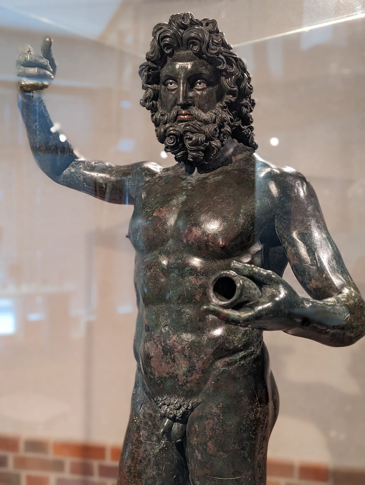
Religious statues and a ceremonial mask were recovered from the sanctuary. Local workshops produced bronze statues of Jupiter and Apollo during the first century. The Jupiter statue is approximately 91 centimetres high. The Apollo statue, approximately 68 centimetres high, has damaged arms and wears a crown associated with his status as a city deity.
Other finds include statues of Hercules, Mercury, and Minerva, a statuette of Silenus, coins, jewellery, and additional religious fragments. The principal sculptures are preserved in the Museum of Evreux. The sanctuary has unusually well-preserved archaeological layers reaching approximately 4 metres in depth. Earlier remains survive beneath the later complex, while the rich architectural decoration of the Severan period is represented mainly by fragments after extensive destruction and nineteenth-century excavation. The archaeological garden around the baths presents the scale and arrangement of the complex as reconstructed for the early third century.