Garrison Point Fort: A Coastal Artillery Fort at Sheerness


Site at a Glance
- Rating
- 3.9
- Popularity
- Low
- Country
- United Kingdom
- Primary era
- Modern
- External website
- Open
- Eras represented
- Modern
- Civilizations
- British
- Site type
- Military
- Remains
- Fort
On this page9 sections
History
Garrison Point Fort is a nineteenth-century armoured artillery fort at Sheerness in the United Kingdom, built by Britain between 1861 and 1872 under the fortification programme that followed the 1860 recommendations of the Royal Commission on the Defence of the United Kingdom. It occupied the end of the Garrison Point peninsula, guarding the strategic junction of the River Medway and the Thames against naval attack and a feared French invasion.
Early defences and the seventeenth-century fort
The position was important because the Thames formed a major trade route and contained vital naval and military facilities. These included the victualling yards at Deptford, Woolwich Arsenal, the shipbuilding yards at North Woolwich, and the magazines at Purfleet. A square blockhouse stood at Garrison Point by 1547, during the reign of Henry VIII, whose government established coastal artillery defences at strategically important locations around England.
A new fort was already replacing the blockhouse when the older structure was destroyed during the June 1667 Raid on the Medway, an attack by the Dutch during the Second Anglo-Dutch War. The defences were rebuilt as a bastion fort by 1669 to designs by Bernard de Gomme, a seventeenth-century military engineer associated with fortifications in England. A bastion fort used projecting angular sections to allow defenders to fire along the faces of its walls. The Half Moon Battery and Cavalier Battery were added later.
Victorian reconstruction
By the nineteenth century, the earlier red-brick defences were considered unable to withstand modern artillery. The Royal Commission’s 1860 recommendations led to their replacement by the present armoured fort on the same site. Construction began in February 1861 and continued until the final armour was installed in June 1872, although about half of the guns had been fitted by that time.
The fort’s intended field of fire overlapped with Grain Fort, Grain Tower, and later the Grain Wing Battery and Dummy Battery on the opposite bank of the Medway, on the Isle of Grain. It was initially armed with 9-inch and 10-inch rifled muzzle-loading guns. These were loaded from the front and used rifled barrels to improve the accuracy of their projectiles. By 1880, the armament also included 11-inch and 12.5-inch rifled muzzle-loaders.
Changing armament and twentieth-century defence
A Brennan torpedo station was added in 1884 and remained in use until about 1906. The Brennan torpedo was wire-guided from a shore station, and rails allowed it to be launched from the fort. The large rifled muzzle-loaders had become obsolete by the end of the nineteenth century and were removed by 1896. Their casemates were converted into barracks and stores.
In 1909, two 6-inch Mark VII breech-loading guns were installed on the roof, while four 12-pounder quick-firing guns were placed in a lower casemate tier. Breech-loading guns were loaded from the rear, and quick-firing guns were intended to engage rapidly moving targets. During the First World War, a coastal-artillery searchlight, a concrete magazine, and a machine-gun pillbox were built east of the fort. The pillbox later disappeared.
The fort remained in service during the Second World War and received two twin 6-pounder quick-firing guns for defence against fast-moving attackers such as E-boats and destroyers. New gun emplacements, gun towers, a magazine, and a searchlight emplacement were also added. By 1944, the reduced threat of invasion or seaborne attack allowed the fort to be placed on care-and-maintenance status, meaning that it was no longer fully active but remained suitable for maintenance or possible reactivation.
Post-war use and preservation
After the Second World War, the Royal Navy Auxiliary Service used the fort as an emergency port-control centre for a possible nuclear war. Part of the disused magazine became a bunker for nuclear-defence officials. The fort was decommissioned in 1956 when the United Kingdom ended its coastal-defence programme, then sold to the owners of the adjacent Sheerness Docks.
It subsequently became a port installation and served during the 1980s as a terminal for a ferry service to continental Europe that has since ceased operation. A navigational radar-control tower was installed on the roof in 1962, and port use brought further changes, including a walkway through one casemate to the former ferry terminal. Garrison Point Fort has been a Grade II listed building since 1977, recognizing its special architectural or historic interest in England. It also forms part of the wider Sheerness defences, which are protected as a scheduled monument. The fort is owned by Medway Ports Ltd, the operator of Sheerness Docks.
The fort is on the Heritage at Risk Register because it is undergoing slow decay. Its military fittings have largely been removed, while the roof and much of the interior are derelict and deteriorating. The main structure nevertheless remains basically intact, with traces of its original fittings surviving.
Remains
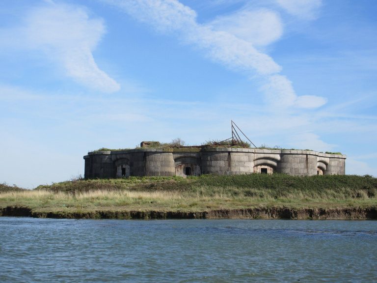
Garrison Point Fort is a semi-circular, two-tiered casemated artillery fort. A casemate is a fortified chamber designed to house artillery or provide a protected firing position. Each of the two gun floors contains 17 granite-faced casemates, which originally accommodated 36 heavy guns behind about 2,000 tons of iron armour. The main structure is built largely of brick, with concrete additions, and its walls and piers are approximately 4.4 metres thick. Two further gun turrets were planned for the roof but were never built. The magazines were placed underground in the basement.
Casemated gun floors
The two vertically arranged gun floors form the principal surviving body of the fort. Their granite-faced openings were designed to protect heavy artillery while directing fire across the Medway and the Thames approaches. The casemates later served as barracks and stores after the original muzzle-loading guns were removed. Port operations subsequently altered one of them by creating a walkway to the former ferry terminal. The roof and much of the interior are now severely decayed, although the substantial brick, concrete, and armoured structure survives.
Defensible rear buildings
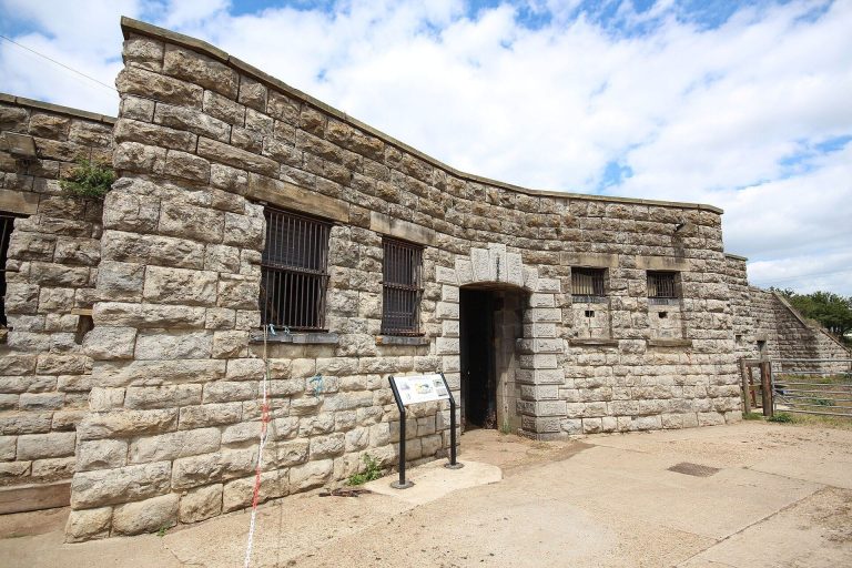
The rear of the semi-circular casemate row is closed by defensible buildings made from ashlar blocks of Kentish ragstone. Ashlar consists of regularly cut and finished masonry blocks laid in even courses. The flanks contain loopholes and gun ports for close defence, while a parade ground occupied the centre of the fort. These elements complete the protected rear of the artillery position and retain the relationship between the casemate row and the internal open space.
Torpedo station and later additions
The Brennan torpedo station survives beside a substantial portion of its launching rails. The remaining metalwork is badly corroded, but the rails preserve the physical arrangement of a weapon system intended to send wire-guided torpedoes from the shore against vessels. The later roof radar-control tower, installed in 1962, reflects the fort’s conversion to port-related use after its military decommissioning.
Other twentieth-century additions included gun emplacements, gun towers, magazines, searchlight positions, the First World War concrete magazine, and the Second World War installations for quick-firing guns. The machine-gun pillbox built east of the fort during the First World War no longer survives. Within the fort, the former nuclear-defence bunker occupied part of the disused magazine, linking the underground spaces to the post-war emergency-control role.