Gallo-Roman Temple in Izernore: A Roman Sanctuary
Site at a Glance
- Popularity
- Medium
- Country
- France
- Primary era
- Classical
- Eras represented
- Classical
- Civilizations
- Roman
- Site type
- Religious
- Remains
- Temple
On this page17 sections
History
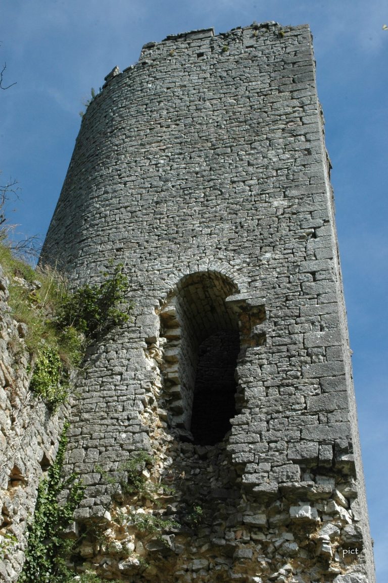
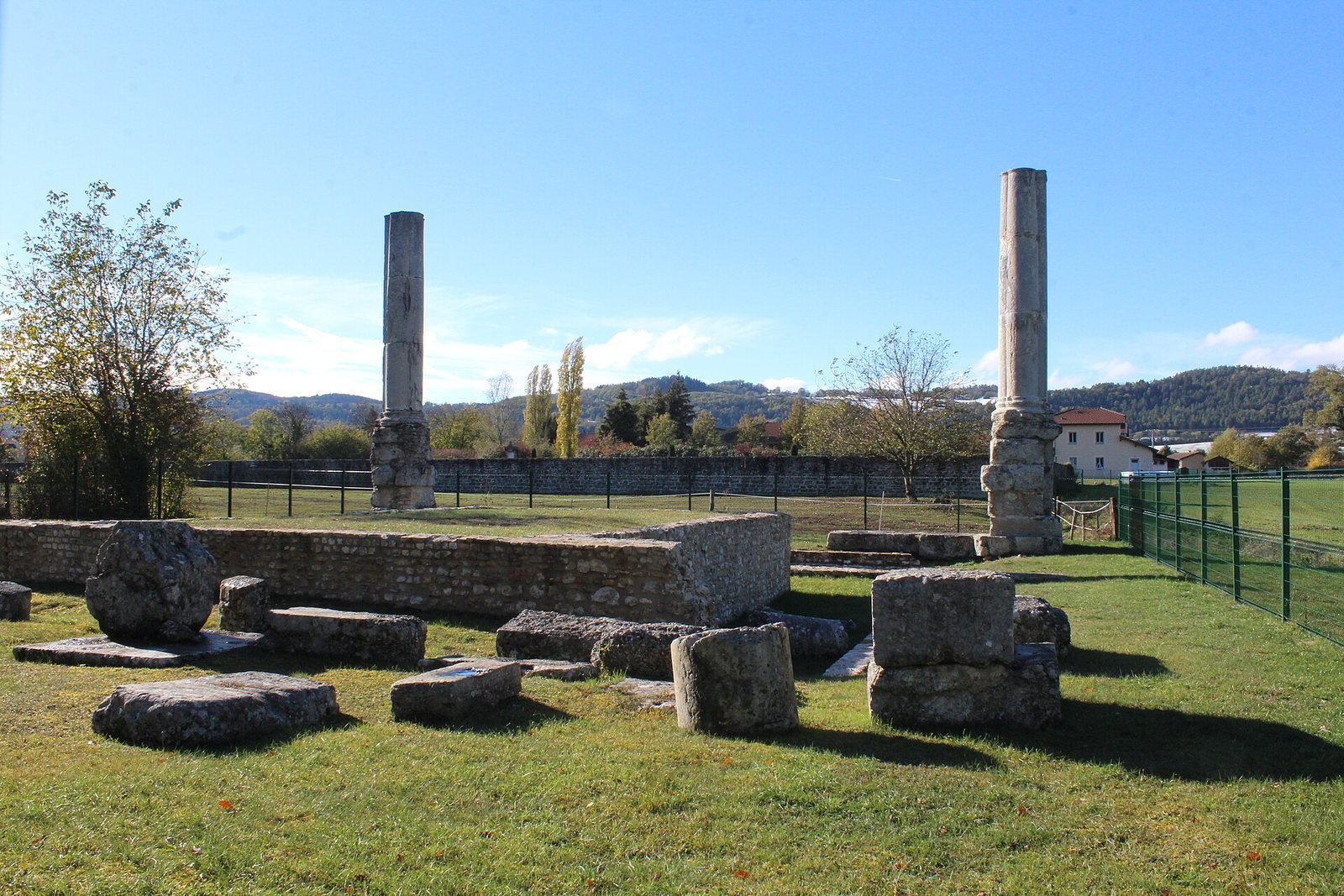
The Gallo-Roman temple in Izernore, France, was a sanctuary within the ancient settlement of Isarnodurum. Its first monumental building is tentatively dated to the second half of the first century CE, during the Flavian dynasty, Rome’s ruling house from 69 to 96 CE. A successor followed later, with construction possibly continuing into the second century. The temple is the only ancient monument in the department of Ain still visible above ground.
Isarnodurum and the temple sequence
Isarnodurum is the ancient settlement identified with present-day Izernore. Its extent is unknown, as is its political association with either of the Gallic peoples called the Sequani and the Ambarri. Depending on the settlement’s boundaries, the sanctuary may have stood in its eastern or northeastern area. An ancient road running north to south appears to have passed to the west. Coins of Gallic date indicate activity at the temple site before either sanctuary was built, though they do not establish the nature or scale of that earlier activity.
The first temple was followed by a larger building on the same spot. The later structure incorporated parts of its predecessor, and a layer of ash lay between the two phases. Coins from the site have helped inform proposed dates, but their circulation could outlast the reigns they commemorate. Their presence therefore does not establish that worship continued when they were deposited.
Abandonment and early accounts
The sanctuary was probably abandoned when the settlement declined at the end of antiquity or in the early Middle Ages. Building materials were systematically taken for reuse, and one temple column later served as the base of a Christian cross commemorating a religious mission. The early sixth-century Life of the Fathers of the Jura refers to the monument as already ruined.
Local antiquarians described visible remains in 1650, 1706 and 1720. The 1650 account came as the temple’s identity and original use were attracting attention, although its dedication remains uncertain.
Excavation and modern interpretation
Thomas Riboud led the earliest excavations in 1783. Work resumed in 1863 at the request of the prefect of Ain, with public funding; Jules Baux published a detailed report three years later. A major restoration followed in 1910, changing the visible remains and making parts of the ancient structure harder to interpret. Further research led by Raymond Chevallier and the Archaeological Group of the Touring Club of France appeared in 1968. Targeted investigations in 2013 and 2014, followed by study of architectural fragments and earlier records, led to cleaning and consolidation of the remains in 2015.
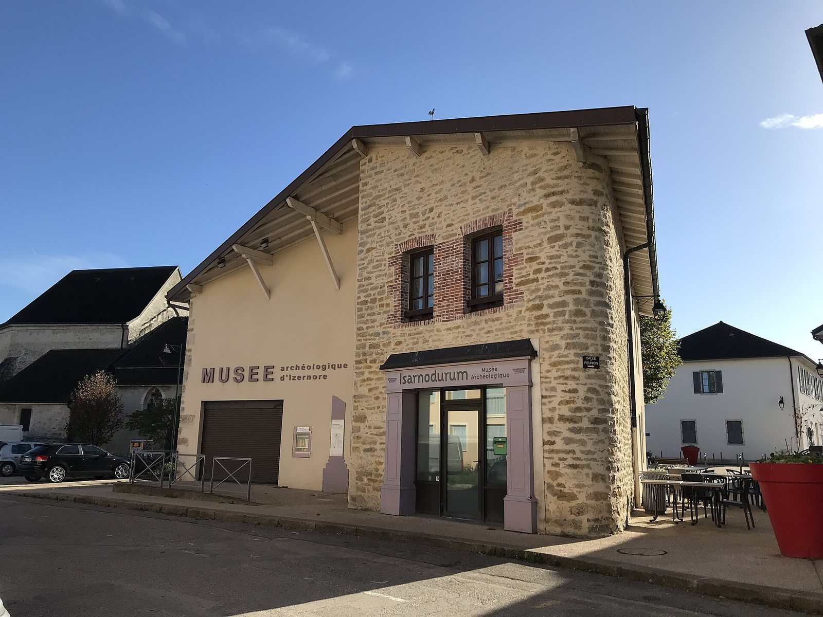
The temple has been classified as a historic monument since 1840. Excavated finds, including coins, inscriptions, decorative pieces and statue fragments, were first kept in a room at the town hall. After thefts, particularly of coins, an archaeological museum was established in 1908 under Émile Chanel, who published its catalogue in 1911. The museum moved in 1982 and received the designation Museum of France in 2003; protective grilles were also installed around the temple.
During the nineteenth and early twentieth centuries, Izernore was proposed as a possible location for Alesia, the site of the decisive Roman siege that ended in the defeat of the Gallic leader Vercingetorix and formed part of Julius Caesar’s conquest of Gaul. The proposal rested on interpretations of Caesar’s writings. Interest in Alesia and Vercingetorix as symbols of French history had grown after France’s defeat in the Franco-Prussian War of 1870 and the loss of territory.
Remains
Setting and wider complex
Landscape and orientation
The temple stands about 500 metres north-northeast of Izernore’s centre, at an elevation of 462 metres. It occupies the outer edge of a ridge overlooking the Bief d’Anconnans. The north-south Oignin–Izernore syncline, a downward fold in geological layers, extends through the area. The buildings’ longest dimension ran northwest to southeast.
Features around the temple
The wider religious complex contained several Gallo-Roman sanctuaries. Wells and refuse pits lay to the west; later excavation suggested that the wells served domestic purposes, making a ritual connection uncertain. Baths to the north were excavated in the mid-nineteenth century and then reburied. A theatre has been proposed, but its presence remains unverified. Excavations beyond the temple also revealed aqueducts, sewers, a chamber that collected underground water, and two underfloor heating systems discovered in 1863.
The first temple
The earlier building measured at least 15 by 17.5 metres. It probably had a single storey and a surrounding colonnade, possibly with Corinthian-style capitals, the ornate tops of classical columns. Its foundations were about 0.95 metres wide, and a few courses of small-block masonry survive. Construction of the later temple disturbed the ground, complicating attempts to establish the first building’s full plan. Earlier descriptions mention walls, partitions and vaulted spaces, but their place in the design is unclear. A threshold from the south may have belonged to an entrance into the surrounding enclosure rather than to the sanctuary itself; it was later moved. Surviving and nearby architectural pieces indicate the use of soft limestone.
The later temple
Plan and inner chamber
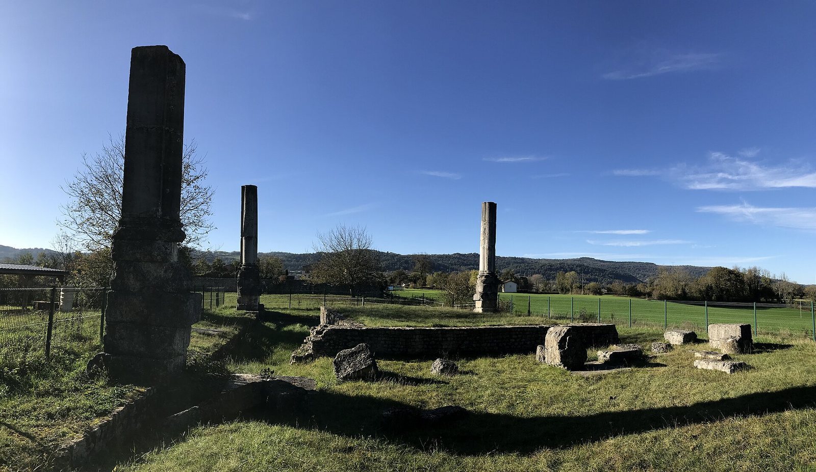
The later temple reused the earlier foundations and incorporated parts of its masonry, but had a larger, different plan. It stood on a raised platform and had columns around its exterior, with a broad entrance staircase on the eastern side. The building measured approximately 19.2 by 22.6 metres, not including the staircase, whose full size is unknown. Its enclosed central chamber measured 7.8 by 12.8 metres and was off-centre, set 3.25 metres from the front colonnade and 4.8 metres from each of the other three sides. That arrangement may reflect the reuse of earlier masonry. The chamber walls have been restored to a width of 0.5 metres, though they were probably originally thicker; the floor was likely a mosaic made from small pieces.
Colonnade and surviving pillars
Masonry supporting the outer colonnade was 1.8 metres wide, indicating a substantial structure that may have used large blocks above. Three square corner pillars survive, each about eight metres high. Made of hard limestone, they have half-columns attached to their inner faces. Projecting stone tabs fitted into sockets to join the blocks, with copper bolts securing the connections. The front and rear sides each had six columns between the corner pillars, while the two long sides had seven. A few surviving fragments suggest that the column tops were probably Corinthian, carved from softer stone than the shafts. Foundations, blocks from the supporting structure and other stone pieces also survive at the site or scattered across it.
Possible elevation
The temple’s full height and roof form remain open to interpretation. One proposal places the central chamber above the roof of a surrounding gallery, an arrangement used in many Gallo-Roman sanctuaries. The nineteenth-century antiquarian Saint-Didier instead proposed a more classical Roman form, with a pitched roof and a monumental triangular gable, comparable to the Maison Carrée at Nîmes.
Painted decoration
Painted surfaces probably decorated the temple. Surviving fragments include a white panel framed by a broad vermilion band made with cinnabar, a costly pigment produced in Spain. Geometric motifs border the band; descriptions of the decoration also include plant forms and animals such as an ox, a bull and a sphinx. Some motifs may draw on styles known from the Italian peninsula and have no known parallel in Gaul. Most fragments have uncertain find contexts, though a few pieces can be linked more closely to the temple’s upper structure, including parts of the architrave, the beam above the columns, and the entablature, the horizontal assembly above them.
Finds and proposed dedications
Inscription and possible divine associations
The temple’s dedication is uncertain. A votive inscription to Mercury, the Roman god associated with commerce and travel, was found reused in a nearby presbytery wall in 1650. Some historians connected the inscribed block with the temple. It was incorporated into the monument during the 1910 restoration, then removed and deposited in the museum. A nearby fragment of Mercury’s characteristic hat may belong to another monument. Other proposed dedications are doubtful. A suggestion that the temple honoured Mars, the Roman god of war, drew on a nearby place-name and an inscription from Matafelon-Granges, but the link is considered highly uncertain. The place-name refers to a natural hollow filled with water. The temple was also tentatively associated with Roma, the personification of the Roman state, after a bronze finger was interpreted as part of a woman’s statue.
Sculpture fragments
An eight-centimetre bronze finger found at the foot of a pillar in 1825 may have belonged to a statue about 2.6 metres high, but it could instead have been part of a chariot fitting. A six-centimetre statuette discovered in 1863 depicts a seated figure, of which the torso and head remain. It was interpreted as Sucellos, a Gallic deity often represented with a mallet.