Gallo-Roman Site of Montbouy: A Rural Sanctuary and Cultural Center
Site at a Glance
- Rating
- 3.6
- Popularity
- Very Low
- Country
- France
- Primary era
- Classical
- Eras represented
- Classical
- Civilizations
- Roman
- Site type
- Religious
- Remains
- Sanctuary
On this page16 sections
History
The Gallo-Roman site of Montbouy is an archaeological site in France, built and developed during the Gallo-Roman period as a rural sanctuary and cultural center associated with a civitas, a Roman territorial and administrative community. Its principal buildings, including the Craon thermal complex and the Chenevière amphitheater, took shape during the first two centuries AD in the former territory of the Senones, near the boundary with the Carnutes.
Earlier traditions and the Celtic landscape
A tradition recorded by Eugène Boutet de Monvel in 1863 associated Montbouy with substantial Celtic remains. It held that the site may have been one of the principal towns of the Boïens until about 1500 BC. In this account, pressure from peoples to the north and south led the Boïens, together with some Lingons and Senones, to leave the Gâtinais region and establish Bologna in northern Italy. The same tradition states that the Senones and Carnutes later occupied the territory.
The Senonian cult center
During the Gallo-Roman period, Montbouy lay close to the junction between the territories of the Carnutes and Senones. It was controlled by the Senones and formed one of their vici, smaller settlements or local administrative centers within a civitas. The site also served as a cult center, bringing religious activity together with other functions associated with rural communities.
The Craon baths and the Chenevière amphitheater developed during the first two centuries AD. Montbouy was one of six long-known rural cult and cultural sites of this type in the territories of the Carnutes and Senones. Its position beside the Loing also shaped its later history. Major winter and spring floods made everyday settlement difficult, especially near the point where the Simon stream entered the beginning of the loop enclosing the source sanctuary. Medieval habitation instead developed about 1.5 kilometers upstream, where Merovingian sarcophagi were found. The Merovingian period was the early medieval era associated with the dynasty that ruled much of Gaul.
Memory, investigation, and archaeological interpretation
After the Gallo-Roman period, the amphitheater remained known as the “Circus of the Saracens.” It was incorporated into the medieval chanson de geste Garin le Lorrain, a heroic poem, and was mentioned again during the seventeenth and eighteenth centuries. Nine hoards found at the site reinforce its interpretation as an important place of passage.
J.-B. Lollois studied the amphitheater in detail in 1836. Nineteenth-century investigations brought the sanctuary and other buildings to light again, while research at the sanctuary resumed in the mid-twentieth century before being interrupted. The amphitheater was listed as a historic monument in 1862.
Remains
The site lies about 1 kilometer north of Montbouy on the left bank of the Loing, at approximately 130 meters above sea level. The Briare Canal partly crosses the archaeological area. The surviving remains form a group of religious, performance, bathing, water-supply, and domestic features distributed between the sanctuary and the amphitheater.
Performance architecture
Chenevière amphitheater
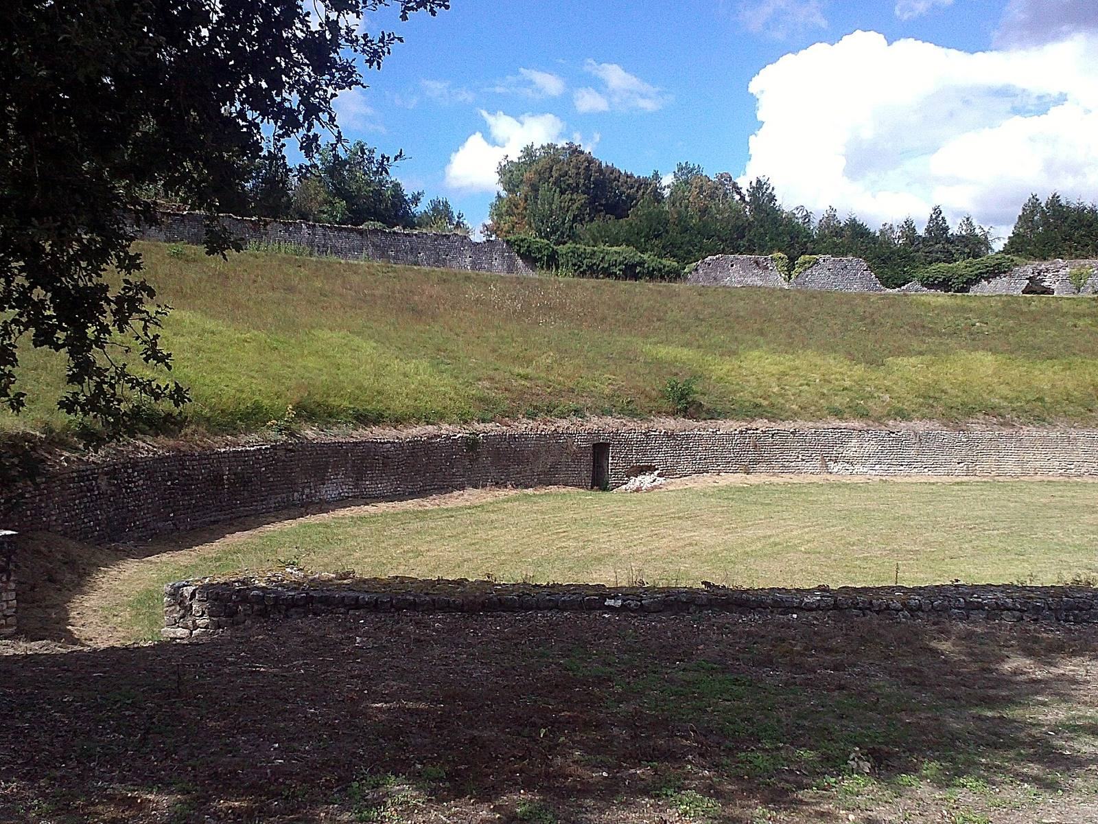
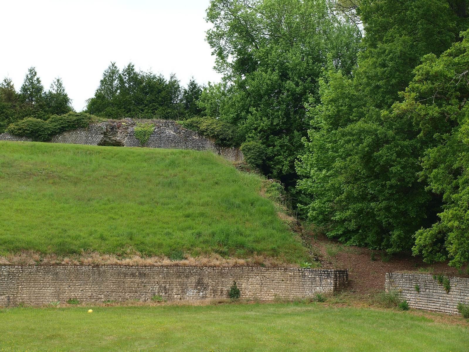
The Chenevière amphitheater stands about 750 meters from the sanctuary, built against the western slope bordering the Loing and facing approximately east. Its design combines a theatre-like cavea, the bank or seating area for spectators, with an amphitheater-like arena. The cavea is not fully semicircular, and the form is characteristic of secondary settlements and rural sanctuaries in Gallia Lugdunensis, the Roman province that included this part of Gaul.
The plan has an angle of about 135 degrees between its aditus, or entrance passages, and its axis is oriented at 73 degrees. An earlier plan incorrectly placed the orientation toward north, and that error was repeated in later publications. Among known Gallo-Roman theatres, the arrangement is considered most similar to the amphitheater at Gennes.
Sanctuary and water features
Source sanctuary
The source sanctuary forms a quadrilateral enclosed by a circulation gallery. On its southern side, the gallery is interrupted by a circular basin containing the spring. An octagonal gallery surrounds the basin, which occupies the position normally taken by the cella, the enclosed central chamber of a classical temple.
Votive basin
Immediately beyond the enclosure, beside the southwestern corner of the octagonal gallery, lies a rectangular basin. Wooden votive offerings were found there, together with roughly carved statues made from tree trunks. These objects connect the water feature with the ritual use of the sanctuary.
Baths and associated buildings
Large baths
Large baths stood approximately halfway along a straight line between the amphitheater and the sanctuary. Construction of the canal destroyed much of their remains, and the surviving evidence does not establish whether they belonged to two separate buildings or to one large complex.
Traces of the baths remain opposite canal marker 19. When the canal water level is low, a mosaic becomes visible in the bank slope about 1 meter below the full-water level. Its white or pink ground uses locally occurring limestone aggregate and is divided by black frames made from ampelite, a dark carbon-rich shale. The tesserae, or small pieces forming the mosaic, are carefully made rectangular pieces measuring about 1 by 2.5 centimeters. They rest on approximately 3 centimeters of the same pink cement, above about 10 centimeters of concrete.
Small temple and wells
A fanum, a small Gallo-Roman temple associated with a local or rural cult, stood a short distance southwest of the baths. A well lay 120 meters northwest of the temple. Three cellars were located less than 200 meters to the west of the well, and a fourth stood about 280 meters to the south.
Aqueduct and traces of the wider settlement
Roman aqueduct
Excavations in 1859 revealed sections of a Roman aqueduct with its flat covering stones still in place. One section lay in Montbouy itself, behind the eastern end of the church near the Loing. Another was found near the river between Montbouy and the main site, in a field locally called the Field of the Medals because large quantities of ancient coins had long been unearthed there.
Foundations and masonry
In 1850, numerous foundations, wall sections, stone heaps, and pieces of Roman masonry were visible near the aqueduct and on the slope extending from the town toward the canal. These remains were described as forming the ground of an entirely destroyed city, indicating the wider extent of the ancient built environment connected with the sanctuary and its associated facilities.