Fort York: A British Garrison and War of 1812 Fortification in Toronto
Site at a Glance
- Rating
- 4.5
- Popularity
- Medium
- Country
- Canada
- Primary era
- Early Modern
- External website
- Open
- Eras represented
- Early Modern, Modern
- Civilizations
- British
- Site type
- Military
- Remains
- Fort
On this page14 sections
History
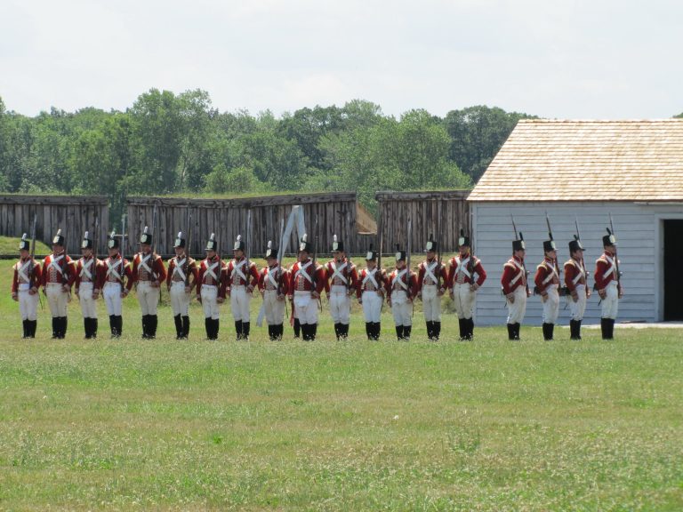
Fort York is a British-built military fortification in Toronto, Canada, established on 20 July 1793 during the colonial period of Upper Canada. Lieutenant Governor John Graves Simcoe selected York, as Toronto was then known, for its natural harbour, its single water approach, and its distance from the United States. The garrison was intended to protect the colonial capital, control access to Lake Ontario, and support military and transportation routes leading toward the Great Lakes and Georgian Bay.
Foundation and early expansion
One hundred soldiers of the Queen’s Rangers landed near Garrison Creek and built 30 green-wood cabins for winter quarters. By November 1793, the settlement included two log barracks, a stockade, and a sawmill. The following year, the Queen’s Rangers added a guardhouse and two small blockhouses near Gibraltar Point. Simcoe also removed several artillery pieces for use at Fort Miamis, leaving York with only a few condemned guns from Kingston. Planned subsidiary fortifications were not completed because funding could not be secured.
By 1796, after much of the colonial administration had moved to York, the garrison held 147 men. In late 1798, the post became an official British Army installation and gained access to military funds. A new stockade and barracks followed, along with carriage and engine sheds, a government house, guardhouse, gunpowder magazine, and storehouses. Rising tensions between Britain and the United States led Major-General Isaac Brock to order three artillery batteries, a western wall, and a dry moat. The batteries included furnaces for firing heated shot, while mobile 12-pounder guns could cover ground beyond the fixed positions.
The War of 1812 and reconstruction
Before the War of 1812, a conflict between the United States and Britain that lasted from 1812 to 1815, Fort York formed part of a wider defensive system around York and Gibraltar Point. Batteries and blockhouses protected the settlement, but regular troops were sent to the Niagara peninsula and the fort was left mainly to Canadian militia. The settlement was therefore inadequately prepared when American forces attacked in April 1813.
The attack opened Henry Dearborn’s campaign against positions in the Canadas, the British colonies that included Upper Canada. American troops landed west of the fort and captured the western battery, forcing British, First Nations, and militia forces back toward Fort York. The British commander, Roger Hale Sheaffe, ordered a silent withdrawal and had the gunpowder magazine ignited. The explosion involved 74 tons of iron shells and 300 barrels of gunpowder, killing more than 250 American soldiers, including Brigadier General Zebulon Pike. American forces occupied York, detained militia members in the fort for two days, and destroyed most of the buildings before departing.
Rebuilding began in the latter part of 1813 to protect a planned four-vessel Royal Navy squadron. Shortages of skilled military workers and the warm winter of 1813–14, which prevented the use of sleighs for transporting supplies, delayed the work. The rebuilt fort was completed around 1815. From late 1813 until the end of the war, it also served as a hospital centre, receiving wounded soldiers transported from the Niagara front. On 6 August 1814, militia fired on the USS Lady of the Lake after it entered the harbour under a white flag during an American reconnaissance operation. The vessel withdrew, and the American squadron did not attack.
Nineteenth-century military use
By 1816, the rebuilt fort contained 18 buildings and could accommodate 650 soldiers, while nearby military facilities held another 350. After the war, it remained a potential rallying point for British forces defending the Niagara peninsula and a protected base for routes between Lake Ontario and the upper Great Lakes. Its condition changed with relations between Britain and the United States, as buildings were demolished or replaced and additional defences were added when renewed conflict seemed possible.
New Fort York was completed in 1841, 847 metres west of the older fort, because the original works were considered increasingly inadequate. The old fort continued to provide batteries, drill space, and a rifle range. From 1839 to 1840, it also housed a Royal Society meteorological and magnetic observatory before the observatory moved to the University of King’s College campus.
During the Rebellions of 1837–1838, uprisings against colonial government in Upper and Lower Canada, much of the garrison was sent to Lower Canada. Ten British regulars remained at Fort York until reinforcements arrived after the Battle of Montgomery’s Tavern. In 1854, the garrison was recalled for the Crimean War, fought chiefly between Russia and an alliance that included Britain and France. During the two-year absence, 150 retired British soldiers, known as enrolled pensioners, maintained the fort.
The 1861 Trent Affair, a diplomatic crisis that heightened fears of war between Britain and the United States, prompted proposals for rifled artillery on mobile carriages, but the plans were not carried out. As Britain withdrew from secondary North American garrisons, Fort York was transferred to the Canadian government on 25 July 1870. The last British imperial troops left in 1871. Canadian militia then used the fort for housing, offices, storage, training, ammunition, and supplies. It served as a local enlistment centre during the Second Boer War and the First World War, and military occupation continued intermittently until the Second World War.
Municipal preservation and interpretation
Toronto agreed to purchase Fort York and New Fort York in 1903, promising to preserve and care for the older fort. The property formally passed to the municipal government in 1909. Pressure from the Old Fort Protective Association, political figures, and the Toronto press led to additional conditions requiring restoration or the return of adjacent commons to federal ownership. Fort York became a National Historic Site of Canada on 25 May 1923. The surrounding precinct became a provincial Heritage Conservation District in 1985, with the district expanded in 2004 to include Fort York Armoury.
Toronto carried out a two-year restoration beginning in 1932, returning the fort as far as possible to its early nineteenth-century form, especially its 1816 configuration, and converting it into a museum. It reopened in 1934, and further restoration followed in 1949. The Canadian militia vacated the site during the earlier restoration, although parts of it were briefly reused during the Second World War. Fort York Armoury was built nearby in the 1930s for military requirements.
In 1958, a proposal to move Fort York to the contemporary waterfront to make way for the Gardiner Expressway was rejected after public opposition, and the highway was rerouted around the fort. This campaign helped stimulate Toronto’s modern historic-preservation movement and contributed to the foundations of the Toronto Historical Board. Archaeological excavations between 1976 and 2011 examined demolished buildings and the fort’s original topography. After Toronto’s 1997 amalgamation, museum operations came under the city’s Museum and Heritage Services, and management passed to a separate board of citizen appointees in 2000.
Remains
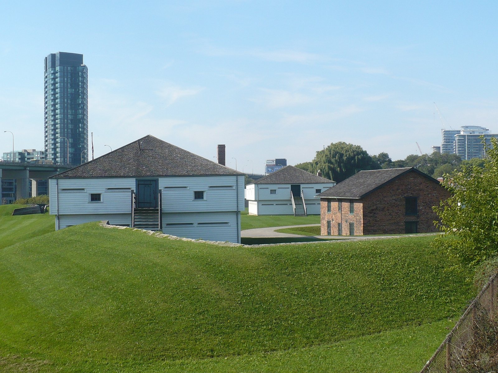
Fort York occupies approximately 3.24 hectares within a larger national historic site of about 16.6 hectares. Its bastioned, stone-lined earthworks, a fortification form with projecting sections for defensive fire, enclose eight historical buildings arranged in their original positions. Seven date from the reconstruction of 1813–15, while the eighth reconstructs a former barracks. The buildings retain original materials, designs, and finishes and together form Canada’s largest collection of buildings dating from the War of 1812.
Ramparts and defensive works
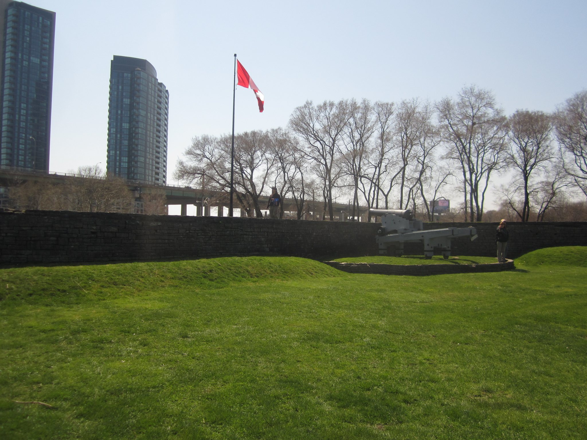
Stone-lined earthen ramparts surround the fort and were designed to absorb cannon fire. They also allowed palisades to be installed against attacks from land. Nine gun positions remain within the earthworks. The southern circular battery was enlarged in 1828, while the 1860s brought palisades, parapets, and an additional seven-gun battery along the southern ramparts.
The defences were rebuilt or strengthened in 1838, during the 1860s, and in the 1930s. The northeastern ramparts were demolished in 1916 to make way for a Bathurst Street streetcar route and reconstructed during the restoration of the 1930s. Growth of the Railway Lands led to the northern ramparts being rebuilt farther south, which required the demolition of a barracks. The southern ramparts were raised by 1.6 metres and moved approximately five metres north. The original shoreline embankment remains visible outside the southern ramparts, although land reclamation left the fort about 900 metres inland by the 1920s.
Surviving military buildings
Blockhouses
The two blockhouses are fortified buildings designed for protected gun positions, troop accommodation, and refuge. Their splinter-proof construction includes loopholes and portholes for small arms and light artillery, overhanging second storeys, raised entrances facing east, cellar storage, and magazine facilities. Their first floors had no windows because openings were considered dangerous. Coursed limestone and shale foundations support square-timber white-pine walls reinforced with wooden pegs and covered externally with clapboards. Each level could be isolated if another floor was penetrated.
The blockhouses originally stood north of the shore batteries and protected their rear approaches. After the wider fort was completed, they served as a citadel and could house troops. Blockhouse No. 1 accommodated 120 soldiers, while Blockhouse No. 2, near the circular battery, accommodated 160. Both briefly had dry moats and drawbridges after the Rebellions of 1837–1838; the moats were later filled. Their interiors were repeatedly modified for military and museum use.
Soldiers’ barracks
The two enlisted soldiers’ barracks originally housed large numbers of soldiers and their families. By the 1860s, they were used mainly as married quarters for three soldiers and their families. A blue officers’ barracks and mess hall, reconstructed in 1986, represents a junior officers’ building. Its single storey contains four apartments, each with four separate quarters connected by a central hall, as well as a servant’s room and kitchen.
Officers’ barracks and mess hall
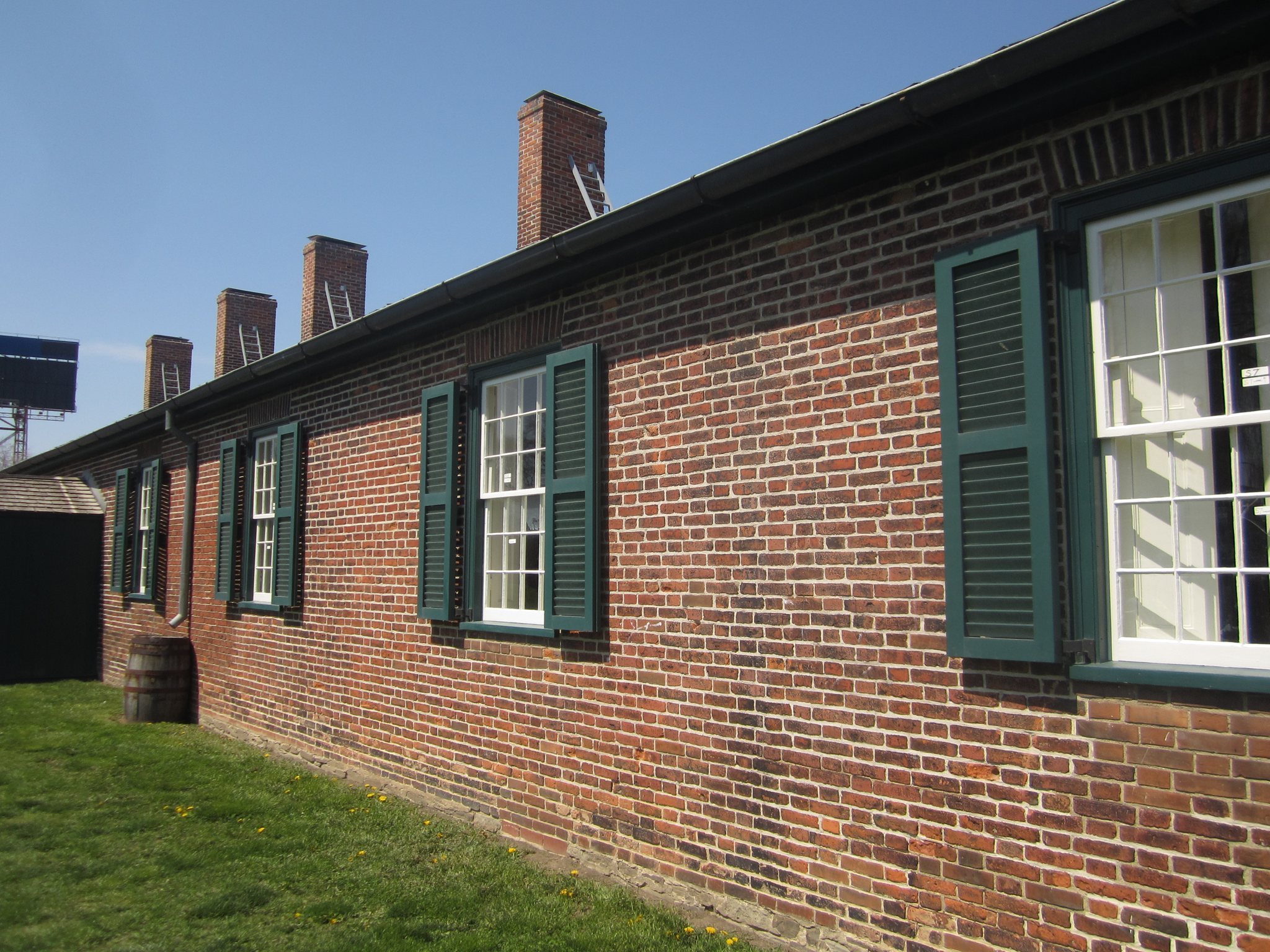
The brick officers’ barracks and attached mess hall have been restored to their 1830s arrangement. Two apartments contain four officers’ living quarters and a kitchen or servants’ room each. The mess hall was designed for senior officers and has separate entrances to the exterior and the barracks, while the servants’ rooms had their own entrance.
The building contains Toronto’s oldest kitchen. A steep pantry staircase descends to the basement kitchen, where the oven survives. The kitchen floors were removed during archaeological investigation, and a ground-level kitchen was added in 1826.
Magazines
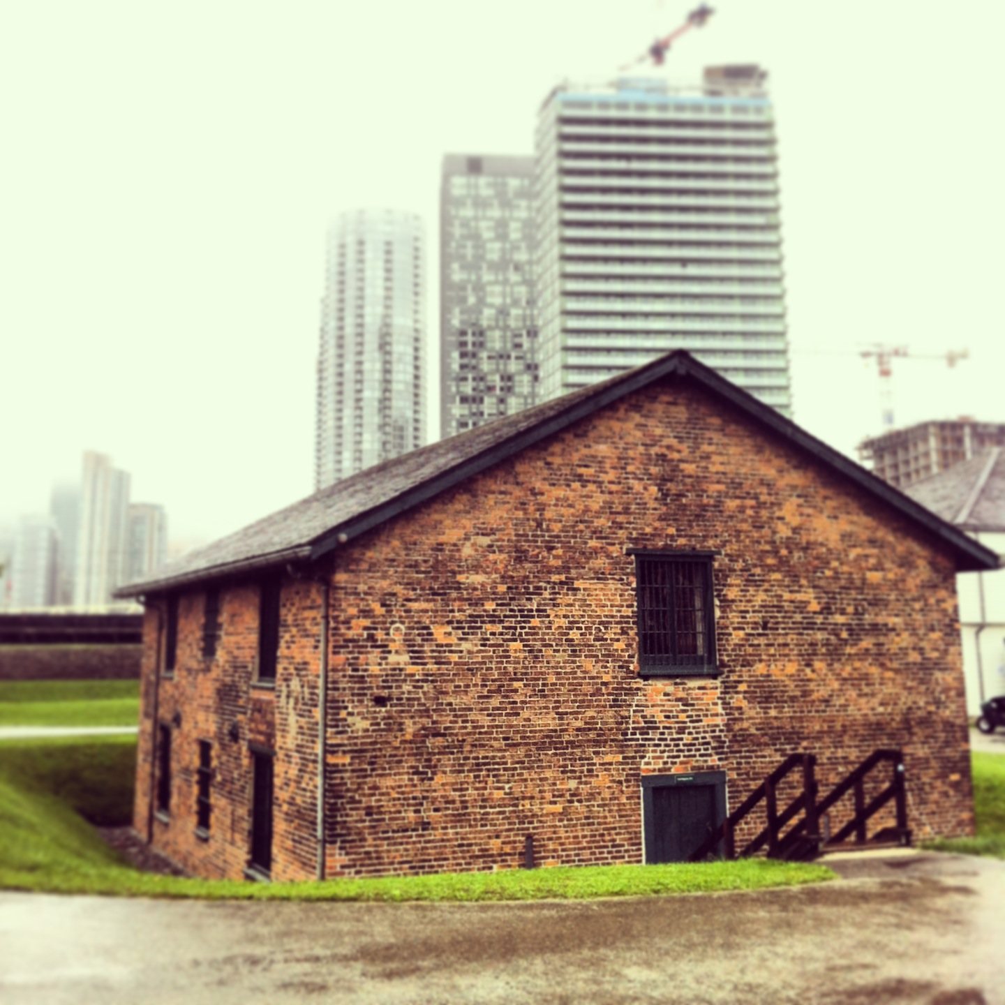
The stone-walled magazine stored ammunition and gunpowder. Its walls are two metres thick and include a vaulted bomb-proof door. Foundation problems soon after its completion led to the construction of a brick magazine. The fort also contains a small gunpowder magazine dating from the 1970s as part of its modern museum facilities.
Archaeological remains and wider precinct
The remains of the original 1793 fort lie beneath the present fort, while the first Government House is buried beneath the parade grounds. Debris and ruins from the April 1813 battle were later deposited in the crater made by the gunpowder-magazine explosion. A maple tree and plaque mark the explosion site. The plaque also commemorates the Rush–Bagot Treaty, the agreement that limited British and American naval armaments on the Great Lakes after the War of 1812.
Several demolished buildings survive archaeologically or remain buried beneath the grounds, including the carpenter’s shop, sappers’ and miners’ barracks, soldiers’ barracks, cookhouse, Commandant’s House, D Barrack, artillery barracks, and 1838 cookhouse. A third blockhouse begun along the western wall in 1815 was destroyed by fire and not rebuilt. The northern area beyond the present ramparts contains the former cluster of the Commandant’s House, D Barrack, artillery barracks, and 1838 cookhouse, which lies outside the current fort because the northern ramparts were moved south during the 1930s restoration.
The wider national historic site includes Garrison Common west of the fort, military cemeteries to the north, and parkland separated from the main site by the Railway Lands. Two pedestrian and cycle bridges, known as Garrison Crossing, connect the northern parkland with the rest of the site. Completed in 2019, they were the first bridges in Canada made entirely of stainless steel. The military cemetery served soldiers and their families from 1793 to 1863, and part of it later became Victoria Memorial Square, where several original headstones were reused in a memorial.
Armoury and visitor centre
Fort York Armoury lies southwest of the visitor centre and remains an active Canadian Army drill hall and armoury under the custodianship of the Department of National Defence. Unlike the historic fort, it continues to serve a military function rather than operating as a museum building.
The visitor centre is a rectangular building of approximately 2,500 square metres built along the escarpment of the original Lake Ontario shoreline. It retains the escarpment and Garrison Common, while its green roof forms the route to Garrison Common. The southern facade uses monolithic weathering-steel panels that evoke the early nineteenth-century shoreline and escarpment. Glazed slits admit light between the panels, and sections of the facade contain glass walls behind steel panels arranged like awnings. The bolted panels can be dismantled when highway maintenance requires access.
Ramps lead through the centre from the entrance at the base of the building toward Garrison Common. The interior contains a 270-square-metre War of 1812 artefact exhibition, a 45-square-metre vault for light-sensitive artefacts, an immersive Battle of York exhibit, exhibition galleries, administrative offices, and a community meeting centre. The site’s museum interprets the War of 1812 and military life in nineteenth-century Canada, while the fort, visitor centre, Garrison Common, military cemeteries, and surrounding parkland form the connected historic precinct.