Fort Southwest Point: A Federal Frontier Outpost in Tennessee
Site at a Glance
- Rating
- 4.7
- Popularity
- Low
- Country
- United States
- Primary era
- Early Modern
- External website
- Open
- Eras represented
- Early Modern
- Civilizations
- Unclassified
- Site type
- Military
- Remains
- Fort
On this page11 sections
History
Fort Southwest Point was a federal frontier outpost in Kingston, Tennessee, United States, built by the United States government in 1797 during the early national period. Positioned at the meeting of the Tennessee and Clinch Rivers, it became a military station, a place of interaction between the Cherokee and the federal government, and a stopping point for people traveling between Knoxville and Nashville.
From Revolutionary Proposal to Frontier Station
The location first attracted military attention in 1779, during the American Revolution, when Colonel Arthur Campbell proposed the meeting of the Clinch and Tennessee Rivers as a possible fort site to Virginia’s governor. Virginia took no action at the time. The site gained new importance after the Avery Trace, an early overland route across Tennessee, reached the area in 1788, and after the Treaty of Holston in 1791 established the Clinch River as the boundary between United States and Cherokee lands.
Beginning at Southwest Point, the Avery Trace became the principal road between East Tennessee and Middle Tennessee until about 1800. The Treaty of Holston placed the site at the edge of territory opened to Euro-American settlement. As settlers moved into the area, conflict increased with Cherokee inhabitants, including Cherokee groups associated with resistance to United States expansion, known as the Chickamauga Cherokee.
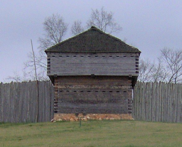
Territorial Governor William Blount kept the militia mobilized through much of the early 1790s. John Sevier encamped at Southwest Point in 1792, and his troops completed a blockhouse, a small strongly built defensive structure, by November. The blockhouse served as a base until federal troops arrived in 1793. From 1793 to 1796, approximately 10 to 15 federal soldiers occupied it.
Construction and Expansion
Federal troops under Captain John Wade and Captain Richard Sparks replaced the blockhouse with a much larger fort, completed in July 1797. Fire destroyed the early construction records. The new post was initially called Fort Butler, after Lieutenant-Colonel Thomas Butler, commander of federal forces in East Tennessee, but the name had changed to Fort Southwest Point by 1798.
Butler moved his headquarters to the fort in 1799. Nine companies, comprising seven infantry companies, one artillery company, and one dragoon company, brought the garrison to approximately 400 to 500 troops. Lots were sold near the post for a settlement that developed into Kingston. The town took its name from Major Robert King, an officer stationed at the fort.
Cherokee Relations and Administrative Use
One early duty of the garrison was removing illegal settlers, known as squatters, from Cherokee lands. Butler helped negotiate the First Treaty of Tellico in 1798, an agreement that addressed settlement and land issues and reduced the need for a large federal force in the area. By 1801, the garrison had fallen to about 100 soldiers.
In 1801, Colonel Return J. Meigs became both Cherokee Agent and Military Agent for the War Department in Tennessee. A Cherokee agent represented the federal government in dealings with the Cherokee, while a military agent handled military administration. Although the garrison was smaller, Fort Southwest Point served as Meigs’s office and as a distribution center for the Cherokee annuity, an annual payment of goods connected to Cherokee land cessions.
Meigs negotiated permission from the Cherokee to build a wagon road between Knoxville and Nashville across Cherokee territory. The Third and Fourth Treaties of Tellico in 1805 transferred most of the Cumberland Plateau to United States control and made the road possible. As these agreements moved the United States-Cherokee boundary south to the Hiwassee River, Fort Southwest Point was no longer needed as a major military post.
Reduction, Abandonment, and Archaeology
Meigs and most of the federal garrison relocated to the Hiwassee area by 1807. Fewer than five soldiers maintained Fort Southwest Point until 1811. The post’s later physical history became connected to the Tennessee Valley Authority, a federally established regional authority responsible for developing and managing the Tennessee River system. The authority purchased the site in the 1930s in anticipation of Watts Bar Dam, although the fort stood well above the reservoir’s flood level.
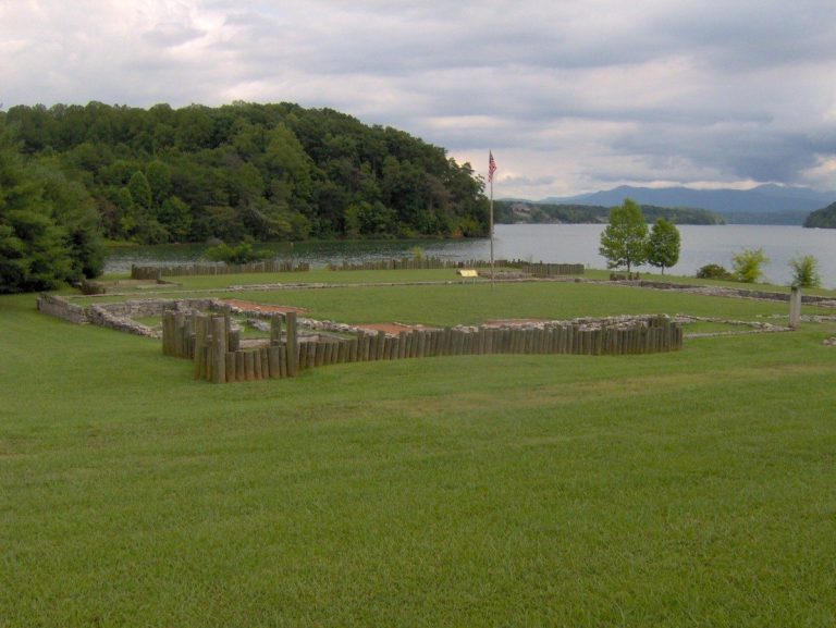
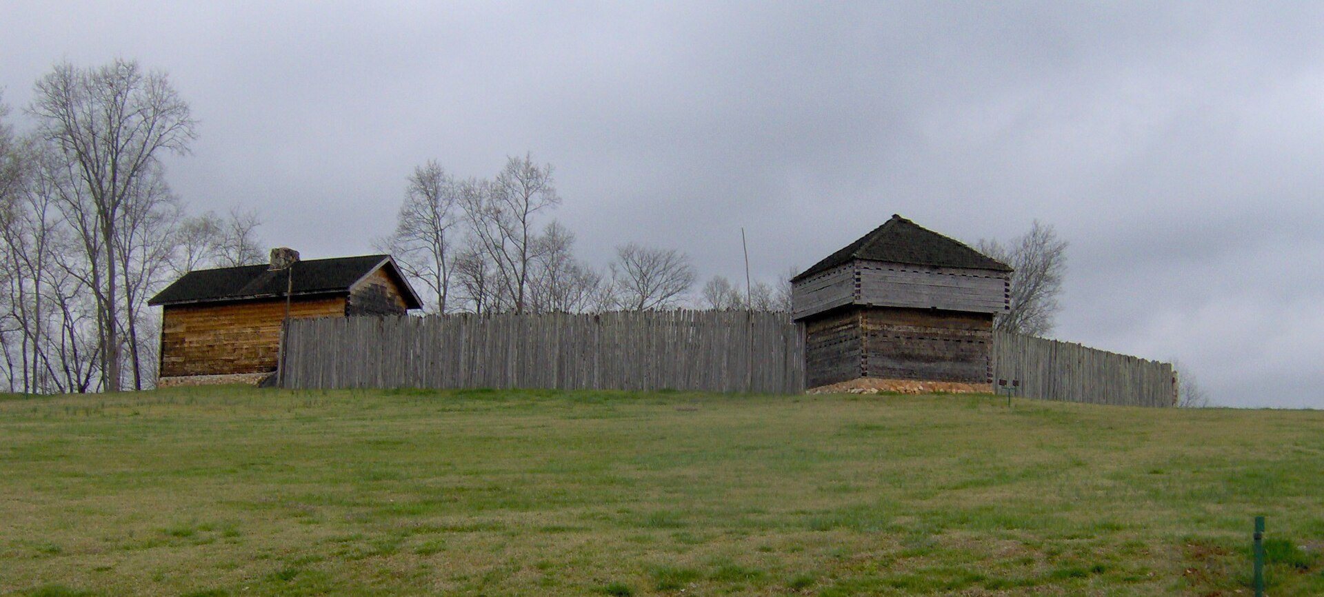
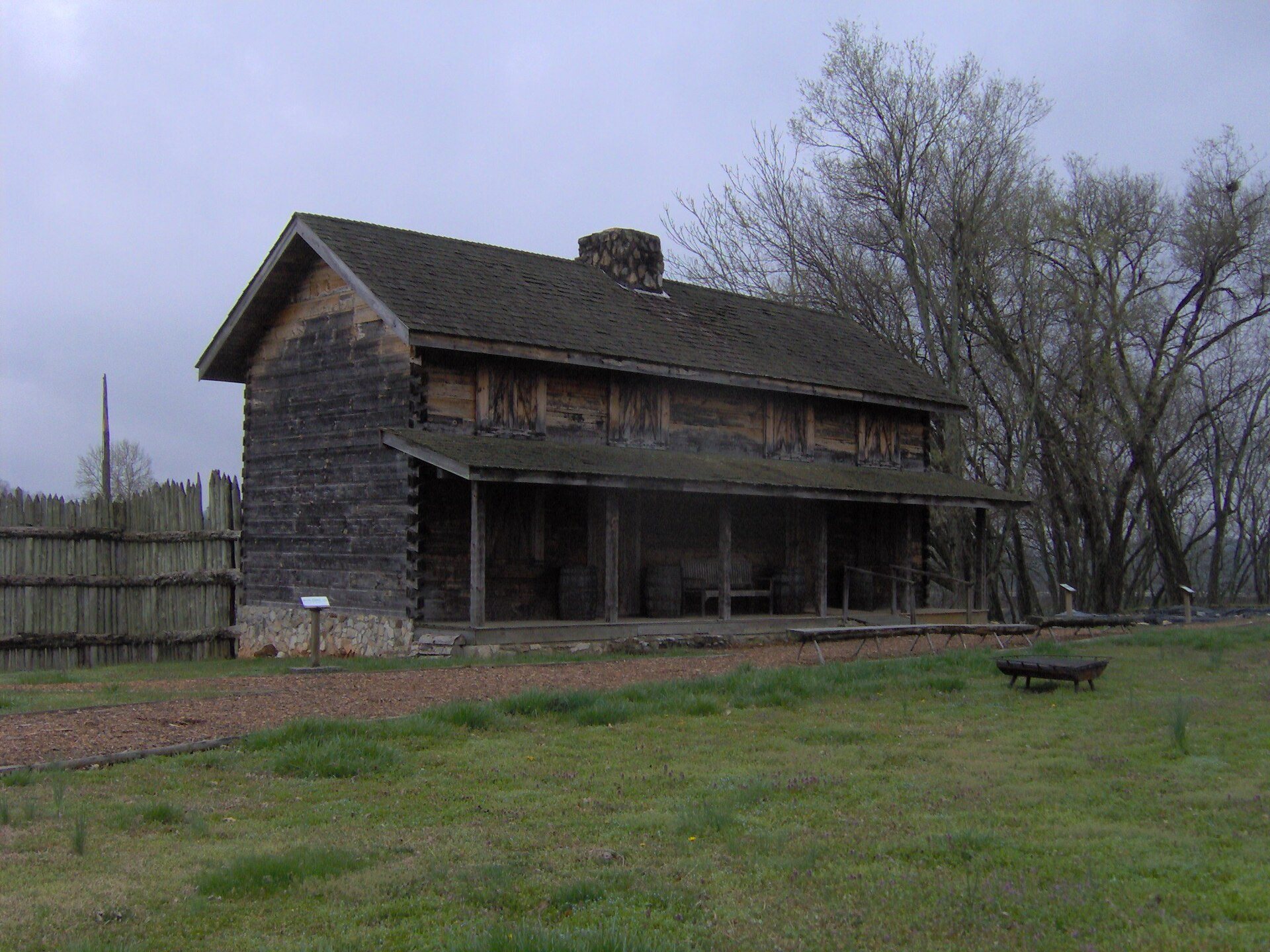
The University of Tennessee excavated the site in 1973. The Tennessee Division of Archaeology conducted more extensive investigations from 1984 to 1986, using the results to guide a partial reconstruction. The City of Kingston and the division subsequently reconstructed part of the fort, and the city manages the site. Fort Southwest Point was added to the United States National Register of Historic Places, the federal inventory of recognized historic and cultural properties, in 1972. In February 2024, Tennessee Governor Bill Lee announced that the site would become a Tennessee state park.
Remains
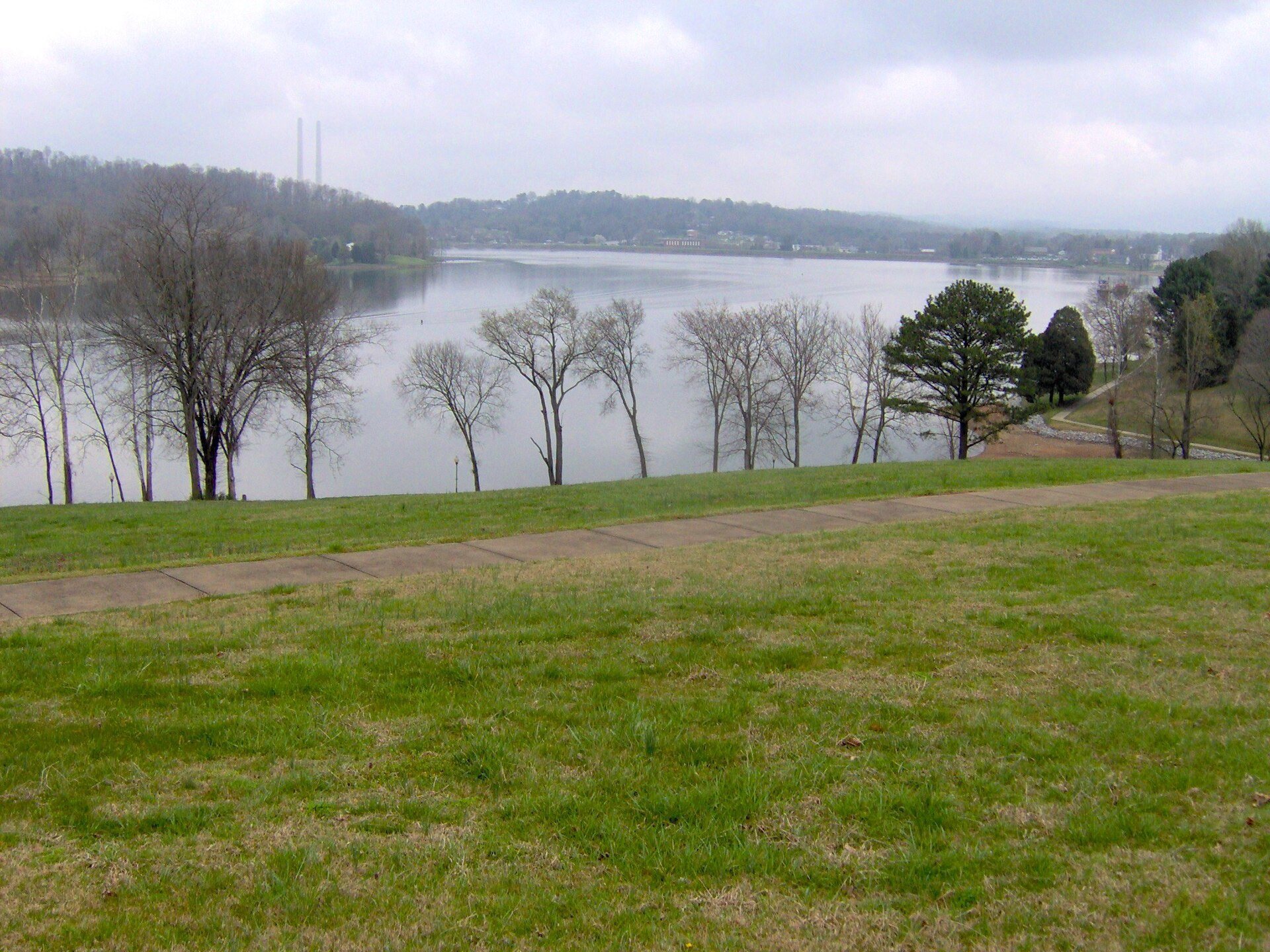
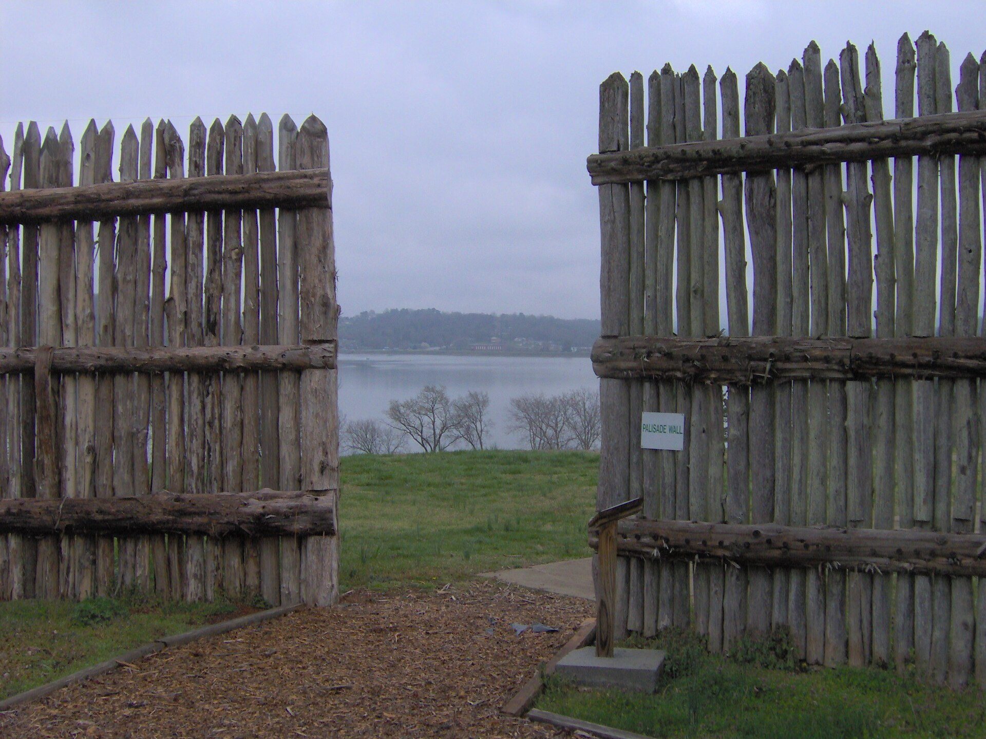
Fort Southwest Point stood on a hill above the meeting of the Tennessee and Clinch Rivers. That confluence is now within Watts Bar Lake, the Tennessee River reservoir created when Watts Bar Dam was completed in 1942. The Emory River enters the Clinch about 5 miles, or 8.0 kilometers, upstream. Archaeological investigations exposed the palisade ditch, the trench associated with a defensive barrier of upright posts, and established the fort’s original arrangement.
Fort Layout and Defensive Structures
The enclosure measured approximately 297 by 175 feet, or 91 by 53 meters, and covered about 1.2 acres, or 4,900 square meters. At least 15 structures stood within it, with most locations identified through foundation remains. The reconstructed portion follows this archaeological layout and forms part of Southwest Point Park, which combines the historic site with a recreational area.
Blockhouses and Enclosure Features
Structure 1 measured 17 by 22 feet, or 5.2 by 6.7 meters, and probably served as a corner blockhouse. Structures 10 and 11 were also probably blockhouses. Structure 10 measured 22 by 18 feet, or 6.7 by 5.5 meters, while Structure 11 measured approximately 17 by 18 feet, or 5.2 by 5.5 meters. Structure 13 resembled Structures 10 and 11 and was probably another blockhouse.
Offices and Barracks
Structure 3 measured 70 by 22 feet, or 21 by 6.7 meters, and probably contained officers’ quarters and administrative offices. Structure 4 measured 62 by 22 feet, or 19 by 6.7 meters, and probably served as a barracks building. Its drain carried water to a cistern. Structures 5 and 6 were probably additional barracks. Structure 5 measured 62 by 22 feet, or 19 by 6.7 meters, and Structure 6 measured 43.5 by 22 feet, or 13.3 by 6.7 meters.
Structure 14 was probably another barracks building, measuring 63 by 17 feet, or 19 by 5.2 meters. Structure 7 measured approximately 83 by 22 feet, or 25 by 6.7 meters. Structure 8 measured 43 by 22 feet, or 13 by 6.7 meters, and may have served as a distribution center.
Vaults and Supply Building
Structure 2 was a 14-foot-deep vault, or 4.3 meters deep, probably used as a privy. Structure 9 was another probable privy, an 8-by-10-foot vault, or 2.4 by 3.0 meters, that reached 10.5 feet, or 3.2 meters, below ground. Structure 12 resembled Structures 2 and 9 and was probably also a privy.
Structure 15 measured 62 by 23 feet, or 19 by 7.0 meters, and was probably used for supplies. Together, the foundations, excavated ditch, and reconstructed buildings define the military post’s internal arrangement and its scale during the period of federal occupation.
Evidence of Earlier Occupation
Archaeological work also revealed prehistoric occupation at the site. Finds included an infant burial, storage pits, and pottery sherds. Hickory-nut shells from a basin-style hearth produced a radiocarbon date of approximately AD 1360, providing evidence of activity at the location centuries before the federal fort was built.