Fort Shirley: A British Colonial Fortress in Dominica
Site at a Glance
- Rating
- 5
- Popularity
- Very Low
- Country
- Dominica
- Primary era
- Early Modern
- Eras represented
- Early Modern
- Civilizations
- British, French
- Site type
- Military
- Remains
- Fort
On this page8 sections
History
Fort Shirley is an eighteenth-century British fortress in Dominica, located north of Portsmouth on the Cabrits Peninsula. Begun in 1765 in the Georgian architectural style, it defended northern Dominica and formed part of Britain’s fortification network in the eastern Caribbean.
British construction and French expansion
The fort was named after Sir Thomas Shirley, the British Governor of the Leeward Islands, a group of islands in the northeastern Lesser Antilles. British engineers Fraser and Bruce designed the complex, whose orderly military plan and restrained classical character reflected Georgian architecture.
French forces occupied Dominica from 1778 to 1784 and expanded Fort Shirley during that period. The British and French made further alterations during the 1790s. French naval attempts to retake Dominica in 1795 and 1805 failed, leaving the fort in British hands.
The 1802 mutiny
In April 1802, African soldiers of the 8th West India Regiment mutinied at Fort Shirley. The regiment was a British Army unit recruited in the Caribbean, including men who had previously been enslaved. The soldiers objected to poor conditions and the failure to pay them, while also fearing that they would be returned to slavery or plantation labor.
The mutineers controlled the garrison for three days. Their revolt influenced the British Mutiny Act of 1807, legislation governing military discipline and service that addressed the legal status of soldiers recruited while enslaved in the West India Regiments. Under the act, such soldiers were freed.
Abandonment and preservation
Fort Shirley had fallen out of use by the 1850s and was abandoned in 1854. It remained under the British Admiralty, the government department responsible for the Royal Navy and its property, until 1901. Ownership then passed to the government of Dominica, and the site remained Crown Land, meaning land held by the Crown and administered by the state.
The surrounding area was later used at different times for quarantine, agriculture, and experimental teak forestry. Restoration began in 1982 on the initiative of Dominican historian and anthropologist Dr. Lennox Honychurch, after years of deterioration. Fort Shirley became part of Cabrits National Park in 1986. The park had been established under the National Parks and Protected Areas Act of 1975.
By 2015, restoration had included the officers’ quarters, barracks, powder magazine, arms store, guardhouse, and ramparts. Fort Shirley has been on Dominica’s UNESCO World Heritage tentative list since 2015 under cultural criteria II and IV. This list identifies sites that a country may nominate for future World Heritage consideration, while the criteria address cultural exchange and important architectural or technological ensembles.
Remains
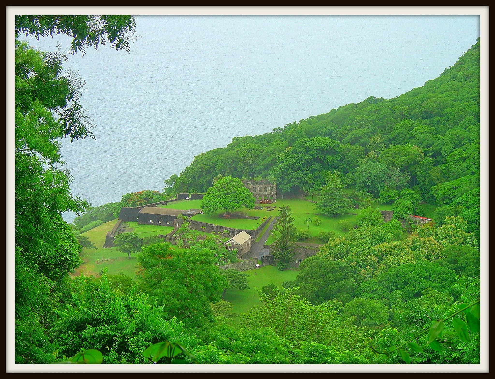
Fort Shirley occupies the floor of a former volcanic crater on the Cabrits Peninsula, also known as Prince Rupert’s Head. The 313-acre peninsula lies north of Portsmouth between Prince Rupert’s Bay and Douglas Bay. The surviving complex combines brick and stone masonry with a Georgian military layout. Restored buildings stand among scattered ruins across the peninsula, and paths connect parts of the archaeological complex.
Buildings and military installations
By the end of the eighteenth century, Fort Shirley contained more than 50 buildings and installations. Its facilities included barracks, officers’ quarters, a bakery, a forge, ordnance and ammunition stores, powder magazines, and seven cisterns. Cisterns were tanks or underground reservoirs that collected and stored water, helping maintain supplies during periods of siege or isolation.
Restored buildings
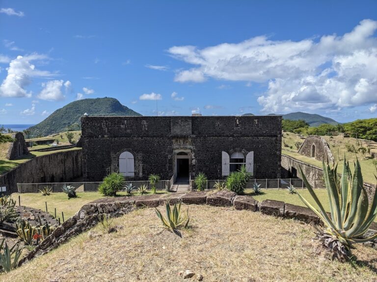
The restored officers’ quarters, barracks, powder magazine, arms store, and guardhouse form the principal preserved buildings. A powder magazine was a purpose-built store for gunpowder and other explosive military supplies. The barracks could accommodate more than 600 soldiers in regular service, along with support personnel such as artisans and enslaved workers. The officers’ quarters are also used for receptions, lectures, concerts, and other cultural events, while the Cabrits Heritage and Ecology Centre forms part of the site.
Defensive works
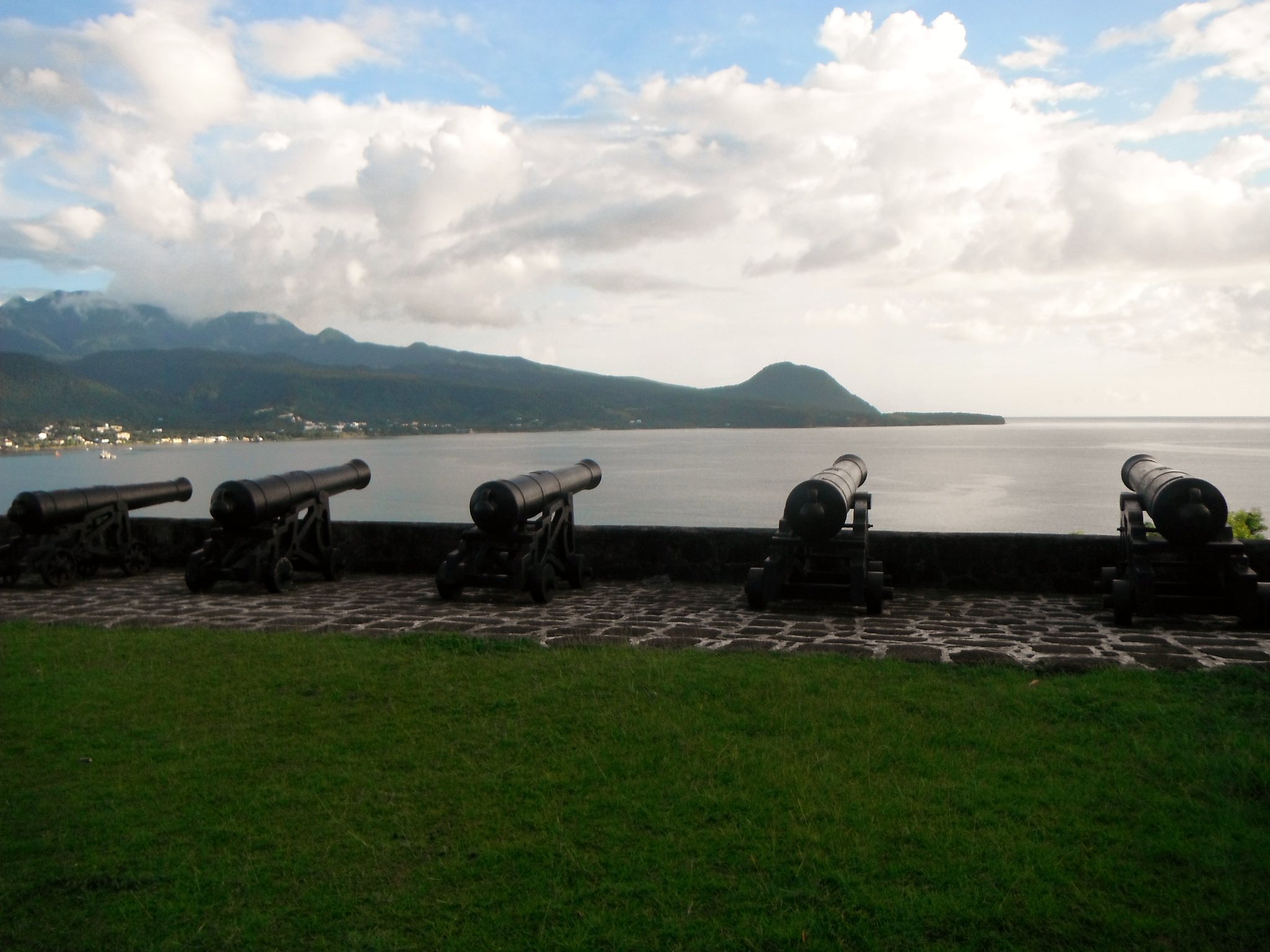
The fort’s defenses included seven gun batteries and ramparts. A gun battery was a fortified position for artillery, while ramparts were raised defensive walls or embankments protecting the fort. The surviving ramparts have been restored in sections, and other military structures remain as ruins distributed across the peninsula.