Fort Ricasoli: A Bastioned Harbour Fortification in Malta


Site at a Glance
- Rating
- 3.8
- Popularity
- Low
- Country
- Malta
- Primary era
- Early Modern
- Eras represented
- Early Modern, Modern
- Civilizations
- British, Crusader, Knights Hospitaller
- Site type
- Military
- Remains
- Fort
On this page12 sections
History
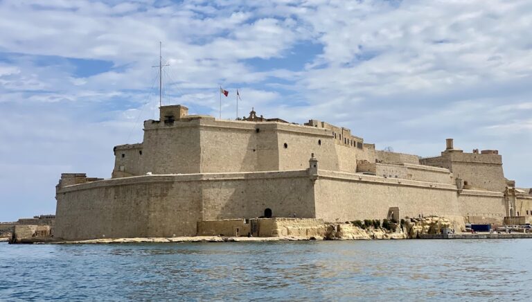
Fort Ricasoli is a bastioned fort in Malta, built by the Order of Saint John on Gallows’ Point at Kalkara, on the eastern side of the Grand Harbour. Construction began in 1670, during the early modern period, and the completed fortress controlled the harbour entrance together with Fort Saint Elmo. Covering approximately 83,800 square metres and rising as high as 20 metres, Fort Ricasoli is the largest fort in Malta.
Before the fortress
The peninsula was formerly called Rinella Point or Punta Sottile. Its later name, Gallows’ Point, recalled a public act of punishment in 1531, when two leaders of a slave rebellion and ten other participants were tortured and hanged there after attempting to seize Fort Saint Angelo and escape the island.
The headland also acquired a military role during the Great Siege of Malta in 1565, the Ottoman campaign against the Order of Saint John that culminated in the defence of Malta. Ottoman forces built an artillery battery on the peninsula to bombard Fort Saint Elmo.
A small semicircular battery was built at Gallows’ Point in 1602. It was first called San Petronio Battery and later became known as Orsi Battery. On 18 January 1629, the Italian knight Alessandro Orsi financed a tower beside it. Officially named Torre San Petronio, the structure was also called Orsi Tower or Torri Teftef. Its purpose was to prevent enslaved people from escaping Malta.
Planning and construction
In 1644, Giovanni de’ Medici proposed abandoning Fort Saint Angelo at Birgu and replacing it with a new fortress on Orsi Point. The proposed installation would have been called Fort Saint Angelo and would have been manned by troops transferred from the older fort, but the plan was never carried out.
Concern about another Ottoman attack grew after the fall of Candia in 1669. In the following year, Grand Master Nicolas Cotoner invited Antonio Maurizio Valperga, a military engineer serving the House of Savoy, to improve Malta’s fortifications. Valperga designed a new fort for the peninsula. The Order approved the proposal despite internal criticism.
The Florentine knight Fra Giovanni Francesco Ricasoli contributed 20,000 scudi to the work, and the new fortress was named in his honour. Its first stone was laid on 15 June 1670, with the initial construction supervised by Valperga. A garrison occupied the fort in June 1674, although the works were still unfinished.
In 1681, the Flemish engineer Carlos de Grunenbergh proposed alterations to Valperga’s design, and these changes were adopted. Barracks, a chapel, and other internal buildings were added during the 1680s and 1690s. Fort Ricasoli was formally declared complete and armed in May 1698.
Eighteenth-century improvements
French engineers inspected the fortress in 1714 and criticized the small size of its bastions. Jacop de Puigirand de Tigné, Charles François de Mondion, and Philippe de Vendôme each contributed to the assessment. Repairs to parapets and gun openings recommended by de Tigné were completed in 1722. His proposed internal defensive line and Vendôme’s planned separating canal were not built because funds were insufficient.
The fort had fallen into poor condition by the middle of the eighteenth century, prompting further maintenance in 1761. By 1785, it mounted eighty guns, including forty-one 24-pounders, and was the most heavily armed fort in Malta. Sections of its outer defensive wall were rebuilt during the 1790s under Antoine Étienne de Tousard. The fortress also served as a prison before the Corradino Correctional Facility was constructed.
French conquest and British rule
During the French invasion of Malta in June 1798, Fort Ricasoli was commanded by the Bali de Tillet and garrisoned by the Cacciatori, a volunteer light-infantry regiment. It repelled three French attacks before surrendering after Grand Master Hompesch formally capitulated to Napoleon Bonaparte.
During the Maltese uprising and blockade that followed the French conquest, the fortress remained in French hands. Its guns repeatedly fired on the insurgents’ San Rocco Battery, about 700 metres away.
Fort Ricasoli continued as an active military installation under British rule. In 1807, Albanian soldiers serving in the Froberg Regiment mutinied, barricaded themselves inside the fort, and eventually blew up the main gunpowder magazine. Loyal troops suppressed the revolt, and some mutineers were condemned to death by court martial. The damaged parts of the fort were repaired without being reconstructed to their original design, and a new magazine was built in 1829.
The fortress served as a temporary naval hospital in the late 1820s and early 1830s, before the opening of Bighi Hospital. During the cholera epidemic of 1837, patients infected at the Ospizio in Floriana were transferred to Ricasoli. Most died within days and were buried at the nearby Wied Għammieq cemetery. Another cholera epidemic affected the fort in 1865.
Artillery and wartime defence
In 1844, 500 men manned the fort. Four years later, Sir John Fox Burgoyne inspected Malta’s fortifications and described Ricasoli as “impregnable.” Higher-calibre artillery was introduced during the 1850s, and the guns were replaced several times in later years.
The seaward enceinte, or main sea-facing defensive wall, was completely overhauled by 1878. By the beginning of the twentieth century, the fort had new gun positions, searchlights, and a torpedo station. Concrete fire-control towers were added to Bastions 2, 3, and 4 during the 1930s, together with further searchlights.
Fort Ricasoli took part in Malta’s defence during the Second World War. On 26 July 1941, its guns helped repel an Italian attack on the Grand Harbour. German aerial bombardment destroyed the gate and Governor’s House in April 1942.
Naval barracks and later uses
Between 1947 and 1958, the fortress operated as HMS Ricasoli and served as a naval barracks. The gate was rebuilt in 1958 in a form slightly different from the original. The Governor’s House was never reconstructed, mainly because of the cost. The Admiralty transferred control of the fort to the government of Malta in 1964.
After the transfer, Fort Ricasoli was initially abandoned. It was later used as a container depot for raw materials arriving in Malta. In 1964, its ditch also became a tank-cleaning facility for Malta Drydocks. The facility treats liquid waste from ships entering the Grand Harbour, removing oil and other chemicals before discharge into the sea. It was privatized in 2012 and is managed by Waste Oils Co. Ltd.
Part of the ditch near the Left Ravelin was filled in 1976, and St. Dominic’s Demi-Bastion was breached for a new road. The surrounding area became Ricasoli Industrial Estate, which was demolished in 2007 to make way for SmartCity Malta.
Conservation and film production
Most of Fort Ricasoli is leased to the Malta Film Commission and has been used extensively for film and television production. Large sets constructed within the fortress served as Port Royal in Cutthroat Island (1995), Rome in Gladiator (2000), Troy in Troy (2004), Alexandria in Agora (2009), Varna in The Last Voyage of the Demeter (2023), and Toulon in Napoleon (2023). Other productions filmed there include Assassin’s Creed (2016), Entebbe (2018), and the miniseries Julius Caesar (2002) and Helen of Troy (2003).
A set known as the Roman Road, built for Julius Caesar, was retained and reused in later productions. Parts of the fortress also represented the Red Keep in the first season of HBO’s adaptation of Game of Thrones.
Fort Ricasoli has been on UNESCO’s tentative list since 1998 as part of the Knights’ Fortifications around the Harbours of Malta. The government of Malta owns the fort. Conservation work in 2004 restored and reattached part of the walls, while works intended to attract further film productions began in early 2019. Extensive restoration plans submitted to the Planning Authority in 2013 were approved in June 2019. The fort continues to serve as a filming location and tank-cleaning facility.
Remains
Fort Ricasoli follows the coastline of its peninsula in an irregular plan. Its principal components are a bastioned land front with outworks, a sea-facing enceinte, and a tenaille trace along Rinella Bay. A tenaille is a low, angular defensive work placed in front of a fortification. Limestone is the main construction material. The surviving complex is largely intact but dilapidated, with coastal erosion affecting the headland and sections of wall between Bastions 3 and 4 collapsed into the sea.
Land front and outworks
The land front is formed by three principal works connected by curtain walls. At the northern end stands St. Dominic’s Demi-Bastion, also called the Left Demi-Bastion or No. 5 Bastion. A demi-bastion is a half-bastion, while a bastion is a projecting fortification that allows defensive fire along adjoining walls. The pentagonal St. Francis Bastion, also known as the Central or No. 6 Bastion, occupies the middle. St. John’s Demi-Bastion, the Right Demi-Bastion or No. 7 Bastion, stands at the southern end.
St. Francis Bastion contains a traverse and a covered abris, a protected shelter for troops. The casemates of the land front served as barracks. A casemate is a vaulted or protected military chamber used for troops, guns, or stores.
A crown-shaped faussebraye surrounds the land front. Its outworks include St. Dominic’s Counterguard, two triangular ravelins, and two caponiers. A ravelin is an outwork beyond the main ditch, while a caponier is a covered passage or defensive work crossing a ditch. Seawater heavily damaged the counterguard, and approximately half of it has collapsed. The British substantially altered the caponiers.
The Left Ravelin contains a 6-inch, or 152-millimetre, breech-loading gun emplacement. The outworks are enclosed by a ditch, covertway, and glacis. A glacis is a sloping bank designed to expose attackers to defensive fire.
Sea-facing defences
The sea-facing enceinte includes No. 1 Bastion, a demi-bastion joined to a tenaille to form Point Battery. Its original projecting tower was dismantled to make room for a directing station for the Brennan Torpedo System, a late-nineteenth-century guided torpedo system operated from shore. An emplacement for an RML 12.5-inch, 38-ton gun remains on the bastion’s face. RML means rifled muzzle-loading, describing a gun whose rifled barrel was loaded from the front.
No. 1 Curtain, the connecting wall between Bastions 1 and 2, contains a casemated battery and a searchlight position. No. 2 Bastion is asymmetrical, with embrasures, British gun emplacements, magazines, and a fire-control tower. An embrasure is an opening through which a gun fires.
No. 2 Curtain, between Bastions 2 and 3, contains embrasures, an expense magazine, and a searchlight position. An expense magazine stores ammunition intended for immediate use. No. 3 Bastion has a flat face, British gun emplacements, magazines, embrasures, and a fire-control tower.
A curtain wall near No. 4 Bastion contains embrasures, magazines, and a sally port, or controlled exit from a fortification. Part of this wall has collapsed into the sea. No. 4 Bastion is smaller than the other sea-facing bastions and contains a gun position, magazine, shelters for gun crews, and a fire-control tower.
No. 5 Curtain connects No. 4 Bastion with St. Dominic’s Demi-Bastion on the land front. It contains gun emplacements, magazines, and gun-crew shelters. A shallow rock-hewn ditch extends from Bastion 1 to Bastion 3.
Harbour-side trace and internal buildings
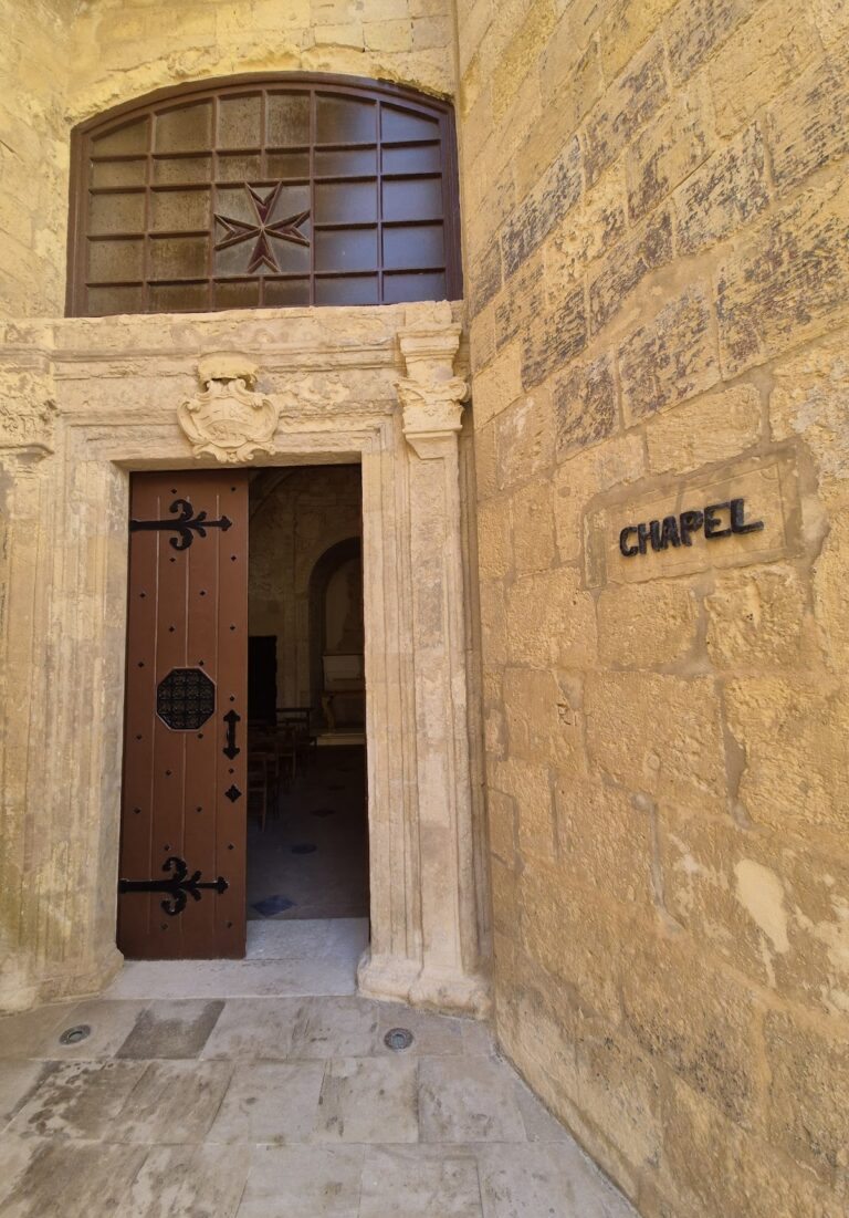
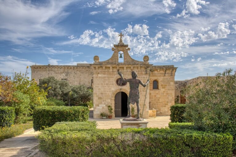
The harbour side consists of a high-walled tenaille running along Rinella Bay. The main gate is set within this defensive line. Near the gate are the Chapel of St Nicholas and the former Governor’s House, which was destroyed during the Second World War and never rebuilt. The gate was reconstructed in 1958 in a slightly altered form.
An inscription on the main gate commemorates the fort’s inauguration in 1698 and praises Grand Master Perellos. At the northern end of the tenaille, on the tip of the peninsula, the rock-hewn ditch of the former Orsi Battery remains visible. The battery was a small semicircular work, protected together with Orsi Tower by a sea-filled ditch and drawbridge. Storm waves destroyed both tower and battery on 8 February 1821, leaving the rock-cut ditch as their surviving physical trace.
The British built a Brennan Torpedo Station near the harbour-side trace in the late nineteenth century. A nearby lighthouse was damaged by severe weather in 1949. Together with the gun positions, magazines, searchlight installations, barracks, chapel, ditches, and harbour-side walls, these remains preserve the successive defensive systems that shaped the fortress over more than two centuries.
Nearby sites