Fort Louvois: A Maritime Fortification in France


Site at a Glance
- Rating
- 4.7
- Popularity
- Medium
- Country
- France
- Primary era
- Early Modern
- External website
- Open
- Eras represented
- Early Modern, Modern
- Civilizations
- French
- Site type
- Military
- Remains
- Fort
On this page11 sections
History
Fort Louvois is a late seventeenth-century French maritime fortification on the Chapus islet at Bourcefranc-le-Chapus, France. Built under Louis XIV, it was the last maritime fortification commissioned during his reign and formed part of the coastal defenses planned after the Rochefort naval arsenal was completed in 1666. The fort controlled the southern approach through the Pertuis de Maumusson, a tidal passage between the island of Oléron and the mainland, in conjunction with the citadel of Château d’Oléron.
Construction under Louis XIV
On 16 December 1690, the Marquis of Louvois, Louis XIV’s Minister of War, informed Michel Bégon, the naval intendant at Rochefort, that the king wished to build a fort on the Chapus islet. The engineer François Ferry prepared an oval design measuring 52 by 78 metres, with artillery openings on two levels. Work on the foundations began on 19 June 1691, on ground formed from shellfish deposits and mud. The difficult conditions slowed construction, and by 20 October only the stone foundations had been completed, although more than half the allocated budget had already been used.
Louvois died on 16 July 1691, after which the military engineer Vauban took charge of the project. Vauban simplified the design and reduced its cost, replacing the planned oval fort and two-level battery with a horseshoe-shaped battery, two pier heads, a single artillery level, and one tower. Construction continued for three years and was completed in 1694 under the engineer Henri-Albert Bouillet.
Artillery changes and military use
Advances in artillery led to the fort’s last major modifications in 1755. The number of artillery openings was reduced from 16 to 10, the battery’s roof was removed, and latrines were added to the walls. The fort was armed in 1824 with four 24-pounder guns and three 32-pounder mortars. In 1870, six 22-pounder howitzers were installed, followed by repairs in 1875 to address damage caused by the sea. A telegraph station and six 16-pounder guns were added during those works.
The French military abandoned Fort Louvois after the First World War. It was classified as a historical monument on 14 June 1929. During the liberation of Marennes on 10 September 1944, the fort was heavily shelled. German forces occupied it but withdrew after one day as Allied forces advanced. Free French forces then took possession, but the fort came under fire from Château d’Oléron, which was still held by German troops. The bombardment destroyed the guardhouse and barracks and badly damaged the keep. Scaffolding was later placed against the tower’s north-west side to prevent its collapse.
Restoration and museum use
The municipality of Bourcefranc-le-Chapus purchased the fort from the French government in 1960. It was completely restored during the 1960s under the direction of the Regional Administration for Cultural Affairs, the French regional authority responsible for cultural heritage, and opened to the public in 1972. Since then, its role has been museum and heritage presentation rather than military defense. It houses an oyster-farming museum and a permanent exhibition on the fort’s history, with models of coastal fortifications along the Charente coast.
Storms have continued to affect the structure. Storm Xynthia flooded the fort in 2010, with water reaching 80 centimetres, and swept away the drawbridge. The same drawbridge had also been carried away during the storm of 1999.
Remains
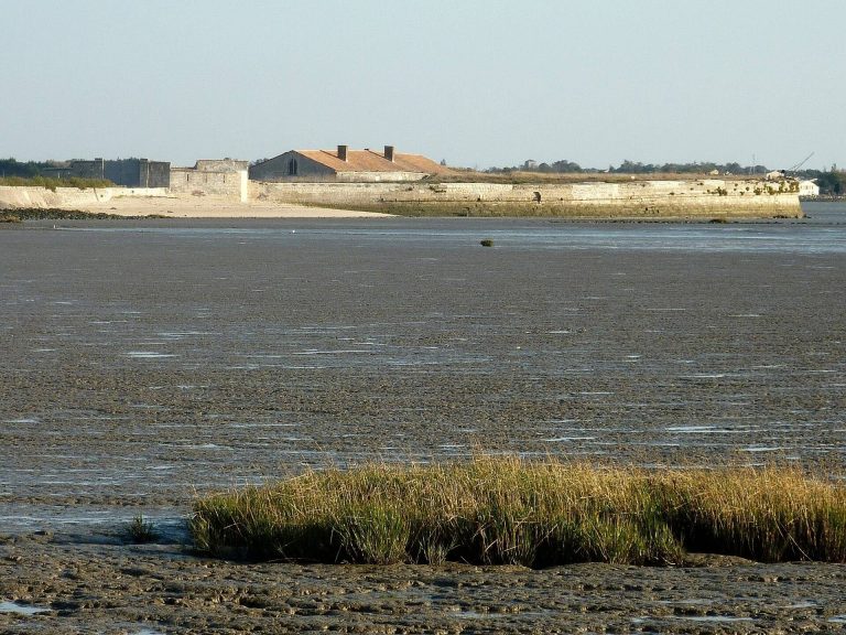
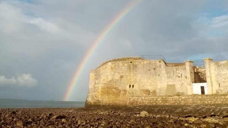
Fort Louvois stands on the Chapus islet approximately 400 metres offshore from Bourcefranc-le-Chapus, opposite the citadel of Château d’Oléron. A straight causeway links the fort to the mainland, although the route is submerged at high tide. Oyster beds lie beside the causeway. The surviving fort follows Vauban’s revised plan, with a horseshoe-shaped battery enclosing a central tower redoubt, a fortified defensive tower, at the open end of the horseshoe.
Battery and enclosure
Horseshoe battery
The battery has a maximum length of about 55 metres and occupies an area of approximately 52 by 55 metres. Its firing platform stands 12 metres above the water and covers 180 degrees laterally. The completed structure therefore differs from Ferry’s original 1691 proposal, which called for an oval fort measuring 52 by 78 metres with artillery openings on two levels. The final fort has a single battery level and the horseshoe plan established during the later redesign.
Enclosure and internal buildings
A moat fills at high tide between the tower and the rest of the fort. One drawbridge formerly gave access from the shore, while a second connected the fort to the tower. Inside the enclosing defensive walls are barracks and a building on the terreplein, the level interior area used for buildings, artillery, or movement. This building contained an arms room, food stores, and a water tank. The powder magazine and barracks stood on opposite sides of the keep, while a corner watch turret, a small projecting structure for observation and defense, flanks the western projection of the enclosure.
Tower and surviving details
Central tower
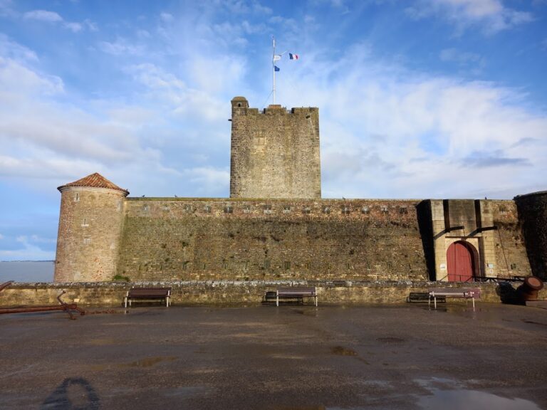
The tower is 24 metres high and has five levels. Its seaward side is semicircular within the horseshoe, while its landward side is shaped like a beak. The ground floor held the powder magazine, and the upper floors provided quarters for the commander and other officers. A lighthouse now stands on the tower.
Keep and watch turret
The keep has crenellations and is surmounted by a corner watch turret. The projecting structure that supports the turret once carried a large armorial shield, which was mutilated during the French Revolution. The fort’s permanent exhibition includes models of coastal fortifications in the Charente region, placing its surviving form alongside structures such as Fort Risban at Calais, Grand Risban at Dunkirk, Fort Lupin on the southern bank of the Charente, and the Tour Vauban and battery at Camaret-sur-Mer.