Fort Davis: A Coastal Defence Fort in Ireland
Site at a Glance
- Popularity
- Medium
- Country
- Ireland
- Primary era
- Modern
- Eras represented
- Early Modern, Modern
- Civilizations
- British, English
- Site type
- Military
- Remains
- Fort
On this page16 sections
History
Early coastal defences
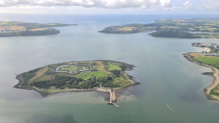
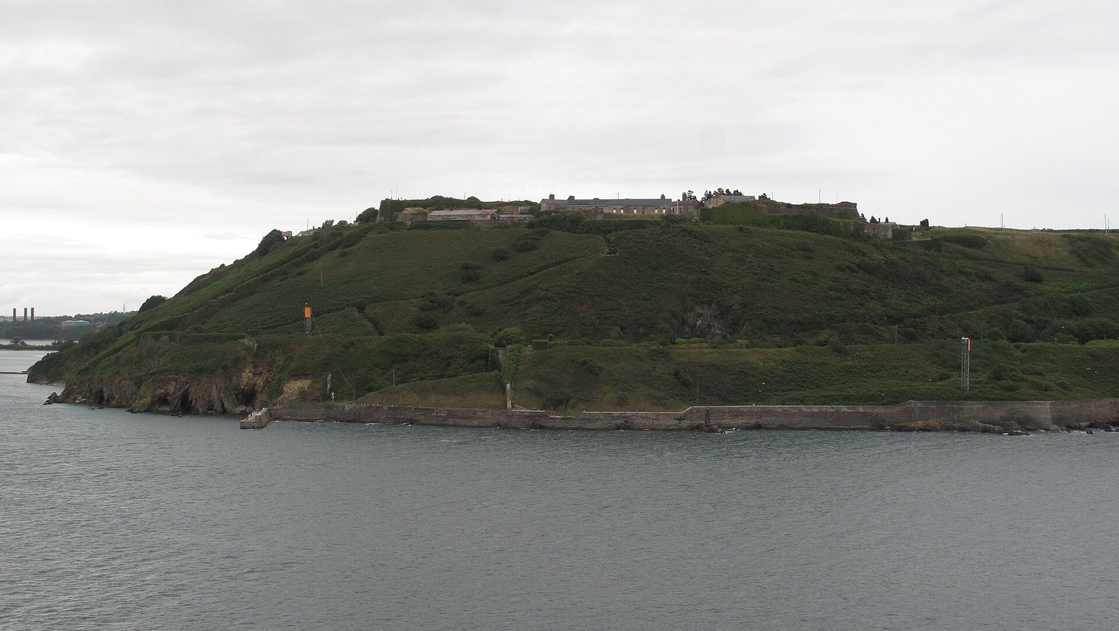
Fort Davis is a coastal fortification near Whitegate, north of Roche’s Point, overlooking the entrance to Cork Harbour in Ireland. A fort stood here by 1607, when the site’s early work became known as Prince Rupert’s Tower, named for the seventeenth-century prince and military commander. By the Williamite War of 1689–1691, a conflict in Ireland between supporters of James II and William III, further coastal defences had been built and the site was called King John’s Fort.
In 1690, Williamite forces led by John Churchill, Duke of Marlborough, captured King John’s Fort and Fort Camden as they prepared for the Siege of Cork. The two forts formed part of the defences protecting the harbour entrance.
Expansion and redevelopment
Further construction took place from the 1790s. During the Napoleonic Wars, the series of conflicts between France under Napoleon and its opponents from 1803 to 1815, some of the fort’s buildings and tunnels housed French prisoners of war. By the mid-nineteenth century, it had been renamed Fort Carlisle, after Frederick Howard, 5th Earl of Carlisle, a former Lord Lieutenant of Ireland. In the 1850s, a Royal Commission proposed improvements to Fort Carlisle and to the harbour defences at Fort Mitchel and Fort Camden.
Fort Carlisle was substantially redeveloped during the 1860s, following the approach of other Palmerston forts, coastal fortifications built under nineteenth-century British defence programmes associated with Lord Palmerston. The work incorporated advances in the use of concrete and reshaped the fort’s defences.
British and Irish military use
During the First World War, Cork Harbour served as a naval base guarding the Western Approaches, the sea areas west of Britain and Ireland, including Atlantic routes to the British Isles. Fort Davis reinforced Fort Camden’s defences on the opposite side of the harbour entrance, and coastal-artillery units of the British Army’s Royal Garrison Artillery were stationed there. Some graves in the fort’s military cemetery date from the Irish War of Independence.
Under the Anglo-Irish Treaty, signed in 1921, Britain retained certain Irish naval facilities known as the Treaty Ports. Their installations, including Fort Carlisle, passed to Irish authorities in 1938. That year, the fort received its present name in honour of Thomas Davis, a nineteenth-century Irish writer and nationalist who helped organise Young Ireland, a movement seeking political and cultural renewal.
During the Emergency, Ireland’s official term for the 1939–1945 Second World War period, units of the Irish Artillery Corps’ Coastal Defence Artillery operated from the fort. By the mid-to-late twentieth century, that service had been merged into other Irish Army artillery regiments, and the site was used mainly for training. It remains owned by Ireland’s Department of Defence and is used by the Irish Army for exercises, ceremonial gun salutes, and other training.
Remains
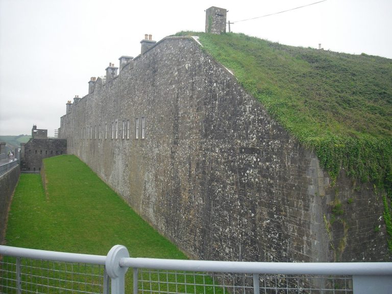
The 74-acre fort has a defended landward side and artillery positions facing the harbour. Its surviving works include a deep dry moat, ramparts, protected gun chambers, and tunnels, alongside above-ground military buildings.
Landward defences
A star-shaped system of ramparts and a dry moat protected the landward approaches. The moat reaches 30 feet (9.1 metres) deep and is up to 40 feet wide; a drawbridge once crossed it. Three musketry caponiers, protected positions from which defenders could fire along the ditch, formed part of the defences. A level platform known as a terreplein held movable guns. A fortified tunnel bears the date 1797.
Seaward artillery
Eight gun positions, arranged in batteries (groups of artillery guns), faced the harbour. Underground shelters and vaulted ammunition stores served the batteries, while bunkered tunnels linked some of them. At its peak, the fort mounted more than 20 guns.
Main emplacement
The main emplacement dates from the Napoleonic era and has a triangular plan. Its projecting defences comprise one full bastion, two demi-bastions, each with one face and one flank, and one semicircular bastion.
Number 1 Battery
Number 1 Battery was first fitted with four protected Moncrieff mountings, gun carriages designed to lower a weapon after firing, for 7-inch rifled muzzle-loading guns (RML), loaded through the barrel. It was later rebuilt for three 12-pounder quick-firing guns (QF), designed for faster loading.
Number 2 Battery
Number 2 Battery had two 10-inch RML guns behind protective shields, within vaulted, fortified gun chambers.
Number 3 Battery
Number 3 Battery had four 7-inch RML guns on Moncrieff mountings.
Number 4 Battery
Number 4 Battery had four 10-inch RML guns in fortified chambers and was later converted into an oil store.
North Battery
North Battery held two 6-inch breech-loading coastal-defence guns (BL), loaded from the rear.
Rupert’s Tower Battery
Rupert’s Tower Battery was first equipped with two 12-inch RML guns. It was later rebuilt to hold two 6-inch BL Mark VII guns.
South Battery
South Battery held two 9.2-inch BL guns.
Other structures and archaeological evidence
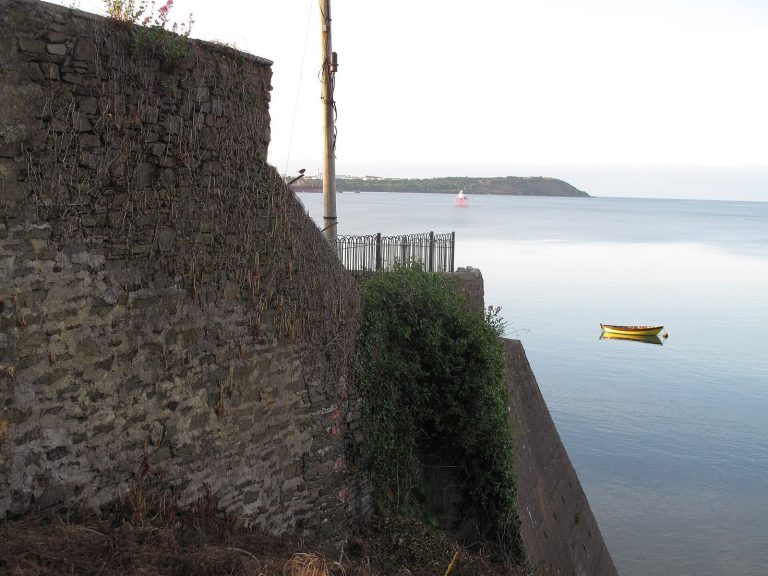
The fort also includes a military cemetery, a pier on the waterfront that provided access by sea, and above-ground barracks and support buildings. Clearing work in 2015 uncovered evidence of torpedo defences.