Feldioara Fortress: A Teutonic and Community Fortress in Romania
Site at a Glance
- Rating
- 4.7
- Popularity
- Medium
- Country
- Romania
- Primary era
- Medieval
- External website
- Open
- Eras represented
- Medieval, Modern
- Civilizations
- Crusader, Hungarian, Teutonic Order
- Site type
- Military
- Remains
- Castle
On this page12 sections
History
Feldioara Fortress is a medieval fortress in Romania, near Feldioara in southeastern Transylvania, built during the thirteenth century in connection with the Teutonic Order. Also known as Marienburg and later Sanctae Mariae, it became the order’s most important fortification in the historical region of the Burzenland, an area broadly corresponding to the surroundings of present-day Brașov.
The Teutonic Order in the Burzenland
In 1211, King Andrew II of Hungary invited the Teutonic Order, a Catholic military-religious order formed during the Crusades, to defend the eastern frontier of the Hungarian crown against repeated Cuman incursions. The order initially received permission to build fortifications from timber and earth. In 1222, Andrew II extended this privilege to stone castles and towns, enabling more permanent construction in the region.
Feldioara Fortress was built on a hill where earlier settlement activity had taken place. The Teutonic Order expanded its territory northward toward the land of the Brodnics and carried out incursions southward toward the Danube. Andrew II became concerned that the order might create an independent state within his kingdom. Pope Honorius III had authorized such a state in 1223, and Andrew expelled the Teutonic Knights from the Burzenland in 1225.
The order’s presence nevertheless introduced building methods influenced by crusader castles in the Holy Land and Asia Minor. The fortress therefore formed part of a frontier settlement whose military and religious functions were connected with wider developments in medieval castle building.
Destruction and later medieval rebuilding
During the Tatar invasion of 1241, the chapel and other buildings at the fortress were destroyed. Afterward, King Bela IV placed the locality under the control of a Cistercian community. The Cistercians, a Catholic monastic order, built a church on the ruins of the earlier fortification.
After the Teutonic period, the local Saxon community probably constructed or developed the towers and curtain walls that shaped the later fortress, although their precise date remains uncertain. Under Sigismund of Luxembourg, the stronghold functioned as a peasant or community fortress, and Feldioara received town rights in connection with it. A rebuilding or refortification may have followed 1420. In 1439, a document described the inhabitants of Feldioara as having fortified a castrum, or fortified stronghold, to protect their possessions.
The fortress was destroyed by the Turks in 1430. It suffered further destruction during Vlad Țepeș’s campaign of 1457, after which the inhabitants rebuilt it in the same year. The southern enclosure wall was probably destroyed after the Battle of Feldioara by forces of Petru Rareș, a sixteenth-century ruler of Moldavia, under the command of the vornic Nicoară Grozav. A vornic was a senior administrative official in the medieval Romanian principalities.
Restoration and archaeological investigation
By 2013, Feldioara Fortress was substantially ruinous. A restoration project prepared in 2012 began in March 2013 and continued until 2017. The Brașov County Council assumed administration of the works from Feldioara municipality and financed the project. Archaeological research was conducted across the site under the direction and organization of Daniela Marcu-Istrate.
The investigations confirmed occupation extending over thousands of years and recovered well-preserved Neolithic, Geto-Dacian, and medieval artefacts. The restored fortress is protected as a Romanian historic monument under code BV-II-a-A-11695 and is listed as national heritage.
Remains
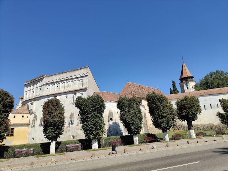
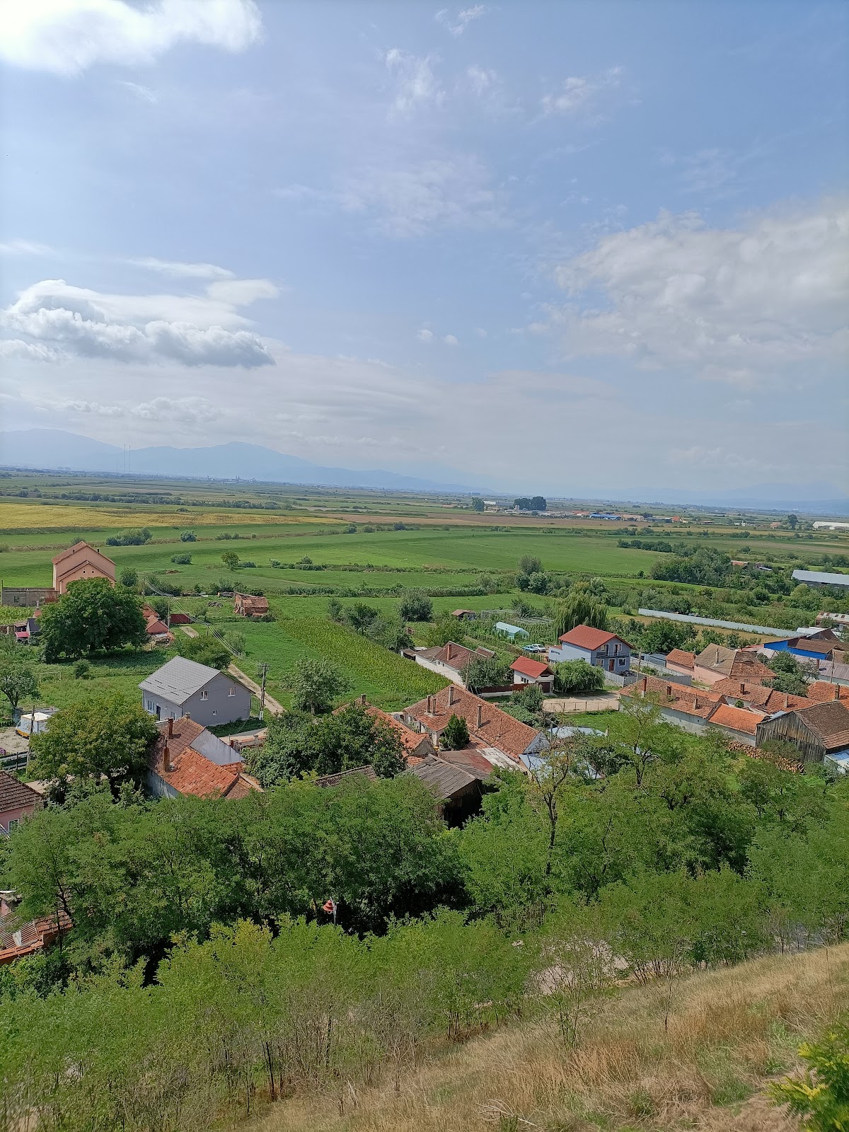
Feldioara Fortress occupies a hill approximately 497 metres above sea level. The locality lies on the left bank of the Olt River, while the fortress hill is surrounded on three sides by the Homorod River. Two separate fortification complexes stand on the hill. An eastern castle ruin is traditionally regarded as the old Teutonic castle, or Ur-Marienburg, while a western enclosure has the character of a church fortress or town fortification. The two complexes are not physically connected.
The two medieval fortification complexes
Eastern castle ruin
The eastern enclosure may represent the principal Teutonic castle, although another interpretation attributes it to the Transylvanian Saxons. Only a fragment of the original Teutonic stone wall remains visibly in the northwestern part of the complex. Its masonry differs from the rest of the ensemble. Large boulders form the base, while smaller boulders were laid above them with high-quality mortar.
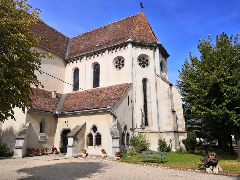
Topographical evidence indicates that the original fortress may have included a second circuit. This inner complex probably contained a chapel, a Knight’s House, and a hospital. The Knight’s House appears to have had a communal dining room on the ground floor, a storeroom above it, and sleeping quarters on the highest floor. The Romanesque chapel of the Teutonic Knights is probably incorporated into the choir of the later Gothic church, while foundations beneath the basilical body are thought to preserve remains of the Knight’s House.
Western church-fortress enclosure
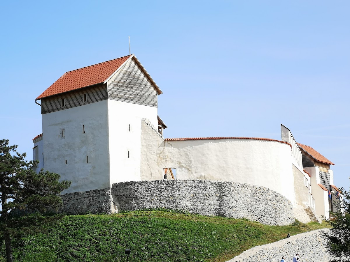
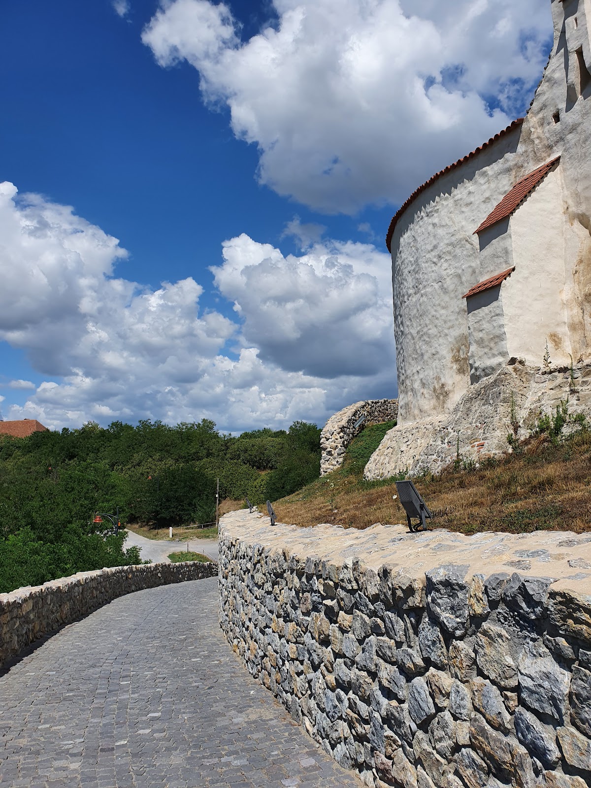
The western complex may preserve the original Marienburg or a church fortress. Its form resembles a fortified town enclosure, but the competing interpretations of the two complexes remain important to the understanding of Feldioara’s medieval development. The later community fortress had an oval plan adapted to the hilltop, with a southern entrance, defensive towers, and curtain walls approximately 6 to 7 metres high.
Walls, towers, and defensive works
Towers and curtain walls
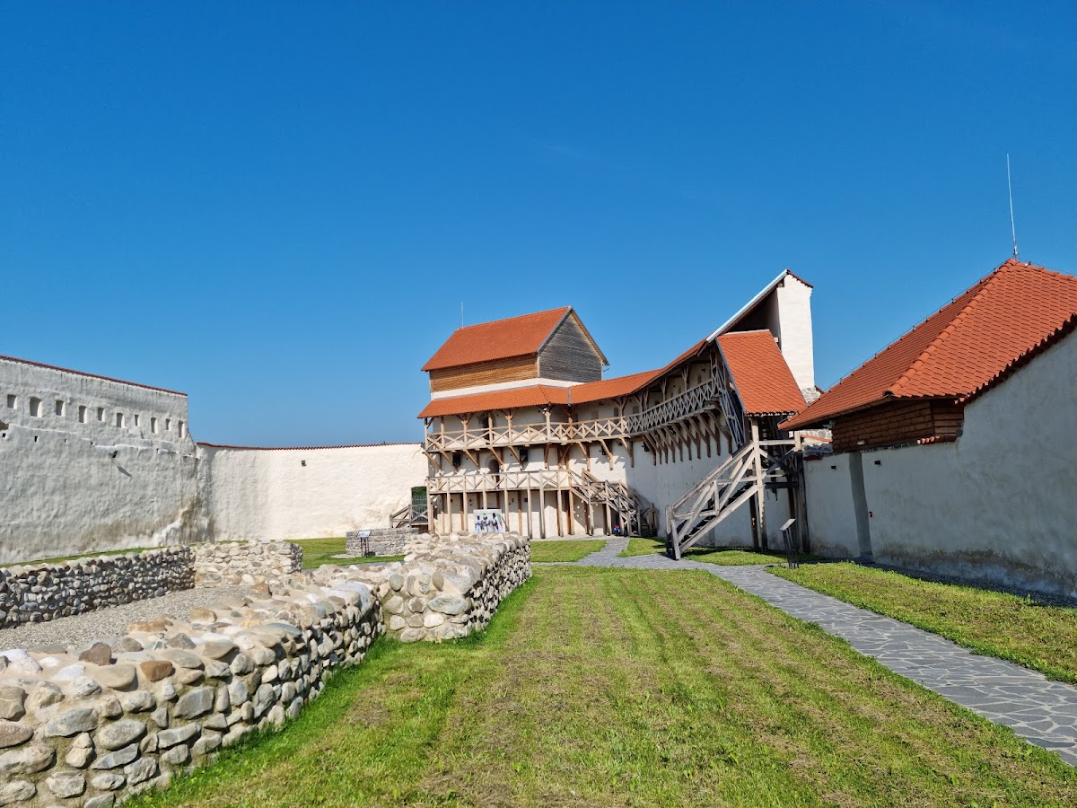
Of the principal towers, the western tower remains visible, while only the basal elements of the southern tower survive. The towers were divided into levels by platforms linked by wooden stairs. The eastern tower is thought to have contained platforms and a half-cylinder vault, a barrel-shaped semicircular ceiling. Holes midway along the curtain walls held beams supporting the wall-walk, the passage along the top of a defensive wall. Machicolations, which are projecting openings used to attack enemies below, remain visible on the southern side.
An inscription dated 1657 is carved into the masonry of the northern tower. Its meaning is uncertain. It may refer to the tower’s construction or to a later renovation. The southern enclosure wall probably underwent further damage after the Battle of Feldioara, leaving the restored complex with a mixture of surviving medieval fabric and reconstructed sections.
Well and outer defensive enclosure
A well approximately 70 metres deep stood west of the curtain wall. It was reconstructed during the restoration carried out between 2013 and 2017. The project also repaired the enclosure walls and the north, south, east, and west towers, together with the Zwinger wall. A Zwinger is an outer defensive enclosure or protected space between fortification walls.
The remains of the chapel and Cistercian monastery were marked at ground level in the inner courtyard. Since the fortress’s complete historical form was unknown, reconstruction was limited to walls and towers whose former appearance could be established from historical information. Underpinning, injections into the masonry, consolidation, and related conservation measures stabilized the older fabric.
Restored fabric and archaeological evidence
Degraded masonry and plaster surfaces were treated with NHL5 hydraulic lime, a conservation lime made from raw material from the Dolomites and imported from Italy. Reconstructed sections used wood, specially made brick modeled on the original brick, stone, and ceramic roof tiles. The restoration sought to evoke the fortress’s seventeenth-century appearance, when the walls were plastered. Wood distinguishes reconstructed areas visually from the original masonry. A lookout area was created on the wall-walk overlooking the Burzenland.
Excavated material from the site includes artefacts associated with the Neolithic Cucuteni culture, the Geto-Dacian period, and the Middle Ages. The locality and surrounding archaeological area also preserve evidence of Bronze Age and Roman occupation. Finds include pottery, glass, gold objects, a hoard of 21 Roman coins, and five gold bars dated to approximately AD 402 to 408.