Farnsburg Castle ruin: A Medieval Noble Seat and Bailiff’s Residence in Switzerland

Site at a Glance
- Rating
- 4.6
- Popularity
- Low
- Country
- Switzerland
- Primary era
- Medieval
- External website
- Open
- Eras represented
- Medieval
- Civilizations
- Holy Roman Empire
- Site type
- Military
- Remains
- Castle
On this page15 sections
History
Farnsburg Castle ruin is a fourteenth-century hilltop castle in Switzerland, built by the medieval Counts of Thierstein around 1330, within the period from 1319 to 1342. It stands on a rocky spur between Ormalingen, Buus, and Hemmiken in the canton of Basel-Landschaft. The castle became the seat of the Thierstein-Farnsburg branch, whose members held the office of landgrave, a territorial authority comparable to that of a count, in the historic territory of Sisgau.
Thierstein foundation
An earlier structure occupied the spur at the beginning of the fourteenth century, and it may have been considerably older. A Thierstein ministerial, a medieval official or service noble serving a territorial lord, was recorded at Farnsburg in 1309. Fragments of thirteenth-century pottery and parts of earlier buildings were incorporated into the masonry of the present castle. Much of the earlier structure may have been removed during construction, leaving its precise form and date uncertain.
The castle was established after the former possessions of the Frohburg noble family passed to the Thiersteins in 1319. By 1342, members of the family using the Farnsburg name had acquired further properties in the surrounding area. Count Sigmund II of Thierstein or his son Otto I may have directed the building work. A joint initiative is considered virtually impossible because Otto was eight years old when his father died.
Farnsburg first appears in written records in 1363, and a charter was issued there in 1367. For several generations, it served as the center of a lordship governed by the Thierstein-Farnsburg line. That lordship included Arisdorf, Buus, Diepflingen, Gelterkinden, Hemmiken, Kilchberg, Maisprach, Ormalingen, Rickenbach, Rünenberg, Tecknau, Wenslingen, Wintersingen, and Zeglingen. The castle was also known by the forms Varsperg and Varnsberg.
Falkenstein inheritance and the Old Zurich War
When the Thierstein-Farnsburg branch died out, the Barons of Falkenstein inherited the castle, its lordship, and the landgraviate in 1418. The landgraviate was held as a fief of the Bishop of Basel. During the fifteenth and sixteenth centuries, the associated bailliage, an administrative district governed by a bailiff, expanded to include Zunzgen, Sissach, Böckten, Tenniken, Diegten, Eptingen, and Itingen.
Around 1440, Hans and Thomas of Falkenstein allied themselves with Habsburg, the ruling dynasty whose regional interests they supported. Their alignment brought Farnsburg into the Old Zurich War, a fifteenth-century conflict involving the Swiss Confederates, Zurich, and Habsburg. After attacking and burning Brugg in 1444, the Falkensteins withdrew to Farnsburg. A Confederate force of nearly 1,500 men besieged the castle, but the besiegers moved on toward Basel and were destroyed at the Battle of St. Jakob an der Birs on 26 August 1444. That defeat saved the castle’s defenders.
Basel’s subsequent war against noble families supporting Habsburg led to the political and economic collapse of the Falkensteins. Their prolonged financial difficulties probably contributed to Farnsburg’s neglect and structural decay.
Basel administration and later destruction
In 1461, Basel acquired the Farnsburg lordship, including its castle, lands, and rights. The city converted the former noble residence into the administrative seat of a territorial bailiff. Repairs and remodelling gave the complex a more contemporary and representative character. Glass windows were installed in 1462, and an outer fortification was constructed.
Following this change, Farnsburg no longer functioned as the base of a substantial military garrison. In 1461, its staff consisted of six servants, four night watchmen, two day watchmen, and a huntsman. The castle’s armament comprised 22 firearms and 10 crossbows, reflecting its administrative role alongside its continuing defensive capacity.
Fourteen insurgents captured the castle during the Swiss Peasant War in 1653. Farnsburg was taken again during the uprising of 1798, when local rural forces expelled the Basel bailiff and set the castle on fire. The ruin was subsequently used as a quarry and deteriorated rapidly.
Excavation and conservation
Rubble-covered parts of the ruin were excavated and restored in 1930 and 1931. A military observation post constructed during the Second World War disturbed the core castle, and repairs to the historic fabric followed in 1944 and 1945. Further maintenance took place in stages from 1947 to 1959. The canton assumed responsibility for the site in 1963, followed by larger repairs in 1981 and 1982 and again in 1986.
Forestry work uncovered the gunpowder tower in 1989, although vegetation later covered the remains again. A major conservation campaign in 2002 and 2003 was carried out under scientific supervision and examined the surviving fabric and the castle’s construction history. Cracks discovered in the shield wall, a particularly massive defensive wall placed on a vulnerable side of a castle, led to closure in 2012 because of the danger of collapse. Repairs were completed from June to November 2013. The ruin is now used as a lookout tower.
Remains
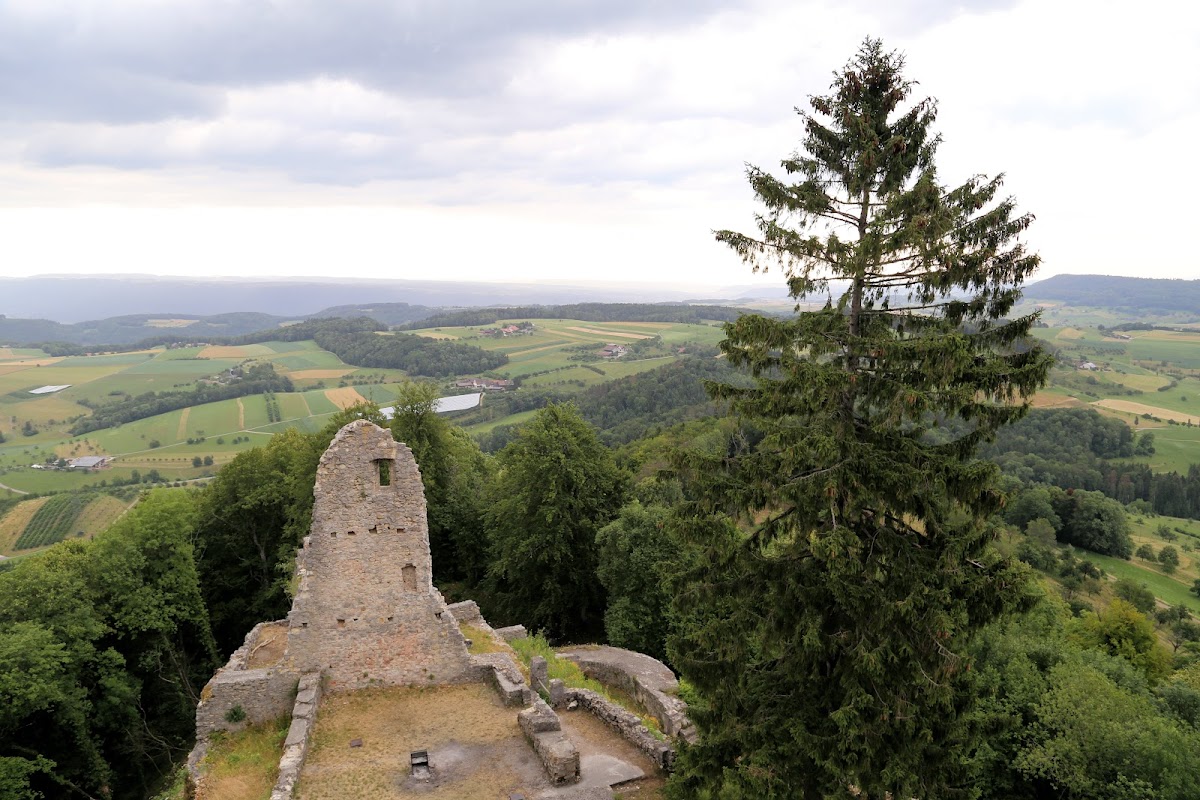
Farnsburg occupies a rocky spur on the northeastern edge of the Farn Mountain, where the municipalities of Buus, Hemmiken, and Ormalingen meet. The spur was artificially terraced, creating an approximately eight-metre vertical drop between the rock terrace and the shield wall. A neck ditch, cut across the landward connection of the spur, is about nine metres wide. It served as an approach obstacle and supplied stone for construction. Near the end of the castle’s use, around 200 wagonloads of material were placed in the ditch to form a garden, while the section beside the access bridge remains visible.
Outer defences and lower castle
The castle extends for approximately 130 metres, including the outer work, and reaches nearly 60 metres in width at the shield wall. Its extensive lower castle occupies the eastern and northern parts of the rock terrace, while the upper castle stands on the western rock head. The lower castle was enclosed by a curtain wall, a defensive boundary wall, reinforced with towers. Its principal spaces served economic functions, while the upper castle contained residential and representational facilities.
Outer work and gates
Approach to the lower castle passed through an outer work at the southeastern end of the neck ditch. A former gate ditch and an outer gate fortification protected this entrance. The fortification consisted of a gate building and a semicircular flanking tower, whose surviving masonry forms a visible defensive remnant. Beyond it, a bridge over the gate ditch led to the inner gate. Until the outer work was added in 1461, the inner gate served as the castle’s outer entrance. Its surviving remains are at foundation level, while historical depictions show a projecting rectangular tower with a lean-to roof.
Bettel Tower and eastern wall
The strong round Bettel Tower, also called the Hound Tower, stood at the southeastern corner of the lower castle. An attached guardhouse contained stables and had an adjoining granary. A semicircular shell tower, a tower open toward the interior and built as an extension of the curtain wall, reinforced the middle of the eastern wall. This tower was at times used as a gunpowder tower or an arsenal tower for hand cannons.
Residential and service buildings
A residential building and adjoining stables in the northern lower castle are identified with the residence of the Zielemp ministerial family. Other buildings attached to the curtain wall survive in fragmentary form. Documentary evidence also allows for burials in the lower castle at certain periods, although that interpretation remains uncertain.
Upper castle and water supply
The Long Stair connected the lower castle with the upper castle on the western rock head. The upper approach followed the southeastern side of the rock, reached the Blue Tower, and then turned sharply across a drawbridge over a feature called the Wolf Ditch. It continued to the Baker’s House, with additional gates in both the tower and the house securing entry to the upper castle.
Blue Tower and cistern
A side door in the Blue Tower led to the castle’s water-supply cistern. The cistern descended to groundwater level and provided the upper castle with a reliable supply. Its position allowed the upper castle to remain defensible if the lower castle had been stormed and captured.
Shield wall and residential wing
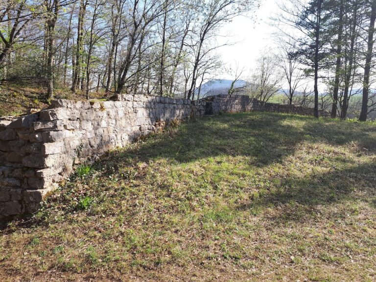
The neck-ditch side of the upper castle was protected by the massive shield wall. Small projecting wall turrets, known as pepper-pot turrets, stood at both ends. The residential wing stood against the inner face of the wall. Historical depictions show a building with a lean-to roof and at least four storeys. Its kitchen is indicated by a smoke channel set into the inner surface of the shield wall.
Administrative complex and second cistern
The northeastern upper castle contained a multi-part complex with administrative rooms, a writing office, a bathhouse, the castle chapel, and an apartment for the chaplain. A small courtyard lay between this complex and the residential wing. A second cistern, holding just under six cubic metres, stood between the residential and administrative areas. It collected rainwater from the roofs and was severely disturbed by the construction of a Second World War bunker.
Surviving fabric and lookout platform
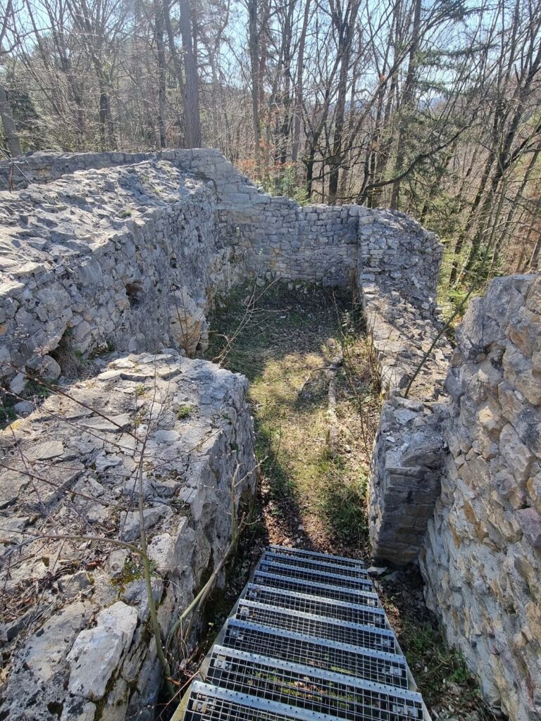
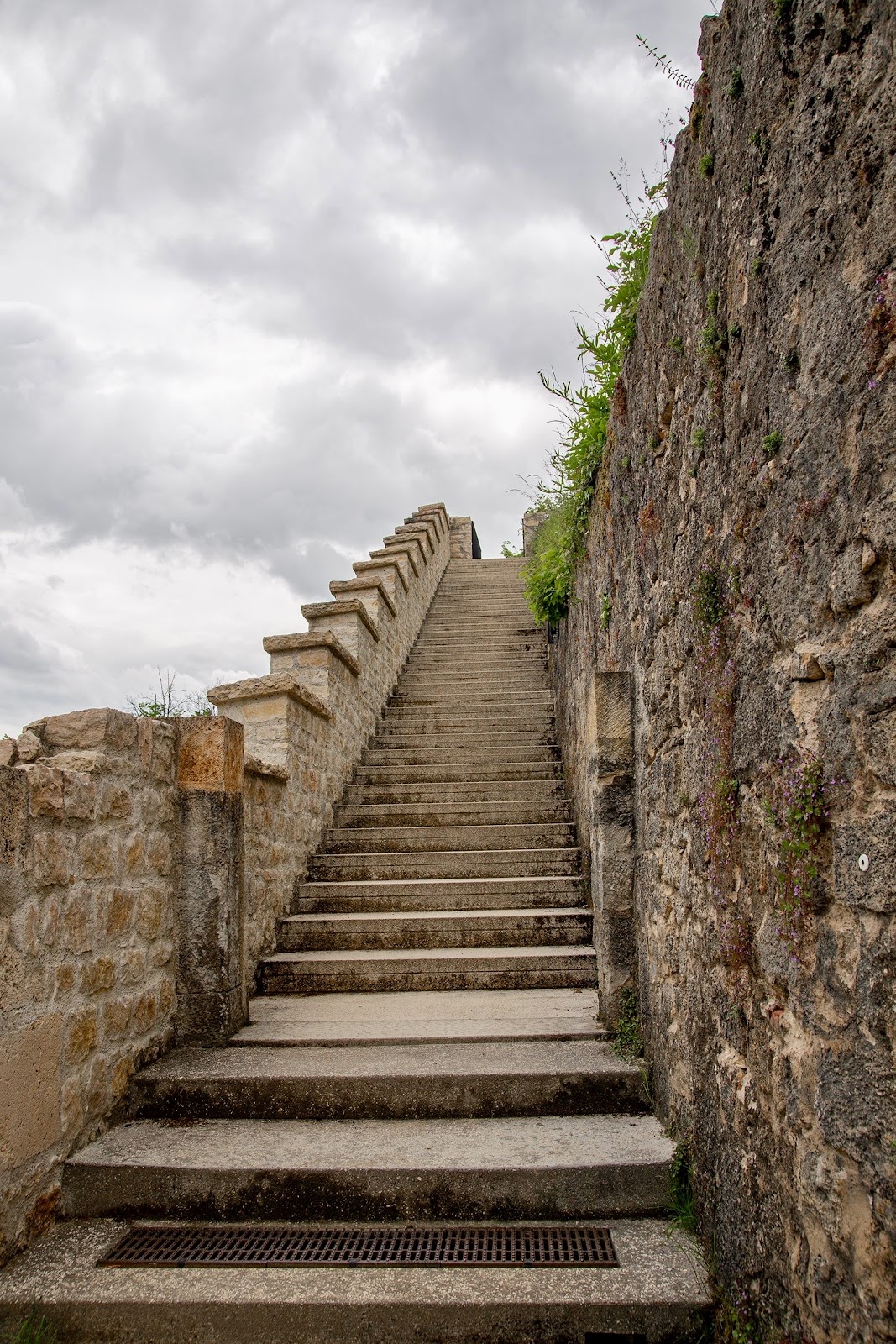
The ruin retains portions of the shield wall, curtain wall, outer work, towers, gate foundations, and other fragmentary buildings. The castle’s stone-and-wood construction can be read through these surviving elements and through the relationships between the lower and upper sections of the site. A modern spiral staircase built into the northwestern end of the shield wall leads to a viewing terrace.
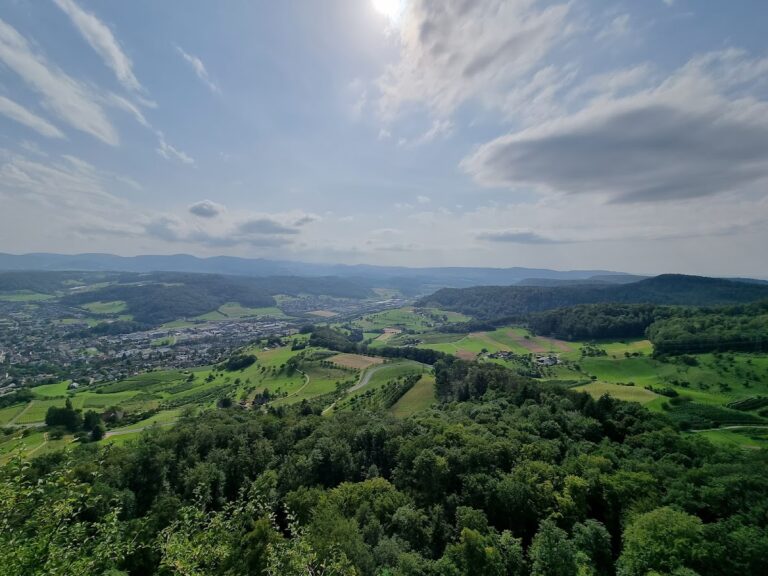
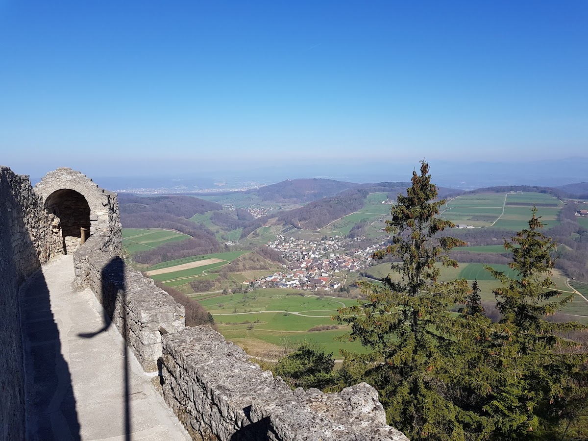
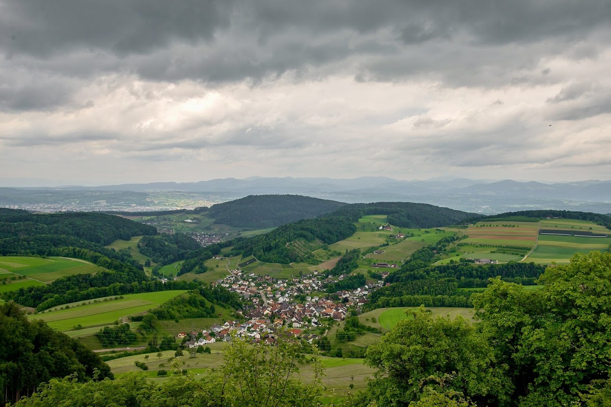
Sixty steps lead to the viewing platform, which stands 12 metres above ground level on the shield wall. From this elevated structure, the landscape toward Buus, Hemmiken, and Ormalingen is visible, with views across much of the Swiss Alps in clear weather.